

Reducing the risk of bird strikes using satellite images and Ascend’s Normalised Difference Water index software (NDWI)


BROWSE PROJECTS
Based on user needs and industry skills, the evolution of customized solutions and the establishment of innovative services is accomplished through project activities. Focusing on various thematic areas, relevant information on the project activities is provided below.
Landfill Methane Monitor (LMM)
Status date: 16 April 2025
Methane Monitor enhances landfill methane emission estimation using satellite observations combined with on-ground tracer gas measurements. This innovative approach accounts for daily and seasonal variations, improving accuracy over traditional methods. The project, co-funded by ESA Kickstart, supports policymakers, regulators, and waste operators in assessing landfill emissions and promoting waste-to-energy as a lower-GHG alternative.

MCKS24/25
Status date: 16 April 2025
MyCoast is revolutionising coastal safety with satellite-enabled emergency response and environmental monitoring. Integrating AI-driven hazard detection, GNSS-IR tidal monitoring, and Satcom emergency connectivity, our smart beacons provide real-time safety alerts, ensuring vital information reaches those who need it—anywhere, anytime. Backed by ESA, MyCoast is pioneering next-generation technology to save lives and enhance global coastal resilience
PLESS DEMO
Status date: 15 April 2025
Provide a brief description of the project in less than 60 words.
It will not appear on the project web page itself but is used in project lists e.g.
https://business.esa.int/projects and search results.
Alizeti
Status date: 15 April 2025
The “Alizeti” project was designed to help smallholder farmers growing high-value crops in Kenya to produce better harvests and to sell them more efficiently to the organisations who further process and sell them. Four pilot clients in the project were provided with custom-built dashboards on the agriBORA platform based on in-situ and remotely sensed data.
CDPP
Status date: 11 April 2025
Patient wandering off is a major concern in long term care facilities. The CDPP project responds to that concern by adding geo-fencing and Search & Rescue (SAR) capability using Galileo GNSS. This prevents dementia patients from getting lost and wandering off facilities.

SATLine
Status date: 09 April 2025
SatLine is an innovative rail track monitoring solution, integrating space technology and a cloud-based platform; it enables precise detection of changes in rail geometry and by providing maintenance alerts, enhances rail safety and operational efficiency across rail networks.
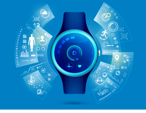
Activity Tracking app
Status date: 09 April 2025
Most Activity Tracker apps overlook key physiological data, especially for physically impaired individuals. This project bridges this gap with cutting-edge biometric sensors measuring heart rate, core temperature, hydration, and stride mechanics – promoting safe, optimized physical activity. Backed by real-world athlete insights, this project enables smart and comprehensive performance tracking, redefining fitness tracking for all.
TIGRIS
Status date: 09 April 2025
Spaceline Labs (SPL) will deliver Earth Observation (EO) data to customers through SPLs software platform. The platform will provide access to EO data from satellites and a fleet of proprietary balloon-borne Satellites based in the stratosphere - developed and operated by SPL. The first iteration of this stratospheric technology is described as TIGRIS in this KickStart study.
Eyes on Plastic
Status date: 09 April 2025
Eyes on Plastic provides a service solution, which combines multiple sensor components into a joint mapping and monitoring solution for plastic in the aquatic environment. By flying high and diving deep, plastic litter can be monitored at all angles and scales. On top, the service invites everybody to actively keep the eyes open on plastic spanning local info to a global reach.

Car-lileo
Status date: 03 April 2025
Car-lileo optimises the processes and digitises the customer communication of car dealerships, detailers, service providers and the mobility sector through novel services based on real-time localisation of cars, keys and assets. Car-lileo is a modern, open, GDPR-compliant, trustful European PaaS/SaaS platform based on GNSS/Galileo, innovative indoor localisation, its own service store and modern cloud architecture.

SGPS
Status date: 31 March 2025
SWÖM is developing a self-inflating rashguard for kids which aims at addressing the numerous fatal and non-fatal drowning accidents that occur each year. ”SWÖM with GPS” project is exploring opportunities to integrate a satellite-based alarm and tracking system to allow for higher safety and enhanced peace of mind for users but also for quicker emergency action in case of drowning.

GHOST-4V
Status date: 31 March 2025
GHOST-4V brings satcom broadband connectivity to humanitarian vehicles, enabling new security and navigation applications.

XFACTorizer
Status date: 28 March 2025
The “Be a verifiable photojournalist!” project is about a possible application of GALILEO/OSNMA service. The authentic location and date/time data of OSNMA – embedded in EXIF tag of photos or videos – can be important help in fighting against fake news and disinformation.
Provide a brief description of the project in less than 60 words.
It will not appear on the project web page itself but is used in project lists e.g.
https://business.esa.int/projects and search results.
TruewaveGPR
Status date: 27 November 2024
The fusion of positioning, inertial and subsurface data sets at a singular point.
A consortium of Europe’s leading ground penetrating radar and electronic developers have teamed up with the UKs most high-profile horizontal drilling operations to create the world’s leading terrain compensating subsurface inspection system capable of creating 3D data sets for analysing buried assets below challenging terrain.
LUCI
Status date: 22 September 2022
Project LUCI aims to assess land use around railway infrastructure and detect changes that could be hazardous to the safe running of the railway. The project aims to give trackside managers crucial information to enhance the decision making process and ultimately make the railways a safer place to work and travel.

MALIBU
Status date: 24 March 2025
AI-enabled services for private companies responsible for roads surveillance and monitoring, for Municipalities responsible for safety and comfort aspects towards the roads’ users but, at the same time, also needing to safeguard the municipality cash balance.
MALIBU leverages on the most up to date technologies (from satellites to AI) to provide users with agile, flexible, effective and economically advantageous solutions for road defects detection, both through an own web platform, or to be integrated in already available user’s systems (e.g., GIS).
The MALIBU on-board unit, thought and designed for the monitoring of asphalt’ s defects, can be installed on cars, vans or, for the mapping of a large part of the urban road fabric, on local buses fleet; that means an adaptive and functional solution that can provide an overall view and always updated status information of roads travelled daily by equipped vehicles.
All the information can be easily accessed on a web platform that allows users to search and filter the data, download it and visualize it as plots, in a tabular format and/or in GIS (directly on the map). Additionally, the platform provides periodic reports, in CSV or PDF format, concerning the data produced by the main services.
In addition to the defects’ detection service, also a set of other sub-services is provided.
IN: BIKE Discovery
Status date: 24 March 2025
A collaborative effort to gather data for insights, knowledge, and evaluation based on moving bicycles u nlocking the potential of bicycle data to revolutionise infrastructure and management decisions for active and micro-mobility.
RT5.0
Status date: 18 March 2025
Rural Tourism 5.0 (RT5.0) is a next generation travel planning ‘eco-algorithm’, designed to improve the visitor experience, impact on the environment, and the economic output of rural tourist destinations.