

Reducing the risk of bird strikes using satellite images and Ascend’s Normalised Difference Water index software (NDWI)


BROWSE PROJECTS
Based on user needs and industry skills, the evolution of customized solutions and the establishment of innovative services is accomplished through project activities. Focusing on various thematic areas, relevant information on the project activities is provided below.

Astrobone
Status date: 14 November 2024
Objective of the project is to study and validate b.Bone scaffold in osteoporotic environment to improve human bone surgery. b.Bone is a synthetic bone substitute, CE marked and indicated for clinical applications in orthopaedic and traumatology surgeries. The scaffold is seeded in vitro with human bone cells in simulated microgravity and then in space (after the current activity), to simulate an osteoporotic accelerated model, and their response is analysed.

ISABHEL
Status date: 11 November 2024
ISABHEL is a continuous monitoring service that leverages 5G technologies and provides qualitative and quantitative information for the management of specific assets, identifies areas for predictive maintenance, supports asset financial resilience and disaster prevention. The proposal is based on the synergistic integration of different technologies enabling advanced monitoring of the structural health of bridges. The service is specifically aimed at monitoring the structural health of bridges located on the Po River, which are recognized as assets of interest for the City of Turin.

TSMF_10CM DP: WaldCursor
Status date: 11 November 2024
TSMF_10CM DP is Tama Group’s core project to develop, test and test market the WaldCursor product. The project covers development, test and field test of a cloud & app based remote sensing analytics information platform for forestry and environmental applications.

GAINS CCN1
Status date: 11 November 2024
GAINS provides historic and near-real-time insights on the production and activity levels at hundreds of sites involved in the global iron and steel supply chain. It offers an “alternative data” source for the Financial Services industry by providing near-real-time leading indicators such as stockpiles of raw materials and levels of activity and production, based primarily on satellite observations.

SUPER
Status date: 11 November 2024
SUPER focuses on using Earth Observation (SatEO) and Satellite Navigation (SatNav) for Urban Air Mobility (UAM) infrastructure planning and integration into public transport, and in planning and monitoring aspects of UAM operations. Relying on SatEO (archived and near real-time) data provides diverse geospatial, environmental, weather and mapping information, and allows combining it with SatNav data from air traffic (once available).
safeBACK
Status date: 31 October 2024
With safeBACK, our integrated Safety Alert and Flood Forecasting Engine, we empower local authorities and civil protection agencies to act proactively in case of flooding. By combining real-time water levels, precipitation forecasts, and Earth observation data, safeBACK provides accurate alerts and probabilistic flood forecasts for brooks and creeks. This enables authorized users to anticipate and understand flooding situations, enhancing response readiness and protecting communities before disaster strikes.

ProvGRASS_DP
Status date: 29 October 2024
ProvGrass generates multi-temporal maps of the grass platform or area of interest including sward quantity and quality to enable customers in the dairy and beef industry to provide products that positively influence sustainably productive farming through end-user (e.g., farmers or advisers) grass management This results in higher quality milk production at better margins, while adhering to increasingly stringent requirements to demonstrate improved sustainability.
DITCH
Status date: 28 October 2024
The newly developed DITCH - Digital Twin Catchment service consists of an online accessible digital representation of basins providing static and dynamic variables like topography, land use and cover, hydrological and ecological conditions (water level, discharge, sediment concentrations, algal blooms) of water bodies, and soil characteristics provided through earth observation (EO) including potential dynamics next to past and present situations.
This physical twin is then also combined with socio-economic information to provide relevant decision support tools for resilient basin management of water-related stakeholders.
FB Eye
Status date: 23 October 2024
FB Eye – acronym of Fire-Bombing Eye – is a commercial initiative to improve the firefighting operations using innovative space-based and ground-based technologies.
FB Eye is an innovative platform-as-a-service commercial provision of integrated satellite/airborne Comms/Nav support to the precision water bombing of large wildfires.
FB Eye provides water bomber pilots with a near real time information map with precise geographical location of most radiating fire hotspots, being the most effective release target to extinguish rapidly the fire.

Space2CLIMB
Status date: 18 October 2024
Space2CLIMB is looking to create a biodiversity service to support the financial service sector by combining GlobalTrust’s expertise in Earth Observation (EO) data analytics with Ecogain’s knowledge of biodiversity.
MTrader
Status date: 16 August 2023
Awake.AI’s marine Marketplace with the power of AI for trading port services and products.
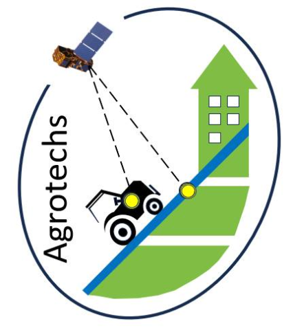
Agrotechs
Status date: 10 October 2024
The Kick-Start activity aimed at developing driveability, site-specific application maps for herbicides, disease risk, harvest sequence and irrigation advise maps. These innovative Satellite Earth Observation (SatEO)-based products support precision farming technology. By leveraging advanced technology, these tools enhance agricultural efficiency, promote sustainability, and reduce input costs, enabling optimal farm management.

SCAF
Status date: 10 October 2024
Mitigrate, an InsureTech startup, pioneers flood risk management with its SaaS platform. Utilizing advanced technologies and earth observation data, it offers nature-based solutions reducing flood risks. Targeting insurance companies, Mitigrate's tool fills a crucial gap, providing pre- and post-flood disaster guidance. Beyond risk reduction, it aligns with global sustainability goals, positively impacting insurance performance metrics. An investment in Mitigrate is an investment in resilience, sustainability, and the future of flood risk management.

B2B Bike Navigation
Status date: 04 October 2024
This project develops an end-to-end navigation service which can be fully integrated into business customers’ own 2-wheeled vehicle products/services, including best-in-class routing optimisation (tailored to user needs) and navigation for 2-wheeler use-cases.
This will make it easier, safer and more convenient for people and goods to travel by light, 2 wheeled transport rather than by cars, vans and trucks.
NbS Monitoring
Status date: 30 September 2024
The NbS Monitoring service delivers a streamlined Earth Observation-based approach to provide accurate, timely, and comprehensive assessments of medium to large-scale NbS peatland projects, increasing the confidence and transparency of project outcomes, and saving costs and time for customers.

WHIS
Status date: 25 September 2024
The Water Health Indicator Service (WHIS) provides a continuous data stream of environmental health indicators for inland water bodies. This service is an API with monitoring and reporting capabilities that allows you to track a set of specialised and highly descriptive Water Health Indicators.

EPOS
Status date: 25 September 2024
Europe requires clean, independent energy sources now more than ever. EPOS is a software-as-a-service solution that provides energy planning in buildings and cities. It combines state-of-the-art energy modelling with Earth Observation data, enabling engineers and decision makers to ideate, analyse the current situation and create diverse supply concepts. EPOS centralises essential data and includes AI algorithms for more efficient energy transformation.
BasinMeter
Status date: 25 September 2024
eLEAF and partner 52impact are overcoming the challenge of obtaining accurate and relevant water-risk related data with ‘BasinMeter’. The project combines scalable Earth observation technology with local datasets to expose the vulnerability of local watersheds and the impact on local related agricultural production and the community WASH (Water, Sanitation and Hygiene). The project will enhance both strategic decision making and direct local intervention to mitigate water-stress.
MiLoW-RRS-DP-2
Status date: 25 September 2024
Following customer requests for expanding the initial service offering of the Micro Local Weather Route Recommendation Service’s high-resolution weather forecasts, new services for snow depth information, weather warnings, a short-term precipitation radar map, and high resolution climatologies were developed to provide better assistance and reduce weather-related risks for planning and undertaking safe outdoor activities.