
Broadcasting has always been at the heart of the satcom industry. From the first artifical satellite, Sputnik (1954), which broadcast a series of beeps it wasnt long until the Telstar 1 (1962) relayed the first TV pictures from the USA to Europe.
Technology has moved on a lot since then and now its normal to see a satellite truck beaming the lastest news as a breaking story happens anywhere on earth.
Satcom also broadasts many tens of thousands of TV and radio channels directly to our homes, with an ever increasing number in high definition. The sector is certainly lucrative and very fast moving.
Insiders
Status date: 16 January 2026
🚀 Get Ready to Elevate Your Sports Experience with Infinity: The Ultimate GPS Accuracy Solution! 🌟
Our innovative tracking device doesn't just capture data; it enriches the entire sports experience by share real-time insights seamlessly across TV broadcasts, second-screen apps, live tracking platforms, ensuring that fans are immersed in the excitement from start to finish.

Oculus
Status date: 25 September 2025
The goal of Project Oculus is to build a generic, easy-to-use cloud platform for our motion tracking device that allows coaches to extract key performance indicators from different sports.

Evento
Status date: 01 August 2025
Experience the future of ticketing with Evento – the secure digital marketplace using geofencing to stop fraud and duplicated tickets. No scams, no copies. Just safe purchases, easy ticket management, and real-time event info right at the venue.
INVENTA
Status date: 23 June 2025
The INVENTA Demo Project implements innovative services able to increase the fruition, accessibility and sustainability of historical/cultural sites through the integration of Virtual & Augmented Reality with Satellite Navigation and Earth Observation. The service is based on an innovative mobile App leveraging SatCom technologies and the 5G network.
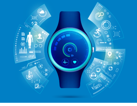
Activity Tracking app
Status date: 09 April 2025
Most Activity Tracker apps overlook key physiological data, especially for physically impaired individuals. This project bridges this gap with cutting-edge biometric sensors measuring heart rate, core temperature, hydration, and stride mechanics – promoting safe, optimized physical activity. Backed by real-world athlete insights, this project enables smart and comprehensive performance tracking, redefining fitness tracking for all.

SGPS
Status date: 31 March 2025
SWÖM is developing a self-inflating rashguard for kids which aims at addressing the numerous fatal and non-fatal drowning accidents that occur each year. ”SWÖM with GPS” project is exploring opportunities to integrate a satellite-based alarm and tracking system to allow for higher safety and enhanced peace of mind for users but also for quicker emergency action in case of drowning.

XFACTorizer
Status date: 28 March 2025
The “Be a verifiable photojournalist!” project is about a possible application of GALILEO/OSNMA service. The authentic location and date/time data of OSNMA – embedded in EXIF tag of photos or videos – can be important help in fighting against fake news and disinformation.
Provide a brief description of the project in less than 60 words.
It will not appear on the project web page itself but is used in project lists e.g.
https://business.esa.int/projects and search results.

BeSpatial.AI Demonstration
Status date: 21 December 2024
How do you target advertising to maximize customer reach and minimize costs? Where do target customers stay, live and work? What locations should be the focus of digital and physical advertisement campaigns?
BeSpatial.AI helps businesses in financial services and other industries to boost their ads performance with customer trained machine learning model (HolistiCRM).
Training is done based on internal datasets, EO (ESA) and GIS data (GeoX). In our first use-case machine learning model accuracy reached 91%.
Machine Learning supported targeting ROI 1127% thanks to lower CPC and higher conversion rates targeting the right (potential customer dense) locations.
BrightEarth
Status date: 20 December 2024
BrightEarth is a web-based application that generates cartographic data from high-resolution satellite imagery. The data are available on demand from anywhere in the world, and include 3D vectors, GIS raster and textured 3D building models.

Insiders
Status date: 28 November 2024
🚀 Get Ready to Elevate Your Sports Experience with Infinity: The Ultimate GPS Accuracy Solution! 🌟
Our innovative RTK based device doesn't just capture data; it enriches the entire sports experience by share real-time insights seamlessly across TV broadcasts, second-screen apps, live tracking platforms, ensuring that fans are immersed in the excitement from start to finish.
MiLoW-RRS-DP-2
Status date: 25 September 2024
Following customer requests for expanding the initial service offering of the Micro Local Weather Route Recommendation Service’s high-resolution weather forecasts, new services for snow depth information, weather warnings, a short-term precipitation radar map, and high resolution climatologies were developed to provide better assistance and reduce weather-related risks for planning and undertaking safe outdoor activities.

Hand for U
Status date: 16 August 2024
“Hand for U” is an application that allows People in Need and Volunteers to easily contact each other and respectively, express their needs and offer their help on behalf of the Volunteering Organisations. “Hand for U” aims to facilitate the creation of a helping community.
SMART TT CARE
Status date: 16 August 2024
Discover Ping4All’s groundbreaking platform for holistic wellbeing and medical sport applications. With state-of-the-art sport-science, digital, and medical knowledge, their innovative solutions redefine health enhancing experiences at sports clubs and integrate sports breast cancer rehabilitation into healthcare systems. Utilizing immersive tech, AI, and 5G, they empower women to manage their health capital, fostering confidence and resocialization. Ping4All's vision is to innovate table tennis for “One Health”, anytime, anywhere.

SeaUrchin
Status date: 22 July 2024
The focus of our DEMO is to develop a Surf Tracking application and enhanced surf forecast and alert service. The tracking app will track and analyse surfers’ position and performance in the water accurately in conjunction with the Samsung Galaxy 5 smartwatch. . The second element of the project is development of an enhanced surf forecast service and personalised conditions alert service. This will be achieved through the use of EO imagery together with other ocean & weather characteristics.

GeoNewsChain
Status date: 04 June 2024
The GeoNewsChain relies on the use of modern technologies, such as GNSS and blockchain, to create a platform that allows citizens to post photos and short descriptions of local events. Each photo can be automatically geotagged and located on a map. Professional journalists can have the option to purchase subscriptions to access the platform, allowing them to receive quick updates on current news.

Spacestack for Newsrooms
Status date: 14 May 2024
Vertical52 is building a platform that will give newsrooms access to high resolution satellite data and help them analyse and visualise their space-borne investigations in a suitable environment.

Craft Your Space
Status date: 13 May 2024
Craft Your Space is a platform dedicated to operators in the Small Satellites market. Users are identified as those companies and operators who manufacture components for the aerospace industry and specifically components for the construction of Small Satellites.

BST HIKES
Status date: 14 February 2024
BST.COACH, a Czech digital youth sports platform has developed a reward-based outdoor exercise application using GNSS-stamped locations.

STARS
Status date: 27 November 2023
The STARS project aims to deliver a product consisting of the automation of real-time workout parameter registration during swimming workouts. Currently, there is no system available in open water swimming that allows for the real-time registration of both biomechanical and physiological parameters in a wearable and comfortable way.

ARcade
Status date: 27 November 2023
Information and entertainment at the right time, in the right place. A platform providing a series of geolocated interconnected virtual spaces, called ‘Arcades’: virtual spaces overlaid on reality, activated by GNSS, where users access images, films, text and sound, using a smartphone/iPad. Turning everyday locations into virtual cinemas, classrooms, music venues, galleries, information hubs or marketing billboards.

Hand for U
Status date: 31 July 2023
“Hand for U” is an application that allows People in Need and Volunteers to easily contact each other and respectively, express their needs and offer their help on behalf of the Volunteering Organisations. “Hand for U” aims to create a safe space for People in Need and Volunteers to self-organise and create an empathetic community.
BIGMIG-DEMO CCN
Status date: 08 May 2023
The project aims to establish a service leveraging Earth Observation data and Machine Learning techniques to support the news industry with measurable, testable, and independent satellite-derived information.

FATE
Status date: 10 February 2023
FATE develops a digital ecosystem to preserve and disseminate cultural heritage sites, realizing an open, participatory and interactive marketplace platform, using best of breed innovative technologies and smart interconnections between service providers, merchants, customers, users and stakeholders, realized on a cloud-based AI supported virtual platform that store, share, manage and maintain historical sites digital twins and related metadata.
Sports Event Live Photography
Status date: 22 September 2022
Success for Live Event Photography!
With support from ESA, UK software company AWOL has successfully piloted and launched their ground-breaking Live Photography service. Participants and supporters at marathon, swim and triathlon events received high quality photos within seconds of them being taken, establishing Live as the de-facto standard for Event Photography worldwide

IE4Education
Status date: 11 August 2022
Creation, production and installation of exhibitions based on satellite images to promote space applications or to highlight a territory or a specific topic.

AIBROINFRA
Status date: 13 July 2022
Quicklink proposes to develop Artificial Intelligence (AI) that will both optimise the quality of remote video contribution and dramatically reduce costs for the production customer. The solution will be tested on the OneWeb network to enable high quality news interviews to be transmitted to and from remote locations.
TREVAR
Status date: 21 March 2022
TREVAR is a platform designed for the realisation of tactical training in team games. The solution is based on GNSS satellite positioning technology and Virtual and Augmented Reality (VR/AR) aspects. The recipients of the system are coaches and players. The main functionality of the system is based on ability to visualise selected tactics and conventional training.
Golf Data Intellect
Status date: 14 March 2022
Technology that automatically records every round, every hole and every shot. Then delivers actionable insights into over 100 statistics that relate directly to your own golf game. The technology works in the background to identify the exact position of every shot. The data is then used to generate statistics, analytics and insights through an array of engaging features that improve a golfer’s game.
‘feed from the field’
Status date: 17 January 2022
At the moment, the ‘feed from the field’ is an emerging technology that takes live content from entertainment and sports sources and publishes it worldwide to mobile phones. The technology ensures the availability of the content to the user with minimum delay from the time the content is available to it being on the user’s smart device. This process is manual and requires operator intervention.

FATMAP Live
Status date: 30 April 2021
FATMAP’s app and 3D mapping technology helps people discover and navigate outdoor adventures all over the world. FATMAP ‘Live’ adds real-time data layers to the map including live satellite views, weather, webcams, local risks and conditions to make enjoying the outdoors easier and safer.
INVENTA
Status date: 07 April 2021
The INVENTA project intends to carry out the feasibility study of an innovative service able to increase the fruition, accessibility and sustainability of historical/cultural sites through the integration of Virtual & Augmented Reality with Satellite Navigation and Earth Observation. The service will be based on an innovative mobile App using 5G network.
SAIUDMA
Status date: 11 March 2021
A new ground-to-space air quality (AQ) analytics platform for city and traffic planning departments with the purpose of positioning data insights at the heart of managing resilient urban environments. Our analytics products form the decision making basis for investing in initiatives that help reduce harmful pollution and push for the design of new infrastructure sensitive to local residential communities and vulnerable population cohorts whilst allowing for sustainable economic development.
ESA FGC
Status date: 10 March 2021
We applied space imagery to automate the identification of football fields with artificial turf material to an extent and frequency not possible with land-based tools. Pooling information enables the generation of information about football fields. Other information may be added for a tailored value proposition to field owners, field manufacturers and for field maintenance.
ES-LR
Status date: 11 December 2020
ES-LR™ is an IoT dedicated to the equestrian community. Its aim is to improve the security and safety of search & rescue (S&R) operations and eventually save more lives.
MiLoW-RRS-DP
Status date: 04 December 2020
To enable the growing community of outdoor enthusiasts to better plan and prepare safe and enjoyable activities, MetGIS, DLR/DFD and Outdooractive developed a fully integrated one-stop-shop solution for weather-based trip planning and decision support on tour. The recommendation features, warning services, high resolution weather forecasts and snow cover maps are powered by space technologies and space derived data.
The SeaUrchin
Status date: 19 October 2020
The SeaUrchin is an affordable state-of-the-art wearable surf tracker, being developed by Kittiwake Labs Ltd in Cornwall, UK. The SeaUrchin tracker takes advantage of GNSS for tracking surfer sessions and applies novel data analysis for session characterisation and to monitor progress.
RASOR
Status date: 14 October 2020
A streaming service for live and replay space imagery - bringing together amazing videos and visualisations from across space into one easily accessible platform.

STARS
Status date: 19 August 2020
The STARS project aims to deliver a service consisting of the automation of real-time workout parameter registration during swimming workouts. Currently, there is no system available in open water swimming that allows for the real-time registration of both biomechanical and physiological parameters in a wearable and comfortable way.
Landmrk Context Expansion
Status date: 14 July 2020
The Landmrk Context Expansion project sees Landmrk’s location based experiences platform supercharged with hyper-local weather data, space data and earth observation data. The resulting platform enables the creation of a variety of compelling experiences for mobile phone users based on their context.

EOMST
Status date: 22 April 2020
The 21Net system enables Internet services on board high-speed trains. The system uses several communication technologies to access the internet: cellular, Wi-Fi and satellite. A Mobile Access Router manages the links switching from one to the other depending on their availabilities. The goal of the project is to improve Users’ experience of the current system by optimizing the bandwidth usage. In a final phase, 21Net will improve the overall system performance with the development of a new generation of its Mobile Access Router: MAR4
GPS Triggered AR System
Status date: 10 January 2020
Imagine you’re walking along Hadrian’s Wall. Your phone vibrates. You pause, hold up your phone and scan the landscape around you. The ghostly figure of a Roman soldier appears on your screen and begins to tell his story...
We have developed a new GPS Triggered AR Module that makes it easier and more cost-effective for organisations to engage audiences.
SHOW
Status date: 19 December 2019
SHOW as a mobile service is aimed at making seniors feeling constantly needed by society, as they are enabled to offer help to family members, friends, or in general people who need support. It addresses the challenges of elderly people regarding increasing mobility, maintaining activity, improving safety, reducing stress, growing assurance of behaviour and reducing social exclusion.
AT
Status date: 07 November 2019
Activity Time (AT) deals with forms of spending time after school or work. Using mobile phone geolocation users receive notifications about interesting activities and events in the neighbourhood and are able to track children activities and results. The service provide NGOs and private companies with tools to manage their own offer and create opportunities to reach the target audience.
AR.fx
Status date: 07 November 2019
AR.fx enables users to create, place and to interact with location-based 3D content in Augmented Reality utilizing smartphones. It incorporates gamification elements such as blueprint (users can connect pre-defined line-dots in AR and create 3D objects) and multi-player capability along with AR Scene-Editor. On a global map users can explore and physically interact with AR content of interest.
RGB
Status date: 10 January 2019
Our latest solution for remote graphics allows sports federations and content owners to adapt TV graphical overlays for different geographies without multiplying the number of feeds, thereby reducing costs and maximising the event value for partners and sponsors.

SIS-SREM
Status date: 26 July 2018
To improve the safety and the information provision for people planning and undertaking outdoor activities in mountain resorts in the Eastern European market, the SIS-SREM project developed an advanced mountain rescue team management (MRTM) solution for organizations to better coordinate teams during search & rescue missions (S&R) and an Infotainment platform that provides 3D outdoor maps and mobile guidance for visitors, enables new forms of digital marketing and communication and integrates RPAS technology based services.

AgeSpot Feasibility Study
Status date: 18 May 2018
AgeSpot provides THE starting point for any innovative technological solution addressing ageing populations. It enables efficient targeting of the silver economy and offers precise demographic data on WHERE and HOW MANY age specific classes currently live and will likely live in the FUTURE. With AgeSpot a new Earth Observation (EO) supported business intelligence service is offered.

FULLVIEW-SAT
Status date: 02 May 2018
FULLVIEW-SAT aims at implementing a solution to deliver a live immersive 360 degrees multicasting of sport events for Major and Minor sport leagues. FULLVIEW-SAT makes use of state-of-the-art Satellite News Gathering (SNG) based on of High Throughput Satellite and full IP solutions. The content is then delivered to the users via Internet; a dedicated App and visors will allow users watching at sport events as they were in the different location of the football field, providing an immersive experience.
SatCom W-IFE
Status date: 03 April 2018
Airlines are embracing next generation connectivity in the cabin and cockpit. High capacity satellites are the key to meeting consumer demand for high speed, high quality and low cost connectivity in the air. Through this SatCom W-IFE ESA activity, Viasat’s satellite-based in-flight connectivity with Viasat Ireland’s in cabin applications is to provide an evolving range of services to the airborne market.
SatCorpAfrica
Status date: 15 March 2018
SatCorpAfrica (SATellite CORPorate services in AFRICA) is a Satcom Applications project by SatADSL (BE) aimed at developing, integrating and validating a satellite IP connectivity system and associated services allowing SatADSL to offer via local African Telecom Operators a solution targeting the WAN (Wide-Area-Network) market segment with a set of attractive and flexible offers.
KABALIST
Status date: 13 July 2017
The project is focused on the set up of reliable and cost effective distribution of live video feed of non-mainstream sport events into the Internet. The context and the proposed pilot service is tailored to the Serie C Italian football league. The novelty introduced with this pilot project is the adoption of uplink in Ka-band using inexpensive and semi-permanent installations to the stadiums, supported by a set of features to ensure compliance with the targets in terms of availability, quality, accessibility and costs.
CCP
Status date: 22 July 2016
This project aims to develop a new technology that allows non-technical personnel trim, play, deploy, videos for Auto-Feed Content Creator component by category.
VICOMESTRA
Status date: 30 October 2015
This project is a critical step to the introduction of HD media streaming services from mobile terminals in 2015. The solution is proposed to demonstrate dynamic video transmissions using the latest HEVC video codec running on a portable encoder combined with the latest Inmarsat BGAN HDR and GX satellite services.
Low Cost Hybrid Terminal Triple Play Solution
Status date: 18 August 2015
The aim of the project is to develop a low cost end-to-end solution for satellite based triple-play services. The platform uses existing infrastructure to enable TV, telephone and IP communication. Satellites are used for downlink communication and different terrestrial media are used for the return traffic.

Lift Off
Status date: 08 September 2014
Internet penetration growth curve is still on the steeper side: people require more and more affordable and fast connection to the Internet, independently from where they are. The key characteristics of what is expected by an Internet connection are speed, affordability and reliability. In this sense the Lift Off Project tries to bring further the innovation brought by the recent satellites investigating on how DPI (Deep Packet Inspection) can be introduced by a Satellite Service Provider. The scope of this innovative “next step” on top of the KA-SAT is to optimize the existing services and to generate innovative market offers for satellite internet connectivity maximizing the user experience while improving the ratio cost/performances.
SHM Telecom Towers
Status date: 02 July 2014
The project “SHM for Telecom Towers” aims at developing a remote monitoring service to support the assessment of the structural integrity of assets, as the towers for Radio-TV Broadcasting or other metal infrastructures, in order to increase safety and optimize the maintenance procedures and promote the transition from a time-based maintenance to a condition-based one.

ISIDE
Status date: 27 September 2011