


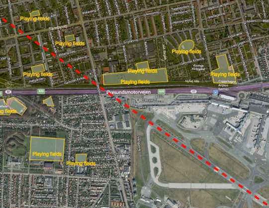
Reducing the risk of bird strikes using satellite images and Ascend’s Normalised Difference Water index software (NDWI)















BROWSE PROJECTS
Based on user needs and industry skills, the evolution of customized solutions and the establishment of innovative services is accomplished through project activities. Focusing on various thematic areas, relevant information on the project activities is provided below.

Big data for migration study
Status date: 13 September 2019
“Big Data” refers to new computational capabilities, that warehouse huge set of data, technologies and analytics in order to extract added value from “bulky information” in a reasonable amount of time. The increasing possibilities offered by satellite technologies integrated with collateral data can support the complexity of the migration flow monitoring

UKSRI
Status date: 14 June 2019
Field-level seasonal weather predictions can empower growers to make better-informed decisions, reducing their food waste and greenhouse emissions. We have demonstrated a working pilot of a new seasonal forecast system that combines EC Copernicus model outputs with daily weather analytics to improve long-term rainfall predictability. Applications include summer planning for irrigation, cultivar selection and decisions about crop mixes to mitigate crops losses from drought, floods or climate-linked pathogens. UKSRI has identified British growers, producers and agronomists who could benefit from these services.

ALBA-TROSS
Status date: 10 April 2019
Alba Orbital is working to develop satellite applications which utilize each aircraft’s unique ‘Automatic Dependent Surveillance-Broadcast’ (ADS-B) signature. ADS-B signals contain data on flight path, and flight weather conditions, and can be used to enhance global weather forecasts, verify aircraft carbon emissions, and aid in Mayday scenarios, especially when fused with other satellite and ground based data-sets.

AgeSpot Feasibility Study
Status date: 18 May 2018
AgeSpot provides THE starting point for any innovative technological solution addressing ageing populations. It enables efficient targeting of the silver economy and offers precise demographic data on WHERE and HOW MANY age specific classes currently live and will likely live in the FUTURE. With AgeSpot a new Earth Observation (EO) supported business intelligence service is offered.

Poolspot
Status date: 14 June 2019
INVITE ALL SWIMMING POOL OWNERS IN YOUR (E-)SHOP
We automatically detect swimming pool owners at wide scale thanks to our identification algorithms using satellite imagery.
Take the opportunity to reach new clients with our direct marketing service.

CERASAT
Status date: 20 March 2019
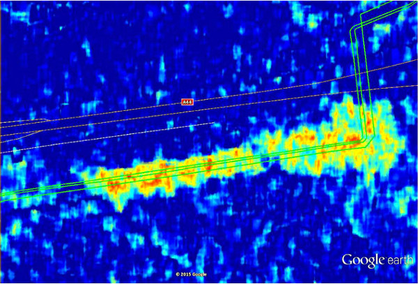
CERASAT aims to provide reliable, real-time and global rainfall measurement services. It extracts the rainfall information from the signalling data generated in satellite communication (SatCom) networks by employing advanced machine learning and signal processing techniques. CERASAT can complement existing rainfall measurement solutions e.g. rain gauges and weather radars.

GEOA
Status date: 20 June 2018
Geoaudio is an ‘Augmented Reality meets Audio’ experience that enhances the tourism offer for outdoor attractions in a non-obtrusive way that does not detract from the natural environment. Users experience an immersive soundscape of voice, music and sound effects triggered by GNSS derived locations as they move through the landscape.

RGB
Status date: 10 January 2019
Our latest solution for remote graphics allows sports federations and content owners to adapt TV graphical overlays for different geographies without multiplying the number of feeds, thereby reducing costs and maximising the event value for partners and sponsors.

European Space-based Information Management System for CBRN (EuroSIM CBRN)
Status date: 22 March 2019
The aim of this project is to investigate the feasibility of developing the next generation of CBRN information management system through the provision of a web-based service model which enables a wide user community to have access to the type of advanced CBRN IM technology already available to the military in the UK, the USA and NATO.

WJETSS
Status date: 22 February 2018
WJETSS enables transportable, consumable and perishable “Things” or dangerous cargo (IoT) to “tell” their Whole-Journey Experience (WJE) from production to consumption, through sensor data monitoring and collection (“SenSourcing”) from all freight legs.
BLUE DISCOVERY
Status date: 18 December 2017
BlueDiscovery is an innovative and powerful technology platform designed to provide an efficient and low-cost Access Control and Visitor Information System to Marine Protected Areas (MPAs)and Tourist Ports, and at the same time to provide to them the capability to efficiently offer a rich set of added-value services to visitors.

HARP
Status date: 08 March 2019
For safe operations, commercial aircraft have to be able to communicate with air traffic control centres at all times. In remote areas such as the polar regions, communication is by HF shortwave radio, which may be severely disrupted by space weather events. The provision of state-of-the-art services for HF communication management is covered by the HARP project.

POINTSAT
Status date: 01 February 2019
POINTSAT enables professional remote collaboration services of support, instruction and training in challenging conditions for the maritime, offshore, and energy industry sectors. The project integrates satellite infrastructure and augmented reality technology into a smart and reliable solution for all technical collaboration needs.

SFCS
Status date: 06 November 2018
Satellite Fruit Control System (SFCS) based on the use of smartphone, image processing and EGNSS technology combined in developed application will allow to estimate the quantity, physical and qualitative parameters of fruits planned for harvest.

Earthcube
Status date: 29 October 2018
Every year, millions of financial contracts whose value is indexed on hard commodities prices are traded on financial markets. Australia and Brazil represent 54% of the global supply, while China and India combined represent more than half of the global demand in hard commodities. It is thus key for investors to be able to forecast outputs and inputs in these countries where opacity remains high. Earthcube leverages satellites to tackle this issue.

TELEKAIROS®
Status date: 29 October 2018
TELEKAIROS® Fintech is a tool for financial and (re)insurance contracts that derive value from an underlying asset such a traditional stock, a bond or stock index. TELEKAIROS is capable to manage different kinds of risks, for example by increasing the efficiency of the underlying market because they lower unforeseen costs of purchasing an asset outright.

TTSat
Status date: 24 October 2018
The successive and recurring epidemiological crisis in developing countries have evidenced the need for more efficient organisation in terms of diseases early detection and warning as well as global emergency response capacity.
There is a clear opportunity to provide an integrated information system delivering real time data collection and alert from/to all sites in a territory where no telecommunication infrastructure is available in remote sites.
Built upon the epiSat business solution by Telemedicine Technologies S.A.S. and leveraging satellite terminals by CLS (Collecte Localisation Satellites), the TTSat service will be deployed in collaboration with UNFPA (United Nations Population Fund) in three countries, Benin, Guinea and Senegal.