Supplementing the ground infrastructure, the development of customized solutions utilizing space-based systems are of particular interest for developing countries. Sustainable and reliable service provisioning is of particular importance for the cooperation with Africa to which many international donors (such as EU and World Bank) give a high priority. The establishment of close partnerships with African organisations and communities in the fields of scientific research, education, technology and applications is a prerequisite for the development of demand-driven projects meeting user-needs.
CCN1 SPARKme
Status date: 25 November 2025
The project proposes a new service designed to establish and operate the Space Data Information Centre (SDIC) in Nairobi (KE) to foster the utilization of space data, expertise and knowledge to catalyse commercial services in multiple sectors and generate revenues strengthening the SPARKme service offering.
BeeSpace
Status date: 25 September 2025
The BeeSpace project is a solution that leverages SatCom IoT and EO to automatically monitor bees’ activity and health while maintaining affordability. This not only benefits beekeepers by improving their beekeeping practices but also helps farmers adopt eco-friendly methods by evaluating the impact of their practices on biodiversity, leading to better data collection for all parties involved.
SENO
Status date: 25 June 2025
The SENO project demonstrates that a significant amount of meaningful social value is created when the humanitarian staff in areas with unreliable communication infrastructure is connected through a reliable, independent, and high-performance satellite service.
SES partnered with Red Cross Burkina Faso (CRBF) and implemented an end to end solution to connect 11 offices of humanitarian organizations in Dori, Seno province, Burkina Faso. Based on the market demand, the service is scalable to other locations worldwide.
INVENTA
Status date: 23 June 2025
The INVENTA Demo Project implements innovative services able to increase the fruition, accessibility and sustainability of historical/cultural sites through the integration of Virtual & Augmented Reality with Satellite Navigation and Earth Observation. The service is based on an innovative mobile App leveraging SatCom technologies and the 5G network.
SMART
Status date: 16 June 2025
Feasibility study for an innovative climate communication AI-based service
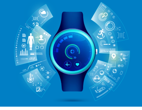
Activity Tracking app
Status date: 09 April 2025
Most Activity Tracker apps overlook key physiological data, especially for physically impaired individuals. This project bridges this gap with cutting-edge biometric sensors measuring heart rate, core temperature, hydration, and stride mechanics – promoting safe, optimized physical activity. Backed by real-world athlete insights, this project enables smart and comprehensive performance tracking, redefining fitness tracking for all.
TeleAssist
Status date: 23 December 2024
TeleAssist is an Augmented Reality (AR) platform that consists of AR glasses and an encrypted communication Web platform integrating satellite-based communication capabilities. The communication platform provides handsfree bi-directional audio-video communication between healthcare professionals which improves the delivery of care in remote areas.
SMART TT CARE
Status date: 16 August 2024
Discover Ping4All’s groundbreaking platform for holistic wellbeing and medical sport applications. With state-of-the-art sport-science, digital, and medical knowledge, their innovative solutions redefine health enhancing experiences at sports clubs and integrate sports breast cancer rehabilitation into healthcare systems. Utilizing immersive tech, AI, and 5G, they empower women to manage their health capital, fostering confidence and resocialization. Ping4All's vision is to innovate table tennis for “One Health”, anytime, anywhere.
Hand for U
Status date: 16 August 2024
“Hand for U” is an application that allows People in Need and Volunteers to easily contact each other and respectively, express their needs and offer their help on behalf of the Volunteering Organisations. “Hand for U” aims to facilitate the creation of a helping community.
SeaUrchin
Status date: 22 July 2024
The focus of our DEMO is to develop a Surf Tracking application and enhanced surf forecast and alert service. The tracking app will track and analyse surfers’ position and performance in the water accurately in conjunction with the Samsung Galaxy 5 smartwatch. . The second element of the project is development of an enhanced surf forecast service and personalised conditions alert service. This will be achieved through the use of EO imagery together with other ocean & weather characteristics.
HAIREMI
Status date: 14 May 2024
A new concept of product to run a sport in the schools using VR environments, haptic devices and enabling competitions and training activities between remote, in the space and in the time, users.
ONE CLASS!
Status date: 22 April 2024
ONE CLASS! is a “ONE STOP SHOP SATCOM-BASED SOLUTION” conceived to foster the use of distance learning in isolated schools/areas, to assist children hospitalized for medium to long-term stay, to support the multiclasses needs and facilitate social integration actions for Foreign Unaccompanied Minors (FUM) needing access to education and social inclusion programmes. Via a project extension (CCN3) a new service is added, providing a rapidly deployable packaged solution for education in emergencies, provisioned with telecommunication systems (“Portable Learning Space (PLS)”. The idea is to conceive, develop and operating a “one stop shop solution” offering to emergency context the opportunity to have a “classroom in place” completely equipped with Information and Communication Technology (ICT) devices and provisioned with an integrated telecommunication system (satellite, mobile, 5G) to start the process of social and cultural integration thanks to the access to digital educational and civil/cultural-oriented contents.
BST HIKES
Status date: 14 February 2024
BST.COACH, a Czech digital youth sports platform has developed a reward-based outdoor exercise application using GNSS-stamped locations.
ABSeaD
Status date: 26 December 2023
ABSeaD focuses on environmental conservation. It utilizes advanced machine learning models to analyse Earth Observation data for the strategic management of Posidonia Oceanica seagrass beds, crucial for carbon sequestration.
ARcade
Status date: 27 November 2023
Information and entertainment at the right time, in the right place. A platform providing a series of geolocated interconnected virtual spaces, called ‘Arcades’: virtual spaces overlaid on reality, activated by GNSS, where users access images, films, text and sound, using a smartphone/iPad. Turning everyday locations into virtual cinemas, classrooms, music venues, galleries, information hubs or marketing billboards.
Hand for U
Status date: 31 July 2023
“Hand for U” is an application that allows People in Need and Volunteers to easily contact each other and respectively, express their needs and offer their help on behalf of the Volunteering Organisations. “Hand for U” aims to create a safe space for People in Need and Volunteers to self-organise and create an empathetic community.
GALILEARN
Status date: 30 May 2023
GALILEARN Project foresees the acquisition, development and consolidation of skills and knowledge, both technical and scientific, with particular reference to Space and Earth Observation, using tools and methods that combine education and entertainment.
Space Augmented UAM
Status date: 14 February 2023
Space Augmented UAM aims to determine the feasibility of a “Space Augmented” service enabling cities and regions to conduct U-Space integration assessment utilizing economic, technical and environmental simulations for predictive assessment considering the individuality of each city to generate a self-sustainable Urban Air Mobility ecosystem.
HeReMo
Status date: 14 February 2023
HeReMo supports the healthcare community to deal with the coronavirus outbreak, with special attention to the growing number of citizens affected by chronic conditions and comorbidities. It reshapes the management of patients, with a personalised healthcare delivery, whose chronic conditions could overload healthcare system during pandemic crisis without overlooking patients’ needs and frailties, even more in areas where terrestrial communications are insufficient. The solution has also benefits for other clinical applications.
FATE
Status date: 10 February 2023
FATE develops a digital ecosystem to preserve and disseminate cultural heritage sites, realizing an open, participatory and interactive marketplace platform, using best of breed innovative technologies and smart interconnections between service providers, merchants, customers, users and stakeholders, realized on a cloud-based AI supported virtual platform that store, share, manage and maintain historical sites digital twins and related metadata.
Space for Children
Status date: 02 February 2023
“Space For Children” is an innovative medical edutainment experience, based on Interactive Reality solution and playable by smartphones and tablets with iOS and Android operating systems, that give doctors and professionals the opportunity to analyze the emotional needs and the psychological support to be offered to children and the family community.
FiELD
Status date: 21 November 2022
Finding Intelligent Environment-led Data (FiELD) initiative delivers a cooperative framework in rural hubs to facilitate implementation of space data by end users through the “citizen science” concept. The range of services is built around the principles of consolidation, facilitation, education and innovation of appropriate earth observation (EO) data, to enhance local authority and citizen decision-making.
Digital Engineer
Status date: 20 October 2022
The Digital Engineer is an AI-powered Digital Assistant allowing engineering learners, students and professionals, to acquire industry knowhow and expertise alongside a group of peers, through hands-on projects, anywhere in the world, to solve big problems on planet Earth, and providing the tools for engineering instructors to focus on teaching. The platform is the foundation of the future of engineering education thanks to powerful digitalization and automation of workflows.
IE4Education
Status date: 11 August 2022
Creation, production and installation of exhibitions based on satellite images to promote space applications or to highlight a territory or a specific topic.
DreamCoder TM 2.0
Status date: 26 July 2022
DreamCoder 2.0 is your first ticket to Space. It is a commercially driven application to digitally access the International Space Station. The service is powered by Nanoracks Europe in partnership with Rina Consulting.
LeA: Learning Achievements
Status date: 13 July 2022
LeA Project boosts the acquisition, development and consolidation of skills and knowledge, both technical and scientific, with particular reference to Space, using tools and methods that combine education and entertainment.
ECOP
Status date: 17 May 2022
ECOPlayer (ECOP) - ecological, virtual educational platform for children and young people. The activity is based on the use of synergy resulting from the integration of modern satellite solutions aimed at creating an educational platform based on three methods of content presentation: Virtual Reality, Augmented Reality and a combination of features of both solutions in the form of Mixed Reality.
The proposed product is based on two key space programmes carried out by ESA: Earth Observation as part of the Sentinel mission and GNSS global positioning systems. The proposed solution envisages exploiting the synergy of the Sentinel project's products with the Galileo and EGNOS satellite navigation systems to provide integrated geo-information to the users.
LudoTrek
Status date: 13 April 2022
LudoTrek is a GNSS-based learning game platform with an easy-to-use interface for creating customisable routes which can designed for educational and entertainment purposes.
AstroLEO
Status date: 13 April 2022
Awareness of the Earth's vulnerability and the digitization of education are important issues for current and future generations of students. AstroLEO serves these areas in an Augmented Reality (AR) based mobile learning application by presenting curriculum-compliant content against the backdrop of Earth observation.
Space studies
Status date: 12 April 2022
Our project develops four workshops with high interactivity between participants and instructor and among participants, in order to provide the participants an experience as similar as possible to the on-site workshop. The workshops offer training in handling of astronomical databases within the virtual observatory scheme; of Earth observations for disaster management and environmental studies; and Life science and “OMICS” technics.
EBX4EDU
Status date: 24 March 2022
For individuals and educational institutions, Earth Blox makes access to satellite data easy by removing the barriers to access and understanding. Earth Blox quickly empowers students to go from sensing to sense-making, whether they are in a lab or at home.
TREVAR
Status date: 21 March 2022
TREVAR is a platform designed for the realisation of tactical training in team games. The solution is based on GNSS satellite positioning technology and Virtual and Augmented Reality (VR/AR) aspects. The recipients of the system are coaches and players. The main functionality of the system is based on ability to visualise selected tactics and conventional training.
CLASS@CROSS
Status date: 23 February 2022
The Class@cross project has developed a Satcom based solution aiming at offering an Education Outreach platform accessible from any ICT device in order to enrich the educational opportunities with special regard to the social factors and cultural and scientific contents.
S.T.E.L.L.E.
Status date: 17 January 2022
S.T.E.L.L.E. will give rise to SCUOLAB – SDA (Satellite Data Augmented), an educational platform with interactive and experiential contents produced from satellite Earth Observation data and based on issues of global importance such as climate change, melting glaciers, rising sea temperatures in order to give the teachers support with innovative resources to conduct both in-person and remote education experiences.
HERMOSA
Status date: 14 December 2021
HERMOSA is a service platform dedicated to support activities on ecosystem restoration and biodiversity conservation in its larger sense and the positive impact it has on the issue of food security, creating sustainable jobs, mitigating and adapting to climate change and empowering communities in technologies. HERMOSA is built using Open Source Software, accessible through the internet, empowered by web-mapping and Remote Sensing technologies.
Robotiphy Severus
Status date: 14 December 2021
Program virtual robots in-browser in realistic immersive environments with space asset integration.
GSOT
Status date: 16 September 2021
The main goal of this project is to create an augmented reality system for the 50ha Grunwald battlefield site in Poland. Visitors will be able to download the application to their smartphones and learn more about the history of the battle while visualising the deployment of all forces on site.
SMRC
Status date: 21 July 2021
SMRC intends to create a school map in rural communities with the help of satellite data, applying computer vision to earth observation data.
SPACE EDU PARK
Status date: 10 February 2021
Digital and gamified learning environment to provide support to Science Teachers and Students in Italian lower secondary schools also through the use of multimedia content enhanced by space assets and AR/VR experiences.
STAY
Status date: 10 November 2020
STAY: is a mobile interactive experience that rewards young people for acting positively during COVID-19 or a similar public health crisis.
The platform incorporates live data feeds, Augmented Reality and geo-location into unique learning experiences that give young people the opportunity to earn pieces of digital merchandise in return for their efforts.
RASOR
Status date: 14 October 2020
A streaming service for live and replay space imagery - bringing together amazing videos and visualisations from across space into one easily accessible platform.
ONE CLASS! Open Network for Education
Status date: 05 October 2020
The ONE CLASS! project proposes an efficient satcom based solution integrated with eLearning services, aiming at supporting two main activities:
- Basilicata Multi-classes: ONE CLASS! supports rural schools located in the Basilicata Region (IT), which need to face the problem of the so-called “multi-classes” with the additional constraint represented by the geographical isolation.
- Social Integration Services for Foreign Unaccompanied Minors (FUM): ONE CLASS! supports social operator entities and reception centres of immigrants and all other NGOs active in the field, which need to offer to foreign unaccompanied minors (FUM) educational and social inclusion services, being often located in very remote areas.
B-LiFE - TEN
Status date: 24 August 2020
The B-LiFE Telecommunication Emergency Node is a new field communication and control system, integrating space assets and new tools for crisis and logistics management.
TeleAssist
Status date: 27 May 2020
TeleAssist is an Augmented Reality (AR) platform that consists of AR glasses and a specialized communication platform integrating satellite-based communication capabilities. For mobile healthcare professionals it improves the delivery and improvement of remote care in rural, poverty, and conflict areas, along with global assistance to mobile emergency care.
Space Science as a Service
Status date: 31 March 2020
The “Space science as a Service” feasibility study aims to validate the viability of a new model to deliver space science satellites through a commercial delivery and implementation plan.
ARGOS > INSIDE
Status date: 12 March 2020
In parallel to the CLS initiative to design a satellite constellation dedicated to Space IoT called Kinéis, this study aimed to analyse the market opportunity of a recently developed hybrid Argos chipset with terrestrial communication capabilities to fill coverage gaps . A largely increased satellite data collection capacity and low cost and small size terminals will permit to significantly multiply the number of devices. Three application areas have been targeted in the feasibility study: container shipping, artisanal fishing, equipment operation control especially for humanitarian aids.
Fully Automating Data Pipeline
Status date: 11 February 2020
In 2010, the United Nations explicitly designated that "safe, clean, accessible and affordable drinking water” is not only a necessity, but also a fundamental human right. However, we live in an imperfect world, in which man-made activities and natural disasters create conditions that limit our access to water and expose us to dangerous water events. Organisations around the world have recognised this challenge and shown their commitment to creating, as the World Bank terms it, “a water-secure world for all.”
IMGeospatial is honoured to be part of this movement and has partnered with three clients to address the biggest water-related threats to our livelihood: flooding, water scarcity and water quality. We provide business intelligence that enables them to proactively manage their water systems, build resilience in their communities and ultimately minimise risk and impact. We do so by automating the data pipeline, reducing the time and cost of turning earth-observed data into actionable insights.
EMC
Status date: 04 February 2020
The EDU-MAT COPERNICUS is related to the use of VR / AR applications in Education. The proposed IT solution aims to create an educational platform with mathematical tasks using visualization of satellite technology in augmented reality. It can be innovative solution allowing students to get acquainted with mathematical knowledge in an interesting way.
GPS Triggered AR System
Status date: 10 January 2020
Imagine you’re walking along Hadrian’s Wall. Your phone vibrates. You pause, hold up your phone and scan the landscape around you. The ghostly figure of a Roman soldier appears on your screen and begins to tell his story...
We have developed a new GPS Triggered AR Module that makes it easier and more cost-effective for organisations to engage audiences.
SHOW
Status date: 19 December 2019
SHOW as a mobile service is aimed at making seniors feeling constantly needed by society, as they are enabled to offer help to family members, friends, or in general people who need support. It addresses the challenges of elderly people regarding increasing mobility, maintaining activity, improving safety, reducing stress, growing assurance of behaviour and reducing social exclusion.
Village Data Analytics
Status date: 02 December 2019
Village Data Analytics (VIDA) is a software-enabled service that automatically identifies remote villages and determines their suitability for a micro-grid installation using earth observation data and machine learning algorithms.
VIDA can be scaled across large user-defined areas to find a portfolio of viable micro-grid sites. This data-driven knowledge de-risks projects, reduces time and planning costs and enables investment at scale.
Cerberus
Status date: 26 November 2019
BlackShore’s crowdsourcing platform Cerberus reinforces developing country economies utilizing satellite imagery amplifying sustainable food production while preserving the environment. This is achieved through the power of satellites, socially conscious gaming and the power of the crowd.
AR.fx
Status date: 07 November 2019
AR.fx enables users to create, place and to interact with location-based 3D content in Augmented Reality utilizing smartphones. It incorporates gamification elements such as blueprint (users can connect pre-defined line-dots in AR and create 3D objects) and multi-player capability along with AR Scene-Editor. On a global map users can explore and physically interact with AR content of interest.
AT
Status date: 07 November 2019
Activity Time (AT) deals with forms of spending time after school or work. Using mobile phone geolocation users receive notifications about interesting activities and events in the neighbourhood and are able to track children activities and results. The service provide NGOs and private companies with tools to manage their own offer and create opportunities to reach the target audience.
MOWGLI Feasibility Study
Status date: 09 August 2019
MOWGLI is a solution that provides a set of services for optimal microgrid planning, designing and operational and maintenance (O&M) applications in urban and rural areas of developing countries, with particular focus on India user case. The activities have been implemented in cooperation with the India Energy Storage Alliance (IESA) and funded by European Space Agency (ESA) within ARTES IAP programme.
BIGMIG
Status date: 02 August 2019
The study aims at identifying possible applications of space data (imagery, navigation data, satellite communications etc.) and other (“big”) data sources to help and improve the mitigation, readiness and response to the human migration phenomena, and to assess their technical and economic viability.
ARCT.esa
Status date: 12 April 2019
The ARCTTM stakeholder mapping tool offers visualization of “Project Health” in the cross-roads between society, environment, business and policy. The unique de-risking tool combines climate change risks with other factors and makes them relevant, simple and visual for owner and decision makers of any infrastructure project.
ARCT has also found a fun and engaging way to score and report on the UN Sustainability Goal Climate Action goal #13. www.arct.tools.
WELLACTIVE
Status date: 14 December 2018
WELLACTIVE is a Silver Fitness & Leisure Platform helping Seniors perform outdoorrecreational activities tailored in real-time to their personal abilities and interests, combining “physical, cerebral and social” undertakings shaped for “impairment and accessibility”.
Curio Canopy
Status date: 11 October 2018
Combining analysis of satellite imagery with crowdsourced data, this urban tree montioring platform connects communities and urban forestry professionals. It provides an open data service that drives improved understanding of urban trees and access to better information in order to: i) increase tree planting and tree care; ii) improve environmental conservation management and planning; iii) support educational and communication resources for learning and knowledge-sharing.
COHABIT
Status date: 12 September 2018
COHABIT monitors and assesses in real-time the whereabouts of large wild animals and dynamically generates geo-fenced alerts for visitors to avoid dangerous encounters and for farmers to protects their crops and livestock. Wildlife – human cohabitation is made possible through the use of data analytics, image-recognition, animal tracking and space technology.
SPARK ME
Status date: 23 July 2018
SPARK ME develops an acceleration programme to attract, support and validate new application and service ideas using Satcom in association with additional space technologies. The ultimate goal is stimulating the creation and growth of new markets of space/satellite-based services, addressing the real users’ need and triggering cross-fertilization processes by "contaminating" other areas of activity with the use of space technologies.
EO-li
Status date: 28 June 2018
EO-li (Earth Observation based location identifier) is an open source web-based,global platform matching demand and supply of identifying, selecting and reporting in the land restoration context. It has four components, namely the (i) identification of a location area to be restored, the (ii) selection of an area and the actors involved in the restoration activity, the (iii) monitoring and reporting on the progress of the project using earth observation and geospatial data and (iv) a learning component providing guidance and capacity strengthening.
SenZitall
Status date: 15 June 2018
The SenZitall integrated solution is envisaged as a one-stop-shop for smart IPM and horticulture management. It will operate as a fully independent, low power WSN providing high resolution, near real-time environmental data as input to an integrated Spatial Decision Support System (SDSS). The sensors will run with a multi-constellation GNSS and a dual uplink SATCOM system.
AgeSpot Feasibility Study
Status date: 18 May 2018
AgeSpot provides THE starting point for any innovative technological solution addressing ageing populations. It enables efficient targeting of the silver economy and offers precise demographic data on WHERE and HOW MANY age specific classes currently live and will likely live in the FUTURE. With AgeSpot a new Earth Observation (EO) supported business intelligence service is offered.
WILDWEGO
Status date: 16 February 2018
WILDWEGO (in the WILDLERNESS WE GO)is an innovative Augmented Reality (AR) ecotourism game fostering biodiversity conservation in wilderness areas by tourists “on the go” in parks and by their family, friends and social networks contacts “remotely”.
SWAY4Edu2
Status date: 14 December 2017
Capacity Building activities for rural schools and rural radio stations in Africa based on eLearning platform accessible on-line via the Sat3Play platform.
SWAY4Edu
Status date: 18 January 2017
SWAY4Edu aims at developing a satellite ICT (Information Communication Technology) solution to support the three main activities of Rural Radios, Electoral eTraining, and Space4Education.
TT-GSAT
Status date: 21 July 2016
TT-GSAT facilitates rescue and emergency services as well as industry and service providers to leverage innovations along evaluated needs and requirements, which results in minimized risk for solution development and eases complex deployments in a mission critical environment.
Comprehensive services with scoping services for innovation driven procurement, test and operation support for SatCom and terrestrial communication, navigation, EO based solutions and training/simulation services are offered.
Project U
Status date: 20 May 2016
Project U is about a new generation software/hardware platform and services that enable an enhanced User-centered learning experience combining together physical and digital presence, promoting active participation versus passive presence.
SatSoHoAfrica
Status date: 20 May 2016
SatSoHoAfrica is allowing the provision of competitive broadband internet services to Small-office-Home-office (SoHo) users in Sub-Saharan Africa.
Cerberus: Forest Falcon FS
Status date: 05 January 2016
If you care about the future, you also care about our planet. Greenhouse gas emissions caused by forest degradation and deforestation are one of the largest causes of global warming. Many organizations have a negative impact on the extent and quality of our forests. It is time we change that. We map what matters. Through our crowd — a big, global community of people who care about our planet just as much as we do — we build maps and information products of high quality and reliability. Our forest monitoring services can be adjusted to your specific needs, so you will get exactly the information you need.
SatResponse
Status date: 06 August 2015
The frequency and impact of natural and man-made disasters is increasing, resulting in needs for better response efforts.
Satellites provide a secure, resilient, always-on infrastructure for dealing with emergency situations; however cost and availability problems often hamper their effective use.
SatResponse investigated new technical, commercial and operational models for delivering better satellite communications and other space-based application services to Disaster Responders.
SATForM 3D
Status date: 06 July 2015
A tremendous opportunity exists for the global forest industry to capture the combined benefits of cutting edge technologies in the areas of satellite remote sensing technology, ground forest measurement, data analytics and cloud computing. The goal of the SATForM 3D project has been to design and develop a web-based application -Forest Mapper- integrating different satellite Earth Observation (EO) and aerial LiDAR with an innovative ground-based Terrestrial Laser Scanning (TLS) forest measurement technique and data analytics, to provide better management and more efficient utilisation of our global forest resources.
The project had the support of the main forest owners and forest managers in Ireland, who have collaborated in defining and validating the Forest Mapper features so that it now provides an innovative solution to their current needs.
B-LiFE
Status date: 29 April 2015
The B-LiFE project is focused on delivering services for field analysis of biological threats and emergencies using a Light Fieldable Laboratory System.
ISIDE 4 Africa
Status date: 30 March 2015
I4A focuses on the provision of educational content and Internet access to African primary and professional high schools and to health and cultural centres. In a nutshell, I4A aims at providing a one-stop-solution for the collection, organization, delivery and use of digital educational contents based on the ISIDE platform/service.
sahel
Status date: 06 May 2011
The SAHEL initiative is a demonstration project for telemedicine service in Sub-Saharan Africa. The project will define and implement an operational pilot system connecting some isolated areas in both Western and Eastern countries of the Sub-Saharan region with medical centres of excellence for clinical services and eLearning. It is the first building block of a large pan-African network for telemedicine, in line with the TTF (Telemedecine Task Force) objectives.


