
Aviation and Remote Piloted Aircraft Systems (RPAS) are domains with tremendous potential for the deployment of space-based services alongside traditional infrastructures. The aviation industry has since long been a pioneer user of space-based solutions (e.g. navigation via satellite, GNSS-based flight procedures). Space-based services are able to offer exceptional capabilities to deal with increasing challenges, such as air traffic congestion, greener, safer and more effective trajectories as well as fleet management. The development of RPAS also faces some unique challenges, such as flight in unsegregated airspace, which are gradually being solved on the technological as well as regulatory level. This opens the way to some exciting new service opportunities, such as unmanned geological surveying and monitoring of infrastructure, all providing clear benefits to society as a whole.

AMSynchro
Status date: 10 July 2026
AMSynchro is a space-enabled assurance platform for hazardous metal powders used in additive manufacturing. It links monitoring, custody, genealogy, warning logic and audit-ready evidence to help operators understand whether materials remained safe, compliant and fit for use throughout storage, handling and movement.
SWAS
Status date: 07 July 2026
The Space Weather Alert System feasibility study investigates the industrial desirability of space weather services in the domain of electricity networks, aviation and GNSS dependent systems in Austria.

FTS
Status date: 02 July 2026
Vixos Beyond is a satellite-based flight termination system for drones that enables safe and regulatory-compliant operations beyond visual line of sight. It provides a complete, independent containment solution—including hardware, communication link, and documentation—ensuring aviation authorities recognize compliance while giving operators global coverage, high reliability, and flexible termination options.
CONSAT
Status date: 02 June 2026
New EU regulations from 2025 require airlines to report on contrail impact. Estuaire is building a satellite-based service to detect and track contrails globally, giving airlines accurate, evidence-based climate data.
TOMCAT
Status date: 08 May 2026
TOMCAT is a turnkey solution for General Aviation pilots, delivering authenticated tracking, i-Conspicuity, and digital flight reporting across all flight phases, ensuring compliance with U-space regulations and enhancing safety.

UVFDR
Status date: 14 April 2026
The universal virtual flight data recorder (UVFDR) is a vendor-agnostic, non-exclusive data repository, providing flight data including Global Aeronautic Distress and Safety System (GADSS) functions from day-to-day aviation operations to users in near real time.
Helios
Status date: 27 March 2026

HOPE
Status date: 26 January 2026
HOPE is a solution, accelerating drone specific category flight authorization. We use the fusion of Satellite Earth Observation (EO) and Artificial Intelligence to accurately forecast human mobility and population density. This provides UAS operators and authorities with the objective data needed to define the Intrinsic Ground Risk Class (iGRC) under the SORA 2.5 framework, simplifying complex regulatory processes. complex regulatory fffffcompliance and opening up more airspace for safe operations.
DTM Tool
Status date: 26 January 2026
The DTM Tool service is a solution developed to address the challenges of the drone market. The service allows, through modern aviation surveillance technologies and geospatial data processing, to support safer and more efficient drone operations.

Frequency
Status date: 01 December 2025
The Frequency Aviation Communication Collaboration platform, designed to streamline communication and improve operational efficiency, demonstrates together with Aer Lingus (a major European airline) that it connects frontline workers, operation control centers, and leadership, facilitating real-time information sharing and decision-making. The platform reduces delays, improves on-time performance, and decreases costs for airlines by automating communication and reducing information silos.

Expanding Ocean Monitoring with High-speed UAVs
Status date: 06 August 2025
High-speed UAVs with satellite links deliver real-time whale presence confirmation, optimising marine area closures and balancing ecosystem protection with economic activity.

Samplifly
Status date: 16 June 2025
SAMPLIFLY is a fast, integrated, and sustainable drone-based express transportation service design to carry different types of samples for industrial companies. SAMPLIFLY is able to operate in highly industrialised areas such as large harbours.
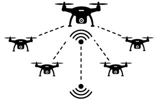
SJAR
Status date: 11 March 2025
UAV swarm-based humanitarian mine-detection and -recognition in GNSS-denied and communication-contested environments, as one module of the Dropla de-mining solution, which includes ground drones for terrain preparation and confirmation.
Drone parcel distribution in a closed area
Status date: 24 February 2025
The project prepares a feasibility study for Technology for Drone parcel distribution in a closed area on designed Drone Helipads. The helipads and Navigation System for drones are satellite-based on GNSS and Earth observation data to ensure safe, precise landings in urban environments. Designed for commercial drone operations, it enhances logistics efficiency while minimizing risks. The system is tested in real-world conditions through Brno Exhibition Centre.

IONA Hubs Network
Status date: 12 February 2025
IONA tackles costly rural deliveries with autonomous, satellite-guided drones that lower costs 5–20×. ESA-supported Cosmogony TMS integrates with existing van TMS to handle drone-vs-van parcel allocation, and removes regulatory hurdles by providing SORA-compliant BVLOS routing and satellite-enabled landing zone identification for last-mile and reverse logistics.

Inteliports PORTAL
Status date: 17 January 2025
Inteliports develops autonomous, heavy lift drones and drone ports for the future of aerial logistics. The PORTAL project is seeking to trial demonstration of multimodal, collaborative logistics involving unmanned, aerial drones and micromobility with advanced robotics, automated infrastructure and SATCOMS enabled technologies. The project is a collaboration between Inteliports and Vodafone.

ANESI
Status date: 17 January 2025
The ANESI kickstart introduces a trustworthy service for aerial inspections to manage, optimize, and maintain solar parks. By using autonomous navigation based on computer vision and precisely detecting anomalies through thermal images, operational inspection and processing time is considerably reduced. The increase in efficiency of Unmanned Aerial Systems (UAS) flights and data handling have a great impact on the energy generated, reducing costs and boosting customer profits, while reducing CO2 emissions.
PLATIN
Status date: 17 January 2025
The objective of PLATIN project is to develop satellite connectivity equipment and services to leverage flight operations of fixed wing, rotor wing, UAVs, Balloons. PLATIN relies on LEO satellite constellations such as Iridium Certus, and also supports cellular 4/5G connectivity.

SaturnX
Status date: 15 January 2025
SaturnX is a drone-based wind turbine inspection service collecting high-resolution RGB images from an offshore wind farm-resident Launch/Recovery/Recharge Platform (LARRP), thereby replacing traditional inspections involving technicians manually climbing turbines using ropes or semi-manual inspections via drones operated from a pilot on the vessel deck. SaturnX inspection flights are conducted BVLOS, enabled by satcom technology and operated from an onshore Control Centre.

VertiRapid
Status date: 26 December 2024
VertiRapid is a cutting-edge service designed to facilitate safe and efficient flight operations around vertiports (vertical landing/starting areas) for drones and Vertical Take Off and Landing aircraft. Leveraging available geodata and verified with Earth Observation (EO) techniques, VertiRapid swiftly determines operational parameters crucial for safe flight, aligning with ISO/DIS 5491 standards and European Aviation Safety Agency guidelines.

BrightEarth
Status date: 20 December 2024
BrightEarth is a web-based application that generates cartographic data from high-resolution satellite imagery. The data are available on demand from anywhere in the world, and include 3D vectors, GIS raster and textured 3D building models.

SUPER
Status date: 11 November 2024
SUPER focuses on using Earth Observation (SatEO) and Satellite Navigation (SatNav) for Urban Air Mobility (UAM) infrastructure planning and integration into public transport, and in planning and monitoring aspects of UAM operations. Relying on SatEO (archived and near real-time) data provides diverse geospatial, environmental, weather and mapping information, and allows combining it with SatNav data from air traffic (once available).
FB Eye
Status date: 23 October 2024
FB Eye – acronym of Fire-Bombing Eye – is a commercial initiative to improve the firefighting operations using innovative space-based and ground-based technologies.
FB Eye is an innovative platform-as-a-service commercial provision of integrated satellite/airborne Comms/Nav support to the precision water bombing of large wildfires.
FB Eye provides water bomber pilots with a near real time information map with precise geographical location of most radiating fire hotspots, being the most effective release target to extinguish rapidly the fire.
DECISIONX:NETZERO
Status date: 13 March 2024
SATAVIA is reducing the climate impact of flying by mitigating the warming effect from the clouds aircraft make and enabling airlines to claim carbon credits as an incentive. Globally, aircraft contrails trap heat in the atmosphere and increase aviation’s climate impact by over 30%, contributing to global warming. From 2025 the European Union Emission Trading Scheme (EU ETS) will require airlines to report this impact.
SATAVIA’s technology provides atmospheric intelligence to change flight plans to avoid contrail-forming conditions. The mitigated climate impact is verified by SATAVIA and converted into tradable units by a patented method with the backing of Gold Standard, a major carbon accreditation platform.

5G Drone Safety Module
Status date: 14 February 2024
Currently drones are not electronically visible, and it is not possible to determine accountability of a drone without searching and hoping you can find the operator. The proposed activity for the ESA Kick-Start project is to solve the issue of electronically identifying and tracking of drones.
AirTracks
Status date: 08 January 2024
AirTracks is a flexible and cost-efficient Air Navigation Information Service for enhanced aircraft safety during approach and departure at small and medium aerodromes which do not have any aeronautical surveillance system (e.g. Radars). Airtracks combines various aircraft surveillance information (ADS-B, Mode-S, etc) in the vicinity of an airfield. The information can be visualized on a web-based display, showing the relevant/customized ancillary information layers in a user-friendly way e.g. flight plan, aeronautical charts, meteorological information as well as safety related notifications to aircraft pilots (NOTAMS).
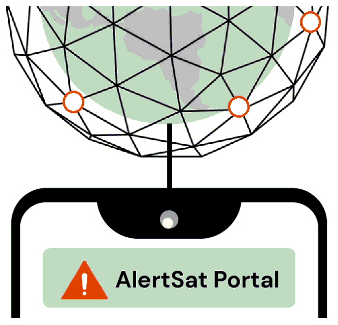
AlertSat Portal
Status date: 26 December 2023
The AlertSat satellite constellation is to deliver Alerts directly to its users, through AlertSat Portal - when critical information has been detected and there is still time to act upon it.
GIP4 Smart Airports
Status date: 19 September 2023
Fourteen million flights are expected in 2035 in Europe. To increase airport capacity and efficiency, optimisation at every step must be carried on. GIP4SmartAirports projects aims at minimizing rotation time and smoothing real-time operations. Space technologies can be a valuable asset to support surveillance and safety, and help airport manager to maintain high quality and complete knowledge of their assets.
CRUISE
Status date: 19 September 2023
CRUISE intents is to design, develop and validate a CyberSec Test Range for UAS/RPAS. This technological framework combining ICT, EO and SATCOM, will be located in the Grottaglie Airport (Italy), a facility that experiments RPAS and studies the integration of UAS in non-segregated airspace. It will offer the overall assessment of vulnerability and resilience of UAS with respect to cyber-attacks.
MWS-A
Status date: 11 September 2023
MWS-A is a new weather nowcasting service for airports with high spatial and temporal resolution. The service combines real-time positions and predicted trajectory data of aircraft, and high resolution nowcasts of the motion and evolution of observed severe weather phenomena. Using these data the MWS-A service engine derives predictions of upcoming encounters of the weather phenomena and aircraft within up to 40 minutes time window in the future.

Proteus
Status date: 16 May 2023
Proteus builds on the success of the SEDDCR project and introduces a significantly increased operating area by leveraging novel space technology such as Iridium NEXT. Integrating with the NHS Highlands, Skyports is delivering to six medical facilities where drone deliveries facilitated by space technology has the potential to significantly enhance patient care.
oneTcall
Status date: 20 March 2023
No GSM coverage? You are on a plane or ship and you need to receive an important call or to make an important call? No problem: with oneTcall you can continue to use your mobile phone and your telephone number without changing your user experience and without any limitation.
Thanks to Satellite you can have IP coverage everywhere in the World and also in Mobility. With OneTCall + IP via Satellite you can have also your Mobile Phone working and keep using your telephone number.
Easy for the customer. No additional infrastructure required for the Operator.
OneTCall is perfect to provide seamless voice coverage also on board of Airplanes and Ships.
OneTcall is a patented service.
TrackSat
Status date: 15 March 2023
Development of a standalone drone tracking service capable of transmitting its position over 4G network during normal flight, addressing drone flight regulations. In case of a crash, the drone will use satellite IoT connectivity to send its latest known position.
DOCS-2
Status date: 15 March 2023
Using civil aircraft to create constellations for providing high spatial & temporal Earth observation data and telecommunication services; a most ecological constellation re-using the most reliable platform.
DroSecMa
Status date: 13 March 2023
“The fence no longer defines the perimeter.” Exponential increase in capability and reduction in cost has made drones a truly disruptive technology. Their capabilities may be leveraged for significantly improved surveillance and data collection but that also
represent a significant and evolving threat. DroSecMa leverages the capabilities of drones while providing real-time threat mitigation.

Space Augmented UAM
Status date: 14 February 2023
Space Augmented UAM aims to determine the feasibility of a “Space Augmented” service enabling cities and regions to conduct U-Space integration assessment utilizing economic, technical and environmental simulations for predictive assessment considering the individuality of each city to generate a self-sustainable Urban Air Mobility ecosystem.
GIP 4 Smart Airports
Status date: 05 December 2022
The GIP 4 Smart Airports solution provides all actors of airport ground operations (e.g. airlines, airport, handlers) with better, accurate, real-time information about ongoing turnaround operations. GIP 4 Smart Airports offers a non-intrusive, bird-eye view of airport activities, without intruding and disrupting current working practices of airport teams, while making real-time information available to everyone.

HOPE
Status date: 21 November 2022
Human safety is a critical factor that defines the iGRC (intristic Ground Risk Class) of the Unmanned Aircraft Systems operations. The HOPE project aims to integrate various source data, including satellite data (SatEO), to forecast human mobility over time, with the help of artificial intelligence and provide the derived information to operators&authorities.
MEANDAIR
Status date: 11 October 2022
Meandair provides pilots with relevant weather data. Before flight, a plan can be registered in the application and the necessary weather information will be downloaded. By pushing the flight button, just before take-off, the Meandair weather information travels along with pilots. Updates of the latest weather can be also downloaded during flight using the SATCOM communication devices. The weather data are also available to 3rd party application developers, behind easy to use programming interface.
DECISIONX
Status date: 27 September 2022
SATAVIA is an AI software and data company simplifying decision-making in aircraft flight operations and maintenance to make aviation smarter and greener.
DECISIONX is a cloud-based analytics platform combining global flight data with atmospheric data to perform environmental exposure assessments for aircraft and buildings. This enables better decision-making in condition monitoring, predictive maintenance and aircraft performance.
DRONEAI
Status date: 19 September 2022
The DRONEAI project aims at providing an integrated approach to provide a close to real time assessment solutions for disaster relief and humanitarian interventions. It consists of a complete and state-of-the-art solution relying on Artificial Intelligence including a set of tools to enable its application in a time of tension and with high level of flexibility. DRONEAI is combined as an edge processing solution in HITEC’s Nomadic Satellite Communication (NoSaCo) terminal, it creates a unique solution to support the on-site analytics.

SWAIR
Status date: 30 June 2022
The aviation industry is becoming increasingly dependent on the GNSS-based technologies, at the same time being aware of its vulnerabilities, including those originating from Space Weather. SWAIR responds to that reality with a system providing GNSS and Space Weather monitoring and performance assessment products, compliant with international regulations and recommendations.
FLAMES
Status date: 28 April 2022
With the FLAMES project, the consortium of Unisphere, Matternet and Nordic Unmanned demonstrated how simulation technologies can be used to increase the automation of drone flights in an urban and maritime environment.
For the first time, high-resolution weather data, the Copernicus digital elevation model, aircraft performance models and trajectory simulations were combined to create a digital twin of drone flights. This forms the basis for automated flight planning, which is offered as a SaaS service. Moreover, the validated simulation technology is the basis for autonomous flight operations in the future and enables a reliable transfer of pilot knowledge into software. As a result, a broader customer base will be able to use drone technology.
4S Safety of Future Transport
Status date: 13 April 2021
4S Safety of Future Transport is a study undertaken within the frame of the 4S Strategic Programme Line that aims at identifying a list of applications that will use highly innovative and secure Satellite Communication systems to support safety critical services within the transportation industry (Aviation, Maritime and Railway).
AgeSpot
Status date: 07 April 2021
AGESPOT is a completely new technological development based on satellite earth observation data offering services that allow access to precise data on WHERE and HOW MANY people, under consideration of their ages and socio-economic attributes, currently live and will likely live in the FUTURE.
airUTM
Status date: 30 March 2021
airUTM is an Unmanned Traffic Management system that allows for equitable use of airspace for both manned and unmanned aircraft in Africa. We enable large numbers of drones to safely and securely conduct operations in compliance with aviation regulations.
ASTROCAST
Status date: 25 March 2021
Astrocast is developing an advanced Nanosatellite network for the Internet of things (IoT).
SEDDCR
Status date: 18 February 2021
In the SEDDCR project, space-enabled delivery drones were used to assist the National Health Service (NHS) in rural Scotland in the fight against COVID-19. The delivery drones carried critical COVID-19 pathology tests and related medicine between hospitals and medical practices, ensuring that the NHS had access to a fast, frequent and reliable medical logistics system.
ACABAS
Status date: 04 February 2021
Using civil aircraft as a platform to collect AIS data, complementing existing terrestrial and satellite solutions, enhancing AIS data availability.

AMMO
Status date: 04 December 2020
Ascend offers two distinct disruptive services that cover all types and sizes of airports, from the smallest to the largest ones. These services offer analysis of Earth Observation data for safety monitoring of the airport surroundings, and combine it with a cloud and browser based management system. Thereby the AMMO services are supporting the airport operators who are asked by the European Aviation Safety Agency (EASA) to comply with the regulation EU 139/2014 on aerodrome safety.

WAMMO (AMMO CCN#1)
Status date: 24 June 2020
The WAMMO project, a continuation of Ascend XYZ’s AMMO project, aims to expand the service with ground radar data. Airports will be able to visualize bird activity and identify the associated areas of interest. Radar data and correlated EO data from multiple airports will be used to produce statistical models for airports not equipped with a radar and with similar habitats.
STAP-ULD
Status date: 04 May 2020
STAP ULD-Watcher provides a new and patented solution for monitoring and tracking airfreight container (ULD) in all airports of the world. Supported by IATA regulations the ULD-Watcher will help to avoid delays, lost baggage or goods and will reduce insurance cost dramatically and increase general profit for the customers of STAP.
SkyLiberty CCN#1
Status date: 20 March 2020
Through the SkyLiberty project, ESNAH has created a service associated to a set of different products to support pilots and other aviation stakeholders in the performance of safe and effective flights.
Originally designed for aviation, the SkyLiberty service has proven to be useful in several other domains (e.g. boats or trucks tracking).
The service is composed of several modules named SkyUser (mobile application and web for pilots), SkyOperator (web application for operators, i.e. persons or entities owning and renting one or more aircrafts to pilots) and SkyLink (tracking device and satellite modem), which have different functionalities tailored to the needs of various stakeholders.

SkyLiberty
Status date: 07 February 2020
SkyLiberty is a new service based on a software product, which aims to improve the preparation and the performance of flight navigations. It offers a full set of new concepts and services for student pilots, beginner and advanced pilots, aircraft operators, airline companies and passengers
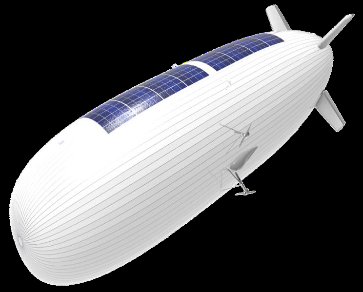
Services enabled by HAPS
Status date: 22 January 2020
HAPS platforms are evolving in the stratosphere to conduct earth observation. They provide large-scale images as a support to decision-making processes in domains like meteorology, security, safety, natural resource inventories, climate change or prevention and monitoring of natural disasters. They provide high versatility, near real-time information and high revisit frequency on their targets
HAPS4ESA
Status date: 17 January 2020
A roadmap for combining High Altitude Pseudo-Satellites (HAPS) and satellites for ‘persistent surveillance’ monitoring scenarios.

ADS-B Xplore
Status date: 14 January 2020
ADS-B Xplore elaborates innovative service ideas targeting:
- Big data applications based on air traffic surveillance data
- A global communication solution accessible for every aircraft to support safety and flight route optimization
- Safe coexistence of manned and unmanned air traffic

KORE
Status date: 07 January 2020
KORE improves UK and international agronomists’ and farmers’ crop management by exploiting new precision agriculture techniques to target inputs and increase crop yields.
KORE utilises remote sensing and satellite navigation techniques to survey fields easily and cost-effectively.
KORE provides simple interpretations of complex information on crop growth and crop health.
KORE replaces a successful, proven on-line agronomy service, EssentialsMap.
Services enabled by HAPS (Thales Alenia Space)
Status date: 14 November 2019
The need for effective surveillance covering large surface areas around the world is expected to boost the market for HAPS.
The study objectives are:
- to define services where HAPS can play a key role in the short-term, mainly for maritime and border surveillance, support to ISR (Intelligence, Surveillance and Recognition) activities and emergency response applications,
- to technically and economically assess and characterise the previous applications and services complemented by satellites.
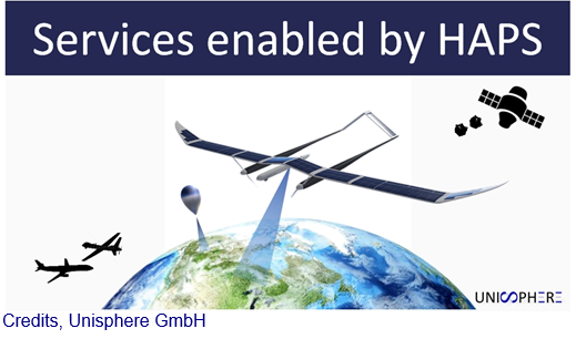
Services Enabled by HAPS (Unisphere)
Status date: 02 September 2019
Within the context of satellites, terrestrial infrastructure and Remotely Piloted Aircraft Systems (RPAS), HAPS are a new platform offering unique advantages, but also complement existing services. Three major HAPS applications have been analyzed within this feasibility study. The concept of “HAPS as a Service” (HaaS) has been introduced and its unique requirements to highly automated flight management were detailed. A follow-up demonstration project with the focus on flight management has emerged from this feasibility study.

ALBA-TROSS
Status date: 10 April 2019
Alba Orbital is working to develop satellite applications which utilize each aircraft’s unique ‘Automatic Dependent Surveillance-Broadcast’ (ADS-B) signature. ADS-B signals contain data on flight path, and flight weather conditions, and can be used to enhance global weather forecasts, verify aircraft carbon emissions, and aid in Mayday scenarios, especially when fused with other satellite and ground based data-sets.
AUDROS
Status date: 02 April 2019
The “Autonomous Drone Services in the CBRNe operations” (AUDROS) Feasibility Study assessed the technical feasibility and commercial viability of space-based services in combination with the emerging RPAS technologies which become a game changer in many service domains to improve the monitoring, early warning, surveillance and reaction on CBRNe events and threats.

NG Aviation – Smart Airports
Status date: 28 March 2019
Proposed system serves as a platform for Airside area management based on ICAO and EUROCONTROL legislative as a support for satellite navigation.
AIME Aeronautical Information Management Environment software platform enables to create and share digital aeronautical data including the temporal warning messages (Digital NOTAM) in AIXM 5.1 format.
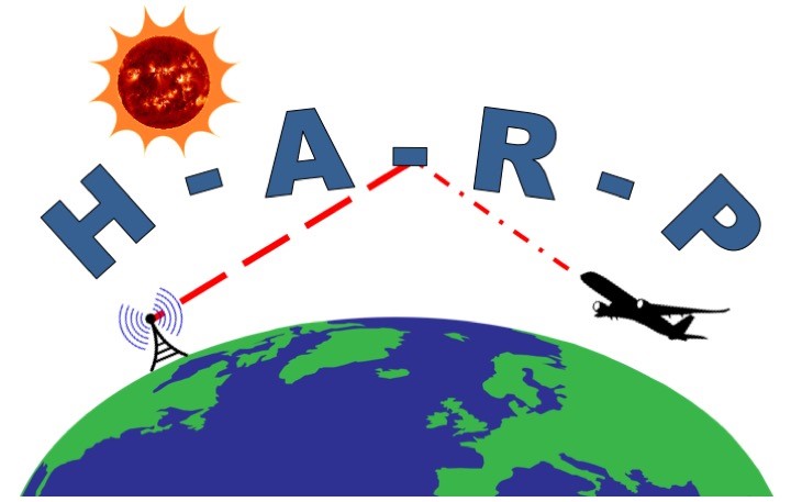
HARP
Status date: 08 March 2019
For safe operations, commercial aircraft have to be able to communicate with air traffic control centres at all times. In remote areas such as the polar regions, communication is by HF shortwave radio, which may be severely disrupted by space weather events. The provision of state-of-the-art services for HF communication management is covered by the HARP project.

RAPSODY
Status date: 19 November 2018
RAPSODY, a project led by TEKEVER, will demonstrate the use of remotely piloted aerial systems (RPAS) in a wide area maritime context, through the execution of search & rescue and pollution monitoring missions. The missions will be executed in near-real scenarios over the Atlantic Ocean. The Satcom-enabled RPAS will be fully prepared and customized to perform these maritime missions, including the integration of specific payloads and the usage of specially tailored mission-oriented data fusion, data compression and automatic feature recognition and identification algorithms.
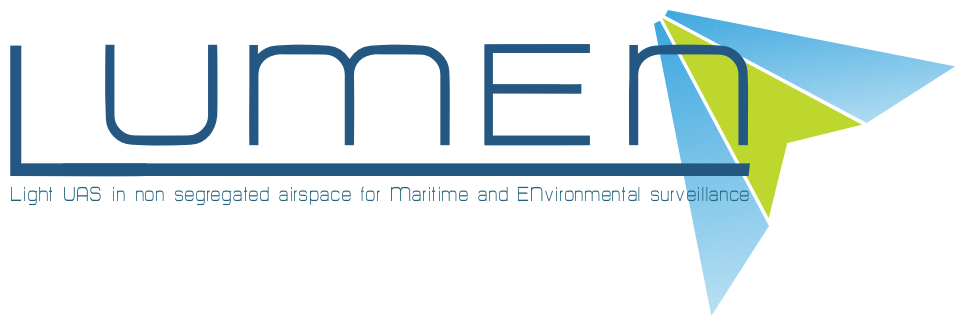
LUMEN
Status date: 28 August 2018
LUMEN provides a fully integrated end-to-end solution for real time monitoring and critical situation management with medium sized RPAS that can operate beyond line of sight.
The service is demonstrated with two specific use cases representative for the target market: flood extend mapping and maritime coastal monitoring.
SAGAS
Status date: 20 June 2018
The SAGAS feasibility study successfully completed the investigation of the viability of Multi-Source ADS-B (Automatic Dependent Surveillance - Broadcast) integrated services, bringing the terrestrial ADS-B (ADS-B-TER) and space based ADS-B (ADS-B-SAT) technologies with added-value from relevant ground and space based data-fusion and advance analytics for delivering the “best of truth” aircraft and airspace surveillance capabilities and value-added applications for the target markets and use scenarios.

Big data applications to boost preparedness and response to migration
Status date: 25 May 2018
The study aims at assessing the technical feasibility and economic viability of services enhancing human migration crisis management, through the use of Big Data solutions and RPAS.
DOCS
Status date: 20 March 2018
Re-using civil aircraft to create constellations for providing high spatial & temporal Earth observation data and telecommunication services; a most ecological constellation re-using the most reliable platform.
DAEDALUS
Status date: 13 December 2017
The DAEDALUS service offered by Satavia aims to assist airlines, air navigation service providers, and aircraft and aeroengine manufacturers to increase operational safety and efficiency, and increase situational awareness of stakeholders on aircraft and the ground. Key objectives include in-flight detection and forecasting of a range of aviation hazards, and analytics to support flight operations.

DART
Status date: 09 November 2017
The DART service aims to offer affordable medium distance transportation capabilities to Polish professionals as primary target market. DART will be based on the use of light aircraft located all over the country, by exploiting GNSS-based approach procedures and remote AFIS services. It ambitions to be much cheaper and flexible than current air-taxi like services.

Uam®
Status date: 27 July 2017
e2E intends to offer more affordable data communication services into niche markets currently underserved from existing infrastructure or where traditional satellite delivery is too expensive. The core of the service concept builds on two key technologies that have been developed with small airborne IDP networks in mind that incudes RPAS, HAPS and small satellites.
DeSIRE II
Status date: 27 June 2017
DeSIRE II, Second Element of the ESA EDA RPAS Demonstration Roadmap, aims at developing and demonstrating a service based on a Remotely Piloted Aircraft (RPA) flying in Beyond Radio Line of Sight (BRLOS) using a dual satcom link supporting Command and Control (C2) and Air Traffic Control (ATC) functions.
The project also aims at demonstrating to the users the potential of RPAS complemented by satellite applications (Satcom, Satnav and Earth Observation) for developing new services for operations.
Project objectives are pursued by means of a real flight campaign using Piaggio Aerospace P.1HH RPAS, and complemented by simulation and emulation activities.

ArTeK
Status date: 20 June 2017
ArTeK aims at developing an innovative, effective and sustainable service offered to Properties managers to have a complete and systematically updated view and enhanced awareness of the state of conservation of immovable Cultural Properties and to support their management and fruition. ArTeK integrated service builds on space assets (earth observation, navigation and satellite communication) as well as additional technologies (drones, on site equipment, etc.) in relation to specific user needs.
STEAM
Status date: 04 May 2017
The objective of this study is to investigate the technical feasibility, financial/non-financial viability and sustainability of a future service aiming at measuring the amounts of sulphur oxides components ejected by vessels travelling inside the Emission Control Areas (ECAs) as defined by the International Maritime Organization (IMO).
RPAS Intelligent Parcel Delivery
Status date: 11 January 2017
In the advent of the remotely piloted aircraft system (RPAS), the Unmanned Parcel Delivery (UPD) project seeks to utilise RPAS and satellite technology to establish a fast, safe and secure UPD service to customers in remote and hard-to-reach locations.
BIOSCOPE FS
Status date: 05 July 2016
BIOSCOPE investigated the technical and economical viability of a vegetation monitoring system based on the integrated use of satellites and Remotely Piloted Aircraft Systems (RPAS).

SASISA
Status date: 25 January 2016
SASISA (Small-Aircraft Service for Instant Situational Awareness) supplies airborne situational awareness support for civil protection operations in the early phases of disaster response. Remote sensing results have often only been accessible after several days. With delivery of georeferenced imagery via satellite broadband during flight and value-added mapping products within a day, SASISA offers transformational change to European emergency management services.

CGWay
Status date: 04 December 2015
An initial study into the feasibility of implementing a high throughput satellite gateway in equipment containers including the use of a highly innovative approach to the antenna using multiple smaller antennas.
PLANET2
Status date: 09 December 2014
PLANET2 aims at providing business and regional aviation with in-flight information updates on weather conditions and hazards, while contributing at the same time to the observation of the atmosphere thanks to in-situ measurements sent from the aircraft to the weather agencies.
DeSIRE
Status date: 30 May 2013
The DeSIRE (Demonstration of Satellites enabling the Insertion of RPAS in Europe) demonstration project is a joint ESA-EDA initiative aimed at demonstrating the safe insertion of Remotely Piloted Aircraft Systems (RPAS) in non-segregated airspace using satellites capabilities for RPAS command and control, ATC communications and Mission data transfer to ground, in order to satisfy the needs of potential user communities. The demonstration will be carried out in Spain through several flights using a RPAS (Heron 1) providing airborne maritime surveillance services to the Spanish Users involved in the project.
Birdstrike
Status date: 20 May 2010
The present activity is concerned with reducing the risk to civil aviation of an accident in the airport airspace environment as a result of bird strike.