

AuthSurance
Status date: 25 June 2026
The solution addresses critical challenges in combating disinformation in general but current sector-specific solution - AuthSurance - provides robust support for insurance service scenarios, where reliable evidence before, during, and after an event of loss is essential. Built on EU-wide legal and technical standards - including eIDAS, GDPR, AML directives, and GALILEO specifications - it ensures compliance, security, and interoperability across trusted ecosystems.

ISTRICE
Status date: 19 June 2026
ISTRICE provides secure, AI-powered tracking and certification for high-value Enertech equipment. Integrating Edge AI, Blockchain, and Satellite Communication on a new generation Intelligent Tracking device code named HedgeLog™. The solution monitors machinery during transit and boot-up. It ensures certified delivery and successful commissioning for deep tech assets like Enertech machinery (e.g. turbines and electrolyzers) Robotic workforces (e.g. robotic cells, arms and humanoids) and other high-tech machinery, reducing financial risks and project delays.
SAT-IS(F)ACTION
Status date: 12 June 2026
SAT-IS(F)ACTION™ delivers satellite-enabled tracking, predictive maintenance, and trusted insurance data for refrigerated food cargo. Combining GNSS, SatCOM, Edge AI, and blockchain, it improves cold-chain visibility, detects anomalies in real time, and certifies shipment data—reducing waste, costs, and claims while enabling new embedded insurance models.

GreenClaims
Status date: 10 June 2026
This project develops an ESG verification platform integrating Earth Observation data with AI-driven analytics to independently verify corporate environmental claims in land-intensive sectors including mining, oil & gas, agriculture, and renewable energy. By combining satellite imagery analysis with natural language processing of corporate disclosures, the service provides scalable, evidence-based verification to support regulatory compliance and combat greenwashing.
HotPay
Status date: 03 June 2026
Using satellite Earth Observation and AI to generate auditable heat indices that trigger parametric insurance payouts during extreme heat events, enabling faster and more transparent climate risk protection.
SELVA
Status date: 03 June 2026
SELVA combines Earth observation, drone evidence and forest inventory data to help insurers, investors and forest managers screen storm exposure, prioritise field review and estimate possible volume and asset impacts across forest portfolios.
AURA
Status date: 03 June 2026
AURA is a NATCAT risk assessment assistant for industrial risk management. Its purpose is to deliver site-level NATCAT exposure analysis and continuous monitoring for floods, wildfires and landslides. The underlying Earth Observation data processing machine shortens risk insight delivery from days to minutes. AURA shall continuously provide analysis-ready data and decision-supporting information to risk experts.
https://business.esa.int/projects and search results.
FUSE
Status date: 08 May 2026
FUSE provides wildfire intelligence for the insurance sector by transforming Earth Observation data into actionable risk insights. The service supports risk assessment, event monitoring, and claims analysis, helping insurers better manage increasing wildfire risks and improve decision-making across their operations.
Belmap4EU
Status date: 07 May 2026
They project expands Belmap, GIM’s geospatial digital twin platform, across Europe to deliver harmonised, property-level intelligence on buildings, parcels and addresses. By integrating national open datasets with Earth Observation–derived features and scalable full-country processing, the platform enables consistent property insights across multiple European countries.
STREAMO
Status date: 07 May 2026
STREAMO is a commercial downstream application seamlessly merging satellite and stratospheric Earth Observation data. Focusing on urban/mountain environments, the platform provides very-high-resolution, near real-time updated maps and insights like vegetation and thermal gradients. It offers a centralized marketplace for accessing archived products and requesting on-demand stratospheric tasking to bridge the gap between satellites and drones.

EO-INSURE
Status date: 23 April 2026
EO INSURE is a service for the insurance world that combine Sentinel-1 SAR and Sentinel-2 optical imagery with weather and fielddata to detect abiotic damages in orchards, tailored to insurance workflows. This new feature opens the doors toward continuous monitoring, rapid event verification, fraud mitigation, and portfolio-level risk monitoring for insurers, brokers, and reinsurers.
RegenAg – MRV
Status date: 15 April 2026
The RegenAg – MRV service provides monitoring, reporting and verification of regenerative agricultural practices, such as cover cropping, no residue burn, crop rotation and improved irrigation. Through innovate use of satellite earth observation and geospatial analytics, cropping systems, irrigation techniques, soil treatment and residue management are monitored and evaluated. The service facilitates high-integrity farm carbon and sustainable farming projects.
Deltaforms
Status date: 26 March 2026
Deltaforms, turning complex satellite data into actionable risk insights, helping the insurance ecosystem to anticipate and cut climate-driven losses.
https://business.esa.int/projects and search results.
Space4DRE
Status date: 20 March 2026
Space4DRE delivers a satellite-enabled parametric insurance solution protecting distributed renewable energy portfolios against weather-driven performance risk. Using Earth Observation data, the service provides transparent, automated downside protection that strengthens cash-flow stability and bankability.

Geo-Shield
Status date: 17 March 2026
OPTIMAIZE develops GEO-SHIELD, a satellite-enabled risk intelligence service that uses Sentinel-1 InSAR data to detect seasonal ground deformation and deliver dynamic, building-level vulnerability scores for clay shrink–swell hazards. The solution supports insurers in underwriting, claims validation, and proactive loss prevention, providing objective, scalable, and cost-efficient geotechnical drought risk assessment.

EWPIP
Status date: 17 March 2026
Data driven parametric insurance solutions for wildfire and drought risks. Droughts and wildfires are increasing in frequency, intensity, and unpredictability, which is challenging traditional insurance models and exposing clients to greater losses. Our parametric insurance solutions offer pre-defined triggers and automated payouts—delivering speed, clarity, and confidence when it matters most.
EODT4Crises
Status date: 12 March 2026
Helyx and the University of Portsmouth (UoP) have developed “Earth Observation Digital Twins (DTs) for Crises” that focus on utility and transport networks. The DTs map the vulnerability of networks to natural hazards and the damage to these systems post-event. By using earth observation imagery, our DTs support the rapid global response of humanitarian teams to crises.
EO-VTI
Status date: 10 March 2026
EO-VTI is developing an Earth Observation–enhanced Vessel Transparency Index in collaboration with an industry partner in order to uncover deceptive and high-risk maritime activity. The project combines satellite data, AIS analytics, and explainable risk scoring to support maritime compliance, insurance, sanctions enforcement, and decarbonisation.
Pemberton Biodiversity monitoring tool
Status date: 05 March 2026
The Pemberton Biodiversity Portal leverages a time series of UAV, aerial, and satellite data, alongside derived data which is ground-truthed and then compiled into a federated biodiversity metrics dataset to provide data consumers with accredited automated remote measurement and tracking of biodiversity.
CropSnap
Status date: 26 February 2026
This service blends satellite insights with simple smartphone photos to monitor crops. By uniting Sentinel-1 and Sentinel-2 data with on-field images and weather trends, it delivers fast, accurate, and affordable loss assessments. The result: quicker claims, lower insurance costs, and stronger protection for smallholder farmers in India—scalable to global agriculture.

RTIS
Status date: 10 February 2026
DataCosmos is Open Cosmos’ proprietary platform for storing and analysing satellite imagery.
RTIS is a near-real-time information system. By leveraging DataCosmos to detect and monitor oil spills and water turbidity in the middle east with rapid delivery time, RTIS will enable the rapid response to critical situations.
Regen Atlas
Status date: 19 January 2026
The Regen Atlas project aims to develop advanced analytics that provide critical insights into the future risks facing carbon sequestration projects. By leveraging forward-looking analytics, Regen Atlas enables participants in carbon markets—including investors, project developers, and marketplaces—to better understand and mitigate risks such as wildfires, cyclones, pests, insects, and seismic events.

SEFPAM
Status date: 15 January 2026
The project will enhance its Mitigrate’s Prevent platform by integrating river flood modelling, alert system, and preventive solutions scenarios. Using satellite imagery, geospatial data, and weather forecasts, the system delivers property-specific recommendations and loss reduction estimates. Piloted with insurers like Gjensidige, the project demonstrates scalable, actionable flood risk prevention across Europe’s insurance markets.
SpaceAware Resilience (SWiiFT)
Status date: 08 January 2026
Feasibility study to investigate commercial uses of Space Weather Data in various industries, understanding the impacts of Space Weather on critical nation infrastructure and how leveraging and utilising space weather data can address these problems and gaps.
InsurEO
Status date: 09 December 2025
The InsurEO project applies innovative Earth Observation (EO) services to provide detailed insights into buildings and their surroundings—ranging from flood and landslide risks to environmental health, climate change, and sustainability. Through an intuitive web platform, organisations will be able to visualize and monitor these insights, whether for a single building or an entire property portfolio. Sectors such as insurance, banking, real estate, and energy service companies (ESCOs) will use these insights to make more informed decisions.
CarbonEagle
Status date: 22 October 2025
Harnessing the power of carbon maps, satellite data, and machine learning, CarbonEagle offers a digital MRV platform to identify and monitor optimal REDD+ project sites globally. It allows investors and project developers to make well-informed decisions for sustainable forest conservation and climate transition.
RAPTOR™
Status date: 12 September 2025
The global events market is valued at ~$900bn in revenue / year. These events purchase insurance to cover the potential for a cancellation and subsequent loss of income and incurred expenses.
However, the insurance market providing this cover faces a problem. Natural disasters and extreme weather events are the leading cause of event cancellations.
BirdsEyeView’s RAPTOR™ technology provides underwriters with the analytics they required to correctly assess their exposure to these extreme weather events when providing cover, events which are increasing in frequency and severity due to climate change.

HabiTracker
Status date: 04 September 2025
HabiTracker is a habitat mapping & biodiversity monitoring service concept that combines Earth Observation data with ground-based IoT sensors to help UK farmers meet environmental reporting requirements and unlock nature-based financial opportunities. Developed by Terrabotics, it provides real-time ecosystem insights, regulatory-compliant reports, and practical recommendations that enhance ecosystem health while supporting farm productivity and sustainability.

GEMS
Status date: 04 September 2025
GEMS is pioneering the development of advanced emissions tracking solutions. Leveraging cutting-edge Earth Observation data from the Copernicus satellite services, our platform enables near real-time detection, identification, and monitoring of NO2/NOx and SO2 emissions sources across Europe. GEMS platform, address a growing demand for accurate emissions tracking, driven by evolving environmental regulations and the increasing focus on sustainable industrial practices.
AgroRisk
Status date: 16 July 2025
AgroRisk is an analytics platform to help financial companies, corporates, and farmers manage climate and environmental risks in agriculture.
RaumZeit
Status date: 07 July 2025
RaumZeit develops advanced risk assessment for supply chain compliance with the EU Deforestation Regulation (EUDR). With the product offering TradeAware, LiveEO offers an End-to-End software solution for traders and operators of complex supply chains, where users can independently upload geolocations, request precision analytics of deforestation risk, and move straight to automated Due Diligence generation, all within the same system.
Advanced Flood Modelling
Status date: 17 June 2025
The project provides a methodology for flood and landslide risk assessment, combining satellite data with physical models and socio-economic analysis in order to support insurance companies in better understanding, mapping and managing natural hazards.
Rheticus FCO
Status date: 17 June 2025
Rheticus® Forest Carbon Offset is a service providing a reliability assessment for emissions offsetting investments for companies' sustainability strategies. The study aims to verify the feasibility of a service automatically providing reports containing key information from the analysis of EO-derived data, integrated within the Rheticus® platform by Planetek Italia, evaluating forest carbon offsets of REDD+ and in general Nature-Based projects.
Advanced Flood Modelling
Status date: 16 June 2025
The project provides a methodology for flood and landslide risk assessment, combining satellite data with physical models and socio-economic analysis in order to support insurance companies in better understanding, mapping and managing natural hazards.

SAFER
Status date: 16 June 2025
SAFER provides accurate, hyperlocal seismic hazard maps and forecasts. Leveraging GNSS, Earth Observation data and advanced AI models, SAFER enables proactive disaster preparedness, informed urban planning, improved infrastructure resilience and enhanced risk assessment for governments, municipalities, infrastructure operators, insurers and financial institutions globally.

Nature Capital
Status date: 05 June 2025
Symbiose is a one-stop shop for forest owners to understand the true value of their forests. Using satellite data and AI models, our platform tracks forest health, predicts future growth with climate scenarios, and identifies risks like fires or pests early. It provides real-time insights to boost both ecological and financial value.

In-terra-gate
Status date: 05 June 2025
In-terra-gate is a software which enables users to interact with satellite data using common natural language. It builds on recent advances in large language models (LLMs), natural language processing (NLP) and visual foundation models in order to make it possible to ask questions about terrestrial and geospatial features and phenomena in satellite images and get a generated answer with relevant information.
Coastal Ecosystems – MRV
Status date: 04 June 2025
The Coastal Ecosystems – MRV service provides monitoring, reporting and verification of conservation and restoration of coastal ecosystems such as mangroves and saltmarshes. Through innovate use of satellite earth observation, key ecosystem characteristics, such as ecosystem extent, above-ground biomass and ecosystem changes are measured. The service supports the development of functional natural capital markets by providing valuable inputs for establishing the integrity of carbon and biodiversity credits.
Scalable Earth Blox
Status date: 26 February 2025
Scalable Earth Blox has transformed the Earth Blox platform into a fully-fledged SaaS enabling non-coders to create, on the cloud and on-demand, customised geospatial solutions and insights with ease. This has enabled us to support a global market, targeting organisations of all sizes, as well as opening up EO to a wider non-technical audience.

SGAM
Status date: 23 December 2024
SGAM is addressed to owners and managers of large infrastructural networks and is designed for the assessment of geohazards that may impact on geotechnical assets, focusing on the interaction between infrastructures and natural environment. It combines Earth Observation data, ground-based monitoring data, geohazard databases, and AI algorithms to identify critical issues allowing for cost-effective predictive maintenance investments. It features techniques such as A-DInSAR and PhotomonitoringTM for precise monitoring of surface changes, allowing for historical analysis and change detection.

BeSpatial.AI Demonstration
Status date: 21 December 2024
How do you target advertising to maximize customer reach and minimize costs? Where do target customers stay, live and work? What locations should be the focus of digital and physical advertisement campaigns?
BeSpatial.AI helps businesses in financial services and other industries to boost their ads performance with customer trained machine learning model (HolistiCRM).
Training is done based on internal datasets, EO (ESA) and GIS data (GeoX). In our first use-case machine learning model accuracy reached 91%.
Machine Learning supported targeting ROI 1127% thanks to lower CPC and higher conversion rates targeting the right (potential customer dense) locations.
THIRSTY
Status date: 12 December 2024
With Project THIRSTY, Hydrosat is deploying two commercial products to enhance food security: 1) we provide accurate yield forecasts that help agribusinesses manage supply chains more efficiently, and 2) we implement a farm management system that helps growers increase crop production while conserving water.

CORISCLIM
Status date: 12 December 2024
Rapid Assessment of Future Coastal Flood Risks Around the World To Build Coastal Resilience

Sat4Insur
Status date: 28 November 2024
The Sat4Insur project aims at delivering a risk assessment platform for agriculture insurance. It offers a complete decision tool to the Agriculture Market Manager of the insurance company and to adjusters to better evaluate crop yield and the financial impact of adverse weather events such as drought, excess water and storm.
LucidEO
Status date: 27 November 2024
Space-enabled Productivity & Wellbeing leveraging satellites, wearables and AI

GAINS CCN1
Status date: 11 November 2024
GAINS provides historic and near-real-time insights on the production and activity levels at hundreds of sites involved in the global iron and steel supply chain. It offers an “alternative data” source for the Financial Services industry by providing near-real-time leading indicators such as stockpiles of raw materials and levels of activity and production, based primarily on satellite observations.

Space2CLIMB
Status date: 18 October 2024
Space2CLIMB is looking to create a biodiversity service to support the financial service sector by combining GlobalTrust’s expertise in Earth Observation (EO) data analytics with Ecogain’s knowledge of biodiversity.

SCAF
Status date: 10 October 2024
Mitigrate, an InsureTech startup, pioneers flood risk management with its SaaS platform. Utilizing advanced technologies and earth observation data, it offers nature-based solutions reducing flood risks. Targeting insurance companies, Mitigrate's tool fills a crucial gap, providing pre- and post-flood disaster guidance. Beyond risk reduction, it aligns with global sustainability goals, positively impacting insurance performance metrics. An investment in Mitigrate is an investment in resilience, sustainability, and the future of flood risk management.

SAIA KS
Status date: 25 September 2024
To support agricultural insurers in claim management and risk management, satellite data is used to support the assessment of current damage caused by weather events and to estimate the risk of future damage to a field.
GeoInsure
Status date: 26 April 2024
GeoInsure is a fully operational, custom designed, state-of-the-art Earth Observation based geospatial tool, specifically build to be seamlessly integrated into the operational workflow of a company active in the (re)insurance market, with an emphasis on natural catastrophes (Nat Cat) and extreme weather events insurance and reinsurance activities.
EO4CSR
Status date: 12 March 2024
The EO4CSR project aimed to assess the potential of Earth observation (EO) derived information to enable companies and financial institutions to facilitate due diligence and reporting requirements deriving from the European CSR Directive (Corporate Social Responsibility - CSRD) and European Deforestation Regulation (EUDR).
ORCAS
Status date: 01 March 2024
Trade in Space creates NFTs on a blockchain, using SatEO analysis. But these aren’t works of art – they're tied to physical commodity crops still growing in the field and this new approach enables us to move into a new age of transactional insight®. In this project Trade in Space will show the value this new approach has in streamlining global coffee and cacao supply-chains.
Energy SCOUT
Status date: 22 February 2024
Energy SCOUTTM is a modular set of services which transform daily and weekly feeds of raw satellite sensor and spatial data into a series of value-added information products, targeting different activities along the oil & gas supply chain.

AFNOL
Status date: 14 February 2024
The project aims to improve the data analytics software used by insurance companies to confirm an accident has happened, who is at fault and the probability of injury.

OPT4SOL.AI
Status date: 26 December 2023
A smarter way to identify the location for your next solar project. OPT4SOL uses satellite images, GIS, and AI to support site selection for new utility scale PV projects. All the data in one place. The system considers every aspect, from exclusion zones and regulatory limits to distances from power lines and areas of high cunsomption supported by AI powered analysis and scoring of potential locations.
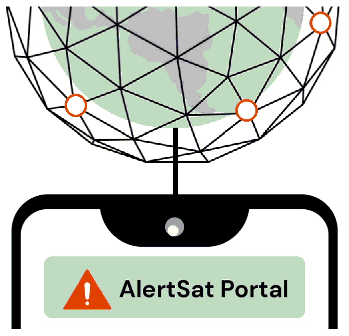
AlertSat Portal
Status date: 26 December 2023
The AlertSat satellite constellation is to deliver Alerts directly to its users, through AlertSat Portal - when critical information has been detected and there is still time to act upon it.
Ecosystems – CPV
Status date: 27 November 2023
Ecosystems – CPV provides data and modelling capabilities for utilizing coastal ecosystems as vital green infrastructure for protecting critical assets, business activities and people along coastal zones. The solution provides quantitative data and flexible modelling approaches to the insurance and infrastructure sectors, facilitating the effective and sustainable use of coastal ecosystems for disaster risk reduction and climate adaptation.

SiriusInsight®
Status date: 27 November 2023
90% of world trade goes by sea making it of great importance economically, strategically and environmentally but the maritime domain is vast and remote making persistent surveillance challenging. SiriusInsight® uses cutting edge artificial intelligence to analyse maritime data from multiple remote and autonomous sources in order to create actionable information for users about otherwise unobserved marine activity.

IBISA Phase 2
Status date: 04 August 2023
IBISA is a pioneering global climate insur-tech that shields businesses and communities against the impacts of climate change. Using satellite data, we measure weather conditions to design and operate cost-efficient, scalable insurance solutions.
Through partnerships with local, global insurers and distribution channels, IBISA creates tailored insurance products that are easy to understand, transparent, affordable and provide rapid payouts. Our innovative use of satellite imagery and actuarial tools results in robust insurance products that cater to real-world needs.
PROFEO
Status date: 10 July 2023
The consortium provides a web-based platform that allows users to get actionable property level flood hazard insights at “the push of a button” combining existing flood data, meteorological data and archived as well as current satellite images. The service is accessible to non-experts, providing flood hazard maps and alerts tailored to the needs of the clients in the real estate domain, and can be scaled to wide geographical areas.
PSVE
Status date: 22 June 2023
PSVE (Port Stockpile Volume Estimation) is a product DBX is developing within the ESA BASS programme; the PSVE module aims to collect and harmonise global, highly fragmented, dry-bulk commodities data in near real-time, by applying state of the art machine learning classification algorithms and establishing a strong correlation between market trends and the localization of dry bulk stockpiles.

Ad Astra
Status date: 30 May 2023
Ad Astra is a project by Astrosat is to assess the technical and commercial feasibility of space services being provided to user organisations without a pay-wall, funded by advertising revenue, specifically global brand Corporate Social Responsibility (CSR) budgets.
PREMIA
Status date: 29 May 2023
PREMIA project aims to fill the gap currently existing between satellite Earth Observation and the agro insurance market by providing an innovative and integrated end-to-end platform.
GAINS
Status date: 12 May 2023
GAINS is an “alternative data” platform for the Financial Services industry providing near-real time activity and leading-indicator production indices for a range of industrial supply chains such as iron ore and steel, and in future other metals, minerals and materials.
GAINS provides historic and near-real-time insights on the activity and production levels at hundreds of industrial sites worldwide on a daily or weekly basis, at a scale not previously possible, by harnessing AI-enabled remote sensing data fusion.
Economic Intelligence Factory
Status date: 12 May 2023
The objective of this demonstration project was the analysis of satellite data to create standardized indicators of economic activity, from the study of key sectors of the economy.
DOCS-2
Status date: 15 March 2023
Using civil aircraft to create constellations for providing high spatial & temporal Earth observation data and telecommunication services; a most ecological constellation re-using the most reliable platform.
Space Augmented UAM
Status date: 14 February 2023
Space Augmented UAM aims to determine the feasibility of a “Space Augmented” service enabling cities and regions to conduct U-Space integration assessment utilizing economic, technical and environmental simulations for predictive assessment considering the individuality of each city to generate a self-sustainable Urban Air Mobility ecosystem.

WS
Status date: 22 December 2022
WaterSentinel aims at providing satellite-powered water quality monitoring tools relevant for Environmental, Social and Governance (ESG) assessments as well as broader environmental monitoring applications.
Its falls within a broader goal of promoting the use of space data for sustainable finance decisions.
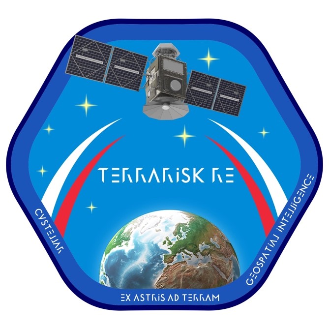
TerraRisk
Status date: 21 November 2022
CyStellar TerraRisk RE is a data analytics platform, designed to deliver real-time geospatial insights and intelligence into risk and underwriting, reserving and rate making, insurance portfolio optimization and claim assessment processes.
BirdsEyeView
Status date: 14 November 2022
BirdsEyeView is a B2B InsurTech. Specifically, BirdsEyeView operates as a Managing General Agent (MGA), using meteorological data from satellites to structure and sell innovative parametric weather insurance products.
Specifically, BirdsEyeView sells a parametric weather insurance product to businesses to protect them against the financial damages caused by excess rainfall events. This product is delivered on BirdsEyeView’s proprietary online algorithmic underwriting engine called RAPTOR™.
BeSpatial.AI
Status date: 02 November 2022
How do you target advertising to maximize customer reach and minimize costs? Where do target customers stay, live and work? What locations should be the focus of digital and physical advertisement campaigns?
BeSpatial.AI helps businesses in financial services and other industries to boost their ads performance with customer trained machine learning model (HolistiCRM).
Training is done based on internal datasets, EO (ESA) and GIS data (GeoX). In our first use-case machine learning model accuracy reached 91%.
Machine Learning supported targeting ROI 1127% thanks to lower CPC and higher conversion rates targeting the right (potential customer dense) locations.
EMT
Status date: 20 October 2022
The aim of the Estate Market Trends (EMT) project is to provide a financial service that introduces a digital transformation of access to real estate market data. The main objective of the proposed solution is to create investment reports based on a selected location (coordinates). The system assumes the use and mutual integration of different sources of real estate data.

NUA
Status date: 20 October 2022
The increasing frequency and severity of extreme weather events has drawn the attention of the insurance industry on climate change risks. For insurance to act as a climate change adaptation tool to increase the resilience of our society, new data and services are necessary. NUA is a highly innovative SaaS for the climate risk management and forecast at local scale.
SAT-IS(F)Action
Status date: 22 September 2022
Existing space technologies (SatNAV, SatCOM, SatEO) can be blended with the most innovative data intelligence and certification technologies (Edge AI, IoT and DLT) to offer next generation Remote Container Monitoring services (Container-as-a-Service, CaaS), hence increasing overall food supply chain safety and reliability, in the pursuit of the highest possible final customer “satisfaction”.
OTAM+
Status date: 16 June 2022
The OTAM (Oil Trading Analytics Monitor) is a comprehensive solution for the oil trading analytics market, created by seamlessly combining Earth Observation data with oil analytics data. This new combination of datasets provides actionable insights on the status of the oil market.
Smart-GAM
Status date: 13 April 2022
Smart GAM aims at offering an innovative and semi-automatic decision-making supporting system for asset management and predictive maintenance purposes to improve the financial resilience of assets, taking advantages of innovative data-fusion algorithms, satellite Earth Observation technologies and their integration with ground-based monitoring/database segment. SGAM focuses on the risks related to structures and infrastructures, analysing their interaction with the local geological and environmental context, by automatically evaluating the direct or potential future interferences with geohazards such as landslides, floods, sinkholes, fires etc. The service aims to support Decision Makers in defining and prioritizing the maintenance operations based on the asset vulnerability and loss scenarios, with a philosophy that may be summarized as “FROM HAZARDS TO MANAGEMENT SOLUTIONS”.
DANPREIT
Status date: 17 March 2022
DANPREIT digital twin is a Prop-tech that prevents, mitigates, and manages Real Estate Investment Trusts (REITs) disputes. Our digital platform uses satellite and non-satellite data to create simulations that can predict exposure to litigious or arbitration procedures.
EO4Belmap
Status date: 14 March 2022
Enhancing Belmap, GIMs’ geo digital twin of the built-up environment, through Artificial Intelligence techniques applied on earth observation data. Resulting in four new Belmap data modules: Greenfields, Building Age, Roofs and Gardens.
SMOCGEO
Status date: 15 February 2022
SMOCGEO is enabling a transparent assessment of the sustainability of global commodities supply chains, using geospatial analytics. The project fuses satellite data, geospatial data and machine learning techniques to transform complex climate data into meaningful outcomes for enterprise corporates and financial institutions.

DeMoFloRa
Status date: 31 January 2022
KickStart activity exploring end-to-end earth observation monitoring solutions for the insurance and the mining industry.
A.I.Perion
Status date: 13 January 2022
AIperion is a SaaS that supports the crop insurance claim management process through the use of A.I., Earth Observation and Meteorological data.
HERMOSA
Status date: 14 December 2021
HERMOSA is a service platform dedicated to support activities on ecosystem restoration and biodiversity conservation in its larger sense and the positive impact it has on the issue of food security, creating sustainable jobs, mitigating and adapting to climate change and empowering communities in technologies. HERMOSA is built using Open Source Software, accessible through the internet, empowered by web-mapping and Remote Sensing technologies.
TERRA
Status date: 13 October 2021
Climate-related economic losses in agriculture have now reached €73bn/year. We need to build a climate-resilient agriculture now, by preparing for the evolving climate risk. TERRA is a SaaS risk-assessment and monitoring tool seamlessly integrating satellite data, reanalyses and seasonal forecasts, targeting insurance companies providing agricultural coverage.

CoffEO
Status date: 08 October 2021
Building a data intelligence & risk management platform for the coffee industry powered by AI, SatEO & cutting-edge agrometeorology to scale sustainable coffee production.
A-QKD-S
Status date: 13 September 2021
This project defines an ‘Augmented Quantum Key Distribution (AQKD)’ Satellite Service that uses nanosatellites to deliver cryptographic keys for fractions of the cost of traditional satellite constellations. This service, rather than compete with large service providers, aims to augment these larger networks and could be used for on a wide range of end applications with multiple market verticals.
GEO
Status date: 11 July 2021
The MIS Global Events Observer (GEO) applies accurate, real time intelligence of space-based and ground sensor data to teams working across the insurance cycle. GEO offers unique opportunities for businesses to make informed decisions when selecting, pricing, monitoring, mitigating and assessing risks, and seeks to drive technology into traditional workflows to enhance policyholder service and deliver cost savings and time efficiencies.
AI4Sendai
Status date: 30 April 2021
From portfolio or project analysis down to single asset, Ai4Sendai helps key industries such as Energy, Oil And Gas, Insurance and banking, Real estate, Agriculture as well as Public authorities and NGO making the best informed decision by providing a timely and accurate planetary intelligence for precisely locate their assets, identify their vulnerabilities to climate change and rate risks to specific natural hazard.
AlertSat
Status date: 13 April 2021
AlertSat is an earth observation change detection satellite constellation developed by the PandionAI corporation. The concept with on-orbit and autonomous image change detection, together with the instant delivery of information, gives end-users a tool to act efficiently in critical situations. AlertSat is designed with today’s challenges of rapid global changes in all areas, environment as well as business, in mind.
AgeSpot
Status date: 07 April 2021
AGESPOT is a completely new technological development based on satellite earth observation data offering services that allow access to precise data on WHERE and HOW MANY people, under consideration of their ages and socio-economic attributes, currently live and will likely live in the FUTURE.
Ag|knowledge 4.0
Status date: 26 March 2021
Ag|knowledge 4.0 improves the agricultural risk management for the stakeholders of the agri-supply chain in emerging economies. The services provided exploit various EO-technologies from remote sensing, weather satellites to GNNS to close a big information gap on operational crop monitoring in support of smallholders. The focus of the pilot-demonstration service is on India.

Orbital Witness
Status date: 11 March 2021
This project is working to provide archives of high-resolution satellite imagery alongside complementary property and legal datasets to allow real estate lawyers to conduct legal due diligence on property assets in a faster and more pain-free fashion.
MoMoRib®
Status date: 26 January 2021
Monitoring and alert system for river bank. MoMoRib® uses a calculation programme based on the multi-methodological comparative analyses applied to geodetic, hydrological and soil-properties patterns, then links the information to the AI processed satellite datasets in the river zones prone to failure and/or where plastic and/or toxic waste can be concentrated.
GEWS
Status date: 26 January 2021
Greenhouse owners are in a very competitive market, in which unexpected costs due to damage and decay of the greenhouse assets can cause severe problems. This demonstration project aims at demonstrating how a notification service using space data can help greenhouse owners to prevent or mitigate non-insurable risks threatening their business, and thereby save costs.

InsureApp Service
Status date: 10 November 2020
The objective of this project is to demonstrate a web-based Water Control Room which improves the efficiency of insurance claim management and water management before, during and after weather-related hazards. The key service offered is the Flood and Rain Report Generator which automatically generates reports for specific flood or rainfall events based on information from satellites, radars, gauges and crowdsourcing
SatSource
Status date: 08 October 2020
SatSource uses space technology to strengthen impact investment screening, monitoring and evaluation, and corporate and financial reporting on the traceability and sustainability performance of agricultural commodity supply chains.
mAPP’ing
Status date: 22 September 2020
FAMOS
Status date: 10 September 2020
The principal objective of the FAMOS project is to develop a comprehensive forest status monitoring system tailored to the requirements of commercial clients from the commodity sector, especially within the context of cocoa, palm oil, and rubber. Combining earth observation, IT technology and GNSS, the service supports target users by improving the efficiency of existing business processes.
IBISA
Status date: 24 June 2020
IBISA enables agriculture index-based insurance for agricultural entrepreneurs, everywhere and in an easy manner, by leveraging Earth Observation data and blockchain technology
EnviNavigator
Status date: 31 March 2020
EnviNavigator is a customer-tailored EO-based analysis services supported by mobile applications targeted for forestry and insurance businesses. The services offer easy access to most up-to-date forest data by utilizing EO-based change detection with machine learning methods for assessment of storm damages, climate-change-driven risks and predicting carbon balance development.
EO Claim Ledger
Status date: 04 March 2020
The insurance industry is facing several challenges today: an increasing number of natural disasters and related losses strain their budgets. The EO-Claim Ledger aims to support the insurance industry by providing a fully automated claim management system making use of Earth observation imagery. Blockchain technology allows the provision of a secured system. It reduces administrative costs and prevents fraud.
Fully Automating Data Pipeline
Status date: 11 February 2020
In 2010, the United Nations explicitly designated that "safe, clean, accessible and affordable drinking water” is not only a necessity, but also a fundamental human right. However, we live in an imperfect world, in which man-made activities and natural disasters create conditions that limit our access to water and expose us to dangerous water events. Organisations around the world have recognised this challenge and shown their commitment to creating, as the World Bank terms it, “a water-secure world for all.”
IMGeospatial is honoured to be part of this movement and has partnered with three clients to address the biggest water-related threats to our livelihood: flooding, water scarcity and water quality. We provide business intelligence that enables them to proactively manage their water systems, build resilience in their communities and ultimately minimise risk and impact. We do so by automating the data pipeline, reducing the time and cost of turning earth-observed data into actionable insights.
OneWave
Status date: 28 January 2020
OneWave, is a complement to the Tsunami Early Warning Systems (TEWS), a system able to detect and monitor the front wave of a Tsunami created from a major geological event, earthquake, landslide or explosive volcano by using accurate satellite radar measurements and precise position of the spacecraft of Copernicus Program.
InsSAT
Status date: 13 January 2020
The InsSAT project delivers a fully functional and operational system of automatic processing and analysis of satellite, meteorological and if needed also aerial data, focused on providing tools for assessment and settlement of insurance claims in the agricultural sector. The project is a CCN to the ASAP (“Advanced Sustainable Agriculture Production”) Demonstration Project that was completed in 2018.
AIMEE
Status date: 16 December 2019
In 2010, the United Nations explicitly designated that "safe, clean, accessible and affordable drinking water” is not only a necessity, but also a fundamental human right. However, we live in an imperfect world, in which man-made activities and natural disasters create conditions that limit our access to water and expose us to dangerous water events. Organisations around the world have recognised this challenge and shown their commitment to creating, as the World Bank terms it, “a water-secure world for all.”
IMGeospatial is honoured to be part of this movement and has partnered with three clients to address the biggest water-related threats to our livelihood: flooding, water scarcity and water quality. We provide business intelligence that enables them to proactively manage their water systems, build resilience in their communities and ultimately minimise risk and impact. We do so by automating the data pipeline, reducing the time and cost of turning earth-observed data into actionable insights.
Village Data Analytics
Status date: 02 December 2019
Village Data Analytics (VIDA) is a software-enabled service that automatically identifies remote villages and determines their suitability for a micro-grid installation using earth observation data and machine learning algorithms.
VIDA can be scaled across large user-defined areas to find a portfolio of viable micro-grid sites. This data-driven knowledge de-risks projects, reduces time and planning costs and enables investment at scale.
SpaceChain
Status date: 27 November 2019
The multisignature wallet makes digital currency transactions more secure by requiring two approvals for each transaction, one from the user and one from the satellite. The security of transactions are guaranteed via satellite hardware isolation, a multiple approval model, and secure satellite communication making the transaction resistant to hacking.
NG-RMP
Status date: 14 November 2019
The Next Generation Recognised Maritime Picture (NG-RMP) provides a real time marine solution for the monitoring of vessels, complemented with advanced decision support. The system provides for risk determination from the viewpoint of either navies and the security of countries EEZ or insurance organisation to determine risk exposure of their marine vessel portfolio in real time worldwide.
SAVANT
Status date: 06 November 2019
SAVANT is an end-to-end analytics and insights service, generating and delivering bespoke products tailored to specific requirements of customers seeking information on the mining industry, with an initial focus on the copper mining sector.
OTAM
Status date: 15 May 2019
The OTAM (Oil Trading Analytics Monitor) is a comprehensive solution for the oil trading analytics market, created by seamlessly combining data from the maritime (AIS+) and remote sensing (optical and SAR) sectors with oil analytics data. This new combination of datasets provides actionable insights on the status of the oil market.
VtDaws
Status date: 07 May 2019
VtDaws is a service developed on a SaaS model. VtDaws includes in its features the access to EO data (especially Sentinel and Copernicus Services data), a change/anomalies detection engine based on machine learning techniques, a warning service transforming data into information to the users and community sourcing features to add in-situ data and share information on smartphones or tablets.

ARCT.esa
Status date: 12 April 2019
The ARCTTM stakeholder mapping tool offers visualization of “Project Health” in the cross-roads between society, environment, business and policy. The unique de-risking tool combines climate change risks with other factors and makes them relevant, simple and visual for owner and decision makers of any infrastructure project.
ARCT has also found a fun and engaging way to score and report on the UN Sustainability Goal Climate Action goal #13. www.arct.tools.
Greenhouse Early Warning Service
Status date: 09 April 2019
Greenhouse owners are in a very competitive market, in which unexpected costs due to damage and decay of the greenhouse assets can cause severe problems. This feasibility study aims to provide insights into how an early warning service using space data can help greenhouse owners to prevent or mitigate non-insurable risks threatening their business.
SSFIS
Status date: 02 April 2019
Smallholders are underserved by credit providers as lenders are unable to assess their risk. Sensonomic’s system uses predictive and prescriptive simulations to assess system effects of credit deployment and open the market. With its dynamic data consumption, and iterative and reactive simulations, the service provides a continually updated prediction of how robust the credit providers portfolio is.
Project Impactor
Status date: 11 March 2019
Impactor deliver a prototype/credit scoring tool based on locally collected data, weather data and remote sensing data works. With this, we can provide financing to smallholders – and support traders in taking over financing activities to these smallholders – Impactor could in a later stage expand to advice, which after then can be presented to impact investors (via a platform).
Ground Instability Risk Profiling (GIRP) now branded as Hi_Ground
Status date: 22 February 2019
Satellite data analytics for (re)insurance
Status date: 16 January 2019
Geospatial data analytics for (re)insurance

Building Stock Monitor Service
Status date: 09 January 2019
The proposed Building Stock Monitor Service is a service to aid municipalities with monitoring the entire building stock within their geographical borders by using satellite imagery from Sentinels 1 and 2.
The revisit time of these satellites give unprecedented update frequency as opposed to current technology that typically involves fly-bys at high costs.

RWatch
Status date: 14 December 2018
Monitor the number of cars in selected retail outlets, and use car park fill rate as a proxy to monitor and predict the financial performance of retail companies

Star Point
Status date: 14 December 2018
Apply the ESA’s DrMUST LoOP outlier detection model to find anomalies in financial trading data and in time-aggregate sales and trading performance measures. Provide rich real-time alerts to sales people and traders when anomalies are detected.
ConsTrack
Status date: 12 December 2018
ConsTrack serves as a comprehensive construction site information service to the economic and financial sector, through an integrative satellite observation and satellite navigation solution and dedicated IT system.
Urban Space Series
Status date: 11 December 2018
The Urban Space Series is a real-time index of urban economic development. The product developed in common with ESA and QuantCube Technology is an IA platform for land characterization, specifically to detect urban city area, based on satellite images. The service monthly provides the shape of selected cities and useful metrics such as area and urban change detection.

Earthcube
Status date: 29 October 2018
Every year, millions of financial contracts whose value is indexed on hard commodities prices are traded on financial markets. Australia and Brazil represent 54% of the global supply, while China and India combined represent more than half of the global demand in hard commodities. It is thus key for investors to be able to forecast outputs and inputs in these countries where opacity remains high. Earthcube leverages satellites to tackle this issue.

TELEKAIROS®
Status date: 29 October 2018
TELEKAIROS® Fintech is a tool for financial and (re)insurance contracts that derive value from an underlying asset such a traditional stock, a bond or stock index. TELEKAIROS is capable to manage different kinds of risks, for example by increasing the efficiency of the underlying market because they lower unforeseen costs of purchasing an asset outright.

CountFloors
Status date: 22 October 2018
CountFloors (CF) is a service designed to collect and analyse GNSS-geocoded images of buildings acquired at street level together with Sentinel data. CF automatically retrieves ground-level and satellite images on urban areas of interest, and uses a machine learning approach to extract risk-relevant characteristics of buildings depicted in the images. These features are sought after by risk modellers and insurance companies; yet they are of interest also in the real estate market and to the municipalities for their planning.

AMBROSIA
Status date: 14 August 2018
The ESA-Ambrosia food safety and traceability platform combines Blockchain technology, IoT, Satellite Earth Observation (SatEO) and GNSS Satellite Navigation to achieve maximum automation, security, and transparency of the food supply chains.
DFMS4i
Status date: 18 July 2018
The project investigated how drought and flood prediction and monitoring services derived from in-situ and space-based Earth Observation data - in from the Sentinel satellites - could support the uptake of agriculture insurance in developing countries, with an initial focus on Uganda.
WaterInfo
Status date: 12 July 2018
Providing continuous updates on hydro reservoir filling levels by means of Earth Observation data & machine learning to improve power price forecasting, production planning and market analysis and energy trading.

AgeSpot Feasibility Study
Status date: 18 May 2018
AgeSpot provides THE starting point for any innovative technological solution addressing ageing populations. It enables efficient targeting of the silver economy and offers precise demographic data on WHERE and HOW MANY age specific classes currently live and will likely live in the FUTURE. With AgeSpot a new Earth Observation (EO) supported business intelligence service is offered.
INSUTRAX
Status date: 19 January 2017
The INSUTRAX feasibility study objective is to investigate the technical feasibility and commercial viability of integrated applications utilizing various satellite data sources (GNSS, EO and Satcom) for cargo tracking in support of IT insurance products focusing on Polish insurance market.
TransparentForests
Status date: 07 December 2016
TransparentForests, a web-based Geographic Information System (GIS) for mapping and data management, is designed to increase the credibility and transparency of the FSC certification process. It supports all stakeholders in engaging with, and improving the certification process. It creates opportunities for operational efficiency across the certification service delivery chain. The TransparentForests concept has applications in forest insurance, finance and biomass energy.
Improving the Efficiency of Loss Adjustment and Claims Management in the Insurance Industry
Status date: 13 July 2016
The study analyses the feasibility and viability potential of an earth-observation based service for supporting the claims management process in the forest insurance industry. A main aspect is loss adjustment after large-scale disasters with a focus on storm events and forest fires.

FLARE
Status date: 10 June 2016
FLARE is an integrated software package and data service which supports the global forestry insurance industry in asset estimation, risk management and loss adjustment. This feasibility study analysed the operational, technical and economic viability of a FLARE system/ service providing Earth Observation and Global Navigation Satellite System data and mapping products, within a simple software interface.

VeriSpace
Status date: 09 February 2016
VeriSpace was an ESA-funded feasibility study that seeks to identify how space assets, such as Earth Observation (EO), Global Navigation Satellite Systems (GNSS) and communication technology, can be used to enable business benefits to insurance companies and loss adjusters when managing insurance claims. During the study, the VeriSpace Consortium specified two sustainable, user-driven services that utilise these space-based technologies to meet the needs of those businesses involved in claims management.
The VeriSpace feasibility study showed that space assets can contribute to providing services that can help the insurance industry in a number of business processes within the overall insurance claims process, which can ultimately provide efficiency savings to the insurance industry.
SatFinAfrica
Status date: 25 March 2015
This is a pilot project to demonstrate the suitability of the Sat3Play platform, originally designed for the consumer and SoHo market, to provide reliable and secured financial services in remote and underserved areas in emerging countries in Africa.
InsureApp Service
Status date: 01 April 2014
This feasibility study carries out an analysis of the most critical elements with respect to technical feasibility and viability (economic as well as non-economic) of a web application aimed at improving the efficiency of the management of insurance claims with a focus on weather-related hazards