Maritime services based on the integrated utilisation of space-based systems are of interest to a wide range of user communities and classes: Fisheries, Coast Guards, Port Authorities, Military Bodies, Shipping Companies, Commercial Operators, International, National and European Institutions. The IAP, SATCOM-APPS and SAT-AIS programmes are engaging with several national and international end-user organisations who expressed interest in satellite based services to complement and enhance their current capabilities related to their daily tasks.
RTIS
Status date: 10 February 2026
DataCosmos is Open Cosmos’ proprietary platform for storing and analysing satellite imagery.
RTIS is a near-real-time information system. By leveraging DataCosmos to detect and monitor oil spills and water turbidity in the middle east with rapid delivery time, RTIS will enable the rapid response to critical situations.
RESIST 2
Status date: 28 January 2026
RESIST provides worldwide coverage for detecting GNSS Spoofers and Jammers anywhere over the Earth’s surface. The system relies on the CMCU, Central Machine learning Computation Unit and ground and space recorded data. RESIST 2 is the demonstration project, including pilots demonstrations in the maritime port of Marin in Spain and the DLR airfield of Cochstedt in Germany.
DECOM
Status date: 26 January 2026
KSAT DECOM aims to help operators and regulators to monitor offshore decommissioning activities by combining oil spill detection, vessel monitoring, multi-mission SAR and EO data, weather condition and greenhouse emissions to reduce costs, increase efficiency of operations, develop safer methods for execution and reduce environmental impacts during decommissioning activities.
DECOM
Status date: 22 January 2026
KSAT DECOM aims to help operators and regulators to monitor offshore decommissioning activities by combining oil spill detection, vessel monitoring, multi-mission SAR and EO data, weather condition and greenhouse emissions to reduce costs, increase efficiency of operations, develop safer methods for execution and reduce environmental impacts during decommissioning activities.
TRACTIONS
Status date: 08 January 2026
TRACTIONS addresses the need for turbidity information by the dredging market and primary production information by the aquaculture sector. TRACTIONS services include continuous local calibration and validation with proprietary optical sensors from the WISPstation network, and very high resolution imagery that is available multiple times and day. This project will pilot the TRACTIONS service on four use cases.
MWI HWZSea
Status date: 10 December 2025
Today, there is no personalised warning system for hazardous weather conditions at sea or near the coast. Yet, many players need such a system for reasons of safety, operational planning and cost savings. HWZSea project will participate in building MWI’s Alert service, designed to meet maritime players specific needs.
Prisma
Status date: 24 November 2025
PONTOS democratizes satellite intelligence for artisanal fishers through edge AI technology. Our maritime co-pilot combines Copernicus Marine data with onboard computing to deliver real-time fishing zone recommendations, voice-assisted compliance, and marketplace pricing power - reducing fuel costs by 30% while ensuring sustainability.
AURAN
Status date: 07 November 2025
AURAN is an AI-powered navigation assistance system for ocean-going ships that integrates onboard sensor data, weather forecasts, and satellite communication to enhance navigational safety, fuel efficiency, and decision-making. The project focuses on developing a semi-autonomous decision-support tool for navigation team to reduce human error and support compliance with international maritime regulations.
TRANSFORM
Status date: 27 October 2025
A circular indoor vegetable production system combining a space-designed adaptive greenhouse with a terrestrial microalgae wastewater treatment system, targeting both Earth and space-based food production optimization and water purification.
TEMIS
Status date: 22 October 2025
Massive end-to-end IoT satellite services, fully operational in GNSS denied environment and very robust to jamming & interferences for highly scalable applications in numerous verticals such as logistics, transport, agriculture/smart farming, maritime, environmental, mining/oil/gas, smart cities, smart building, e-health, utilities, industry…
DSOE-WPM
Status date: 25 September 2025
A feasibility study by SatVu to assess the use of high-resolution nighttime thermal satellite imagery for detecting water pollution outflows. The project aims to evaluate technical, commercial, and environmental value, engaging stakeholders and delivering a proof of concept using data from the HotSat satellite constellation.
WINDJAMMER
Status date: 24 September 2025
VAKE Overwatch provides detailed analysis of global maritime traffic, identifying dark vessel movements in users’ Areas of Interest (AoIs). VAKE Pathfinder verifies reported vessel tracks, highlighting any deviations (from AIS). The WINDJAMMER project fully automates product delivery, enabling end-users to generate reports and make custom data queries for maritime activity using satellite imagery and tracking data.
GEMS
Status date: 04 September 2025
GEMS is pioneering the development of advanced emissions tracking solutions. Leveraging cutting-edge Earth Observation data from the Copernicus satellite services, our platform enables near real-time detection, identification, and monitoring of NO2/NOx and SO2 emissions sources across Europe. GEMS platform, address a growing demand for accurate emissions tracking, driven by evolving environmental regulations and the increasing focus on sustainable industrial practices.
OCEAN-BULLETIN-GDSC
Status date: 26 June 2025
The Ocean Bulletin Web interface, powered by HIRES-CURRENTS high resolution ocean forecasts, delivers real-time, fine-scale met-ocean data to optimize shipping routes, improve Estimated Time of Arrival (ETA) accuracy, and support emissions reduction in the Green Digital Shipping Corridor.
DWR
Status date: 17 June 2025
The Digitising Water Resilience project, led by Krucial in collaboration with SAS Analytics, Deep Planet, SRUC, and the University of Strathclyde, has demonstrated the feasibility of a globally scalable solution for monitoring water stress. Combining IoT sensors, Earth Observation (EO) data, and advanced analytics, the solution provides actionable insights to address water quality and quantity challenges. This innovative approach supports better decision-making, sustainability, and regulatory compliance in diverse sectors and geographies.
Global Water Quality Digital Twin (GWDT)
Status date: 17 June 2025
Water quality digital twin bridges together AMR abundance values with EO observation water quality markers extracted from Copernicus Marine. This project proved the feasibility to predict AMR abundance values in water utilizing machine learning model (random forest decision tree, xgboost) trained on 30 water quality, oceanographic, biochemistry parameters such as alkalinity, water pH, turbidity, sea water salinity, sea water velocity. etc.)
DECARDIS
Status date: 16 June 2025
DECARDIS optimises maritime efficiency with Just-In-Time (JIT) operations, enhancing route planning, real-time data sharing, and stakeholder collaboration. Leveraging space-based technologies like Sentinel satellite data and AIS, the solution improves operational precision, reduces fuel consumption, and lowers emissions. Delivered via a cloud-based SaaS platform, DECARDIS supports ports, shipping lines, and cargo owners for sustainable, cost-effective operations.
RATIO
Status date: 16 June 2025
RATIO project aims to evaluate the technical and commercial feasibility of using satellites with the capability of detecting RF activity in various operational scenarios. Stakeholders within the maritime and humanitarian/rule of law domains are involved to define use cases of interest and requirements that are requested to be covered by technically and commercially feasible service solutions proposed by the Consortium.
AquaMap
Status date: 04 June 2025
AquaMap is Marble Imaging’s geospatial decision-support tool that uses Earth Observation (EO) data and environmental data to identify optimal aquaculture sites, supporting food security and reducing financial losses. With global seafood demand soaring and EO-based solutions still nascent, AquaMap taps into a high growth market with scalable, data driven analytics. By computing an Aquaculture Suitability Index (ASI), AquaMap presents an easily understandable scalable way to identify optimal locations, mitigate risks, and improve sustainability in aquaculture planning and investment
nEmO
Status date: 25 April 2025
The ambition of nEmO is to deliver fish catch predictions through data models that integrate fishing activity and environmental data, complemented by an EO-based toolbox. This toolbox displays environmental maps and offers simple multivariate analysis for selected fish species, providing valuable insights for fishermen. Integrating fish catch predictions and EO-based information enables to create more accurate assessments of fish stock abundance and maximizing operational usability within the industry. This synergy strengthens the effectiveness of the service, increasing the likelihood of market acceptance and adoption.
AGT
Status date: 22 April 2025
AquaGuard Technologies revolutionizes maritime safety and environmental protection. Our AI-powered geospatial SaaS platform proactively detects abandoned derelict vessels (ADV’s), minimizing environmental pollution & damage, helping to advance a circular economy and enhancing resilience to climate change.
Contact us to learn more.
MCKS24/25
Status date: 16 April 2025
MyCoast is revolutionising coastal safety with satellite-enabled emergency response and environmental monitoring. Integrating AI-driven hazard detection, GNSS-IR tidal monitoring, and Satcom emergency connectivity, our smart beacons provide real-time safety alerts, ensuring vital information reaches those who need it—anywhere, anytime. Backed by ESA, MyCoast is pioneering next-generation technology to save lives and enhance global coastal resilience
PLESS DEMO
Status date: 15 April 2025
Provide a brief description of the project in less than 60 words.
It will not appear on the project web page itself but is used in project lists e.g.
https://business.esa.int/projects and search results.
Eyes on Plastic
Status date: 09 April 2025
Eyes on Plastic provides a service solution, which combines multiple sensor components into a joint mapping and monitoring solution for plastic in the aquatic environment. By flying high and diving deep, plastic litter can be monitored at all angles and scales. On top, the service invites everybody to actively keep the eyes open on plastic spanning local info to a global reach.
DHI Global Seas
Status date: 05 March 2025
Global Seas (focussing on the shipping industry) allows you to reduce fuel consumption and to improve your vessel performance.
Global Seas Offshore Wind Energy CCN (focussing on the offshore wind industry) allows you to reduce downtime during installation and O&M of offshore wind farms as well as optimizing allocation of expensive operational assets.
INGURU PREDICT
Status date: 03 February 2025
Optimization of Port Activities in Real Time to Reduce Environmental Impact on specific parameters, Using Artificial Intelligence and Satellite Images
SeaScope
Status date: 31 January 2025
Viridien’s SeaScope service increases knowledge on the presence, characteristics and behaviour of oil pollution in marine and coastal environments by combining deep interpretative understanding with the unique spatial, spectral and textural information contained within historical and frequently acquired contemporary satellite images.
5G MASS
Status date: 21 January 2025
The 5G-assisted Maritime Autonomous Surface Ship (5G MASS) focuses on the domain of assisted and autonomous shipping in the proximity of seaports. The purpose of the project was to develop a system (5G MASS namely) and implement a set of functional blocks, shared between the ship and the port digital environment where a prototype of Remote Operation Center is deployed. Thanks to the terrestrial 5G millimetre-wave network, the 5G MASS system aggregates real-time information shared between the shipboard and the Remote Operation Center with the aim to assist the pilot and the bridge team in the berthing operations.
SeaNext
Status date: 21 January 2025
Seafar and neXat are crafting a navigational masterpiece, a semi-autonomous shipping service utilizing satellite communications to redefine maritime efficiency. In this project we will be developing algorithms, forging heat maps that illuminate the path to seamless connectivity. As we plot this course, our machine-to-machine interfaces will light the way for ship captains, optimizing satellite usage and reducing costs.
SEUSS
Status date: 21 January 2025
SEUSS integrates satellite derived weather and ship position data into HR Wallingford’s underwater noise model, improving the assessment of the impact of noise on marine life.
Space Technology Aided 3D Underwater Scanning
Status date: 26 December 2024
The project evaluates how 3D models of underwater assets produced for inspection and maintenance purposes can be enhanced by using satellite-based position technologies to improve the accuracy of the models themselves as well as position them in the global coordinate system. It also evaluates scan data transfer to the cloud, from remote locations, using satellite communication technology.
Rumore
Status date: 23 December 2024
Gain Unmatched Insights into Radar System Types and Locations: RUMORE provides intelligence on ground radio transmitters, including their key parameters, by analysing Synthetic Aperture Radar (SAR) images operating in the same band as the transmitters. The Pulse Descriptor Words (carrier frequency, bandwidth, duration, modulation type, Pulse Repetition Frequency, Polarization, TOA, DOA), are used to identify and expand transmitter type databases.
ASBCIMS
Status date: 21 December 2024
SuperVision Infrastructure - critical infrastructure monitoring system that utilizes satellite data and Earth Observation (EO) methods to develop an automated software solution for detecting and assessing damages and risks in close proximity to critical infrastructure. Exploring a fusion of optical and radar data with varying resolutions, the system serves as a rapid-response tool specifically designed for occupied and inaccessible territories.
AVISAR
Status date: 19 November 2024
AVISAR is a demonstration project which aims to provide solutions to support clean and safe operations within the energy sector through carefully selected services, for both onshore and offshore operations. AVISAR is a product suite based on multi-mission, multi-sensor Earth Observation assets to address the challenges faced to reduce costs, increase efficiency and develop safer and cleaner methods of operation.
DITCH
Status date: 28 October 2024
The newly developed DITCH - Digital Twin Catchment service consists of an online accessible digital representation of basins providing static and dynamic variables like topography, land use and cover, hydrological and ecological conditions (water level, discharge, sediment concentrations, algal blooms) of water bodies, and soil characteristics provided through earth observation (EO) including potential dynamics next to past and present situations.
This physical twin is then also combined with socio-economic information to provide relevant decision support tools for resilient basin management of water-related stakeholders.
WHIS
Status date: 25 September 2024
The Water Health Indicator Service (WHIS) provides a continuous data stream of environmental health indicators for inland water bodies. This service is an API with monitoring and reporting capabilities that allows you to track a set of specialised and highly descriptive Water Health Indicators.
SeaUrchin
Status date: 22 July 2024
The focus of our DEMO is to develop a Surf Tracking application and enhanced surf forecast and alert service. The tracking app will track and analyse surfers’ position and performance in the water accurately in conjunction with the Samsung Galaxy 5 smartwatch. . The second element of the project is development of an enhanced surf forecast service and personalised conditions alert service. This will be achieved through the use of EO imagery together with other ocean & weather characteristics.
WARM
Status date: 12 July 2024
WARM uses Machine Learning to identify water stress based on satellite and remote sensing data. The result is a water resilience map that covers entire basins and shows water quantity, water quality, and climate factors in detailed areas.
RAMar
Status date: 04 July 2024
RAMar has been assessing the introduction of space-based RF-data into the existing KSAT vessel detection service. The existing service based on SAR and AIS has been expanded to utilise RF-data as an additional source of information with the aim to enhance the detection and characterisation of dark vessels.
DIBAS
Status date: 19 June 2024
DDK Positioning Ltd. (DDK) provide GNSS hardware and Precise Point Positioning (PPP) services that improve GNSS positions from 10m to an accuracy of <5cm. DDK delivers its positioning service exclusively via the Iridium satellite communications constellation using Iridium’s 66 military grade LEO satellites to market sectors globally, from pole-to-pole.
SMARTFISHING
Status date: 03 June 2024
SMARTFISHING is a digital twin solution, consisting in a hardware-software platform enabling the remote monitoring of the status (and position of fishing vessels, the optimisation of fishing activities, the reduction of fuel consumption and the predictive maintenance of critical vessels components).
Digital Port Platform
Status date: 07 May 2024
The Digital Port Platform is a Hub of maritime modules to improve port operations and lower their environmental impacts.
This Hub gathers space assets and other sources of data to transform them into key indicators thanks to advanced AI technologies.
It allows real-time situational awareness to solve major environmental and performance issues.
HIRES-CURRENT-PERF
Status date: 06 March 2024
This feasibility study quantifies the performance of short-term optimal routing mode using a new generation of surface currents data obtained by AI fusion of high-resolution satellite observations.
OSCAR
Status date: 26 December 2023
Space-data surveillance service for effective vessel management, enabling greater efficiencies in the planning of construction and the maintenance of offshore wind farms.
It will not appear on the project web page itself but is used in project lists e.g.
ABSeaD
Status date: 26 December 2023
ABSeaD focuses on environmental conservation. It utilizes advanced machine learning models to analyse Earth Observation data for the strategic management of Posidonia Oceanica seagrass beds, crucial for carbon sequestration.
AlertSat Portal
Status date: 26 December 2023
The AlertSat satellite constellation is to deliver Alerts directly to its users, through AlertSat Portal - when critical information has been detected and there is still time to act upon it.
WaSat
Status date: 12 December 2023
The Norwegian company Ocean Oasis is developing a wave powered desalination technology to increase access to safe and affordable water in water scarce coastal regions. The capacity to efficiently evaluate the wave resource in specific locations allows for production forecasting and pricing. Earth Observation data has been used to improve the accuracy of the analysis tool.
Visu8
Status date: 28 November 2023
Satellite enabled smart autonomous micro-particulate analysis for real-time and remote water quality monitoring.
SiriusInsight®
Status date: 27 November 2023
90% of world trade goes by sea making it of great importance economically, strategically and environmentally but the maritime domain is vast and remote making persistent surveillance challenging. SiriusInsight® uses cutting edge artificial intelligence to analyse maritime data from multiple remote and autonomous sources in order to create actionable information for users about otherwise unobserved marine activity.
TRACTIONS
Status date: 24 November 2023
TRACTIONS addresses the need for water transparency information by the dredging market and primary production information by the aquaculture sector. TRACTIONS services include continuous local calibration and validation with proprietary optical sensors from the WISPstation network, and very high resolution imagery that is available multiple times and day. This project will study the feasibility of the TRACTIONS service.
VASP
Status date: 18 September 2023
In this project, Space Norway, together with the Norwegian Coastal Administration (NCA), the European Maritime Safety Agency (EMSA) and Kongsberg Seatex (KSX), have enabled a platform for Maritime VHF communications services using VDE-SAT, targeting the services the International Maritime Organization (IMO) has defined in the Maritime Service Portfolio (MSP). The following three services were demonstrated:
-
Ice chart distribution
-
SAR coordination
-
Mandatory Reporting System (MRS) information exchange
SeaWire DeepSea 5G LEO
Status date: 16 August 2023
Unleashing the power of 5G connectivity at sea, the SeaWire DeepSea 5G LEO solution transforms maritime communication. This innovative solution combines terrestrial and non-terrestrial networks for unmatched speed, seamless transitions, and lower costs. Beyond solving current maritime challenges, it anticipates future needs, promising an improved quality of life at sea, smarter transportation, and a revolution in the maritime industry.
PORT SENTINEL
Status date: 10 August 2023
The main objective of PORT SENTINEL is to estimate the technical and economic feasibility of new relative services to the "Port of the Future" that can take advantage of “space-based” data. The Consortium is proposed to serve the market with instrument for the monitoring of seabed, and in particular harbour, integrating data of satellite navigation and surveys of the state of the seabed.
CroSSMaps
Status date: 07 August 2023
Development of a solution for scalable, crowd-sourced seafloor mapping to support the fishing industry with better nautical charts.
RESIST
Status date: 25 July 2023
RESIST provides worldwide coverage for detecting GNSS Spoofers and Jammers anywhere over the Earth’s surface. The system relies on the CMCU, Central Machine learning Computation Unit and ground and space recorded data.
OPAT
Status date: 30 May 2023
The aim of the project is to detect and Track the Plastic litter at sea.
oneTcall
Status date: 20 March 2023
No GSM coverage? You are on a plane or ship and you need to receive an important call or to make an important call? No problem: with oneTcall you can continue to use your mobile phone and your telephone number without changing your user experience and without any limitation.
Thanks to Satellite you can have IP coverage everywhere in the World and also in Mobility. With OneTCall + IP via Satellite you can have also your Mobile Phone working and keep using your telephone number.
Easy for the customer. No additional infrastructure required for the Operator.
OneTCall is perfect to provide seamless voice coverage also on board of Airplanes and Ships.
OneTcall is a patented service.
DOCS-2
Status date: 15 March 2023
Using civil aircraft to create constellations for providing high spatial & temporal Earth observation data and telecommunication services; a most ecological constellation re-using the most reliable platform.
MoSCI-ECOSPACE
Status date: 06 March 2023
MoSCI-ECOSPACE is a service tool to assess the condition of ecosystems – like beaches, dunes or controlled flood plains – and man-made structures – like seawalls or dikes – in coastal territories and inform decision-making in case of ill-condition, damage or destruction, based on products derived from earth- and airborne- observing systems.
SyriUS
Status date: 03 March 2023
SyriUS develops innovative data services for bathymetric mapping and seafloor characterization. Currently, these data are often outdated or unavailable for very shallow waters. SyriUS combines proven earth observation (EO) technology [EOMAP] with uncrewed maritime systems (UMS) [Maritime Robotics]. The created data products provide time- and cost-effective large area coverage with calibration and validation of EO data by UMS data.
MaSSha
Status date: 15 February 2023
Development of VDES satellite network roaming, VDES-based maritime IoT services, and maritime DSC distress alert detection for effective search and rescue.
WS
Status date: 22 December 2022
WaterSentinel aims at providing satellite-powered water quality monitoring tools relevant for Environmental, Social and Governance (ESG) assessments as well as broader environmental monitoring applications.
Its falls within a broader goal of promoting the use of space data for sustainable finance decisions.
AIS+
Status date: 16 December 2022
The availability of qualitative data is crucial for the automation of ports. The automation process is often hampered by data streams that are incorrect, have insufficient resolution or are incomplete. This service will provide verified and improved AIS data based on space assets.
SMS
Status date: 16 December 2022
The project comprises two activity streams:
-
Weather over AIS, which aims to extract weather information from vessels that use AIS to improve weather forecasting in areas where this information is scarce.
-
AIS and Synthetic Aperture Radar (SAR) data fusion, which enables the creation of a service for detecting “dark” vessels, creating a wide-area situational awareness solution for public entities.
eOdyn SeaWaze Offshore Demo Project
Status date: 16 December 2022
eOdyn SeaWaze Offshore Demo Project sought to develop a service called SeaOps by eOdyn. It is a new decision support tool to boost marine operations efficiency while supporting risk mitigation and cost reduction. This tool has been developed within the SeaWaze Offshore Demo Project. The pledge is to avoid unnecessary ocean currents and sea-state related weather down times, from bidding phase to execution.
SCD
Status date: 28 November 2022
Unibap demonstrated the SpaceCloud-as-a-Service (SCaaS) business model and SpaceCloud ecosystem which brings edge, cloud, and storage capabilities with flexible analytics to satellites. SpaceCloud enables low latency, high value actionable information, better optimized and managed downlink bandwidth, and increased satellite utility. This benefits many different business verticals such as precision agriculture, crisis and disaster management, civil and defence security and environment preservation.
Profumo
Status date: 04 November 2022
Profumo proposes novel weather-based services for the Mediterranean navigation with the aim of granting fuel saving, pollution reduction and improving safety for passengers, crew, goods and ships’ instruments.
The idea is to establish a cooperative schema (between commercial vessels) where meteo-marine data is collected from standard and non-standard on-board instrumentation.
Acquired data is used in the Profumo service center to produce reliable high resolution meteo-marine forecasts and nearly real time information, allowing the provision of helpful route optimization and navigation services also in a complex and constrained basin as the Mediterranean one.
To satisfy the demand of commercial customers, Profumo has conceived innovative services expressly for the middle short routes.
Dynamic Routing at Mediterranean scale.
The service provides pre-voyage route planning and updated information for optimal re-routing for vessels. This is possible due to the Profumo’s integrated approach involving weather observations, forecasts and optimal route computation through the modeling of ship’s characteristics, for predicting the vessel’s specific response to weather phenomena, in terms of seakeeping and fuel consumption.
Moreover, the system provides frequently refreshed meteo information allowing in-route corrections, therefore optimizing speed and course.
Navigation assistance
By using the navigation assistance service, the crew is fully supported in the route decision and planning. Profumo, integrating real time meteo-marine conditions, increases the safety and the navigation comfort through the application of the most recent guidelines for avoiding dangerous situations in adverse weather and sea conditions.
High definition weather products
Thanks to the cooperative meteo data injected in high resolution, local-scale forecasts, Profumo provides detailed predictions with a native (not rescaled) resolution of few kilometers.
UNDERSEE
Status date: 21 October 2022
In the same way we check the weather forecast and take preventive measures, so we will do for the water.
MESPAC
Status date: 13 October 2022
MESPAC is a service suite that delivers to the offshore wind industry highly accurate, continuous and certified wind, wave and other metocean information for offshore wind farm sites. Based on Earth Observation Satellites, the quality of the data provided is suitable for bankability and advanced design activities for new marine energy projects.
SATET
Status date: 11 August 2022
The SATET project will assess how the space asset data can be used to forecast revenues, and costs and quantify operational risks associated with the planning, operation and management of wave and wind energy platforms.
Eyes on Plastic
Status date: 26 July 2022
Eyes on Plastic provides a service solution, which combines multiple technical components into a joint mapping and monitoring solution for plastic in the aquatic environment. By flying high with satellites and diving deep with Remotely Operated Underwater Vehicles, plastic litter can be monitored at all angles and scales.
WISE 5G
Status date: 17 May 2022
The enhanced performance of a 5G oriented connectivity on-board of Ferry Vessels based on the use of Ka HTS and Ku satellite bandwidth, as supplementary backhauling, can introduce on-board new families of services for the passengers, the crew and the Ferry itself.
FLAMES
Status date: 28 April 2022
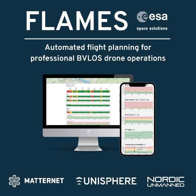
With the FLAMES project, the consortium of Unisphere, Matternet and Nordic Unmanned demonstrated how simulation technologies can be used to increase the automation of drone flights in an urban and maritime environment.
For the first time, high-resolution weather data, the Copernicus digital elevation model, aircraft performance models and trajectory simulations were combined to create a digital twin of drone flights. This forms the basis for automated flight planning, which is offered as a SaaS service. Moreover, the validated simulation technology is the basis for autonomous flight operations in the future and enables a reliable transfer of pilot knowledge into software. As a result, a broader customer base will be able to use drone technology.
EMLM
Status date: 22 March 2022
EMLM investigated the technical feasibility and commercial viability of Earth observation satellites to detect, monitor and model the movement of large accumulations of floating marine plastic litter as it travels from the source, along rivers and estuaries, and into the Oceans.
PlastEcoTrack
Status date: 21 March 2022
This project assesses the technical and commercial feasibility of space-related services to support the reduction of marine litter. A multi-technology approach is studied to detect and track marine litter in the coastal area. An integrated economic channel from the collect to the revalorization is evaluated, including the tracking solution and involving local fishing communities to boost efficiency.
PLESS
Status date: 28 February 2022
Marine pollution in the form of plastics is a devastating problem that not only affects the whole planet ecosystem, but also represents a great socio-economic impact on human activities
It is considering this ever increasing problem that there is an urge for new conceptual and technological solutions that can help to detect, monitor and mitigate the consequences of marine plastics pollution and, ultimately, contribute for the establishment of adequate policies that can contribute for its mitigation.
KSAT DECOM
Status date: 28 February 2022
KSAT DECOM aims to help operators and regulators to monitor offshore decommissioning activities by combining oil spill detection, vessel monitoring, multi-mission SAR and EO data, weather condition and greenhouse emissions to reduce costs, increase efficiency of operations, develop safer methods for execution and reduce environmental impacts during decommissioning.
atPACE
Status date: 14 February 2022
A project-centric, situational awareness portal aiding construction and decommissioning of offshore installations. Rich insights are engineered from Earth Observations, AIS, weather, sea state and various GIS data repositories and combined with in-situ surveys and sensor data. All information is dynamically shared amongst project stakeholders creating common understanding, transparency, and improved efficiency.
PoF
Status date: 16 December 2021
A consortium consisting of Arthur D. Little, CLS and Marlink are performing a study on how space-based technologies can be leveraged in the modernization of ports. The study includes a full range of Space-based technologies including satellite communications GNSS, SAT-AIS and Earth Observation and how these technologies could be applied in combination with terrestrial assets.
SNAPPED
Status date: 25 August 2021
This project is a technical, economic and commercial feasibility assessment into an adaptive Load Reduction Device (LRD) for Floating Offshore Wind (FLOW) mooring systems that can significantly reduce Levelized Cost of Energy (LCOE).
Plastic Less Society
Status date: 28 May 2021
This project assesses the technical and commercial feasibility of space-related services to support the reduction of marine litter. A multi-technology approach is studied to detect and track marine litter in the coastal area. An integrated economic channel from the collect to the revalorization is evaluated, including the tracking solution and involving local fishing communities.
FEST
Status date: 16 May 2021
Vake is making the oceans safer and more transparent by detecting and exposing IUU fishing activity. They deliver Deep Maritime Insights through automated data fusion of vessel trackers and satellite imagery. During the project, the work included activities towards NGOs and Government Agencies working on analyzing IUU fishing activities and other illegal or unreported activities.
4S Safety of Future Transport
Status date: 13 April 2021
4S Safety of Future Transport is a study undertaken within the frame of the 4S Strategic Programme Line that aims at identifying a list of applications that will use highly innovative and secure Satellite Communication systems to support safety critical services within the transportation industry (Aviation, Maritime and Railway).
ASTROCAST
Status date: 25 March 2021
Astrocast is developing an advanced Nanosatellite network for the Internet of things (IoT).
HoloCap pilotage application
Status date: 19 March 2021
A remote pilotage telepresence project, utilizing 3D game engine, volumetric video and Augmented Reality to bring maritime pilots virtually onboard a ship`s bridge from a remote location.
CubeHAPS
Status date: 25 February 2021
A constellation of mini HAPS that provides a low-latency and low-cost telecommunication service over areas not covered by terrestrial infrastructures.
Foresight Marine
Status date: 23 February 2021
Foresight Marine digitises the process of machinery inspection; our edge sensors generate certifiable & actionable data accessible to anyone, anytime, anywhere – from the ship mechanic to the board room decision makers.
HeraSpace IUU
Status date: 17 February 2021
HeraSpace IUU helps the identification of illegal unreported and unregulated fishing supporting EU legislation and environmental protection.
ZPR
Status date: 08 February 2021
The aim of the project is to give MPAs (Marine Protected Areas), National Research Institutes, NGO and as well as marine operators access to advanced technologies as artificial intelligence (AI), robotics and space technologies, that could help, favourite and accelerate marine conservation.
Specifically, the project will allow the data mining of coastal marine habitats through embedded AI on satNav localized underwater explorer-class drones and surface vessels whose autonomous survey are optimized by cloud AI and Earth Observations (EO), creating web dashboards for MPAs to access all the marine habitats data, trends and alerts, and share them all within their community.
ACABAS
Status date: 04 February 2021
Using civil aircraft as a platform to collect AIS data, complementing existing terrestrial and satellite solutions, enhancing AIS data availability.
OPTIPORT
Status date: 28 January 2021
A significant contributor to the global GHG emission is the “hurry-and-wait” behaviour in tramp shipping. OPTIPORT is a Just-in-Time Arrival service that calculates optimal port arrival times for vessels currently underway by leveraging data from Sat-AIS and geospatial analytics.
This problem is tackled by combining the capabilities of StormGeo (weather forecasting, fleet performance and vessel routing) and Oceanbolt (port congestion, commodity trade flows and AIS data processing).
ReMedy DEMO Project
Status date: 22 January 2021
A Thousand miles out at a sea. You are the captain on a large container ship. A crew member is seriously ill. You have been trained for this and it is your call. Remote medical care is complicated due to the distance between parties.
Telemedicine currently focuses on analysis / consultation. MedAssist.online’ s Two- way Augmented Reality service adds the “DO-factor”, by bringing a remote doctor virtually alongside a caretaker, working jointly to deliver the best possible care at lowest cost.
ARCAmarine
Status date: 11 January 2021
The goal of the study is to develop an end-to-end solution mitigating cyber risks related to maritime communications via satellites. In particular navigation data are critical to improve the safety of maritime traffic and the reliability of downstream services.
MoSCI-ECOSPACE
Status date: 08 January 2021
The MoSCI - ECOSPACE product is a service for storage, processing, visualisation and analysis of Earth and airborne observation datasets. It aims at delivering meaningful information for overseeing and managing risks to critical infrastructure (CI) in coastal and riverine settlements. The service targets in priority the public water authorities responsible for managing coastal and riverine areas and resources; the utilities, contractors and engineering consultants; and the international financial institutions and insurance brokers.
CarbonSpace
Status date: 15 December 2020
CarbonSpace is an AI and satellite-powered B2B SaaS platform for remote carbon footprint tracking that provides organizations with actionable insights to tackle climate change.
OAPM
Status date: 14 December 2020
Developed by CGG’s Satellite Mapping business unit, with support from ESA, OAPM provides regular, cost effective, satellite-derived information over offshore assets to establish a baseline, and a programme of routine pollution monitoring. The emphasis of the OAPM service is regular delivery of high-quality slick interpretation to enhance situational awareness.
ECDPIF
Status date: 10 December 2020
MONITORED AI is a space-based application aimed at Detection & Prevention of Illegal, Unregulated and Unreported (IUU) fishing for different stakeholders involved in the monitoring of Environmental Crimes in Europe and Beyond. The AI powered solution integrates Synthetic Aperture Radar (SAR) imagery and Automatic Identification System (AIS) to autonomously detect dark vessels (no AIS transmission) and spot suspicious behaviour.
Floating Weed Manager
Status date: 24 November 2020
Floating Weed Manager is a surveillance and monitoring service for freshwaters where aquatic weeds cause social and economic disruption to communities living and working around impacted lakes and reservoirs. It combines radar and optical satellite EO data to provide weekly data and maps of weed coverage to support weed management programmes.
NIVCS
Status date: 23 November 2020
NIVCS is a project that leverages Oceanbolt’s ability to process and analyze AIS signals, leveraging the latest big data processing analytics frameworks and the extensive Global Navigation Satellite Systems. The aim of the project is to help combat illegal, unreported and unregulated fishing, while providing transparency into fishery emissions.
Virtual Watchkeeper
Status date: 18 November 2020
Shipping Companies invest in safely transporting goods and/or passengers. Maintaining a quality portfolio of vessels, along with leading marine safety standards and capability, have taken on a greater importance than ever. Besides mere compliance, they want to verify the safe practices on board and assess the competencies of crew members. Our comprehensive solution increases the situational awareness on board and verifies safe practices at any moment and/or review actions when needed.
The SeaUrchin
Status date: 19 October 2020
The SeaUrchin is an affordable state-of-the-art wearable surf tracker, being developed by Kittiwake Labs Ltd in Cornwall, UK. The SeaUrchin tracker takes advantage of GNSS for tracking surfer sessions and applies novel data analysis for session characterisation and to monitor progress.
MSaaS
Status date: 14 October 2020
Developments on Unmanned Maritime Systems (UMS) are flourishing. In MSaaS, economically and technically sustainable UMS based services are identified, defined and assessed creating business opportunities for manufacturers and suppliers of ship technology.
mAPP’ing
Status date: 22 September 2020
B-LiFE - TEN
Status date: 24 August 2020
The B-LiFE Telecommunication Emergency Node is a new field communication and control system, integrating space assets and new tools for crisis and logistics management.
Map2Fish
Status date: 21 August 2020
Map2Fish is a service that consists of a WMS service and a web mobile application that provides to the corresponding customers and end-users near real time and forecast of pelagic fish concentration probabilities and parameters like sea surface temperature, dissolved oxygen, chlorophyll-a concentration, water transparency, currents and waves.
AquaEye
Status date: 26 June 2020
The AquaEYE system verifies the physical location of certified aquaculture facilities and water quality data.
TeleAssist
Status date: 27 May 2020
TeleAssist is an Augmented Reality (AR) platform that consists of AR glasses and a specialized communication platform integrating satellite-based communication capabilities. For mobile healthcare professionals it improves the delivery and improvement of remote care in rural, poverty, and conflict areas, along with global assistance to mobile emergency care.
Blue Discovery
Status date: 22 May 2020
BLUE DISCOVERY is an innovative and powerful technology platform designed to provide an efficient and low-cost Access Control and Visitor Information System to Marine Protected Areas (MPAs), allowing them to offer a comprehensive set of added-value services to their visitors.
SyriUS Feasibility Study
Status date: 04 April 2020
SyriUS is developing innovative data services for bathymetric mapping, benthic mapping, seafloor characterization, habitat mapping, and environmental monitoring. Current end users experience a lack of such data availability. For example, bathymetric maps are often outdated and not available for very shallow waters. SyriUS proposes three innovative data services that combine proven earth observation (EO) technology from EOMAP GmbH & Co. KG with unmanned maritime systems (UMS) solutions from Maritime Robotics AS. Data products created via the SyriUS services provide larger area coverage than can be obtained using only UMS, and with greater accuracy than can be obtained using only EO solutions.
MARVELOWS
Status date: 04 March 2020
The project objective is to identify and specify new services using VDES (VHF Data Exchange System), so leveraging robust ship-to-ship, ship-to-shore and shore-to-ship communications that this technology makes available. Starting from e-navigation Maritime Service Portfolio (MSP) as defined by IMO e-navigation strategic implementation plan, two services have been identified that mostly match the Contractor business opportunities: dematerialisation and towage.
Sceye Services Enabled by HAPS Complemented by Satellite
Status date: 31 January 2020
Sceye investigates the feasibility of using High Altitude Pseudo Satellites (HAPS) for increasing awareness in maritime areas through observation and communications relay.
IntVAR
Status date: 28 January 2020
The proposed mobile application will be a platform supporting users interested in active spending time by the water. The integration of GNSS and VR/AR technologies combined with satellite imageries will offer new opportunities to improve travel safety and to help avoid dangerous navigation obstacles. The application will also enable communication between active users and participation in virtual regattas.
OneWave
Status date: 28 January 2020
OneWave, is a complement to the Tsunami Early Warning Systems (TEWS), a system able to detect and monitor the front wave of a Tsunami created from a major geological event, earthquake, landslide or explosive volcano by using accurate satellite radar measurements and precise position of the spacecraft of Copernicus Program.
Services enabled by HAPS
Status date: 22 January 2020
HAPS platforms are evolving in the stratosphere to conduct earth observation. They provide large-scale images as a support to decision-making processes in domains like meteorology, security, safety, natural resource inventories, climate change or prevention and monitoring of natural disasters. They provide high versatility, near real-time information and high revisit frequency on their targets
MoSCI
Status date: 20 January 2020
MoSCI - ECOSPACE is a suite of web-based subscription services for storage, processing, visualisation and analysis of earth and airborne observation datasets - spanning over a range of spatial and temporal resolutions, with capacity to deliver meaningful information for overseeing and managing risks to critical infrastructure (CI) in coastal and riverine settlements and be an early-warning decision support system.
HAPS4ESA
Status date: 17 January 2020
A roadmap for combining High Altitude Pseudo-Satellites (HAPS) and satellites for ‘persistent surveillance’ monitoring scenarios.
FSARG
Status date: 14 January 2020
FSARG is a mobile application which is dedicated mainly to recreational anglers. It enables the use of integrated depth data of fishing grounds with up-to-date information on species and quantities of fish present in a given water reservoir. Information on the most appropriate fishing times on a given day and location are also available.
MULDIARCOS
Status date: 27 November 2019
The MULDIARCOS project has implemented and demonstrated a cohesive end-to-end delivery chain of satellite imagery and met-ocean data. The implemented service has been demonstrated during maritime operations in the Arctic. Arctic maritime operations often have a need of fast and regular earth observation and weather information. In the project, focus has been on streamlined and effective ordering, delivery procedures due to limited and expensive communication channels to the vessels during the operations.
Cerberus
Status date: 26 November 2019
BlackShore’s crowdsourcing platform Cerberus reinforces developing country economies utilizing satellite imagery amplifying sustainable food production while preserving the environment. This is achieved through the power of satellites, socially conscious gaming and the power of the crowd.
GLAUCUS: Smart Fishing and Route Planning System
Status date: 07 November 2019
GLAUCUS is an end-to-end system to help fisheries to optimise their navigation routes and identify the best fishing grounds, dynamically updated to know where it would be more convenient to fish during the fishing trip. The system allows fishermen to locate the fishing grounds and also provides the optimal route to navigate through the seas, between fishing grounds and/or to the ports.
AMTRACK2
Status date: 07 November 2019
The AMTRACK service aims at filling the gaps between terrestrial AIS service and SAT-AIS (Satellite AIS) service. Both services provide ship positions but the first is limited because of the limited VHF range of coastal stations, typically 25-30 nautical miles, while the second is limited in areas of high ship densities (Asia, Golf of Mexico, Europe…).
Big data for migration study
Status date: 13 September 2019
“Big Data” refers to new computational capabilities, that warehouse huge set of data, technologies and analytics in order to extract added value from “bulky information” in a reasonable amount of time. The increasing possibilities offered by satellite technologies integrated with collateral data can support the complexity of the migration flow monitoring
AutoNautUSV-CommsHub
Status date: 12 September 2019
An unmanned surface vessel to upload data from remote sea-bed assets by underwater acoustic communications. The wave and solar energy powered AutoNaut USV shall remain at sea for many weeks “harvesting” valuable data. For oil and gas, defence and marine science customers it shall significantly reduce safety exposure in the offshore environment and remove the need for costly conventional vessels.
Services Enabled by HAPS (Unisphere)
Status date: 02 September 2019
Within the context of satellites, terrestrial infrastructure and Remotely Piloted Aircraft Systems (RPAS), HAPS are a new platform offering unique advantages, but also complement existing services. Three major HAPS applications have been analyzed within this feasibility study. The concept of “HAPS as a Service” (HaaS) has been introduced and its unique requirements to highly automated flight management were detailed. A follow-up demonstration project with the focus on flight management has emerged from this feasibility study.
COLDSUN
Status date: 21 August 2019
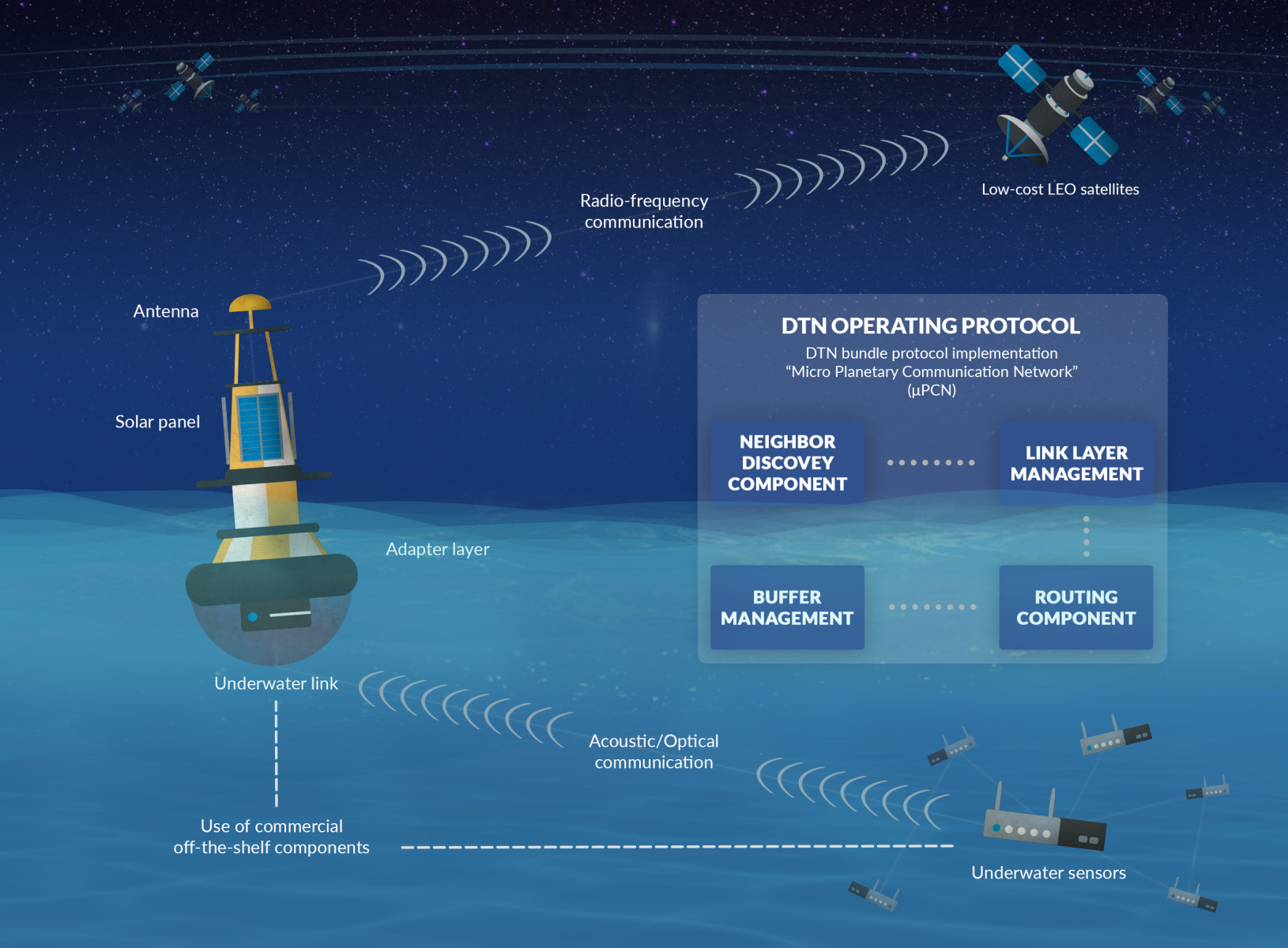
The project has explored a communication service that allows to transmit data between underwater networks and the internet via satellite networks. The overall system renders possible low-cost data transfer using a data relay buoy equipped with interfaces for underwater as well as satellite communication. This offers a cheap and flexible communication solution for companies operating in a maritime environment.
UNDERSEE
Status date: 26 July 2019
UNDERSEE is committed to develop a scalable solution to bring knowledge about rivers, lakes and oceans to water dependent stakeholders by providing simple access to water quality data.
SatCBRN
Status date: 12 July 2019
SatCBRN explores the use of satellite services for surveillance and hazard management of incidents involving release of chemical, biological, radiological or nuclear threat agents.
eOdyn surface currents
Status date: 01 July 2019
eOdyn’s surface currents service enables saving costs and mitigate risks on offshore Oil & Gas marine operations. Simultaneously providing unique information onboard vessels and to onshore support teams, this satellite-based service supports decision making.
VtDaws
Status date: 07 May 2019
VtDaws is a service developed on a SaaS model. VtDaws includes in its features the access to EO data (especially Sentinel and Copernicus Services data), a change/anomalies detection engine based on machine learning techniques, a warning service transforming data into information to the users and community sourcing features to add in-situ data and share information on smartphones or tablets.
ARCT.esa
Status date: 12 April 2019
The ARCTTM stakeholder mapping tool offers visualization of “Project Health” in the cross-roads between society, environment, business and policy. The unique de-risking tool combines climate change risks with other factors and makes them relevant, simple and visual for owner and decision makers of any infrastructure project.
ARCT has also found a fun and engaging way to score and report on the UN Sustainability Goal Climate Action goal #13. www.arct.tools.
ARC-REACH
Status date: 08 April 2019
A number of countries are making preparations to turn the rapidly warming Arctic into a busy global shipping route.
The objective of the ARC-REACH project is to validate the need and feasibility to setup a cost-effective low-power long-range dynamic radio network, tailored for tracking of cargo and maritime activity, complemented with remote sensing of the environment.
ISSWIND Demo
Status date: 13 March 2019
ISSWIND provides value-adding services to wind power industry in the areas of planning and operations, with financial and organizational benefits, to a wide range of wind power stakeholders. More accurate wind resource assessments and power production estimations are just two of the range of services available that shall benefit the client’s business.
PRIIMA
Status date: 08 February 2019
PRIIMA serves the need for high-resolution sea-ice forecasts in the Arctic and Antarctic maritime sector. It converts static satellite images into real-time information and even into animations showing the future drift of sea-ice over the next hours and days, while the resolution of the images is being conserved.
NARWHALS
Status date: 05 February 2019
NARWHALS objective is to realise a feasibility study of a service capable to provide high accuracy positioning by monitoring and mitigating the ionospheric impact on GNSS navigation in the Arctic environment. Istituto Superiore Mario Boella (ISMB) and SpacEarth Technology (SET/INGV) propose a possible solution by combining their expertise in low power hardware and managing ionospheric data.
POINTSAT
Status date: 01 February 2019
POINTSAT enables professional remote collaboration services of support, instruction and training in challenging conditions for the maritime, offshore, and energy industry sectors. The project integrates satellite infrastructure and augmented reality technology into a smart and reliable solution for all technical collaboration needs.
ARCtic Sea-ice and CleAN monitoring
Status date: 17 January 2019
The project brings solution for a systematic and automatic detection of sea ice (including the identification of ice and marginal ice zone) and oil slicks in the Arctic from Sentinel-1 images. Based on Machine Learning (Support Vector Machines), it permits to process automatically thousands of images with high accuracy.
ANHS
Status date: 10 January 2019
The market opportunity identified by DHI GRAS is to provide customers with updated information of navigational hazards including coastlines and submerged reefs in the Arctic.
WONDER
Status date: 21 December 2018
The targeted solution is an automated, cloud-based digital service for water quality monitoring which could be utilized globally. The solution builds on earth observation, global positioning, crowd sourcing, internet of things (IoT) and predictive analysis.
RAPSODY
Status date: 19 November 2018
RAPSODY, a project led by TEKEVER, will demonstrate the use of remotely piloted aerial systems (RPAS) in a wide area maritime context, through the execution of search & rescue and pollution monitoring missions. The missions will be executed in near-real scenarios over the Atlantic Ocean. The Satcom-enabled RPAS will be fully prepared and customized to perform these maritime missions, including the integration of specific payloads and the usage of specially tailored mission-oriented data fusion, data compression and automatic feature recognition and identification algorithms.
IceCast
Status date: 06 November 2018
IceCast demo project aims to develop and demonstrate a service based on IoT based capabilities combined with space assets, to help navigation planning in ice covered water areas. The solution fetches data from different data sources, stores the data, analyses it and provides output via graphical UI. There are three pilot customers who are piloting the solution in Baltic Sea and are giving input for solution development during the creation phase.
TELEKAIROS®
Status date: 29 October 2018
TELEKAIROS® Fintech is a tool for financial and (re)insurance contracts that derive value from an underlying asset such a traditional stock, a bond or stock index. TELEKAIROS is capable to manage different kinds of risks, for example by increasing the efficiency of the underlying market because they lower unforeseen costs of purchasing an asset outright.
SYMPA
Status date: 18 October 2018
Sympa: “All-around solution for the sustainable monitoring and control of Marine protected Areas”.
Vitrociset Belgium, le Centre Spatial de Liège, and LaMMA joined in Consortium, developed a system for the supervision of the touristic and commercial traffic for the benefit of the Marine Protected Area and maritime authorities, by mean of providing added value location based services to tourists and integrating this information with AIS data.
Sympa service offering is completed by the “Vessel Detection” facility that exploits the Sentinel images for target detection; and the “Water quality” monitoring which integrates earth observation into innovative biogeochemical and hydrodynamic models as support the for a sustainable and competitive tourism.
Blue SIROS
Status date: 04 September 2018
The project investigates the technical feasibility and commercial viability of an operational system for marine route optimisation, which integrates modelling/forecasts of ocean currents based on near-real time satellite altimetry data services. The service supports commercial users in the maritime community with respect to fuel savings, competiveness and port logistics as well as ship safety.
LUMEN
Status date: 28 August 2018
LUMEN provides a fully integrated end-to-end solution for real time monitoring and critical situation management with medium sized RPAS that can operate beyond line of sight.
The service is demonstrated with two specific use cases representative for the target market: flood extend mapping and maritime coastal monitoring.
JERICHO VDE
Status date: 23 July 2018
Feasibility study, performed by a Polish team, providing a comprehensive overview of the VDES technology future maritime applications potential. Analysis regards two of the most interesting services, i.e. MSI (Maritime Safety Information) exchange, with particular emphasis on polar regions, and SAR (Search and Rescue) operation coordination – on-scene search patterns exchange.
Pi-Link
Status date: 13 July 2018
Collection and transmission of ocean water column data opens up new data-based revenue streams across a range of industrial sectors and stakeholders. The Pi-Link activity explores the market and technical feasibility around sustainably gathering and supplying such data using a sensor-equipped version of SNTech’s Pisces device, called Pi-Sense.
SENSE
Status date: 17 June 2018
The preservation of safety and information distribution in the maritime transport market is currently enabled by systems, which already show signs of overload, such as AIS. SENSE is a feasibility study to analyse and assess the use of space assets, and in particular VDES, for maritime navigation systems. The project aims at developing a viable system services concept closing the information gap between ship and shore. SENSE’s core value is information exchange using worldwide standardized dataflows and thus ensure easy scalability and integration of new vessels.
SeaSearch
Status date: 11 May 2018
Based on mobile phone detectors and data correlation from other sources such as satellite, maritime and radar systems, SeaSearch focuses on the detection of small vessels at sea and generates Maritime Situation Awareness Pictures.
i-FishSAT
Status date: 17 January 2018
Intelligent Integrated Information System for Sustainable Fisheries Management via Satellite (iFishSAT) has developed a range of solutions that exploit space assets (Communication, Earth observation and GNSS satellites) to streamline the fresh seafood value chain by allowing fishermen to sell produce to customers whilst still at sea thus, providing direct linkage to a broader customer base and without geographical limitations as well as reducing waste through discard of produce that is desirable in the local market. This new model for the seafood industry transforms it from a local or regional activity to a Europe-wide open marketplace where profit for fishermen is enhanced whilst also ensuring that retailers and consumers get the best quality produce at prices that are not unduly inflated by agents’ fees.
International Satellite Derived Shallow Water Bathymetry Service
Status date: 15 January 2018
A web-based service to provide immediate, off-the-shelf, online access to shallow water depth data derived from very high resolution satellite imagery.
BLUE DISCOVERY
Status date: 18 December 2017
BlueDiscovery is an innovative and powerful technology platform designed to provide an efficient and low-cost Access Control and Visitor Information System to Marine Protected Areas (MPAs)and Tourist Ports, and at the same time to provide to them the capability to efficiently offer a rich set of added-value services to visitors.
MAPP-DEMO
Status date: 11 December 2017
Following a pirates' attack, onboard communication equipments are destroyed: the vessel’s track is lost, the research area grows as time passes, making it harder to deploy rescue assets efficiently.
The challenge is to answer to the question: “Where is my ship?”
The ‘Keep in sight’ service combines a hidden tracker installed onboard and EO acquisitions to provide this critical information.
SIMONA
Status date: 17 November 2017
The aim of SIMONA project is to provide an information platform that based on the integration of satellite and terrestrial data can both complement and enhance existing Maritime situation awareness services operated by Italian Coast Guard and Navy over a wide area of the Mediterranean Sea and at the same time provide space-based services bringing functional advantages to private stakeholders like Merchant ships Insurance Companies and leisure boat users.
The technological key is represented by the integration of services from Earth Observation sensors (mainly Cosmo SkyMed Copernicus Landsat and WorldView) Satellite Communications (Orbcom or Iridium) Satellite Navigation (GPS EGNOS Galileo in the future) along with information andor operational services coming from other Institutional (AIS Cadastral Data) andor Private assets (Merchant Ship databases Port Info databases).
SatApps
Status date: 19 September 2017
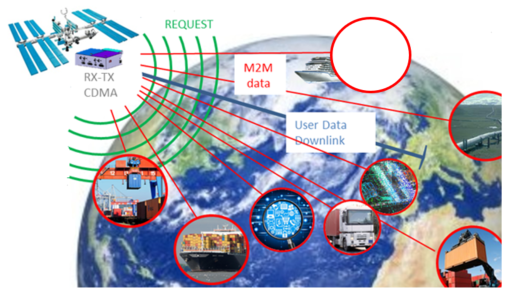
Internet of Things/IoT – M2M – industry 4.0 – these headlines are representing large user groups which have an urgent need of a globally available, low-cost, secure data service, dedicated to very small data volumes per sensor and for use also in remote areas. The objective of the study is to perform an in depth requirements analysis on 2 focus pilot user groups: railway transportation and container/waste management.
MarIA
Status date: 15 September 2017
This project has developed a cloud-based system to support more efficient management of sustainability standards in commercial fishing and processing operations. The system developed allows for the inputting of information manually into smartphones/tablets and the capture of information from sensors on-board fishing vessels (including GPS position), whilst at sea, which is sent via satellites to a central database. This database is viewable by prospective customers before the catch is landed.
SUMO
Status date: 05 September 2017
SUMO is a service to assist in the planning and monitoring of marine operations for offshore wind farms. The service integrates diverse information to allow the monitoring and forecasting of metoceanic conditions and track the locations of vessels and personnel involved.
This improves the management and coordination of the construction, operations and maintenance activities and leads to increased efficiency and safety.
Uam®
Status date: 27 July 2017
e2E intends to offer more affordable data communication services into niche markets currently underserved from existing infrastructure or where traditional satellite delivery is too expensive. The core of the service concept builds on two key technologies that have been developed with small airborne IDP networks in mind that incudes RPAS, HAPS and small satellites.
Com4Offshore
Status date: 27 June 2017
The Com4Offshore services enable communication and information exchange between offshore and onshore supporting logistics processes and construction workflow with the aim to significantly reduce the time and costs of the costly offshore construction projects. It offers:
- Satellite based public service supporting the communication needs of the different user groups in offshore wind farm areas.
- Technically and economically optimal solution to the users irrespective of their location by combining wireless, mobile and satellite network technologies.
- Access communications services, sensor devices & software applications for offshore construction activities
DeSIRE II
Status date: 27 June 2017
DeSIRE II, Second Element of the ESA EDA RPAS Demonstration Roadmap, aims at developing and demonstrating a service based on a Remotely Piloted Aircraft (RPA) flying in Beyond Radio Line of Sight (BRLOS) using a dual satcom link supporting Command and Control (C2) and Air Traffic Control (ATC) functions.
The project also aims at demonstrating to the users the potential of RPAS complemented by satellite applications (Satcom, Satnav and Earth Observation) for developing new services for operations.
Project objectives are pursued by means of a real flight campaign using Piaggio Aerospace P.1HH RPAS, and complemented by simulation and emulation activities.
STAR-FISH Feasibility Study
Status date: 11 May 2017
STAR-FISH is a management system that will automatically monitor and record fishing activity and fish discarding, in order to verify compliance with discarding regulations. The STAR-FISH service will consist of:
- A Remote Monitoring System (RMS) (hardware and software) installed on board vessels to monitor, record, identify and transmit fish discard data
- On-shore software which monitors fishing and discarding data from vessels and can provide alerts to fishing regulators
- Interfacing with databases/platforms to support fish sustainability and traceability statistics
STEAM
Status date: 04 May 2017
The objective of this study is to investigate the technical feasibility, financial/non-financial viability and sustainability of a future service aiming at measuring the amounts of sulphur oxides components ejected by vessels travelling inside the Emission Control Areas (ECAs) as defined by the International Maritime Organization (IMO).
Intelligent sensor and satellite network (ISSN)
Status date: 02 December 2016
The project is a feasibility study in order to establish whether there are sufficient market opportunities, and the technological maturity for developing a flexible and reliable intelligent sensor network where satellites are among the nodes in the network (ISSN). ISSN has a number of potential application areas in connection with Offshore Oil & Gas exploration and production, environmental surveillance in general, safety, search and rescue, transportation etc.
PROTECT
Status date: 28 September 2016
The PROTECT project aims to exploit existing systems and infrastructure in conjunction with applicable space based assets to provide cost-effective added-value technology centred services that provide improved situational awareness to both on-board and shore based stakeholders, based on real-time innovative integration of piracy and sensor information/data.
Profumo FS
Status date: 02 September 2016
Profumo proposes novel weather-based services for the Mediterranean navigation with the aim of granting fuel saving, pollution reduction and improving safety for passengers, crew, goods and ships’ instruments. The idea is to establish a cooperative schema (between commercial vessels) where meteo-marine data is collected from standard and non-standard on-board instrumentation and used to produce innovative high resolution meteo-marine products, and to provide route optimization and navigation services.
ARCTICSAT
Status date: 22 March 2016
The objective of this feasibility study is to assess and validate the requirements for space technologies in support of optimising situational awareness in the Arctic. The major focus is on two application areas – shipping (e-Navigation in the Arctic) and oil & gas (Arctic oil spills).
EO Crowd
Status date: 22 February 2016
Over 90% of our seas are unsurveyed. EO Crowd uses crowd sourcing, EO data and open data to fill this data gap.
SaMoLoSa FS
Status date: 28 January 2016
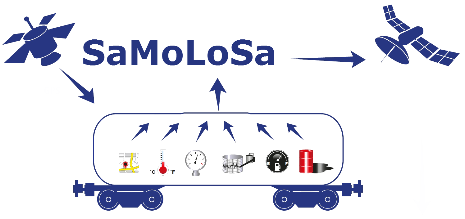
The Ovinto SaMoLoSa study addresses the use of satellite technology for the reduction of transport risk, security enhancement and optimisation of logistic operations by the tracking and monitoring of extremely dangerous goods in unpowered, mobile transport units such as rail tank cars and intermodal tank containers.
SEA SEARCH
Status date: 26 January 2016
SeaSearch provides detection and identification capabilities of small vessels, agnostic to vessels’ size.
Based on the mobile phone detectors and other sensors such as radars, AIS and SAR, SeaSearch builds Maritime Situational Awareness Pictures.
Sensors are using SeaSearch own developed technology based on Software Defined Radio (SDR).
PLASMA
Status date: 04 December 2015
This project covers the specification, design, implementation and pre-operational demonstration of a ‘Platform for Advanced SAT-AIS Maritime Applications’ (PLASMA) at the UK’s Satellite Applications Catapult facility in Harwell.
ICWM for MED
Status date: 04 June 2015
ICWM for MED solution provides water quality monitoring and surveillance of coastal areas by integrating information from: Earth Observation, Navigation and Communication satellite assets; in situ measurements; crowdsourcing information. It intends to address the current limitations from both Earth Observation based and traditional at sea measurements methods in order to support the duties of environmental agencies and coastguard authorities.
SASS@Sea
Status date: 25 March 2015
The objective of the project is the development and validation of a system for the provisioning of an integrated maritime communications service.
METSAR
Status date: 09 September 2014
The METSAR project will investigate the feasibility of developing and demonstrating a new concept to the Search and Rescue (SAR) community.
ISABELIA
Status date: 27 June 2014
The ISABELIA Feasibility Study specified and validated the sustainability of services and that would provide users at sea with near real time information on dangerous ice situations, indicators of collision risk and on risk of grounding, thereby improving the safety of vessels in the Baltic Sea.
CAESAR
Status date: 02 May 2014
The CAESAR feasibility study, finished in March 2014, focused on a service able to provide detailed and timely information on the weather and marine conditions to the maritime Search and Rescue (SAR) coordination centres, with the aim of reducing the risks and improving the efficiency of SAR operations.
SAMBA
Status date: 07 April 2014
The objective of SAMBA is to establish feasibility of space-based services for maritime emission monitoring. SAMBA will achieve its objective by combining AIS/GPS-based maritime emissions with remote sensing-based atmospheric pollution monitoring into maritime emission compliance monitoring and information provision service.
iFish North Sea
Status date: 03 March 2014
I-fish North Sea aims to provide an integrated information and communications system that will utilise a combination of satellite communications and satellite navigation to enable unified timely and accurate collection, management, and use of marine fisheries data to provide value added services to fisheries stakeholders for improved sustainability of our fast depleting fisheries resources.
FISHSAT
Status date: 27 September 2013
FISHSAT is conceived as a system of systems employing space assets (Earth Observation, Satellite Navigation and Satellite Communication) to improve collaboration between markets, fisheries and enforcement authorities. The intended benefit of FISHSAT is to increase the efficiency of fishing activities, match better the market demand, improve catch traceability and strengthen enforcement.
SEMAFORS
Status date: 22 April 2013
SEMAFORS, the Ship Efficiency Monitoring, weAther Forecasting and Optimised Routing Service is a user focused project in support of the shipping industry.
SEMAFORS will investigate, establish and demonstrate through sea trials a concept to improve ship fuel efficiency by providing the means to better planning, avoiding of adverse weather and by making better use of ocean currents.
EASY Feasibility Study
Status date: 12 December 2012
The objective of the EASY feasibility study has been to carry out an analysis of the technical feasibility and commercial viability of "one-stop-shop" services to the high value leisure yachting market mainly but not limited to the Mediterranean Sea, integrating various space assets (Satellite Communications, Satellite Navigation, Earth Observation). The integrated system and associated services shall provide enhanced services in order to render yachting more reliable, safe and "easy", thereby attracting a wider spectrum of potential users.
Blue Belt
Status date: 01 November 2012
Embedded into the SAT-AIS context, this IAP Demonstration Project aims to support the EMSA Blue Belt project. Providing space-based AIS data, it seeks to complement the terrestrial AIS data and provide an added-value source of information for Customs Authorities interested in maritime situational awarenees for vessels and geographical focus areas.


