
Energy security is critical for the growth and prosperity of European economies. Space-based systems and services already play an important part in the commercial sectors of the energy industry, but there is still a significant potential for increasing this.
Space services have applications in renewable energy sources as well as in traditional oil-carbon and nuclear sectors. Such services can deliver benefits throughout all the phases of energy production and supply, ranging from identifying reservoirs and sites, to controlling and monitoring of the distribution networks across Europe. They also provide support to policy formulation and enforcement.
MagWatch3D
Status date: 17 July 2026
Geomagnetic storms can disrupt electric power grids and other critical infrastructure. MagWatch3D delivers high-resolution – better than 10 km spatial resolution and 1 second cadence – near real-time physics-based space weather intelligence on geomagnetic disturbance, geoelectric fields and geomagnetically induced currents (GICs) for power grid operation, insurance, and other activities affected by Earth’s magnetic field such as magnetic surveys and navigation.
SWAS
Status date: 07 July 2026
The Space Weather Alert System feasibility study investigates the industrial desirability of space weather services in the domain of electricity networks, aviation and GNSS dependent systems in Austria.

PowerEdge
Status date: 07 July 2026
The project is developing a new standard for physical snowpack measurements for the hydropower industry by use of L-band radar measurements in combination with InSAR processing techniques. The added values are higher resolution of snow estimations in time and space as well as less need for physical presence (equipment & humans) in the mountains to do snow estimations.
AHMOS
Status date: 03 July 2026
The project assesses the feasibility of a scalable "hydrogen-safety-as-a-service" system. It integrates a Raman LiDAR sensor with AmbaSat’s satellite communication and cloud analytics platform. Teesside University provides critical validation and net-zero expertise, ensuring continuous, early detection of industrial hydrogen leaks
RELECT
Status date: 02 July 2026
Rheticus® Electric Towers (RELECT) is a demonstration project aimed at developing an Earth Observation service using very-high-resolution SAR imagery and AI to rapidly detect damage to power lines after extreme events. It enables Transmission System Operators to assess affected infrastructure within 24 hours, improving response times, reducing costs, and enhancing the resilience and sustainability of energy networks.
AUTOSEA
Status date: 25 June 2026
AUTOSEA demonstrated a space-enabled autonomous maritime service using the LM450 USV, DockMaster autonomous docking and AutomatePro mission control to support repeatable surveys, hull-inspection workflows and coastal/offshore monitoring with reduced crew exposure and lower operating cost.
PLECO
Status date: 23 June 2026
PLECO demonstrates SolarCleano B1A, a fully autonomous robotic system for cleaning and inspecting large-scale photovoltaic plants in remote and harsh environments. It combines dry cleaning, inspection, predictive maintenance, satellite navigation, satellite communications and cloud analytics to reduce soiling-related energy production losses of 10-20%.

Preflet LEO
Status date: 23 June 2026
A new macro‑intelligence layer that answers which buildings from the portfolio lose energy, why it happens, and where to act first. LEO integrates surface‑temperature from satellite data with real energy‑weather behaviour to help organizations identify abnormal heat‑loss patterns remotely across large building portfolios.

ISTRICE
Status date: 19 June 2026
ISTRICE provides secure, AI-powered tracking and certification for high-value Enertech equipment. Integrating Edge AI, Blockchain, and Satellite Communication on a new generation Intelligent Tracking device code named HedgeLog™. The solution monitors machinery during transit and boot-up. It ensures certified delivery and successful commissioning for deep tech assets like Enertech machinery (e.g. turbines and electrolyzers) Robotic workforces (e.g. robotic cells, arms and humanoids) and other high-tech machinery, reducing financial risks and project delays.

GreenClaims
Status date: 10 June 2026
This project develops an ESG verification platform integrating Earth Observation data with AI-driven analytics to independently verify corporate environmental claims in land-intensive sectors including mining, oil & gas, agriculture, and renewable energy. By combining satellite imagery analysis with natural language processing of corporate disclosures, the service provides scalable, evidence-based verification to support regulatory compliance and combat greenwashing.
HydrocastAI
Status date: 03 June 2026
HydrocastAI is a data-driven, space-enhanced hydrological forecasting service designed to optimize hydropower operations and improve flood management. By combining satellite Earth observation, meteorological forecasts, and machine learning, the platform delivers highly accurate, real-time predictions of river discharge, enabling energy traders and plant operators to maximize efficiency and mitigate climate-related risks.
BlueSentinel
Status date: 02 June 2026
BlueSentinel is a next-generation maritime surveillance system delivering persistent, high-resolution awareness beyond satellites and fixed infrastructure. Using modular sensors on infrastructure, ships, and drones, it detects and tracks cooperative and non-cooperative vessels in remote and sensitive waters, giving authorities, infrastructure owners and crews real-time visibility where it matters most.
Space to Subsea
Status date: 29 May 2026
UVisions underwater 3D scanner is sold worldwide and helps asset owners get a clear overview and understanding of the state of their underwater assets. Based on customer requests this project integrates satellite-based positioning ensuring: 3D-models referenced in the global coordinate system, Improved accuracy and increased ease-of-use.

Terma BCTaaS
Status date: 08 May 2026
ProUST UniverSAS® is a modular, software-defined power supply platform designed to enable high-efficiency, scalable, and flexible battery testing for e-mobility and space-related applications. The system combines advanced power electronics, digital control, and integrated analytics to support a wide range of battery testing scenarios, from laboratory validation to industrial-scale operations.
STREAMO
Status date: 07 May 2026
STREAMO is a commercial downstream application seamlessly merging satellite and stratospheric Earth Observation data. Focusing on urban/mountain environments, the platform provides very-high-resolution, near real-time updated maps and insights like vegetation and thermal gradients. It offers a centralized marketplace for accessing archived products and requesting on-demand stratospheric tasking to bridge the gap between satellites and drones.

Belmap4EU
Status date: 07 May 2026
They project expands Belmap, GIM’s geospatial digital twin platform, across Europe to deliver harmonised, property-level intelligence on buildings, parcels and addresses. By integrating national open datasets with Earth Observation–derived features and scalable full-country processing, the platform enables consistent property insights across multiple European countries.

E-Mobility SpaceLink
Status date: 30 March 2026
he project, led by Archimede, entails designing a solar-powered canopy for charging electric vehicles in remote areas lacking access to the power grid. Satellite imagery analysed by Planetek Italia will identify optimal installation sites, while satellite connectivity will enable deployment in emerging electric mobility markets, supported by Arthur D. Little’s sector-specific research.
EODT4Crises
Status date: 12 March 2026
Helyx and the University of Portsmouth (UoP) have developed “Earth Observation Digital Twins (DTs) for Crises” that focus on utility and transport networks. The DTs map the vulnerability of networks to natural hazards and the damage to these systems post-event. By using earth observation imagery, our DTs support the rapid global response of humanitarian teams to crises.

OCTAGON
Status date: 25 February 2026
OCTAGON is a suite of intelligent tools and services available in Cloud in the form of SaaS, to facilitate the decision-making process and the management of energy assets, where "intelligent" means: optimal design, dimensioning and management of the energy system, simulation and management of multiple scenarios/sites (“behind” and “beyond” the meter) and easy to use for all players in the energy system, decision makers and users.

Dark Vision
Status date: 23 February 2026
Using innovative space-based nighttime imagery, Dark Vision will provide an understanding of how artificial light at night (ALAN) impacts our planet ranging from the effects on human health, ecology, the environment, biodiversity and the global economy.

RTIS
Status date: 10 February 2026
DataCosmos is Open Cosmos’ proprietary platform for storing and analysing satellite imagery.
RTIS is a near-real-time information system. By leveraging DataCosmos to detect and monitor oil spills and water turbidity in the middle east with rapid delivery time, RTIS will enable the rapid response to critical situations.
SnowPower
Status date: 03 February 2026
Water resources in snow, defined by the snow water equivalent (SWE), are of key importance to supply renewable energy production through hydropower. Information of the spatial distribution and temporal evolution in SWE are essential to forecast and manage reservoir water levels and electricity production. SnowPower provides this information based on recent advances in snow remote sensing techniques.
EO x Grid
Status date: 26 January 2026
Service description: We're building an EO- and AI-driven forecasting service for optimizing operations of electricity distribution grids and informed decision-making related to local flexibility markets.
DECOM
Status date: 26 January 2026
KSAT DECOM aims to help operators and regulators to monitor offshore decommissioning activities by combining oil spill detection, vessel monitoring, multi-mission SAR and EO data, weather condition and greenhouse emissions to reduce costs, increase efficiency of operations, develop safer methods for execution and reduce environmental impacts during decommissioning activities.

DECOM
Status date: 22 January 2026
KSAT DECOM aims to help operators and regulators to monitor offshore decommissioning activities by combining oil spill detection, vessel monitoring, multi-mission SAR and EO data, weather condition and greenhouse emissions to reduce costs, increase efficiency of operations, develop safer methods for execution and reduce environmental impacts during decommissioning activities.

Smart-Inno Expert Space Weather Service (SME SWS)
Status date: 21 January 2026
The mission of Smart-Inno Expert Space Weather Service is to protect Earth-based infrastructure, specifically Electricity Networks, from the destructive effects of Space Weather. The service delivers specialized intelligence to power system operators providing a comprehensive package including a Forecast, a Nowcast (real-time data), and a Scaled Alert System tailored to the operational needs and risk tolerance of the power networks.

EarthImages for Enterprise
Status date: 08 January 2026
Enterprise users of commercial EO data are struggling to adapt to proliferation of data providers over the last decade. Many struggle with the knowledge, time and commercial and operational tools to enable them to exploit this increasingly powerful resource. The EarthImages for Enterprise project designed a solution to this problem, focused initially on the energy sector, but applicable across multiple markets.
SpaceAware Resilience (SWiiFT)
Status date: 08 January 2026
Feasibility study to investigate commercial uses of Space Weather Data in various industries, understanding the impacts of Space Weather on critical nation infrastructure and how leveraging and utilising space weather data can address these problems and gaps.
InsurEO
Status date: 09 December 2025
The InsurEO project applies innovative Earth Observation (EO) services to provide detailed insights into buildings and their surroundings—ranging from flood and landslide risks to environmental health, climate change, and sustainability. Through an intuitive web platform, organisations will be able to visualize and monitor these insights, whether for a single building or an entire property portfolio. Sectors such as insurance, banking, real estate, and energy service companies (ESCOs) will use these insights to make more informed decisions.
MESPACdemo
Status date: 24 November 2025
MESPAC is a Data and Analytics as a Service (DAaaS) cloud platform that uses patented machine learning models to combine SatEO and offshore in-situ data. It delivers accurate, continuous, fast, and scalable metocean intelligence for offshore operators. The service line solves data inefficiency, inconsistency, and insufficiency for offshore developers across the entire lifecycle of their projects. This approach aims to contribute to accelerating offshore wind and blue economy project development, reducing survey time while supporting bankability and operational planning.

E-Spacement
Status date: 01 November 2025
E-Spacement enables the location optimization of electric vehicle (EV) charging infrastructure using spatial data, including space assets, and artificial intelligence (AI).
ImpactMaps
Status date: 30 October 2025
The solution will be used to identify disused and abandoned mines and environmental pollution, as well as determining the best locations for photovoltaics and quantifying investment volumes and ROI automatically.

JP-VISION
Status date: 20 October 2025
JP-VISION is an advanced inspection solution for photovoltaic plants, integrating drones, AI, and thermal analysis to enhance efficiency and maintenance. It provides real-time reports, detects anomalies, and reduces operational costs. Designed for scalability, JP-VISION ensures precise, automated, and cost-effective monitoring for sustainable energy management.

FASTWIND
Status date: 04 September 2025
FASTWIND is a validated cloud-based tool to deliver satellite SAR derived wind products and automatically deliver them in into engineering and financial analysis tools. In collaboration, software developer Exceedence, Simply Blue Group, a leading blue economy developer, and NORCE Norwegian Research Centre, have used satellite data from ESA’s satellite network to showcase the great potential of satellite data as an information source for offshore wind development.

GEMS
Status date: 04 September 2025
GEMS is pioneering the development of advanced emissions tracking solutions. Leveraging cutting-edge Earth Observation data from the Copernicus satellite services, our platform enables near real-time detection, identification, and monitoring of NO2/NOx and SO2 emissions sources across Europe. GEMS platform, address a growing demand for accurate emissions tracking, driven by evolving environmental regulations and the increasing focus on sustainable industrial practices.
GRIDFOR
Status date: 25 August 2025
GRIDFOR delivers hyperlocal weather forecasting using satellite Earth Observation and AI to enable two critical applications: predictive Dynamic Line Rating for grid operators seeking to optimize transmission capacity without expensive sensors, and compliance-grade renewable energy forecasting for solar and wind producers requiring accurate scheduling to reduce costly imbalance penalties in European energy markets.
https://business.esa.int/projects and search results.

SpaceEPC
Status date: 11 August 2025
SatVu is collaborating with the Urban Big Data Centre (Part of the University of Glasgow) to enhance the analysis of building energy efficiency.
The study will drive the development of the Heat Loss Index (HLI), a pioneering metric designed to identify buildings with high thermal energy wastage, enabling policymakers and urban planners to focus retrofitting efforts where they will have the greatest impact.

5SEnSES
Status date: 22 July 2025
5SEnSES is a service (SaaS) based on cloud-native platform for the gas and oil extraction sector. It integrates seismic, satellite (SAR), GPS and IoT data in real time, correlating ground-surface movements, seismic activity and pore pressure through an AI engine. The platform delivers faster, cost-effective, environmentally responsible monitoring and predictive simulation, surpassing traditional assessment methods and complying with all regulatory and legislative requirements.
SOLARSTEG
Status date: 30 June 2025
SOLARSTEG is a satellite-based IoT monitoring and ERP platform empowering decentralised solar-based energy equipment to provide smart solar energy services for businesses and cooperatives in Africa which rely heavily on diesel due to unreliable grid access. It enables the deployment of innovative business models to deliver affordable and reliable energy.
DBX SPECTRUM
Status date: 16 June 2025
SPECTRUM is the new DBX Commodities’ technology pipeline that accurately characterises the activity of the steelmaking industry across the globe, using ESA spaceborne satellites.
DHI Global Seas
Status date: 05 March 2025
Global Seas (focussing on the shipping industry) allows you to reduce fuel consumption and to improve your vessel performance.
Global Seas Offshore Wind Energy CCN (focussing on the offshore wind industry) allows you to reduce downtime during installation and O&M of offshore wind farms as well as optimizing allocation of expensive operational assets.

SeaScope
Status date: 31 January 2025
Viridien’s SeaScope service increases knowledge on the presence, characteristics and behaviour of oil pollution in marine and coastal environments by combining deep interpretative understanding with the unique spatial, spectral and textural information contained within historical and frequently acquired contemporary satellite images.

ANESI
Status date: 17 January 2025
The ANESI kickstart introduces a trustworthy service for aerial inspections to manage, optimize, and maintain solar parks. By using autonomous navigation based on computer vision and precisely detecting anomalies through thermal images, operational inspection and processing time is considerably reduced. The increase in efficiency of Unmanned Aerial Systems (UAS) flights and data handling have a great impact on the energy generated, reducing costs and boosting customer profits, while reducing CO2 emissions.
Space Technology Aided 3D Underwater Scanning
Status date: 26 December 2024
The project evaluates how 3D models of underwater assets produced for inspection and maintenance purposes can be enhanced by using satellite-based position technologies to improve the accuracy of the models themselves as well as position them in the global coordinate system. It also evaluates scan data transfer to the cloud, from remote locations, using satellite communication technology.
HSR
Status date: 23 December 2024
HeatScape Resolve project is developed jointly by Paulinyi&Partners cPlc. and Envirosense Hungary Ltd. to provide a solution for mapping and mitigating the urban heat island effect using satellite earth observation imagery, aiming to improve the effectiveness of existing predictive simulations. It makes use of Earth Observation data as input parameters for microclimate simulations for large scale urban real estate developments.
REGREEN
Status date: 23 December 2024
The REGREEN solution is a software as a service to locate the highest-potential sites for energy co-generation from multiple renewable energy sources including solar, wind, and hydro. REGREEN combines Earth Observations and actual power generation data from existing plants as training features of an Artificial Intelligence model that forecasts power production from renewables at any desired location on the map.

IPAS
Status date: 21 December 2024
IPAS (Interruption Prevention Alert Service) is a next-generation risk alert solution, developed with support from major UK utilities, to alleviate risk within proximity to critical assets across entire networks.
The platform harnesses satellite technology, asset geo-data and other third-party data intelligence to identify third party interference within close proximity to critical utility assets and enable more rapid operational response.
ASBCIMS
Status date: 21 December 2024
SuperVision Infrastructure - critical infrastructure monitoring system that utilizes satellite data and Earth Observation (EO) methods to develop an automated software solution for detecting and assessing damages and risks in close proximity to critical infrastructure. Exploring a fusion of optical and radar data with varying resolutions, the system serves as a rapid-response tool specifically designed for occupied and inaccessible territories.

ENTEL
Status date: 20 December 2024
ENTEL combines EO satellite imagery and geospatial data to improve the effectiveness and resilience of large energy infrastructure operators, supporting their activities during the whole network life-cycle.
AVISAR
Status date: 19 November 2024
AVISAR is a demonstration project which aims to provide solutions to support clean and safe operations within the energy sector through carefully selected services, for both onshore and offshore operations. AVISAR is a product suite based on multi-mission, multi-sensor Earth Observation assets to address the challenges faced to reduce costs, increase efficiency and develop safer and cleaner methods of operation.

DITCH
Status date: 28 October 2024
The newly developed DITCH - Digital Twin Catchment service consists of an online accessible digital representation of basins providing static and dynamic variables like topography, land use and cover, hydrological and ecological conditions (water level, discharge, sediment concentrations, algal blooms) of water bodies, and soil characteristics provided through earth observation (EO) including potential dynamics next to past and present situations.
This physical twin is then also combined with socio-economic information to provide relevant decision support tools for resilient basin management of water-related stakeholders.

PowerEdge
Status date: 18 September 2024
The project is developing a new standard for physical snowpack measurements for the hydropower industry by use of L-band radar measurements in combination with InSAR processing techniques. The added values are higher resolution of snow estimations in time and space as well as less need for physical presence (equipment & humans) in the mountains to do snow estimations.
Wind Sat
Status date: 04 September 2024
The Wind Sat project is developing an AI-powered forecasting platform for wind energy production using satellite imagery and other data sources. It provides high-frequency forecasts to help renewable energy companies optimize asset management, energy trading, and grid balancing.

DAPV
Status date: 30 July 2024
An advanced data-driven AI enabled, earth observation and ground data based, software solution for forecasting of energy production, crop yield, O&M as well as design and economics of Agri-PV plants.
M3S
Status date: 24 July 2024
The proposed service utilizes Earth Observation (EO) satellites and geospatial technologies to optimize micro-mobility planning and fleet management in urban areas. Its goal is to offer sustainable and efficient solutions for the growing micro-mobility sector, encompassing electric cars, bicycles, and scooters.
DIBAS
Status date: 19 June 2024
DDK Positioning Ltd. (DDK) provide GNSS hardware and Precise Point Positioning (PPP) services that improve GNSS positions from 10m to an accuracy of <5cm. DDK delivers its positioning service exclusively via the Iridium satellite communications constellation using Iridium’s 66 military grade LEO satellites to market sectors globally, from pole-to-pole.
SEEDS
Status date: 14 June 2024
Streamlining tree vegetation management with accurate insights using geospatial analytics.
PWP APPIDE CCN
Status date: 06 May 2024
APPIDE is an AI-powered tool designed to increase the efficiency of thermographic inspections of photovoltaic plants (both ground- and roof-mounted). Using radiometric, RGB, and GPS data acquired from drones, APPIDE generates detailed reports in a matter of hours, identifying exactly where and what the performance problems are on solar sites. Our AI-based solution drastically reduces the inspection times by human inspection and increases the reliability of reports. Overall, APPIDE allows you to make more inspections with fewer human resources, maximising the return on investment of your drones and your business.
SatADAPT
Status date: 30 April 2024
SatADAPT is a Predictive Maintenance system based on vibration monitoring and AI. The system consists of wireless vibration sensors which send data to an AI engine in the cloud which is also replicated onto Edge devices. The AI looks for anomalies in the frequency spectrum and warns of potential failures, classifies the expected defects, and estimates the time to failure.

SA4D
Status date: 16 April 2024
What short and long-term actions can be implemented to foster opportunities for the space sector in aiding the green transition and decarbonisation of the economy, with a particular focus on the Buildings and Energy & Utilities sectors?
THERMALEEGO
Status date: 07 March 2024
Revolutionize energy asset inspection with ThermAleego: AI-powered software using thermal imaging and space assets for precise anomaly detection, optimal maintenance, and cost savings.
Energy SCOUT
Status date: 22 February 2024
Energy SCOUTTM is a modular set of services which transform daily and weekly feeds of raw satellite sensor and spatial data into a series of value-added information products, targeting different activities along the oil & gas supply chain.
3E Solar Data Services
Status date: 28 January 2024
3E Project Development solution provides accurate and bankable satellite-based solar irradiation data for solar power modelling: 3E Solar Irradiation Data. It is your go-to application to assess the long-term yield of future solar assets, improve the return on investment and evaluate operational plant performance.
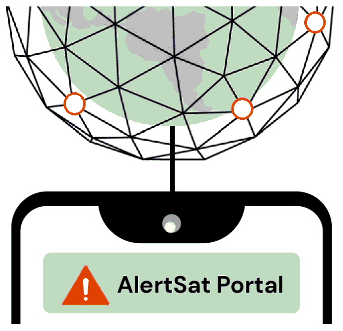
AlertSat Portal
Status date: 26 December 2023
The AlertSat satellite constellation is to deliver Alerts directly to its users, through AlertSat Portal - when critical information has been detected and there is still time to act upon it.

SP4GO
Status date: 26 December 2023
SP4GO is a solution to support the maintenance of electric power distribution infrastructures. SP4GO uses cost-effective and high-resolution satellite data to reduce inefficiencies and maintenance costs of high voltage power lines by detecting potentially dangerous situations related to the overgrowth of vegetation, the construction of new buildings that come too close to infrastructure and detecting land terrain change.
SP4GO is targeted to electric power Transmission System Operators (TSO) and electric power Distribution System Operators (DSO).
OSCAR
Status date: 26 December 2023
Space-data surveillance service for effective vessel management, enabling greater efficiencies in the planning of construction and the maintenance of offshore wind farms.
It will not appear on the project web page itself but is used in project lists e.g.
Origin Orbit™
Status date: 04 December 2023
Origin Orbit™ is an advanced cloud based B2B software platform, revolutionizing gas and water pipeline management through satellite remote sensing, machine learning, and our integrity management expertise. The platform aims to offer faster, more cost-efficient, and environmentally conscious solutions in line with relevant regulatory and legislative requirements, vastly surpassing traditional survey and assessment methods.

EDGE-AI
Status date: 30 September 2023
Revolutionizing critical infrastructure protection and biomass monitoring with AI-powered drones. Leveraging cutting-edge technology to redefine security and efficiency in the energy sector. Welcome to the future of real-time surveillance and monitoring solutions.
SMARTGRIDS-DEMO
Status date: 13 September 2023
The project develops technically and financially feasible services that can assist stakeholders of the energy network sector in their work practices. Earth Observation data and Artificial Intelligence techniques are the key assets for developing services that can help improve performance, reduce costs and mitigate problems, which arise from the management, maintenance and operation of the energy network infrastructures.
APPIDE
Status date: 07 August 2023
APPIDE is an AI-powered tool designed to increase the efficiency of thermographic inspections of photovoltaic plants. Using radiometric, RGB, and GPS data acquired from drones, APPIDE generates detailed reports in a matter of hours, identifying exactly where and what the performance problems are on solar sites. Our AI-based solution drastically reduces the inspection times by human inspection and increases the reliability of reports. Overall, APPIDE allows you to make more inspections with fewer human resources, maximising the return on investment of your drones and your business.
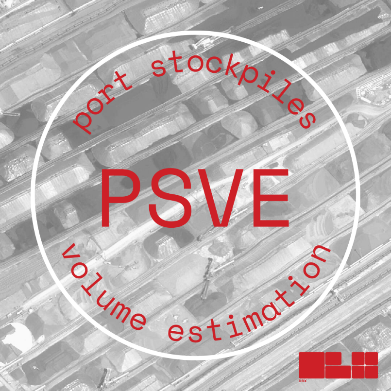
PSVE
Status date: 22 June 2023
PSVE (Port Stockpile Volume Estimation) is a product DBX is developing within the ESA BASS programme; the PSVE module aims to collect and harmonise global, highly fragmented, dry-bulk commodities data in near real-time, by applying state of the art machine learning classification algorithms and establishing a strong correlation between market trends and the localization of dry bulk stockpiles.
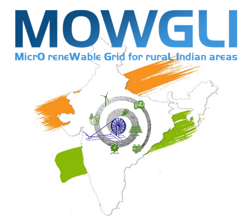
MOWGLI
Status date: 31 May 2023
From planning to monitoring: the exploitation of satellite technologies in urban and rural microgrid life cycle.

FLARE
Status date: 16 May 2023
FLARE is an easy-to-use software analytics platform that provides earth observation data and analyses derived from it in a geospatial context. It offers governmental data and data intelligence that are directly accessible, making it possible to conduct feasibility studies, plan renewable energy opportunities faster, and assess suitability by looking beyond the solar and wind resources. FLARE is valuable for those looking to find and share renewable energy land opportunities with energy developers.
Steadycast
Status date: 14 April 2023
Steadycast is an advanced solar forecasting platform for optimizing solar energy integration into power systems and electricity markets. Based on Physics-AI Hybrid modeling and fusion of heterogeneous geospatial data like Earth Observation (EO), it provides worldwide top quality real time and historical forecast data via API. Tailored web visualization tools are also available to better support decision making from planning to operations.
GeoStorage
Status date: 27 March 2023
Energy sustainability on Earth and on the Moon? Yes! GeoStorage is investigating the use of energy storage in different geologic formations, such as caverns, depleted oil and gas reservoirs, and abandoned mines for strategic and large-scale applications in national energy grids. The project is aiming to secure renewable energy base load and improve their interoperability with other energy sources.
3E Solar Data Services
Status date: 27 March 2023
3E Project Development solution provides accurate and bankable satellite-based solar irradiation data for solar power modelling: 3E Solar Irradiation Data. It is your go-to application to assess the long-term yield of future solar assets, improve the return on investment and evaluate operational plant performance.
DOCS-2
Status date: 15 March 2023
Using civil aircraft to create constellations for providing high spatial & temporal Earth observation data and telecommunication services; a most ecological constellation re-using the most reliable platform.
GIADA
Status date: 15 March 2023
GIADA exploits gravity field observations, mainly derived from GOCE mission, with others in situ data to build a 3D model of the Earth crust at regional scale. The service results help oil & gas and mining companies in the preliminary exploration activities to identify regions with high potential in terms of natural resources exploitation.
Other industries which can take benefit from the service results are mining companies, or more in general companies requiring a good knowledge of the geological setting at regional scale for resource exploitation purposes.
Space Augmented UAM
Status date: 14 February 2023
Space Augmented UAM aims to determine the feasibility of a “Space Augmented” service enabling cities and regions to conduct U-Space integration assessment utilizing economic, technical and environmental simulations for predictive assessment considering the individuality of each city to generate a self-sustainable Urban Air Mobility ecosystem.

Human Switch CCN
Status date: 14 February 2023
Automotive electrification will change the way energy is produced and consumed across the globe due to the resulting increase in local capacity of mobile battery storage.
The Human Switch enables increased update and utilisation of EV technology along with improved load balancing to support increased utilisation of renewables, helping to improve air pollution and CO2 issues.
The transition from fossil fuel to Electric Vehicles (EVs) will have a seismic impact in the utility, automotive and oil and gas markets as petroleum supply and infrastructure is replaced with power supply and storage.
Recent research has modelled the scale of these potential revenues, combining both the need for storage and V2G capabilities, where many EV owners can be aggregated into one, and their energy loads traded on the power exchanges.
Human Switch will offer two services; Human Switch Transition and Live Service:
EV8 Switch – EV8 Switch helps consumers and fleet managers make the right decisions about going electric, simplifying the process by analysing actual driving behaviour and needs. We know that range anxiety, cost savings, carbon footprint and operational compromise are common concerns, EV8 Switch uses real world data to help consumers decide if owning an electric vehicle will suit their needs.
EV8 Live – Ev8 Live will harness the potential for electric vehicles to become a central component in the energy system, helping customers make and save money through vehicle charging.

SEED
Status date: 23 January 2023
Self-learning and AI-powered Atmosphere and Energy Forecasting System using Earth Observation Data, Machine Learning technology, and High-Performance Computing. SEED is tailored to the needs of Indian renewable operators in terms of optimizing solar farm’s operations and maintenance scheduling based on weather and predictive insights generated by the SEED system. It can be adapted to other regions as well.
SatNetMonitor
Status date: 02 January 2023
SatNetMonitor is a vegetation management and infrastructure risk detection service for electricity network companies. Disaster management service module is offered to Distribution Service Operators (DSO).
EPOS
Status date: 22 December 2022
Europe requires clean, independent energy sources now more than ever. EPOS is a software-as-a-service solution that provides energy planning in buildings and cities. It combines state-of-the-art energy modelling with Earth Observation data, enabling engineers and decision makers to ideate, analyse the current situation, and create diverse supply concepts. All necessary data is provided in one place, and AI decision support algorithms are included to make the energy transformation process more efficient.
RESUCI DEMO
Status date: 21 December 2022
RESUCI – DEMO is focused on the implementation of pre-operational services that aim at improving recurrent daily operations of critical infrastructures’ managers, including energy operators and forest managers.
For this, two services have been implemented using Earth Observation (EO) imagery:
-
Service 1: Right of way monitoring for obstacles and activity detection – standing as an alternative to traditional methods of characterizing and monitoring the rights-of-ways of linear networks, this EO based service provides faster updated characterization of the land use, when compared to traditional methods
-
Service 2: Field maintenance operations management and control - this service fills a gap and stands a high value management tool that prevents the need for common monitoring approaches, typically by deployment of field teams. Also, this service is designed to be provided continuously, providing users with up-to-date information on the status of the maintenance tasks
eOdyn SeaWaze Offshore Demo Project
Status date: 16 December 2022
eOdyn SeaWaze Offshore Demo Project sought to develop a service called SeaOps by eOdyn. It is a new decision support tool to boost marine operations efficiency while supporting risk mitigation and cost reduction. This tool has been developed within the SeaWaze Offshore Demo Project. The pledge is to avoid unnecessary ocean currents and sea-state related weather down times, from bidding phase to execution.

SNOWtoWATER
Status date: 16 December 2022
SNOWtoWATER service provides high resolution and accurate snow water equivalent and snow cover data. SNOWtoWATER makes use of innovative A.I. algorithms fed by remote sensing data and quantitative sitespecific analysis, providing results through a digital platform.
DeFROST for Hydro
Status date: 05 December 2022
Extraction of Snow Water Equivalent through satellite data for hydropower energy production and trading optimization.
WatAspace
Status date: 05 December 2022
How much water is flowing in the river? What is the water level in the reservoir?
The answer to these questions is not always easy to find, especially on ungauged rivers and on reservoirs managed by third parties. WatAspace answers these questions by using satellite data, without the need of in-situ sensors
Climate-proofing of buildings
Status date: 21 November 2022
To make existing buildings more environmentally and socially sustainable, we need to know how efficiently they work with energy. Energy auditing is used for this purpose. It determines a building’s energy performance and identifies energy-saving opportunities.
The key component to energy auditing is climate data.
Outdoor temperatures are used to assess the energy performance of heating systems.
Solar radiation is used to assess the energy performance of photovoltaic systems.
The availability and accuracy of these data are crucial.
Using MeteoInsight, there is no need to use data from distant weather stations and waste time manually processing the data.
SWESAT
Status date: 04 November 2022
Remote measurements of snow storage with acceptable accuracy is a long awaited solution by the hydropower industry due to its potential in providing high number of data points and high spatial coverage. We demonstrate a novel approach to derive snow storage (SWE) by use of L-band radar measurements in combination with the interferometry technique.
Profumo
Status date: 04 November 2022
Profumo proposes novel weather-based services for the Mediterranean navigation with the aim of granting fuel saving, pollution reduction and improving safety for passengers, crew, goods and ships’ instruments.
The idea is to establish a cooperative schema (between commercial vessels) where meteo-marine data is collected from standard and non-standard on-board instrumentation.
Acquired data is used in the Profumo service center to produce reliable high resolution meteo-marine forecasts and nearly real time information, allowing the provision of helpful route optimization and navigation services also in a complex and constrained basin as the Mediterranean one.
To satisfy the demand of commercial customers, Profumo has conceived innovative services expressly for the middle short routes.
Dynamic Routing at Mediterranean scale.
The service provides pre-voyage route planning and updated information for optimal re-routing for vessels. This is possible due to the Profumo’s integrated approach involving weather observations, forecasts and optimal route computation through the modeling of ship’s characteristics, for predicting the vessel’s specific response to weather phenomena, in terms of seakeeping and fuel consumption.
Moreover, the system provides frequently refreshed meteo information allowing in-route corrections, therefore optimizing speed and course.
Navigation assistance
By using the navigation assistance service, the crew is fully supported in the route decision and planning. Profumo, integrating real time meteo-marine conditions, increases the safety and the navigation comfort through the application of the most recent guidelines for avoiding dangerous situations in adverse weather and sea conditions.
High definition weather products
Thanks to the cooperative meteo data injected in high resolution, local-scale forecasts, Profumo provides detailed predictions with a native (not rescaled) resolution of few kilometers.
INSURE
Status date: 04 November 2022
INSURE aims to provide an extensive set of services to any company involved in the decommissioning of their oil and gas operation, as well as photovoltaic, wind and green energies offshore and onshore platforms. INSURE service implements a set of functional blocks for the monitoring of the environment, the platform status and support the management of the platforms off-shore during all the phases of activity through an advanced telecommunication system.
Roof Solar Panel Calculator
Status date: 04 November 2022
An easy-to-use service for detecting roofs suitable for solar panel installation. The service provides information about roof measurements, pitch, orientation, and potential solar energy production.
SnowPower
Status date: 21 October 2022
The amount of water stored in snow is a crucial information for hydropower managers, yet hard to retrieve with current methods. SnowPower was able to generate large-scale snow information for mountainous regions at unprecedented accuracy and resolution from active radar satellites, combined with established data and a snow model to complement traditional methods.
MESPAC
Status date: 13 October 2022
MESPAC is a service suite that delivers to the offshore wind industry highly accurate, continuous and certified wind, wave and other metocean information for offshore wind farm sites. Based on Earth Observation Satellites, the quality of the data provided is suitable for bankability and advanced design activities for new marine energy projects.

City DT4DT
Status date: 29 June 2022
City DT4DT is an advanced package of services developed for the urban utilities and municipalities. The package includes a 3D environment, complemented by three space-based monitoring modules, for predictive analyses.
OTAM+
Status date: 16 June 2022
The OTAM (Oil Trading Analytics Monitor) is a comprehensive solution for the oil trading analytics market, created by seamlessly combining Earth Observation data with oil analytics data. This new combination of datasets provides actionable insights on the status of the oil market.
Unmanned maritime data acquisition and intelligence for decommissioning
Status date: 24 March 2022
The project consortium led by Sulmara are developing an unmanned subsea data acquisition and delivery system for decommissioning of offshore energy assets. The service is based on use of an uncrewed surface vehicle (USV), combined with a remote operated towed vehicle (ROTV) to acquire subsea survey data required by offshore energy operators. The main services offered are pipeline, area, and asset integrity surveys, including environmental surveys.
Decom
Status date: 16 March 2022
BMT and 4EI investigated the feasibility of developing a unique service to support the decommissioning of energy assets using commercially available space-based data. The study focussed on how Earth Observation (EO) data might be used to improve the existing Environmental Impact Assessment processes.
EO4Belmap
Status date: 14 March 2022
Enhancing Belmap, GIMs’ geo digital twin of the built-up environment, through Artificial Intelligence techniques applied on earth observation data. Resulting in four new Belmap data modules: Greenfields, Building Age, Roofs and Gardens.
KSAT DECOM
Status date: 28 February 2022
KSAT DECOM aims to help operators and regulators to monitor offshore decommissioning activities by combining oil spill detection, vessel monitoring, multi-mission SAR and EO data, weather condition and greenhouse emissions to reduce costs, increase efficiency of operations, develop safer methods for execution and reduce environmental impacts during decommissioning.
atPACE
Status date: 14 February 2022
A project-centric, situational awareness portal aiding construction and decommissioning of offshore installations. Rich insights are engineered from Earth Observations, AIS, weather, sea state and various GIS data repositories and combined with in-situ surveys and sensor data. All information is dynamically shared amongst project stakeholders creating common understanding, transparency, and improved efficiency.
MOOD Decom
Status date: 14 February 2022
Feasibility study of digital services supporting decommissioning activities at sea through the provision of Earth Observation (EO)-enriched modelled MetOcean parameters relevant for operation planning and environmental impact monitoring.
VIDA
Status date: 20 January 2022
VIDA is an earth observation and AI-powered custom software that enables data-driven investment, business and policy decisions in rural villages in Africa and Asia. → www.villagedata.io
Gridfinder
Status date: 22 October 2021
Gridfinder is a mapping service using machine learning to analyse satellite imagery to provide development funders, national governments, and private foundations with bespoke information on potential project off-grid energy locations, training on how to integrate this information in their planning systems, and the offer of a subscription service to benefit from this information on an ongoing basis.
SNAPPED
Status date: 25 August 2021
This project is a technical, economic and commercial feasibility assessment into an adaptive Load Reduction Device (LRD) for Floating Offshore Wind (FLOW) mooring systems that can significantly reduce Levelized Cost of Energy (LCOE).
Foresense SEIA
Status date: 21 July 2021
SEIA is a solution supporting distribution network operators to perform faster, safer, more accurate and ecologically friendly asset monitoring and assessments. Our algorithm leverages state-of-the-art technological advances in machine learning to automate the monotonous and repetitive aspects of condition estimation of energy transmission network towers. This allows cost-effective funding decisions based on automated analysis of assets’ condition in aerial photography.
AVISAR
Status date: 11 June 2021
AVISAR is a pre-operational demonstration project enabling primarily Mexican and other Energy stakeholders to understand and adopt Earth Observation to solve their oil & gas challenges onshore and offshore.
SmartGrids
Status date: 13 April 2021
The SmartGrids feasibility study delivers the benefits of space based assets to energy network stakeholders. Technologies such as cloud computation and deep learning are coupled with multispectral satellite imagery, SAR, GNSS, and satellite communications to develop strongly scaling, novel, bespoke cost efficient services capable of supporting and enhancing existing operations.
SAFES
Status date: 13 April 2021
The SAFES feasibility study has the objective to identify and define applications that use highly innovative Satellite Communication technologies to support essential services in the Energy & Utilities and Media & Entertainment sectors
AlertSat
Status date: 13 April 2021
AlertSat is an earth observation change detection satellite constellation developed by the PandionAI corporation. The concept with on-orbit and autonomous image change detection, together with the instant delivery of information, gives end-users a tool to act efficiently in critical situations. AlertSat is designed with today’s challenges of rapid global changes in all areas, environment as well as business, in mind.
AgeSpot
Status date: 07 April 2021
AGESPOT is a completely new technological development based on satellite earth observation data offering services that allow access to precise data on WHERE and HOW MANY people, under consideration of their ages and socio-economic attributes, currently live and will likely live in the FUTURE.
3DE
Status date: 29 March 2021
3DE is a Platform-as-a-Service (PaaS) solution targeted at the energy sector that facilitates the management of geospatial data for Right of Way Management and Asset Inspection. Using remote sensing technologies (satellite, aircraft, and drones) combined with machine learning techniques, 3DE improves predictive maintenance work practices, increases the safety of operational personnel, and reduces Operations and Maintenance (O&M) costs.
ASTROCAST
Status date: 25 March 2021
Astrocast is developing an advanced Nanosatellite network for the Internet of things (IoT).
DeFROST for Hydropower
Status date: 01 March 2021
Based on satellite data, DeFROST delivers the ultimate snow monitoring solution for Energy (hydropower) industry. With DeFROST, such actors can improve current water inflow seasonal forecast by ingesting snow data, as well as, diagnosing early snow melt events for hydropower energy generation optimization
VisionV
Status date: 09 February 2021
VisionV integrates a combination of data provided by the end-user (spatial and non-spatial) and data derived from space-borne assets (VHR optical, elevation, structural health) to create new AR/VR visualisation capabilities in the context of:
- Situational awareness for Critical National Infrastructure (CNI) asset management
- Search & Rescue
SatADAPT
Status date: 09 February 2021
The SatADAPT solution consists of wireless vibration sensors which transmit vibration data from the equipment being monitored to a Gateway that runs a local Artificial Intelligence engine (edge AI). The Edge AI is in turn synchronized with a centralized AI engine which is part of a cloud based Central Management System or CMS. The edge AI engine analyses the data looking for anomalies in the frequency spectrum and warns of potential failures, along with a classification of the expected defects and estimated time left to occurrence.
Making green buildings greener
Status date: 29 January 2021
Air quality impacts our health and our quality of life. Most of us spend 90% of their time indoors - but do we know if the air quality in our homes is good?
In this project, Airmine outlines smart home solutions to improve air quality in homes. We develop hyper-local outdoor air quality nowcasts and forecasts using data from our outdoor air quality sensors. By integrating local air quality data with smart home systems, the user can take predictive measures that can improve indoor home health.
GEWS
Status date: 26 January 2021
Greenhouse owners are in a very competitive market, in which unexpected costs due to damage and decay of the greenhouse assets can cause severe problems. This demonstration project aims at demonstrating how a notification service using space data can help greenhouse owners to prevent or mitigate non-insurable risks threatening their business, and thereby save costs.
ENTEL
Status date: 26 January 2021
The ENTEL project enables the development of an innovative service to improve the effectiveness of large infrastructure (electricity and gas pipeline) operators' activities within network life-cycle.
Space for Sanitation - Woodco
Status date: 18 December 2020
This Feasibility Study explores business opportunities for the utilisation of satellite earth observation data, satellite communication and terrestrial communications to link toilets and sewage treatment facilities to wider sensor networks, to significantly augment sanitation management and the monitoring of public health.
MonICATO
Status date: 18 December 2020
MoniCATO proposes a backward compatible solution to secure the use of satellite-derived time in devices used by power grids (like Phasor Measurement Units and Intelligent Electronic Devices), combining authenticated Galileo signals, digital identity and Distributed Public Key Infrastructure (DPKI). Overall, the project proposes a new concept for the secure transmission of timing data among the nodes of the network and offers enhanced services for the monitoring of intentional interfering and cyber-attacks against GNSS signals and network devices.

OAPM
Status date: 14 December 2020
Developed by CGG’s Satellite Mapping business unit, with support from ESA, OAPM provides regular, cost effective, satellite-derived information over offshore assets to establish a baseline, and a programme of routine pollution monitoring. The emphasis of the OAPM service is regular delivery of high-quality slick interpretation to enhance situational awareness.
PV Forecast Service
Status date: 09 November 2020
The global deployment of solar PV electricity generation is hampered by the unpredictability of the power generated. Better PV forecasts would allow electricity system operators to schedule alternative electricity generation earlier, hence reducing system costs and carbon intensity. Addressing climate change as effectively as possible is at the core of Open Climate Fix’s mission.
GridEyeS
Status date: 19 October 2020
GridEyeS AI service contextualizes satellite, weather, drone and other operational data at scale, enabling fast and frequent monitoring of power lines at a fraction of the cost.
Human Switch
Status date: 10 September 2020
Automotive electrification will change the way energy is produced and consumed across
the globe due to the resulting increase in local capacity of mobile battery storage.
The Human Switch enablesincreased update and utilisation of EV technologyalong with improved load balancing to support increased utilisation of renewables, helping to improve air pollution and CO2 issues.
The transition from fossil fuel to Electric Vehicles (EVs) will have a seismic impact in the utility, automotive and oil and gas markets as petroleum supply and infrastructure is replaced with power supply and storage.
Recent research has modelled the scale of these potentialrevenues, combining both the need for storage and V2G capabilities, where many EV owners can be aggregated into one, and their energy loads traded on the power exchanges.
Human Switch will offer twoservices; Human Switch Transitionand Live Service:
Human Switch Transition Service (Switch)–Switch helps consumers and fleet managers to make the right decisions about going electric, based on their actual driving behaviour and needs. We know that range anxiety, cost savings, carbon footprint and operational compromise are common concerns, Switch uses real world data to take the guessing out of transitioning.
Human Switch Live Service - The service allows EV owners to participate in lucrative V2G market mechanisms whilst preserving the minimum level of transport utility from their vehicle. Live helps customers make and save money through vehicle charging, by embedding EV's into the energy system.

ADVISER
Status date: 24 August 2020
ADVISER (AugmenteD VIrtual reality SErvice for Renewable energy) aims to empower Decision Support satellite and UAVs based i-EM SAT services combined with mixed reality capabilities to provide support for the Planning & Construction and the Operation & Maintenance of renewable energy power plants: VR-AR technologies, coupled with the utilization of space assets, could empower O&M activities, in terms of cost savings, effectiveness of the interventions and safety.
SEED
Status date: 24 August 2020
An advanced AI enabled satellite-based data powered software solution for renewable energy production forecasting including solar and wind energy
SENECA
Status date: 24 August 2020
SENECA (Space Enabling blockchaiN for Emobility appliCAtions) aims to provide blockchain-enabled services to manage the energy flow between e-vehicles and the grid using space-assets. The goal of the services derived from this kick-start, is to allow in the future users to perform energy-transactions in a secure and agile blockchain environment, where smart contracts will enable the utilization of e-vehicles battery in relationship with renewable energy availability, facilitate e-vehicles fleet management needs, and finally support the electrical grid necessities.
SatNetMonitor
Status date: 13 July 2020
Electricity is the lifeblood of modern society and security of electricity supply is extremely important. Energy transmission and distribution networks are vulnerable. Information collected by satellites can be used to make the maintenance of the networks more efficient, to reduce risks due to the changing environment, and to mitigate the risk of interruptions.
ATMM
Status date: 30 April 2020
The driving force of SBI is to invent and develop innovative solutions. As a new service, the Automated Transportation Mining Monitoring is designed to provide transparency on global coal flows. It monitors volumetric changes of coal stock piles at harbor sites, activities of vessels and harbor infrastructure. The services will be available via different channels according to the customers’ needs.
ERMS
Status date: 30 April 2020
KVS Technologies automates drones, enabling them to deliver emergency response services for power grid operators in case of power outages or problems on the grid. To further strengthen this offering, KVS Technologies explored the use of satellite communication and Earth observation, to allow it to operate even in emergency situations where the cellular network is down.
Shrub Mapping
Status date: 07 April 2020
The Shrub Mapping service is intended to detect shrub management needs in young boreal forest areas. Based on Terramonitor’s Earth observation and multi-source data, the cloud service maps large forest areas, analyses and monitors the shrub situation in conifer forests and generates insights about the need for forest management duties anywhere in the world.
ERP
Status date: 23 March 2020
The ERP kick starts aims at delivering solution blueprints for forecasting
- the utilization of public fast-charging sites for Electric Vehicles (EV) and cover methods for the provision of EV navigation to the next suitable charging site
- on suitable geographical areas for new fast-charging infrastructure
- on EV public fast-charging energy demand (incl. peaks/lows)
RESUCI
Status date: 04 March 2020
RESUCI is an undergoing project developed to prove the technical and commercial viability of using spate assets and technology in support of resilient and sustainable right of way corridors for powerlines and pipelines, while simultaneous contributing to mitigate the infrastructure related negative impacts to the surrounding environment.
SP4GO
Status date: 14 February 2020
SP4GO feasibility study addresses the needs of Distribution System Operators (DSO) and Transmission System Operators (TSO) using innovative solutions.
Demand/Response and e-Mobility needs will be addressed in the context of Smart-grid area, while for the infrastructure operation and maintenance (O&M) the services considered are vegetation monitoring, electric consumption estimation, impact of weather events such as lightning on energy infrastructure, and satellite backup platforms for data exchange and communication.
Fully Automating Data Pipeline
Status date: 11 February 2020
In 2010, the United Nations explicitly designated that "safe, clean, accessible and affordable drinking water” is not only a necessity, but also a fundamental human right. However, we live in an imperfect world, in which man-made activities and natural disasters create conditions that limit our access to water and expose us to dangerous water events. Organisations around the world have recognised this challenge and shown their commitment to creating, as the World Bank terms it, “a water-secure world for all.”
IMGeospatial is honoured to be part of this movement and has partnered with three clients to address the biggest water-related threats to our livelihood: flooding, water scarcity and water quality. We provide business intelligence that enables them to proactively manage their water systems, build resilience in their communities and ultimately minimise risk and impact. We do so by automating the data pipeline, reducing the time and cost of turning earth-observed data into actionable insights.
Poworganic
Status date: 28 January 2020
Poworganic is developing a circular micro-credit model powered by satellite imagery, tackling the energy, sanitation and health crisis in developing countries and further.
CRESS
Status date: 28 January 2020
Bennamann’s end-to-end fugitive biomethane capture, processing, storage and distribution service gives customers the ability to generate revenue from waste, while facilitating local supply of a zero-carbon energy.
Services enabled by HAPS
Status date: 22 January 2020
HAPS platforms are evolving in the stratosphere to conduct earth observation. They provide large-scale images as a support to decision-making processes in domains like meteorology, security, safety, natural resource inventories, climate change or prevention and monitoring of natural disasters. They provide high versatility, near real-time information and high revisit frequency on their targets
River Nexus
Status date: 16 January 2020
River Nexus is a life changer for millions of people in the river basins in developing countries. River Nexus offers climate-services based on space-technology applications and the productive use of clean renewable energy to improve the local economy. Through a single infrastructure, we cover local essential needs for sustainable development, while targeting also national and international hydro meteorological value chains.
S4CI – Support for Critical Infrastructure
Status date: 13 January 2020
A monitoring service that provides Critical National Infrastructure (CNI) asset owners and operators with resilience against problems associated with structural health through the use of Earth Observation data and in-situ devices.
ALEEGO
Status date: 13 January 2020
ALEEGO online platform is for demanding companies caring for data safety and integrity wishing to inspect their assets using UAV technology, in a simple way.
AIMEE
Status date: 16 December 2019
In 2010, the United Nations explicitly designated that "safe, clean, accessible and affordable drinking water” is not only a necessity, but also a fundamental human right. However, we live in an imperfect world, in which man-made activities and natural disasters create conditions that limit our access to water and expose us to dangerous water events. Organisations around the world have recognised this challenge and shown their commitment to creating, as the World Bank terms it, “a water-secure world for all.”
IMGeospatial is honoured to be part of this movement and has partnered with three clients to address the biggest water-related threats to our livelihood: flooding, water scarcity and water quality. We provide business intelligence that enables them to proactively manage their water systems, build resilience in their communities and ultimately minimise risk and impact. We do so by automating the data pipeline, reducing the time and cost of turning earth-observed data into actionable insights.
ThermCERT
Status date: 12 December 2019
Fuel poverty is an increasingly large social problem in the Great Britain, as well as in the rest of Europe. Ageing, inefficient building stock and rising fuel prices are pushing more and more households into fuel poverty.
ThermCERT reduces the complexity, cost and time spent identifying households who may qualify for Energy Company Obligation (ECO) support, allowing energy suppliers to deliver their obligation more efficiently.
ThermCERT Feasibility Study
Status date: 11 December 2019
The European Commission established a long-term objective of decreasing the CO2-emission levels for the building sector by 27% by 2030.
Every third building in Europe is in need of deep renovation (older that sixty years). People in these houses are overpaying for the heating many times. That is both economically and environmentally harmful. Buildings account for 40% of the EU's energy consumption, 36% of its CO2 emissions. Current annual building renovation rate in Europe is below 2%.
The actual thermal performance of building stock is the critical element for situation awareness, impacting progress on energy efficiency measure uptake.
Utilising Earth observation, satellite navigation and ground level data, ThermCERT represents a crucial aid in helping to understand the true thermal performance of the city built environment, highlighting the energy efficiency problematic areas and issues.
Village Data Analytics
Status date: 02 December 2019
Village Data Analytics (VIDA) is a software-enabled service that automatically identifies remote villages and determines their suitability for a micro-grid installation using earth observation data and machine learning algorithms.
VIDA can be scaled across large user-defined areas to find a portfolio of viable micro-grid sites. This data-driven knowledge de-risks projects, reduces time and planning costs and enables investment at scale.
IoT4Verticality
Status date: 18 November 2019
IoT4verticality is a decision support solution to improve the current inspection procedures and enable condition-based maintenance of critical infrastructures; it monitors the verticality of structures, which is particularly important in tall structures such as flanged poles and guyed poles/towers.
SnowSense DP
Status date: 23 September 2019
Provision of Snow, Run-off and Hydropower Information for Remote Areas: We are using In-Situ Snow Monitoring, Earth Observation and Model Techniques as innovative solution for the assessment of snow cover, the amount of water stored in it, it’s potential for energy production and the related risk of flood events.
GridWatch
Status date: 09 September 2019
GridWatch offers owners of high voltage power infrastructures a continuous monitoring and alarming system to support the inspection, maintenance and management procedures of power lines, and a management system providing the measurements of the parameters necessary to dynamically operate the power lines, i.e. ambient temperature, wind speed and direction, solar irradiance and conductor temperature.
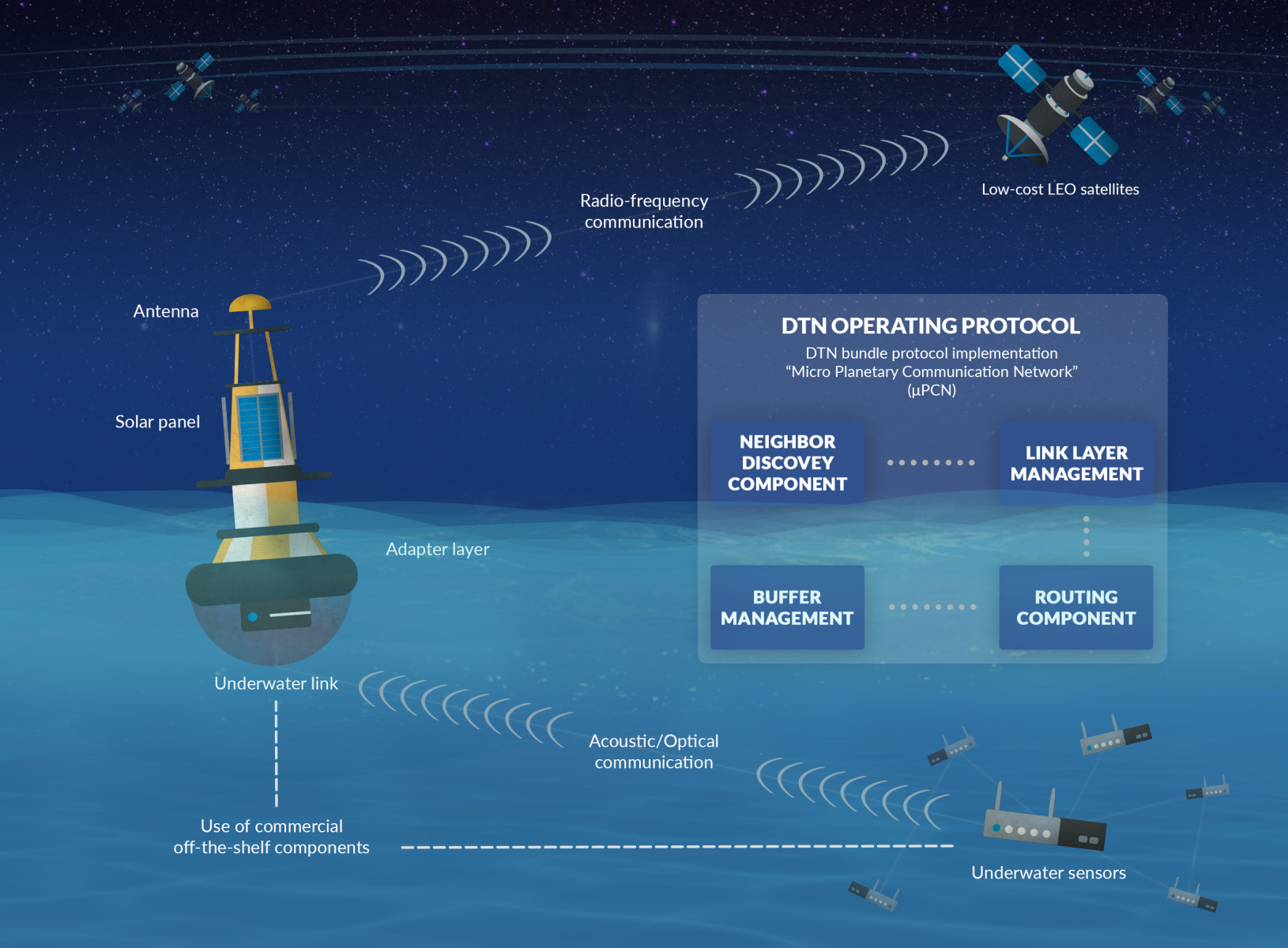
COLDSUN
Status date: 21 August 2019
The project has explored a communication service that allows to transmit data between underwater networks and the internet via satellite networks. The overall system renders possible low-cost data transfer using a data relay buoy equipped with interfaces for underwater as well as satellite communication. This offers a cheap and flexible communication solution for companies operating in a maritime environment.
MOWGLI Feasibility Study
Status date: 09 August 2019
MOWGLI is a solution that provides a set of services for optimal microgrid planning, designing and operational and maintenance (O&M) applications in urban and rural areas of developing countries, with particular focus on India user case. The activities have been implemented in cooperation with the India Energy Storage Alliance (IESA) and funded by European Space Agency (ESA) within ARTES IAP programme.

eOdyn surface currents
Status date: 01 July 2019
eOdyn’s surface currents service enables saving costs and mitigate risks on offshore Oil & Gas marine operations. Simultaneously providing unique information onboard vessels and to onshore support teams, this satellite-based service supports decision making.

CSP-FoSyS
Status date: 14 June 2019
Concentrating solar thermal power plants with an electricity production of up to 250 MW have to be integrated into the electricity grid. Both day-ahead and intra-day forecasting of the production and therefore direct solar irradiance forecasting is needed.
During the demonstration project, a forecasting system based on the use of satellite data, cloud cameras, numerical weather prediction models and plant model was developed. The system was installed, tested and demonstrated in La Africana CSP power plant in Spain.
OTAM
Status date: 15 May 2019
The OTAM (Oil Trading Analytics Monitor) is a comprehensive solution for the oil trading analytics market, created by seamlessly combining data from the maritime (AIS+) and remote sensing (optical and SAR) sectors with oil analytics data. This new combination of datasets provides actionable insights on the status of the oil market.
VtDaws
Status date: 07 May 2019
VtDaws is a service developed on a SaaS model. VtDaws includes in its features the access to EO data (especially Sentinel and Copernicus Services data), a change/anomalies detection engine based on machine learning techniques, a warning service transforming data into information to the users and community sourcing features to add in-situ data and share information on smartphones or tablets.

ARCT.esa
Status date: 12 April 2019
The ARCTTM stakeholder mapping tool offers visualization of “Project Health” in the cross-roads between society, environment, business and policy. The unique de-risking tool combines climate change risks with other factors and makes them relevant, simple and visual for owner and decision makers of any infrastructure project.
ARCT has also found a fun and engaging way to score and report on the UN Sustainability Goal Climate Action goal #13. www.arct.tools.
ISSWIND Demo
Status date: 13 March 2019
ISSWIND provides value-adding services to wind power industry in the areas of planning and operations, with financial and organizational benefits, to a wide range of wind power stakeholders. More accurate wind resource assessments and power production estimations are just two of the range of services available that shall benefit the client’s business.

POINTSAT
Status date: 01 February 2019
POINTSAT enables professional remote collaboration services of support, instruction and training in challenging conditions for the maritime, offshore, and energy industry sectors. The project integrates satellite infrastructure and augmented reality technology into a smart and reliable solution for all technical collaboration needs.

ARCtic Sea-ice and CleAN monitoring
Status date: 17 January 2019
The project brings solution for a systematic and automatic detection of sea ice (including the identification of ice and marginal ice zone) and oil slicks in the Arctic from Sentinel-1 images. Based on Machine Learning (Support Vector Machines), it permits to process automatically thousands of images with high accuracy.

Space4Microgrids – India
Status date: 03 January 2019
Space4Microgrids – India
The Space4Microgrids – India project focuses on supporting the implementation and operations of microgrids in India. The overall aim is to determine the feasibility of viable and sustainable operational satellite based services that can subsequently be developed and demonstrated. These services will aim at resolving various challenges related to deployment of sustainable microgrids for remote, isolated and emerging areas in India. Our services will assist in planning, design, operational and maintenance stages.
WONDER
Status date: 21 December 2018
The targeted solution is an automated, cloud-based digital service for water quality monitoring which could be utilized globally. The solution builds on earth observation, global positioning, crowd sourcing, internet of things (IoT) and predictive analysis.

ESA-IoT
Status date: 19 December 2018
The study intends to understand the future of a satellite-based IoT solution and the market for related products in multiple industries that require monitoring and in particular the monitoring of assets in remote areas. Through the study we engaged with major industrial companies providing them with a small demo of the proposed IoT product to validate business opportunities.

TELEKAIROS®
Status date: 29 October 2018
TELEKAIROS® Fintech is a tool for financial and (re)insurance contracts that derive value from an underlying asset such a traditional stock, a bond or stock index. TELEKAIROS is capable to manage different kinds of risks, for example by increasing the efficiency of the underlying market because they lower unforeseen costs of purchasing an asset outright.
WaterInfo
Status date: 12 July 2018
Providing continuous updates on hydro reservoir filling levels by means of Earth Observation data & machine learning to improve power price forecasting, production planning and market analysis and energy trading.
HelloBin
Status date: 11 July 2018
HelloBin services optimizes routing for waste collection for waste collectors and contributes to the ability to manage the waste stream more efficiently.

AgeSpot Feasibility Study
Status date: 18 May 2018
AgeSpot provides THE starting point for any innovative technological solution addressing ageing populations. It enables efficient targeting of the silver economy and offers precise demographic data on WHERE and HOW MANY age specific classes currently live and will likely live in the FUTURE. With AgeSpot a new Earth Observation (EO) supported business intelligence service is offered.
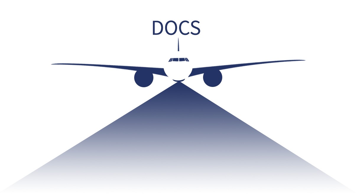
DOCS
Status date: 20 March 2018
Re-using civil aircraft to create constellations for providing high spatial & temporal Earth observation data and telecommunication services; a most ecological constellation re-using the most reliable platform.
SatCorpAfrica
Status date: 15 March 2018
SatCorpAfrica (SATellite CORPorate services in AFRICA) is a Satcom Applications project by SatADSL (BE) aimed at developing, integrating and validating a satellite IP connectivity system and associated services allowing SatADSL to offer via local African Telecom Operators a solution targeting the WAN (Wide-Area-Network) market segment with a set of attractive and flexible offers.
SatBAMS
Status date: 21 February 2018
The Battery Array Management System automates the storage and distribution of power. Unlike existing battery arrays, the BAMS will maintain better Security of Supply, ensure that the reserve does not loose capacity over time and extends operation of batteries by 50%-100%.

SPOTTITT
Status date: 19 December 2017
Spottitt is the new brand name for the SEWISS service delivered by the project consortium. Spottitt has been conceived to support onshore wind developers, turbine manufacturers and energy providers with the complex, expensive and time consuming process of screening and selecting the most suitable greenfield sites for development, without the need for initial travel to sites of interest.
SatApps
Status date: 19 September 2017
Internet of Things/IoT – M2M – industry 4.0 – these headlines are representing large user groups which have an urgent need of a globally available, low-cost, secure data service, dedicated to very small data volumes per sensor and for use also in remote areas. The objective of the study is to perform an in depth requirements analysis on 2 focus pilot user groups: railway transportation and container/waste management.
SUMO
Status date: 05 September 2017
SUMO is a service to assist in the planning and monitoring of marine operations for offshore wind farms. The service integrates diverse information to allow the monitoring and forecasting of metoceanic conditions and track the locations of vessels and personnel involved.
This improves the management and coordination of the construction, operations and maintenance activities and leads to increased efficiency and safety.

Uam®
Status date: 27 July 2017
e2E intends to offer more affordable data communication services into niche markets currently underserved from existing infrastructure or where traditional satellite delivery is too expensive. The core of the service concept builds on two key technologies that have been developed with small airborne IDP networks in mind that incudes RPAS, HAPS and small satellites.
Com4Offshore
Status date: 27 June 2017
The Com4Offshore services enable communication and information exchange between offshore and onshore supporting logistics processes and construction workflow with the aim to significantly reduce the time and costs of the costly offshore construction projects. It offers:
- Satellite based public service supporting the communication needs of the different user groups in offshore wind farm areas.
- Technically and economically optimal solution to the users irrespective of their location by combining wireless, mobile and satellite network technologies.
- Access communications services, sensor devices & software applications for offshore construction activities
DAMMINGS
Status date: 24 May 2017
The project designed, developed and carried out pre-operations of a service platform providing an automated and continuous monitoring service of dam infrastructure and its surroundings by integrating GNSS and InSAR space capabilities.
M3i
Status date: 12 April 2017
M3i is an end-to-end, one-stop service that reduces the fieldwork required to gather information on critical Landscapes of Interest. Satellite imagery, analysed in conjunction with a minimal set of ground-based data, significantly reduces the time and money required to perform surveys, and thus greatly improves the potential for all forms of land use to be incorporated into sustainable management schemes.
TransparentForests
Status date: 07 December 2016
TransparentForests, a web-based Geographic Information System (GIS) for mapping and data management, is designed to increase the credibility and transparency of the FSC certification process. It supports all stakeholders in engaging with, and improving the certification process. It creates opportunities for operational efficiency across the certification service delivery chain. The TransparentForests concept has applications in forest insurance, finance and biomass energy.
Intelligent sensor and satellite network (ISSN)
Status date: 02 December 2016
The project is a feasibility study in order to establish whether there are sufficient market opportunities, and the technological maturity for developing a flexible and reliable intelligent sensor network where satellites are among the nodes in the network (ISSN). ISSN has a number of potential application areas in connection with Offshore Oil & Gas exploration and production, environmental surveillance in general, safety, search and rescue, transportation etc.
PalmOilVision
Status date: 24 November 2016
PalmOilVision aims at providing the palm oil sector with innovative, reliable and cost efficient services for increasing production sustainability and efficiency, through the integration of Earth observation imagery and Remotely Piloted Aircraft Systems (RPAS).
ISSWIND
Status date: 02 November 2016
This project consists on a study to define Supporting Services for the Wind Power Industry, having in mind the possible use of space technology, assets or products and its added value, gaps and possible improvements.

Profumo FS
Status date: 02 September 2016
Profumo proposes novel weather-based services for the Mediterranean navigation with the aim of granting fuel saving, pollution reduction and improving safety for passengers, crew, goods and ships’ instruments. The idea is to establish a cooperative schema (between commercial vessels) where meteo-marine data is collected from standard and non-standard on-board instrumentation and used to produce innovative high resolution meteo-marine products, and to provide route optimization and navigation services.
PIMSIS
Status date: 01 September 2016
To demonstrate the added value of space assets for the monitoring of the integrity and safety of gas & oil transmission pipelines.
GridWatch FS
Status date: 22 March 2016
The solution intends to provide owners of High Voltage power infrastructures with useful information for supporting the management of both procedures for inspection and maintenance, and dispatching of electrical energy.
Com4Offshore
Status date: 17 February 2016
The objective of the feasibility study is the assessment of the technical feasibility and commercial viability of an integrated communication system, enabling a multimodal usage of communication infrastructure and services for offshore wind park construction. The interactive applications of such innovative system include a simplified, reliable and cost effective exchange of voice, video data and positioning information between the contractual partners of offshore construction activities during a complete wind farm project.

SEWISS
Status date: 14 January 2016
The SEWISS service has been conceived to support onshore wind developers with the complex, expensive and time consuming process of screening and selecting the most suitable greenfield sites for development, without the need for initial travel to sites of interest. The SEWISS system is conceived to be a one-stop online portal, where developers can access recent, relevant, high resolution EO, and non EO data layers, then within the same portal use these layers of data to conduct automated land cover, rooftop recognition, green field, turbine selection and positioning analysis across their areas of interest.
HV-SATPROTEC
Status date: 16 September 2015
Feasibility study on new electricity infrastructure management services using space assets
SharperSat
Status date: 31 August 2015
With the support of ESA, Finnish company Sharper Shape Ltd is developing innovative services for the improvement of maintenance and recovery of high voltage electricity transportation infrastructure using SatEO, GNSS data and Unmanned Aerial Vehicles.
TransparentForests (FS)
Status date: 14 August 2015
Forest products such as paper, wood and composite materials are used in everything from construction to news distribution and energy generation, yet they may represent considerable environmental and social impacts. Today, knowing the origin and life cycle of product constituents is important for both retailers and consumers. Major corporations do not like to be associated with poor forest management: it is bad for business and for customer relations.
Arctic IAP
Status date: 08 July 2015
Telespazio VEGA UK are developing a range of value-added services using layers of geo-information and commercial data that can be customised to the needs of specific operators. The services include primarily satellite derived imagery VMS (24/7 Vessel Monitoring System) from the Telespazio Group, AIS (Automatic Identification System) provided by Canadian consortium member exactEarth Europe Ltd, and low bandwidth high fidelity image transfer system AnsuR, a Norwegian company.
Maritime expertise and access to the market through Marine South East and additional maritime data layers are provided by Stevenson Astrosat and HR Wallingford.
This solution presents a viable Arctic Integrated Situational Awareness Service building upon existing operational or semi-operational services provided by consortium members, and adding additional features believed to be of value to the user community that will help to differentiate and ensure the success of the service.

SURMON
Status date: 18 June 2015
The SURMON Demonstration Project targets airborne Geophysical Survey (GS) and oil Pipeline Monitoring (PM) services based on the use of a Remotely Piloted Aircraft System (RPAS). Equipped with suitable sensors and making use of satellite communication and navigation, operation of the RPA beyond line-of-sight is enabled.
INTOGENER
Status date: 12 June 2015
INTOGENER (INTegration of EO data and GNSS-R signals for ENERgy applications) Demo is a project aiming at demonstrating the operational capabilities of a water flow monitoring and prediction system aimed at hydropower production and water management organizations.
SnowSense
Status date: 08 July 2014
SnowSense aims at the qualitative, spatial and temporal improvement of available snow information (snow covered area, snow parameters). It integrates space and ground-based assets to achieve this target. The project has won the 2013 ESA IAP IntegSpace Award.
WIAP
Status date: 26 May 2014
This study aims to identify and realise the benefits that can be brought to the wind power service industry by integrating new and/or improved space capabilities. The study focusses on the users/stakeholders of the wind industry to understand their needs, with the aim to identify a potential gap in the infrastructure.
UASatCom
Status date: 04 October 2012
The UASatCom project targets airborne geophysical survey and oil and gas pipeline monitoring services based on an Unmanned Aircraft System (UAS). Equipped with suitable sensors and making use of satellite communication and navigation, operation of the UAS beyond line-of-sight is enabled.
Pims
Status date: 11 June 2012
Pipeline integrity management is a key concept in the gas and pipeline industry. This concept involves the definition of a Pipeline Integrity Management System (PIMS), which describes all activities to ensure that the pipeline system is safe and operational 24/7.
CSS-SpaceMon
Status date: 21 March 2012
CCS SpaceMon aims at the integration of spaceborne Earth observation, navigation and communication to support the monitoring of future CO2 storage sites as part of Carbon Capture and Storage (CCS) technology. The monitoring plays an important role and is mandatory during operation but also after abandonment of such sites.
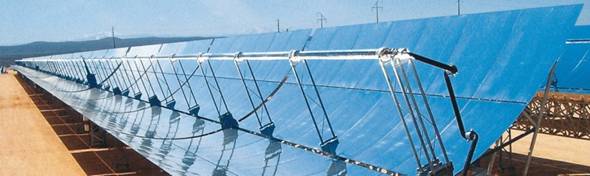
CSP-FoSyS-FS
Status date: 15 June 2011
Concentrating solar thermal power plants with an electricity production of up to 250 MW have to be integrated into the electricity grid. Both day-ahead and intra-day forecasting of the production and therefore direct solar irradiance forecasting is needed. The feasibility study investigates a production forecasting service using numerical weather prediction and satellite-based nowcasting. It will prepare the setup of a demonstration solar production forecast system for the Andasol-3 power plant in Spain.
SPACEGRID
Status date: 10 November 2010
The aim of the study is to promote the integration of state-of-the-art satellite telecommunication and Earth observation technologies with power grid management systems. The activity is carried out by Carlo Gavazzi Space SpA in close collaboration with TERNA SpA , the primary owner of the Italian National High Voltage Electricity Transmission Grid (NTG), with nearly 60 thousand km of lines throughout the national territory.