
Transport is essential to modern civilisation. Yet modern society has realised that the world’s continuing and growing demand for mobility cannot be met by simply expanding today’s means of transport. Indeed, transport systems are major contributors to congestion, death and injuries from accidents, climate change, and resource exhaustion, public health problems due to air pollution and noise and deterioration of ecosystems.
Space-based systems, notably the use of global navigation satellite systems and satellite telecommunications, may increasingly help meeting mobility challenges based on innovative services. The ability to accurately determine and communicate one’s position at any moment thanks to GNSS is starting to have a major impact on the management of ship and lorry fleets, road and rail traffic monitoring, the mobilisation of emergency services, the tracking of goods carried by multimodal transport and air traffic control.

SPACES
Status date: 02 July 2026
SPACES is an ESA co funded demonstration project developing a smart, inclusive approach to accessible parking management. The system combines sensor enabled parking bays, Bluetooth supported permit validation, and satellite informed mapping to support real time monitoring, improve data accuracy, and reduce misuse of accessible parking spaces. Piloting with Dún Laoghaire Rathdown County Council and South Dublin County Council, SPACES is led by Access Earth in partnership with iConnect101, with a focus on equitable mobility, evidence-based planning, and accessibility by design.
NEPTUNE
Status date: 25 June 2026
NEPTUNE addresses critical gaps in maritime security by fusing AIS, radar, and satellite data through a dynamic trust model that continuously evaluates source reliability. When vessel risk exceeds a threshold, the system autonomously tasks drone reconnaissance to reduce uncertainty. The result is smarter, more cost-effective surveillance for port authorities, coast guards, and naval operators.

AuthSurance
Status date: 25 June 2026
The solution addresses critical challenges in combating disinformation in general but current sector-specific solution - AuthSurance - provides robust support for insurance service scenarios, where reliable evidence before, during, and after an event of loss is essential. Built on EU-wide legal and technical standards - including eIDAS, GDPR, AML directives, and GALILEO specifications - it ensures compliance, security, and interoperability across trusted ecosystems.
AIPASS
Status date: 25 June 2026
This ESA-supported feasibility study investigated the commercial and technical viability of an AI-powered SaaS analytics platform for bus, coach and shuttle service operators. The study developed an analytics platform, producing service performance insights to support service improvement and optimisation, with external transport operator engagement confirming alignment with real operational needs. The project was completed in June 2026.
AUTOSEA
Status date: 25 June 2026
AUTOSEA demonstrated a space-enabled autonomous maritime service using the LM450 USV, DockMaster autonomous docking and AutomatePro mission control to support repeatable surveys, hull-inspection workflows and coastal/offshore monitoring with reduced crew exposure and lower operating cost.

ISTRICE
Status date: 19 June 2026
ISTRICE provides secure, AI-powered tracking and certification for high-value Enertech equipment. Integrating Edge AI, Blockchain, and Satellite Communication on a new generation Intelligent Tracking device code named HedgeLog™. The solution monitors machinery during transit and boot-up. It ensures certified delivery and successful commissioning for deep tech assets like Enertech machinery (e.g. turbines and electrolyzers) Robotic workforces (e.g. robotic cells, arms and humanoids) and other high-tech machinery, reducing financial risks and project delays.

GRailMon
Status date: 12 June 2026
The GRailMon project aims to fine-tune and demonstrate an innovative GNSS-based solution for monitoring
the 3D position of sections of railway tracks with millimeter precision.
SAT-IS(F)ACTION
Status date: 12 June 2026
SAT-IS(F)ACTION™ delivers satellite-enabled tracking, predictive maintenance, and trusted insurance data for refrigerated food cargo. Combining GNSS, SatCOM, Edge AI, and blockchain, it improves cold-chain visibility, detects anomalies in real time, and certifies shipment data—reducing waste, costs, and claims while enabling new embedded insurance models.

GreenClaims
Status date: 10 June 2026
This project develops an ESG verification platform integrating Earth Observation data with AI-driven analytics to independently verify corporate environmental claims in land-intensive sectors including mining, oil & gas, agriculture, and renewable energy. By combining satellite imagery analysis with natural language processing of corporate disclosures, the service provides scalable, evidence-based verification to support regulatory compliance and combat greenwashing.

HAISat
Status date: 09 June 2026
Within the HAISat feasibility study, an autonomous underwater inspection system consisting of an autonomous underwater vehicle and a supporting autonomous surface vehicle will be evaluated on actual ship hulls. Additional integrated satellite technology will help improve inspection data quality and operational efficiency of the system.
iQoL
Status date: 05 June 2026
iQoL enables satellite network operators to increase their Service Level Agreement (SLA) capacity while offering a new tier of hybrid SLA’s with Quality of Experience support. Same networks, delivering increased differentiation, with higher margins. For Automotive OEM’s they gain resilient, seamless on the move connectivity that is essential for software defined vehicles and autonomous driving
Orion Fleet Metrics
Status date: 08 May 2026
Orion FleetMetrics is a new module of the Orion GNSS platform designed for precise fuel and energy consumption analysis of fleets with all types of powertrains (combustion, hybrid, and electric).
SETSITS
Status date: 08 May 2026
SETSITS develops Lanternn for Networks (LbV) - Valerann’s Advanced Traffic Management System (ATMS) engineered to resolve critical inefficiencies in road network management using real-time data fusion and analytics. Offering a transformative solution for national and urban road operators, LbV enables hyper-accurate data management to enhance safety, efficiency, and sustainability while leveraging proprietary technology to overcome the limitations of outdated processes.

Terma BCTaaS
Status date: 08 May 2026
ProUST UniverSAS® is a modular, software-defined power supply platform designed to enable high-efficiency, scalable, and flexible battery testing for e-mobility and space-related applications. The system combines advanced power electronics, digital control, and integrated analytics to support a wide range of battery testing scenarios, from laboratory validation to industrial-scale operations.

Bumble Bee
Status date: 07 May 2026
Bling Automated is offering an automated on-demand delivery solution for urgent B2B use cases, where parts or items are needed fast for a job. The company provides faster, safer, and more cost-efficient deliveries, at a time when demand for speed, automation, regulatory readiness, and improving unit economics are aligning.
STREAMO
Status date: 07 May 2026
STREAMO is a commercial downstream application seamlessly merging satellite and stratospheric Earth Observation data. Focusing on urban/mountain environments, the platform provides very-high-resolution, near real-time updated maps and insights like vegetation and thermal gradients. It offers a centralized marketplace for accessing archived products and requesting on-demand stratospheric tasking to bridge the gap between satellites and drones.
ADMONS-TI
Status date: 23 April 2026
The project develops an automated monitoring system for transport infrastructure (road, rail, waterways). It combines UHD Model of TI, vehicle sensor data, and satellite imagery to detect risks, changes, and maintenance needs. Available as on-premises or SaaS, the solution enhances inspections, lowers costs, and extends infrastructure lifespan.

CEROC
Status date: 07 April 2026
Evaluation of operational feasibility and value of supervising multiple autonomous electric ferries from a centralized Remote Operation Centre.

E-Mobility SpaceLink
Status date: 30 March 2026
he project, led by Archimede, entails designing a solar-powered canopy for charging electric vehicles in remote areas lacking access to the power grid. Satellite imagery analysed by Planetek Italia will identify optimal installation sites, while satellite connectivity will enable deployment in emerging electric mobility markets, supported by Arthur D. Little’s sector-specific research.
EODT4Crises
Status date: 12 March 2026
Helyx and the University of Portsmouth (UoP) have developed “Earth Observation Digital Twins (DTs) for Crises” that focus on utility and transport networks. The DTs map the vulnerability of networks to natural hazards and the damage to these systems post-event. By using earth observation imagery, our DTs support the rapid global response of humanitarian teams to crises.
EO-VTI
Status date: 10 March 2026
EO-VTI is developing an Earth Observation–enhanced Vessel Transparency Index in collaboration with an industry partner in order to uncover deceptive and high-risk maritime activity. The project combines satellite data, AIS analytics, and explainable risk scoring to support maritime compliance, insurance, sanctions enforcement, and decarbonisation.
IntMAP
Status date: 02 March 2026
IntMAP delivers satellite-enhanced geo-fencing and AI-based routing intelligence for intermodal logistics hubs. It converts GNSS traces into leg-level journeys across road, rail, barge, and terminals, supporting CO₂ accounting under ISO 14083 and GLEC v3.2. Coverage includes 2 500 + hub geofences across Europe and North America, built on 1 000 + geofences in ports and terminals.

Dark Vision
Status date: 23 February 2026
Using innovative space-based nighttime imagery, Dark Vision will provide an understanding of how artificial light at night (ALAN) impacts our planet ranging from the effects on human health, ecology, the environment, biodiversity and the global economy.

Tunnll
Status date: 18 February 2026
Tunnll provides an innovative, efficient, and user-friendly local transit solution for small towns. Tunnll is a next-generation public bus service that achieves higher efficiency with advanced technologies.

AutoTrust
Status date: 13 February 2026
A cloud-based solution for the transport and logistics industry that provides 5G/4G and Satellite Communication integrated connectivity enabling continuous vehicle telemetry monitoring with data assurance and analytics.

Scope 3
Status date: 12 February 2026
Measuring and controlling GHG scope 3 emissions is crucial for the chemical industry goal of achieving carbon neutrality by 2050. Reliable monitoring mechanisms built from precise, trusted data, allow to calculate their precise product carbon footprints, and conduct truthful life cycle assessments. Scope 3 services fully cover the evolving needs from the industry with a user-friendly monitoring and simulation platform specialized on multi-modal transport emissions.

SATV2X
Status date: 04 February 2026
Today there are many roads, especially in rural areas, where cellular network coverage is inadequate to sustain reliable Intelligent Transport Systems (ITS). The SATV2X pilot aims to address this issue by integrating satellite and 5G terrestrial networks. This integration provides ubiquitous V2X (vehicle-to-everything) radio coverage, enhancing road safety use cases through a C-ITS Platform.
Project Eclipse
Status date: 29 January 2026
Following a successful feasibility study for a multipurpose shared electric fleet solution for NHS Hospitals, Project Eclipse covered the development and pilot of a new and highly innovative transport technology for Newcastle Hospitals NHS Foundation Trust. The project was set out to reduce transport related challenges for employees and patients by providing a sustainable, optimised, fully electric fleet solution that improves access, reduces cost and helps the NHS meet ambitious Net Zero targets.
RESIST 2
Status date: 28 January 2026
RESIST provides worldwide coverage for detecting GNSS Spoofers and Jammers anywhere over the Earth’s surface. The system relies on the CMCU, Central Machine learning Computation Unit and ground and space recorded data. RESIST 2 is the demonstration project, including pilots demonstrations in the maritime port of Marin in Spain and the DLR airfield of Cochstedt in Germany.
DTM Tool
Status date: 26 January 2026
The DTM Tool service is a solution developed to address the challenges of the drone market. The service allows, through modern aviation surveillance technologies and geospatial data processing, to support safer and more efficient drone operations.

HOPE
Status date: 26 January 2026
HOPE is a solution, accelerating drone specific category flight authorization. We use the fusion of Satellite Earth Observation (EO) and Artificial Intelligence to accurately forecast human mobility and population density. This provides UAS operators and authorities with the objective data needed to define the Intrinsic Ground Risk Class (iGRC) under the SORA 2.5 framework, simplifying complex regulatory processes. complex regulatory fffffcompliance and opening up more airspace for safe operations.
DECOM
Status date: 26 January 2026
KSAT DECOM aims to help operators and regulators to monitor offshore decommissioning activities by combining oil spill detection, vessel monitoring, multi-mission SAR and EO data, weather condition and greenhouse emissions to reduce costs, increase efficiency of operations, develop safer methods for execution and reduce environmental impacts during decommissioning activities.

DECOM
Status date: 22 January 2026
KSAT DECOM aims to help operators and regulators to monitor offshore decommissioning activities by combining oil spill detection, vessel monitoring, multi-mission SAR and EO data, weather condition and greenhouse emissions to reduce costs, increase efficiency of operations, develop safer methods for execution and reduce environmental impacts during decommissioning activities.
Darwin CAVs Implementations
Status date: 12 January 2026
Darwin, the UK’s leader in Connected Autonomous Vehicles (CAVs) with 4+ years at Harwell Campus, is revolutionizing port logistics! Launching in Liverpool Port, we’re redefining efficiency and sustainability, with plans to expand to EU, starting with port of Valencia. Join us as we drive the future of autonomous port operations across the UK, EU, and beyond!


REER
Status date: 15 December 2025
During and after disaster events, ensuring that aid reaches those most in need is of paramount importance. When disasters lead to damaged and blocked road infrastructure, the delivery of aid becomes more difficult. This project aims at integrating automatically detected flood extents with routing services so that logistic planning can be undertaken utilising the current state of the road infrastructure.

SpaceInBus
Status date: 04 December 2025
SpaceInBus is a smart mobility platform integrating event ticketing and transport services, optimising routes using demand forecasting. It connects event organisers, transport operators and passengers to provide convenient, sustainable, and cost-efficient travel solutions for festivals, concerts and group trips.

AURAN
Status date: 07 November 2025
AURAN is an AI-powered navigation assistance system for ocean-going ships that integrates onboard sensor data, weather forecasts, and satellite communication to enhance navigational safety, fuel efficiency, and decision-making. The project focuses on developing a semi-autonomous decision-support tool for navigation team to reduce human error and support compliance with international maritime regulations.
STASH+
Status date: 01 November 2025
STASH+ delivered a breakthrough asset tracking solution for healthcare, combining indoor Bluetooth positioning with outdoor cellular and satellite connectivity. Using innovative paper battery technology, the system achieved 9-month battery life in a <5mm form factor. The prototype demonstrated seamless tracking of high-value medical equipment and temperature-sensitive pharmaceuticals across hospital networks and supply chains.

E-Spacement
Status date: 01 November 2025
E-Spacement enables the location optimization of electric vehicle (EV) charging infrastructure using spatial data, including space assets, and artificial intelligence (AI).
TEMIS
Status date: 22 October 2025
Massive end-to-end IoT satellite services, fully operational in GNSS denied environment and very robust to jamming & interferences for highly scalable applications in numerous verticals such as logistics, transport, agriculture/smart farming, maritime, environmental, mining/oil/gas, smart cities, smart building, e-health, utilities, industry…

The Digital Worksite
Status date: 01 August 2025
The Digital Worksite project develops a satellite-enabled solution to improve safety and efficiency for railway maintenance teams by tracking people, vehicles and equipment in real-time during worksites.

RoadCast
Status date: 01 August 2025
RoadCast provides high-resolution, route-based weather nowcasting to support safer and smarter mobility. Our solution delivers real-time forecasts and hazard alerts for rain, wind, hailstorms and road conditions, enabling proactive risk management and reduced losses for autonomous vehicles resulting safer and expanded operations.
Travel Hands
Status date: 30 June 2025
Travel Hands is a service designed to ease the outdoor commute of VIP (Visually Impaired People) by pairing them with sighted & verified volunteers to travel together outdoors ensuring a safe, convenient, and inexpensive travel experience. The VIP pay for the service and Volunteer help in a flexible way and walk more. Volunteers are vetted through Enhanced DBS and trained by us.
Track & Trust
Status date: 27 June 2025
Track & Trust is a cost-effective tracking solution utilizing satellite communication, IoT mesh networks and blockchain technology. The system offers a scalable tracking and communication platform which solves a broad range of supply chain challenges, such as the intricate recording and tracking of goods for last-mile delivery in cases where communications networks are unavailable or unreliable. Track & Trust is predestined for guaranteeing logistics and related services run smoothly despite disruptions to available communications infrastructure.

OCEAN-BULLETIN-GDSC
Status date: 26 June 2025
The Ocean Bulletin Web interface, powered by HIRES-CURRENTS high resolution ocean forecasts, delivers real-time, fine-scale met-ocean data to optimize shipping routes, improve Estimated Time of Arrival (ETA) accuracy, and support emissions reduction in the Green Digital Shipping Corridor.

Samplifly
Status date: 16 June 2025
SAMPLIFLY is a fast, integrated, and sustainable drone-based express transportation service design to carry different types of samples for industrial companies. SAMPLIFLY is able to operate in highly industrialised areas such as large harbours.
SPACE4LIFE
Status date: 29 April 2025
This activity is a study aimed at assessing the feasibility of the development of a service based on satellite assets and cutting edge informatic technologies for a more effective management of level crossing monitoring and maintenance and the increase of road users’ safety at railroad intersections. The conceived service is proposed in response to the need of decreasing level crossing accident occurrence and, thus, making railroad intersection safer. The feasibility of service development is studied from a technical and economical point of view. The best compromise between costs and high performance is foreseen and finally achieved.
AGT
Status date: 22 April 2025
AquaGuard Technologies revolutionizes maritime safety and environmental protection. Our AI-powered geospatial SaaS platform proactively detects abandoned derelict vessels (ADV’s), minimizing environmental pollution & damage, helping to advance a circular economy and enhancing resilience to climate change.
Contact us to learn more.

SATLine
Status date: 09 April 2025
SatLine is an innovative rail track monitoring solution, integrating space technology and a cloud-based platform; it enables precise detection of changes in rail geometry and by providing maintenance alerts, enhances rail safety and operational efficiency across rail networks.

Car-lileo
Status date: 03 April 2025
Car-lileo optimises the processes and digitises the customer communication of car dealerships, detailers, service providers and the mobility sector through novel services based on real-time localisation of cars, keys and assets. Car-lileo is a modern, open, GDPR-compliant, trustful European PaaS/SaaS platform based on GNSS/Galileo, innovative indoor localisation, its own service store and modern cloud architecture.
GHOST-4V
Status date: 31 March 2025
GHOST-4V brings satcom broadband connectivity to humanitarian vehicles, enabling new security and navigation applications.
IN: BIKE Discovery
Status date: 24 March 2025
A collaborative effort to gather data for insights, knowledge, and evaluation based on moving bicycles u nlocking the potential of bicycle data to revolutionise infrastructure and management decisions for active and micro-mobility.
RT5.0
Status date: 18 March 2025
Rural Tourism 5.0 (RT5.0) is a next generation travel planning ‘eco-algorithm’, designed to improve the visitor experience, impact on the environment, and the economic output of rural tourist destinations.
DHI Global Seas
Status date: 05 March 2025
Global Seas (focussing on the shipping industry) allows you to reduce fuel consumption and to improve your vessel performance.
Global Seas Offshore Wind Energy CCN (focussing on the offshore wind industry) allows you to reduce downtime during installation and O&M of offshore wind farms as well as optimizing allocation of expensive operational assets.
Microtractor
Status date: 24 February 2025
Using space to help small farmers down on earth.
Galileo High Accuracy Service (HAS) offers a step change in the performance of non-ground assisted localization and that enables us to build new autonomous vehicles. The Microtractor is a small fully autonomous adaptable electric vehicle designed for small farmers and rural delivery. It operates without human intervention, reduces cost and increases efficiency.
With modular attachments for diverse applications, it revolutionizes sustainable agriculture and last-mile logistics in rural areas.
TRIPS
Status date: 13 February 2025
TRIPS Transport Management Tool will be deployed through a Web-application to offer to municipal police forces, city infrastructure management, info mobility providers and insurance companies an effective instrument for the prevention of road accidents and road safety management.

IONA Hubs Network
Status date: 12 February 2025
IONA tackles costly rural deliveries with autonomous, satellite-guided drones that lower costs 5–20×. ESA-supported Cosmogony TMS integrates with existing van TMS to handle drone-vs-van parcel allocation, and removes regulatory hurdles by providing SORA-compliant BVLOS routing and satellite-enabled landing zone identification for last-mile and reverse logistics.

5G MASS
Status date: 21 January 2025
The 5G-assisted Maritime Autonomous Surface Ship (5G MASS) focuses on the domain of assisted and autonomous shipping in the proximity of seaports. The purpose of the project was to develop a system (5G MASS namely) and implement a set of functional blocks, shared between the ship and the port digital environment where a prototype of Remote Operation Center is deployed. Thanks to the terrestrial 5G millimetre-wave network, the 5G MASS system aggregates real-time information shared between the shipboard and the Remote Operation Center with the aim to assist the pilot and the bridge team in the berthing operations.

SeaNext
Status date: 21 January 2025
Seafar and neXat are crafting a navigational masterpiece, a semi-autonomous shipping service utilizing satellite communications to redefine maritime efficiency. In this project we will be developing algorithms, forging heat maps that illuminate the path to seamless connectivity. As we plot this course, our machine-to-machine interfaces will light the way for ship captains, optimizing satellite usage and reducing costs.

Inteliports PORTAL
Status date: 17 January 2025
Inteliports develops autonomous, heavy lift drones and drone ports for the future of aerial logistics. The PORTAL project is seeking to trial demonstration of multimodal, collaborative logistics involving unmanned, aerial drones and micromobility with advanced robotics, automated infrastructure and SATCOMS enabled technologies. The project is a collaboration between Inteliports and Vodafone.
Satellite Data Freight Calculator (SDFC)
Status date: 16 January 2025
The Satellite Data Freight Calculator (SDFC) project aims to significantly innovate the dry bulk shipping industry by developing an advanced freight pricing tool combining market prices with carbon emissions. This service integrates AIS Satellite data with deep learning algorithms to predict ocean freight prices accurately and in near real-time.

VertiRapid
Status date: 26 December 2024
VertiRapid is a cutting-edge service designed to facilitate safe and efficient flight operations around vertiports (vertical landing/starting areas) for drones and Vertical Take Off and Landing aircraft. Leveraging available geodata and verified with Earth Observation (EO) techniques, VertiRapid swiftly determines operational parameters crucial for safe flight, aligning with ISO/DIS 5491 standards and European Aviation Safety Agency guidelines.
Space4LevelCrossing
Status date: 26 December 2024
Space4LevelCrossing is a feasibility study of technical and commercial viability of innovative solutions based on use of satellite data in combination with the train on-board environment perception system for improving safety of Level Crossings.
Linking Drones Last Mile Delivery
Status date: 26 December 2024
Having already created a groundbreaking drone delivery solution that combines proprietary drone technology with a user-friendly mobile application, Linking Drones are now looking to expand their service offering by allowing offline satellite imagery maps, providing live telemetry from the drone, and enabling the use of third-party drones via our easy-to-use mobile app.

SGAM
Status date: 23 December 2024
SGAM is addressed to owners and managers of large infrastructural networks and is designed for the assessment of geohazards that may impact on geotechnical assets, focusing on the interaction between infrastructures and natural environment. It combines Earth Observation data, ground-based monitoring data, geohazard databases, and AI algorithms to identify critical issues allowing for cost-effective predictive maintenance investments. It features techniques such as A-DInSAR and PhotomonitoringTM for precise monitoring of surface changes, allowing for historical analysis and change detection.
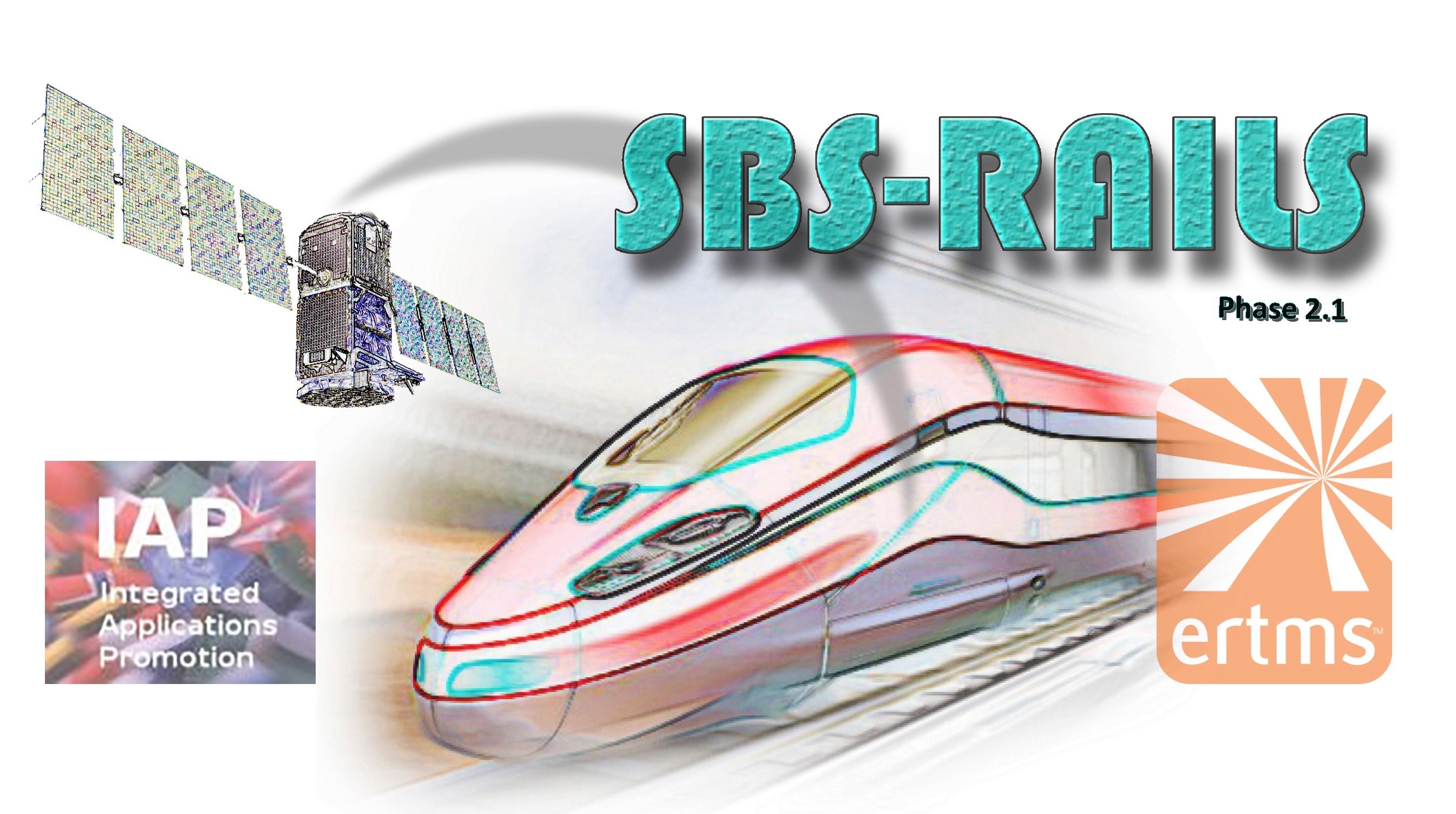
SBS RailS Phase 2.1
Status date: 22 December 2024
SBS RailS Phase 2.1 aims to design, build and test the first European Demonstrator of Train Control System based on the ERTMS L2 standard operating with satellite navigation and on satcom multi-bearer telecom service.
ASBCIMS
Status date: 21 December 2024
SuperVision Infrastructure - critical infrastructure monitoring system that utilizes satellite data and Earth Observation (EO) methods to develop an automated software solution for detecting and assessing damages and risks in close proximity to critical infrastructure. Exploring a fusion of optical and radar data with varying resolutions, the system serves as a rapid-response tool specifically designed for occupied and inaccessible territories.
DragonFly
Status date: 20 December 2024
Today, speed and effectiveness have become essential characteristics of the logistics sector and the transportation of goods more and more requires a continuous monitoring of various parameters (e.g. position, temperature, shocks) during the different steps of the goods journey (i.e. collection, transport, storage, delivery). Indeed, the loss and/or the deterioration of shipped goods have enormous financial impacts for companies, in particular for items with a very high value (e.g. pharmaceuticals products, rare items). DragonFly is a comprehensive solution able to provide an effective continuous real-time monitoring solution which has been designed to monitor globally the end-to-end journey of the most critical goods (such as pharmaceutical products) in a cost-effective way.
LucidEO
Status date: 27 November 2024
Space-enabled Productivity & Wellbeing leveraging satellites, wearables and AI
AVISAR
Status date: 19 November 2024
AVISAR is a demonstration project which aims to provide solutions to support clean and safe operations within the energy sector through carefully selected services, for both onshore and offshore operations. AVISAR is a product suite based on multi-mission, multi-sensor Earth Observation assets to address the challenges faced to reduce costs, increase efficiency and develop safer and cleaner methods of operation.

DITCH
Status date: 28 October 2024
The newly developed DITCH - Digital Twin Catchment service consists of an online accessible digital representation of basins providing static and dynamic variables like topography, land use and cover, hydrological and ecological conditions (water level, discharge, sediment concentrations, algal blooms) of water bodies, and soil characteristics provided through earth observation (EO) including potential dynamics next to past and present situations.
This physical twin is then also combined with socio-economic information to provide relevant decision support tools for resilient basin management of water-related stakeholders.

B2B Bike Navigation
Status date: 04 October 2024
This project develops an end-to-end navigation service which can be fully integrated into business customers’ own 2-wheeled vehicle products/services, including best-in-class routing optimisation (tailored to user needs) and navigation for 2-wheeler use-cases.
This will make it easier, safer and more convenient for people and goods to travel by light, 2 wheeled transport rather than by cars, vans and trucks.

LUNESA
Status date: 16 August 2024
Producing 2D and 3D Digital Elevation Maps (DEMs) based on merging EO data with real-time image capture from thousands of shared e-scooters, e-bikes, e-mopeds etc to develop up-to-date mapping and terrestrial imaging solutions
M3S
Status date: 24 July 2024
The proposed service utilizes Earth Observation (EO) satellites and geospatial technologies to optimize micro-mobility planning and fleet management in urban areas. Its goal is to offer sustainable and efficient solutions for the growing micro-mobility sector, encompassing electric cars, bicycles, and scooters.
OPVIDA
Status date: 23 July 2024
This kick-start activity centred around Luna Systems' computer vision solution which is designed to improve the safety of shared micromobility vehicles. The system employs computer vision to identify patterns in shared vehicle rider behavior, focusing on sidewalk riding, travel speed, and proximity to pedestrians. This data provides valuable insights for shared mobility operators, enabling them to enforce safer riding practices among their ridership. Recognizing the limitations of Global Navigation Satellite Systems (GNSS) in urban environments, the activity centred on exploring the feasibility of AI-based techniques such as Visual Wayfinding and Map Matching to enhance positioning accuracy to ensure robust ride safety assessments.
PARK
Status date: 22 July 2024
PARK uses GNSS Raw measurement for improving positioning accuracy of micro-mobility vehicles for parking purpose and to prevent micro-mobility urban cluttering. Added value of a GNSS accuracy positioning service, through GNSS Raw measurement, is that it can be implemented by avoiding costly infrastructure and with zero-impacts for users.

SAFERIDE
Status date: 04 July 2024
Introducing SafeRide, the cutting-edge safety solution for cyclists. Utilizing advanced smartphone sensors, SafeRide detects accidents in real-time and instantly alerts emergency services, ensuring rapid response. Designed for all cyclists, from casual riders to professionals, SafeRide offers seamless integration and scalable pricing, making safer cycling accessible to everyone. confidence—choose SafeRide.

Friilink Mobile
Status date: 27 June 2024
Friilink mobile offers a comprehensive technological solution for buses and trains that allows operating companies to offer entertainment services to passengers with high-speed internet always available on board, generate new revenue through digital advertising tools optimized with AI, save in expenses through its telematics integration solution, route optimization and vehicle status monitoring, and increase on-board safety.

Remote Planet
Status date: 27 June 2024
Remote Planet from Secure Innovation offers real access without physical presence, allowing you to have control over your critical assets from anywhere in the world. Harnessing the power of satellite technology featuring Wi-Fi, GNSS, GSM and LEO functionality, this convenient solution provides 24/7 monitoring, management, protection and control to safeguard your assets and operations.
DIBAS
Status date: 19 June 2024
DDK Positioning Ltd. (DDK) provide GNSS hardware and Precise Point Positioning (PPP) services that improve GNSS positions from 10m to an accuracy of <5cm. DDK delivers its positioning service exclusively via the Iridium satellite communications constellation using Iridium’s 66 military grade LEO satellites to market sectors globally, from pole-to-pole.
Digital Port Platform
Status date: 07 May 2024
The Digital Port Platform is a Hub of maritime modules to improve port operations and lower their environmental impacts.
This Hub gathers space assets and other sources of data to transform them into key indicators thanks to advanced AI technologies.
It allows real-time situational awareness to solve major environmental and performance issues.
HIRES-CURRENT-PERF
Status date: 06 March 2024
This feasibility study quantifies the performance of short-term optimal routing mode using a new generation of surface currents data obtained by AI fusion of high-resolution satellite observations.

AFNOL
Status date: 14 February 2024
The project aims to improve the data analytics software used by insurance companies to confirm an accident has happened, who is at fault and the probability of injury.
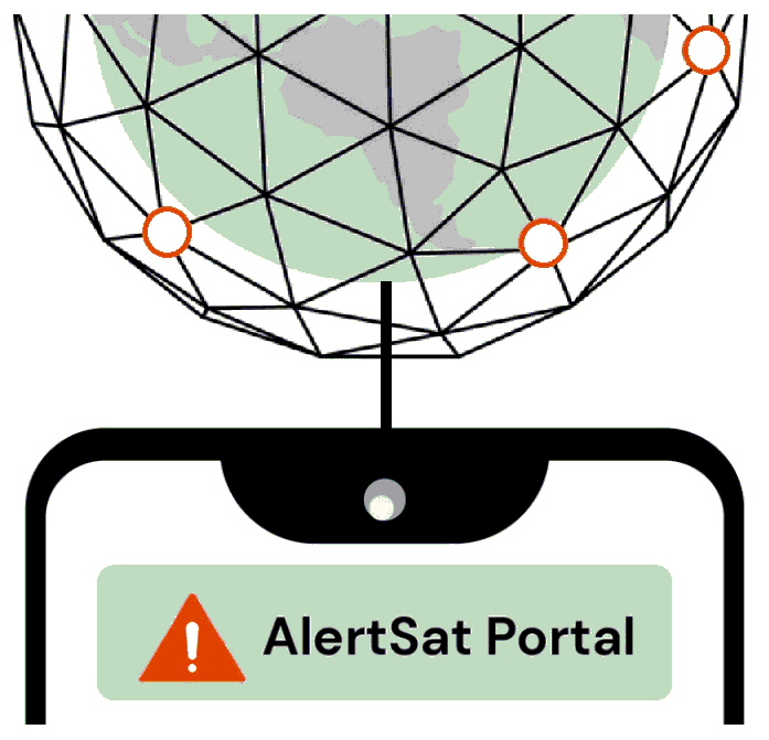
AlertSat Portal
Status date: 26 December 2023
The AlertSat satellite constellation is to deliver Alerts directly to its users, through AlertSat Portal - when critical information has been detected and there is still time to act upon it.
ARcade
Status date: 27 November 2023
Information and entertainment at the right time, in the right place. A platform providing a series of geolocated interconnected virtual spaces, called ‘Arcades’: virtual spaces overlaid on reality, activated by GNSS, where users access images, films, text and sound, using a smartphone/iPad. Turning everyday locations into virtual cinemas, classrooms, music venues, galleries, information hubs or marketing billboards.

SiriusInsight®
Status date: 27 November 2023
90% of world trade goes by sea making it of great importance economically, strategically and environmentally but the maritime domain is vast and remote making persistent surveillance challenging. SiriusInsight® uses cutting edge artificial intelligence to analyse maritime data from multiple remote and autonomous sources in order to create actionable information for users about otherwise unobserved marine activity.
SA4D
Status date: 24 November 2023
The goal of the project “Space Acting for Decarbonisation (SA4D)” is to perform a feasibility study that will demonstrate the technical and economic viability of suitable satellite-based services for suggesting decarbonisation actions targeting agriculture, food production and building construction economic sectors.
GIP4 Smart Airports
Status date: 19 September 2023
Fourteen million flights are expected in 2035 in Europe. To increase airport capacity and efficiency, optimisation at every step must be carried on. GIP4SmartAirports projects aims at minimizing rotation time and smoothing real-time operations. Space technologies can be a valuable asset to support surveillance and safety, and help airport manager to maintain high quality and complete knowledge of their assets.
VASP
Status date: 18 September 2023
In this project, Space Norway, together with the Norwegian Coastal Administration (NCA), the European Maritime Safety Agency (EMSA) and Kongsberg Seatex (KSX), have enabled a platform for Maritime VHF communications services using VDE-SAT, targeting the services the International Maritime Organization (IMO) has defined in the Maritime Service Portfolio (MSP). The following three services were demonstrated:
-
Ice chart distribution
-
SAR coordination
-
Mandatory Reporting System (MRS) information exchange
MTrader
Status date: 16 August 2023
Awake.AI’s marine Marketplace with the power of AI for trading port services and products.

SeaWire DeepSea 5G LEO
Status date: 16 August 2023
Unleashing the power of 5G connectivity at sea, the SeaWire DeepSea 5G LEO solution transforms maritime communication. This innovative solution combines terrestrial and non-terrestrial networks for unmatched speed, seamless transitions, and lower costs. Beyond solving current maritime challenges, it anticipates future needs, promising an improved quality of life at sea, smarter transportation, and a revolution in the maritime industry.

PORT SENTINEL
Status date: 10 August 2023
The main objective of PORT SENTINEL is to estimate the technical and economic feasibility of new relative services to the "Port of the Future" that can take advantage of “space-based” data. The Consortium is proposed to serve the market with instrument for the monitoring of seabed, and in particular harbour, integrating data of satellite navigation and surveys of the state of the seabed.

RESIST
Status date: 25 July 2023
RESIST provides worldwide coverage for detecting GNSS Spoofers and Jammers anywhere over the Earth’s surface. The system relies on the CMCU, Central Machine learning Computation Unit and ground and space recorded data.
MUSE/ ISP
Status date: 05 June 2023
Autonomous driving requires precise and reliable position information. ANavS develops in the project MUSE an Integrated Sensor Platform (ISP) which includes 3 GNSS receivers, an IMU, two cameras, a Lidar and a powerful sensor fusion for precise positioning.
SmartMetRoadMap
Status date: 05 June 2023
SmartMetRoadMap is focused on updating a platform dedicated to the provision of tailored services for the operational management of meteorological risks on roads.
The updated platform is based on an AI-driven fusion of high-resolution NWP output and heterogeneous measurements captured in real-time, possibly also via 5G, and is specifically designed to make the most of satellite weather monitoring data.
Proteus
Status date: 16 May 2023
Proteus builds on the success of the SEDDCR project and introduces a significantly increased operating area by leveraging novel space technology such as Iridium NEXT. Integrating with the NHS Highlands, Skyports is delivering to six medical facilities where drone deliveries facilitated by space technology has the potential to significantly enhance patient care.
RANGLO
Status date: 04 April 2023
Data integration and predictive analytics service for rail freight in the UK. The Ovinto unique, complementary software platform will help and feed the existing software infrastructure for different users and customers, connecting any relevant internal & external data source to make software modules/silos extremely flexible through collaboration, data exchange and integration.
https://business.esa.int/projects and search results.
Telecense
Status date: 31 March 2023
Telecense allows Companies, Authorities, International Organizations and Labs to assess and anticipate population growth and migration in emerging countries.
Diginove has developed earth observation algorithms and demographic models in order to build Telecense, a service that provides geo-localized population estimation where censuses are unavailable or outdated.
oneTcall
Status date: 20 March 2023
No GSM coverage? You are on a plane or ship and you need to receive an important call or to make an important call? No problem: with oneTcall you can continue to use your mobile phone and your telephone number without changing your user experience and without any limitation.
Thanks to Satellite you can have IP coverage everywhere in the World and also in Mobility. With OneTCall + IP via Satellite you can have also your Mobile Phone working and keep using your telephone number.
Easy for the customer. No additional infrastructure required for the Operator.
OneTCall is perfect to provide seamless voice coverage also on board of Airplanes and Ships.
OneTcall is a patented service.
DOCS-2
Status date: 15 March 2023
Using civil aircraft to create constellations for providing high spatial & temporal Earth observation data and telecommunication services; a most ecological constellation re-using the most reliable platform.
TrackSat
Status date: 15 March 2023
Development of a standalone drone tracking service capable of transmitting its position over 4G network during normal flight, addressing drone flight regulations. In case of a crash, the drone will use satellite IoT connectivity to send its latest known position.
CertiPro
Status date: 28 February 2023
In this truly European project, an innovative railway track worker protection system will be evaluated for its reliability and its ability to enhance the safety of railway track workers. The goal is to demonstrate the safety capabilities of the track worker protection system in a real environment, integrated into the challenging infrastructure of a railway operator in Italy.
U-space2
Status date: 14 February 2023
The U-space2 study aims to identify and analyse the technical and economic feasibility of an Advanced and Specialized Traffic Information Service (A/S-TIS) exploiting space services such as SATNAV, SATEO, SATCOM, METEOSAT and ground services (5G) in support of UAM. The expected result is a A/S-TIS preliminary mock-up of the, its service and system architecture design, its development and business plan.
Space Augmented UAM
Status date: 14 February 2023
Space Augmented UAM aims to determine the feasibility of a “Space Augmented” service enabling cities and regions to conduct U-Space integration assessment utilizing economic, technical and environmental simulations for predictive assessment considering the individuality of each city to generate a self-sustainable Urban Air Mobility ecosystem.
PinPoint: The Future of Tracking
Status date: 14 February 2023
The World’s First Intelligent Tracking- & IoT-solution – Through 2-way direct satellite communication. No more manual tracking and logistics - our systems handles automated tracking & logistics, via direct 2-way satellite communication - anywhere on the planet!
eOdyn SeaWaze Offshore Demo Project
Status date: 16 December 2022
eOdyn SeaWaze Offshore Demo Project sought to develop a service called SeaOps by eOdyn. It is a new decision support tool to boost marine operations efficiency while supporting risk mitigation and cost reduction. This tool has been developed within the SeaWaze Offshore Demo Project. The pledge is to avoid unnecessary ocean currents and sea-state related weather down times, from bidding phase to execution.

SODOR
Status date: 28 November 2022
This Satellites for Digitalisation of Railways (SODOR) project will deliver pilot demonstrations of improved network connectivity for train monitoring and passenger broadband. The project aims to demonstrate how new constellations of communication satellites can seamlessly fill gaps in terrestrial coverage and provide additional capacity to improve safety and provide travellers with better connectivity.

HOPE
Status date: 21 November 2022
Human safety is a critical factor that defines the iGRC (intristic Ground Risk Class) of the Unmanned Aircraft Systems operations. The HOPE project aims to integrate various source data, including satellite data (SatEO), to forecast human mobility over time, with the help of artificial intelligence and provide the derived information to operators&authorities.
Profumo
Status date: 04 November 2022
Profumo proposes novel weather-based services for the Mediterranean navigation with the aim of granting fuel saving, pollution reduction and improving safety for passengers, crew, goods and ships’ instruments.
The idea is to establish a cooperative schema (between commercial vessels) where meteo-marine data is collected from standard and non-standard on-board instrumentation.
Acquired data is used in the Profumo service center to produce reliable high resolution meteo-marine forecasts and nearly real time information, allowing the provision of helpful route optimization and navigation services also in a complex and constrained basin as the Mediterranean one.
To satisfy the demand of commercial customers, Profumo has conceived innovative services expressly for the middle short routes.
Dynamic Routing at Mediterranean scale.
The service provides pre-voyage route planning and updated information for optimal re-routing for vessels. This is possible due to the Profumo’s integrated approach involving weather observations, forecasts and optimal route computation through the modeling of ship’s characteristics, for predicting the vessel’s specific response to weather phenomena, in terms of seakeeping and fuel consumption.
Moreover, the system provides frequently refreshed meteo information allowing in-route corrections, therefore optimizing speed and course.
Navigation assistance
By using the navigation assistance service, the crew is fully supported in the route decision and planning. Profumo, integrating real time meteo-marine conditions, increases the safety and the navigation comfort through the application of the most recent guidelines for avoiding dangerous situations in adverse weather and sea conditions.
High definition weather products
Thanks to the cooperative meteo data injected in high resolution, local-scale forecasts, Profumo provides detailed predictions with a native (not rescaled) resolution of few kilometers.

Project Lunar
Status date: 21 October 2022
Phase 1 of Project LUNAR has determined the feasibility of a multi purpose shared electric fleet solution for NHS Hospitals. We wanted to reduce transport related challenges for employees and patients by providing a sustainable, optimised solution that improves access and reduces cost.
DECISIONX
Status date: 27 September 2022
SATAVIA is an AI software and data company simplifying decision-making in aircraft flight operations and maintenance to make aviation smarter and greener.
DECISIONX is a cloud-based analytics platform combining global flight data with atmospheric data to perform environmental exposure assessments for aircraft and buildings. This enables better decision-making in condition monitoring, predictive maintenance and aircraft performance.
LUCI
Status date: 22 September 2022
Project LUCI aims to assess land use around railway infrastructure and detect changes that could be hazardous to the safe running of the railway. The project aims to give trackside managers crucial information to enhance the decision making process and ultimately make the railways a safer place to work and travel.
SAT-IS(F)Action
Status date: 22 September 2022
Existing space technologies (SatNAV, SatCOM, SatEO) can be blended with the most innovative data intelligence and certification technologies (Edge AI, IoT and DLT) to offer next generation Remote Container Monitoring services (Container-as-a-Service, CaaS), hence increasing overall food supply chain safety and reliability, in the pursuit of the highest possible final customer “satisfaction”.

YouShip
Status date: 16 August 2022
YouShip is an on demand delivery platform that connects any business with local couriers or autonomous delivery robots to provide the best delivery experience at the best price. The platform in real-time matches the couriers according to the packages type, delivery windows, and locations. Its AI-powered algorithms find and notify the right courier to the right location at the right schedule time.
DRAMA (AMMO CCN#2)
Status date: 11 August 2022
DRAMA enables airports to address the drone challenge in a systematic, fact-based manner. All decisions concerning the management of drones and procurement of detection solutions are driven by risk assessment and ongoing risk monitoring. DRAMA provides airports with an easily adaptable solution that enables mitigation strategies and drone sensor selection.
Local Hub
Status date: 17 May 2022
The community calendar model will underpin healthier ageing, help address deprivation and inequalities through improved access to transport to activities, improving overall health and wellbeing, mental health and prevention of long-term conditions.
CONTACTLESS
Status date: 28 April 2022
Contactless Car Rental, transforms the car rental experience from being counter-centric to app-centric. It ensures a car rental company can offer a service where the rental customer can get the right car in the right location at the right time, providing much greater convenience while removing the need for user/staff contact.
FLAMES
Status date: 28 April 2022
With the FLAMES project, the consortium of Unisphere, Matternet and Nordic Unmanned demonstrated how simulation technologies can be used to increase the automation of drone flights in an urban and maritime environment.
For the first time, high-resolution weather data, the Copernicus digital elevation model, aircraft performance models and trajectory simulations were combined to create a digital twin of drone flights. This forms the basis for automated flight planning, which is offered as a SaaS service. Moreover, the validated simulation technology is the basis for autonomous flight operations in the future and enables a reliable transfer of pilot knowledge into software. As a result, a broader customer base will be able to use drone technology.
Smart-GAM
Status date: 13 April 2022
Smart GAM aims at offering an innovative and semi-automatic decision-making supporting system for asset management and predictive maintenance purposes to improve the financial resilience of assets, taking advantages of innovative data-fusion algorithms, satellite Earth Observation technologies and their integration with ground-based monitoring/database segment. SGAM focuses on the risks related to structures and infrastructures, analysing their interaction with the local geological and environmental context, by automatically evaluating the direct or potential future interferences with geohazards such as landslides, floods, sinkholes, fires etc. The service aims to support Decision Makers in defining and prioritizing the maintenance operations based on the asset vulnerability and loss scenarios, with a philosophy that may be summarized as “FROM HAZARDS TO MANAGEMENT SOLUTIONS”.
EO4Belmap
Status date: 14 March 2022
Enhancing Belmap, GIMs’ geo digital twin of the built-up environment, through Artificial Intelligence techniques applied on earth observation data. Resulting in four new Belmap data modules: Greenfields, Building Age, Roofs and Gardens.
KSAT DECOM
Status date: 28 February 2022
KSAT DECOM aims to help operators and regulators to monitor offshore decommissioning activities by combining oil spill detection, vessel monitoring, multi-mission SAR and EO data, weather condition and greenhouse emissions to reduce costs, increase efficiency of operations, develop safer methods for execution and reduce environmental impacts during decommissioning.
MOOD Decom
Status date: 14 February 2022
Feasibility study of digital services supporting decommissioning activities at sea through the provision of Earth Observation (EO)-enriched modelled MetOcean parameters relevant for operation planning and environmental impact monitoring.
iVOICE - WOMBATT
Status date: 03 January 2022
IVOICE is a ground breaking technology that can change the way dangerous levels of fatigue are prevented in the mining industry. iVOICE is a non-invasive method to help operators prevent accidents in safety-critical working environments. iVOICE is a key part of fatigue management systems being applied within the mining industry by Wombatt Fatigue Management.
PoF
Status date: 16 December 2021
A consortium consisting of Arthur D. Little, CLS and Marlink are performing a study on how space-based technologies can be leveraged in the modernization of ports. The study includes a full range of Space-based technologies including satellite communications GNSS, SAT-AIS and Earth Observation and how these technologies could be applied in combination with terrestrial assets.
AIDA-SHM
Status date: 14 December 2021
AIDA-SHM (Artificial Intelligence Data Analyser – Structural Health Monitoring) is an IoT artificial intelligence software solution for monitoring and predicting the health of reinforced concrete structures.
AITO
Status date: 14 December 2021
Service for automation of logistics tasks in industrial and urban environments using a fully autonomous driving transport system.
Tandem
Status date: 10 September 2021
Tandem is building the future of mobility for towns and small cities by turning existing local taxis, minibuses and coaches into smart, shared shuttles
Beeline
Status date: 27 July 2021
The Beeline Cycle Routing project involves creating a routing engine and underlying mapping data to mimic human intelligence in route selection for cyclists. Traditional routing engines simply optimize for shortest distance or time. Beeline’s solution is intended to allow for optimization for safety, pleasantness, quietness of route and other parameters important to cyclists.
Xylene EO
Status date: 16 May 2021
Xylene is a SaaS providing European importers of raw materials, a smart supply chain with transparency and control to comply with regulations and consumer demands and protect companies' brand reputation. This innovative approach combines supply chain data gathering and analytics with satellite technology (SatNav and EO) and blockchain to create supply chain transparency.
SAT SHV
Status date: 29 April 2021
The Satellite Navigation supported Shipment Visibility Platform (SAT SHV) for the Global Supply Chain Industry targets a platform to provide shipment visibility to players of International Supply Chains, in particular to larger Importers and Exporters as well as to Logistics Service Providers. Integration of Satellite Data AIS data of vessels as well as aircrafts is a key component of the designed solution. In addition, PLS embraces a holistic approach to cover multiple modes (sea, air, land) and is covering supply chains door to door.
4S Safety of Future Transport
Status date: 13 April 2021
4S Safety of Future Transport is a study undertaken within the frame of the 4S Strategic Programme Line that aims at identifying a list of applications that will use highly innovative and secure Satellite Communication systems to support safety critical services within the transportation industry (Aviation, Maritime and Railway).
HGR
Status date: 30 March 2021
The project designed a hybrid GNSS receiver (HGR). The HGR provides innovative time and position certification services for smart transportation applications. HGR has the ability to detect spoofing and meaconing attacks, therefore validating the authenticity of the location-related data. The HGR combines GALILEO OSNMA service, ADS-B data from aircrafts and Network timing information
ASTROCAST
Status date: 25 March 2021
Astrocast is developing an advanced Nanosatellite network for the Internet of things (IoT).
ChAI Price Predictions
Status date: 23 March 2021
ChAI is using satellite imagery to help the nickel supply chain, a crucial ingredient in the batteries that power electric vehicles, laptops and phones. With mines located in inhospitable or remote locations where traditional sources of information have been hard to come by, buyers and sellers of nickel can now use ChAI to help reduce their risk.
MEMT
Status date: 23 February 2021
MEMT (Mobile Equipment Monitoring & Maintenance Tool) improves decision making for mine managers and foremen on operational efficiency of their mobile heavy machinery fleet. The easy to deploy system allows to gain visibility on various aspects of the working conditions and working environment. The main target is to increase the fleet performance, preserving the good health condition of their machinery.
Foresight Marine
Status date: 23 February 2021
Foresight Marine digitises the process of machinery inspection; our edge sensors generate certifiable & actionable data accessible to anyone, anytime, anywhere – from the ship mechanic to the board room decision makers.
SEDDCR
Status date: 18 February 2021
In the SEDDCR project, space-enabled delivery drones were used to assist the National Health Service (NHS) in rural Scotland in the fight against COVID-19. The delivery drones carried critical COVID-19 pathology tests and related medicine between hospitals and medical practices, ensuring that the NHS had access to a fast, frequent and reliable medical logistics system.
DARTT
Status date: 15 February 2021
DARTT (DemAnd-Responsive rural Transport for Tourism) is a demand-responsive transport solution to improve the viability of public transport in rural areas, focussing on a tourism target audience. It combines a new experience for discovering tourism destinations, with booking bus tickets in rural areas.
ACABAS
Status date: 04 February 2021
Using civil aircraft as a platform to collect AIS data, complementing existing terrestrial and satellite solutions, enhancing AIS data availability.
Collie AI
Status date: 02 February 2021
Route optimization software is abundantly present in logistics. However, none of the available solutions has a global scope of application, they are limited to a single transport mode: ship, train, truck, or airplane. Though extremely useful, there is an essential missing piece of information: the concatenation between transport modes.
OPTIPORT
Status date: 28 January 2021
A significant contributor to the global GHG emission is the “hurry-and-wait” behaviour in tramp shipping. OPTIPORT is a Just-in-Time Arrival service that calculates optimal port arrival times for vessels currently underway by leveraging data from Sat-AIS and geospatial analytics.
This problem is tackled by combining the capabilities of StormGeo (weather forecasting, fleet performance and vessel routing) and Oceanbolt (port congestion, commodity trade flows and AIS data processing).
Car-lileo
Status date: 18 December 2020
Car-lileo is a trustful, European platform solution giving car dealerships, detailers, service providers and the mobility sector an overview of their stock and insights at the Point of Sale. Cars, assets and persons interacting with them are located indoor/outdoor seamless, processes are optimized and customer experience enhanced.
CarbonSpace
Status date: 15 December 2020
CarbonSpace is an AI and satellite-powered B2B SaaS platform for remote carbon footprint tracking that provides organizations with actionable insights to tackle climate change.
CoDRIVE
Status date: 09 December 2020
Better travel experience for the public by providing reliable and efficient real-time situational awareness and traffic information for optimal decision making;
Providing car manufacturers with highly integrated low-cost geospatial information platform, which could be integrated with ADAS or CAVs;
Enabling smart network management for local authorities, promoting efficient traffic control, safer route planning, thereby reducing congestion and the carbon footprint.
MSaaS
Status date: 14 October 2020
Developments on Unmanned Maritime Systems (UMS) are flourishing. In MSaaS, economically and technically sustainable UMS based services are identified, defined and assessed creating business opportunities for manufacturers and suppliers of ship technology.
B-LiFE - TEN
Status date: 24 August 2020
The B-LiFE Telecommunication Emergency Node is a new field communication and control system, integrating space assets and new tools for crisis and logistics management.
STAP-ULD
Status date: 04 May 2020
STAP ULD-Watcher provides a new and patented solution for monitoring and tracking airfreight container (ULD) in all airports of the world. Supported by IATA regulations the ULD-Watcher will help to avoid delays, lost baggage or goods and will reduce insurance cost dramatically and increase general profit for the customers of STAP.
ATMM
Status date: 30 April 2020
The driving force of SBI is to invent and develop innovative solutions. As a new service, the Automated Transportation Mining Monitoring is designed to provide transparency on global coal flows. It monitors volumetric changes of coal stock piles at harbor sites, activities of vessels and harbor infrastructure. The services will be available via different channels according to the customers’ needs.
3TIMS
Status date: 17 April 2020
The project “3TIMS” focuses on the on-board monitoring of the completeness of freight trains, because the lack of electrical power supply at its wagons prevented a safe solution so far. 3TIMS involves rail stakeholders and investigates fusion of three technologies (GNSS, IMU, Brake Pipe monitoring), plus M2M radio link, to establish the design and consolidating it by a proof-of-concept analysis.
SaMoLoop
Status date: 26 March 2020
A service platform and data services solution, fully focusing on supply chain optimization through integrated software services. The ultimate aim of this solution is to optimize logistics and increase efficiency in the complete rail and intermodal freight supply chain, for multiple stakeholders at the same time.
SkyLiberty CCN#1
Status date: 20 March 2020
Through the SkyLiberty project, ESNAH has created a service associated to a set of different products to support pilots and other aviation stakeholders in the performance of safe and effective flights.
Originally designed for aviation, the SkyLiberty service has proven to be useful in several other domains (e.g. boats or trucks tracking).
The service is composed of several modules named SkyUser (mobile application and web for pilots), SkyOperator (web application for operators, i.e. persons or entities owning and renting one or more aircrafts to pilots) and SkyLink (tracking device and satellite modem), which have different functionalities tailored to the needs of various stakeholders.

ARGOS > INSIDE
Status date: 12 March 2020
In parallel to the CLS initiative to design a satellite constellation dedicated to Space IoT called Kinéis, this study aimed to analyse the market opportunity of a recently developed hybrid Argos chipset with terrestrial communication capabilities to fill coverage gaps . A largely increased satellite data collection capacity and low cost and small size terminals will permit to significantly multiply the number of devices. Three application areas have been targeted in the feasibility study: container shipping, artisanal fishing, equipment operation control especially for humanitarian aids.
Fully Automating Data Pipeline
Status date: 11 February 2020
In 2010, the United Nations explicitly designated that "safe, clean, accessible and affordable drinking water” is not only a necessity, but also a fundamental human right. However, we live in an imperfect world, in which man-made activities and natural disasters create conditions that limit our access to water and expose us to dangerous water events. Organisations around the world have recognised this challenge and shown their commitment to creating, as the World Bank terms it, “a water-secure world for all.”
IMGeospatial is honoured to be part of this movement and has partnered with three clients to address the biggest water-related threats to our livelihood: flooding, water scarcity and water quality. We provide business intelligence that enables them to proactively manage their water systems, build resilience in their communities and ultimately minimise risk and impact. We do so by automating the data pipeline, reducing the time and cost of turning earth-observed data into actionable insights.
CRESS
Status date: 28 January 2020
Bennamann’s end-to-end fugitive biomethane capture, processing, storage and distribution service gives customers the ability to generate revenue from waste, while facilitating local supply of a zero-carbon energy.
ADS-B Xplore
Status date: 14 January 2020
ADS-B Xplore elaborates innovative service ideas targeting:
- Big data applications based on air traffic surveillance data
- A global communication solution accessible for every aircraft to support safety and flight route optimization
- Safe coexistence of manned and unmanned air traffic
ALEEGO
Status date: 13 January 2020
ALEEGO online platform is for demanding companies caring for data safety and integrity wishing to inspect their assets using UAV technology, in a simple way.
S4CI – Support for Critical Infrastructure
Status date: 13 January 2020
A monitoring service that provides Critical National Infrastructure (CNI) asset owners and operators with resilience against problems associated with structural health through the use of Earth Observation data and in-situ devices.
EUROPORT
Status date: 07 January 2020
Ports are fundamental and main part of inter-modal global transport in the world. The growth in freight transport stresses the existing infrastructure to its limits. There are already considerable signs of congestion in the European transport system, e.g. on the roads and in harbors. Congestion will have a negative impact on the costs and time of transportation, which affects the prices and the quality of products.
EUROPORT aims to optimize the synchronization between the several transportation modes reducing the downtime in the logistic chain.
IFTRAINING
Status date: 07 January 2020
Virtual reality training is revolutionizing the way we train employees by allowing them to learn by doing. They are more engaged, better prepared and develop new skills faster with data-driven insights. In this project we explore how to use satellite communication to enable virtual training anywhere and space weather to adapt the virtual training according with outdoor conditions.
Track & Trust KS
Status date: 20 December 2019
Datarella’s Track & Trust product seeks to boost transparency between stakeholders and offer immutable trusted tracking for stakeholders in humanitarian supply chains. Track & Trust architecture leverages advanced blockchain technology and satellite connected IoT devices to guarantee that goods are continually accounted for even in the most exigent and adversarial conditions.
DG-TRAC Demo Project
Status date: 10 December 2019
The DG-Trac project addresses the tracking and tracing of dangerous goods in the medical sector integrating and using navigational and communication space services together with GSM/UMTS and Internet. DG-Trac introduces a centralised mechanism for the management and distribution of information concerning each dangerous goods transport.
In case of an accident, emergency service will be informed about the involved dangerous goods.

SAQM FS
Status date: 27 November 2019
The project aims to test the feasibility of providing accurate and high resolution global air quality modelling services using vehicles extracted from very high-resolution earth observation imagery. Providing detailed air quality modelling for a large number of cities will improve decision making, enable efficient and cost effective urban growth and reduce the air pollution impact on human health.
GLAUCUS: Smart Fishing and Route Planning System
Status date: 07 November 2019
GLAUCUS is an end-to-end system to help fisheries to optimise their navigation routes and identify the best fishing grounds, dynamically updated to know where it would be more convenient to fish during the fishing trip. The system allows fishermen to locate the fishing grounds and also provides the optimal route to navigate through the seas, between fishing grounds and/or to the ports.
Stratio.OEMs
Status date: 29 October 2019
Stratio uses Artificial Intelligence to enable automotive manufacturers to automate fault detection, identifying its root causes and estimating component’s state of life and remaining useful life, reducing the need for manual or semi-manual analysis of vehicle data.
DW-TRAC
Status date: 09 July 2019
DW-TRAC (Dangerous Waste Tracking & Tracing) lays the foundation for the implementation of a sustainable service for real-time tracking and tracing of dangerous/hazardous waste in Europe, providing a better service and transparency for customers, carriers and authorities.
eOdyn surface currents
Status date: 01 July 2019
eOdyn’s surface currents service enables saving costs and mitigate risks on offshore Oil & Gas marine operations. Simultaneously providing unique information onboard vessels and to onshore support teams, this satellite-based service supports decision making.
PLIMM
Status date: 24 June 2019
‘Helping to find the important needles within the InSAR time series haystack’
The PLIMM services developed within the project provide users with unique information on the performance of their assets. Using a set of proprietary workflows and algorithms on processed InSAR data the system is able to identify critical insights within the millions of individual measurement points. Developed in close collaboration with the user community, the system provides earth observation outputs in a format that is most appropriate for the target sectors.
SenTAct
Status date: 12 June 2019
The services is a visual communications service for operational management. The service helps teams in the field assimilate information relevant for the local context. We aim to offer a communications platform which leverages Location Intelligence to provide the right information at the right time, and Augmented Reality to ease access and understanding of the information.
GeoSHM Demo Project
Status date: 10 June 2019
The GeoSHM Demo Project implements a pre-operational installation and demonstration across three of the longest bridges in the world. The primary purpose of the project is the integration of GNSS positioning and Earth Observation techniques to enable the Structural Health Monitoring (SHM) of long-span bridges. This project intends to bring the GeoSHM service to the global market incrementally.
RailSAT
Status date: 07 May 2019
RailSAT intends to enhance the current practices of monitoring railway track geometry and the surrounding environment by using Earth observation satellite data, in particular Interferometric Synthetic Aperture Radar (InSAR), and satellite navigation.

ARCT.esa
Status date: 12 April 2019
The ARCTTM stakeholder mapping tool offers visualization of “Project Health” in the cross-roads between society, environment, business and policy. The unique de-risking tool combines climate change risks with other factors and makes them relevant, simple and visual for owner and decision makers of any infrastructure project.
ARCT has also found a fun and engaging way to score and report on the UN Sustainability Goal Climate Action goal #13. www.arct.tools.
ARC-REACH
Status date: 08 April 2019
A number of countries are making preparations to turn the rapidly warming Arctic into a busy global shipping route.
The objective of the ARC-REACH project is to validate the need and feasibility to setup a cost-effective low-power long-range dynamic radio network, tailored for tracking of cargo and maritime activity, complemented with remote sensing of the environment.
DynTrans
Status date: 20 February 2019
The Dynamic Public Transport System (DynTrans) is a concept for dynamic public transport systems based on existing transport networks and satellite positioning. DynTrans assists public transport providers and governmental institutions to increase the attractiveness of their public transport systems. The system provides a taxi-like transportation service for the costs of a bus ticket to passengers.

PRIIMA
Status date: 08 February 2019
PRIIMA serves the need for high-resolution sea-ice forecasts in the Arctic and Antarctic maritime sector. It converts static satellite images into real-time information and even into animations showing the future drift of sea-ice over the next hours and days, while the resolution of the images is being conserved.
NARWHALS
Status date: 05 February 2019
NARWHALS objective is to realise a feasibility study of a service capable to provide high accuracy positioning by monitoring and mitigating the ionospheric impact on GNSS navigation in the Arctic environment. Istituto Superiore Mario Boella (ISMB) and SpacEarth Technology (SET/INGV) propose a possible solution by combining their expertise in low power hardware and managing ionospheric data.

ARCtic Sea-ice and CleAN monitoring
Status date: 17 January 2019
The project brings solution for a systematic and automatic detection of sea ice (including the identification of ice and marginal ice zone) and oil slicks in the Arctic from Sentinel-1 images. Based on Machine Learning (Support Vector Machines), it permits to process automatically thousands of images with high accuracy.
WONDER
Status date: 21 December 2018
The targeted solution is an automated, cloud-based digital service for water quality monitoring which could be utilized globally. The solution builds on earth observation, global positioning, crowd sourcing, internet of things (IoT) and predictive analysis.

ESA-IoT
Status date: 19 December 2018
The study intends to understand the future of a satellite-based IoT solution and the market for related products in multiple industries that require monitoring and in particular the monitoring of assets in remote areas. Through the study we engaged with major industrial companies providing them with a small demo of the proposed IoT product to validate business opportunities.
EMUSER
Status date: 10 December 2018
EMUSER is an innovative obstacle detection system integrated with a satellite Broad Band link for the safety of active level crossings.
EMUSER provides increased resilience in case of natural disasters or damages to the rail infrastructure. It can be installed in areas that are uncovered by conventional communication networks.

TELEKAIROS®
Status date: 29 October 2018
TELEKAIROS® Fintech is a tool for financial and (re)insurance contracts that derive value from an underlying asset such a traditional stock, a bond or stock index. TELEKAIROS is capable to manage different kinds of risks, for example by increasing the efficiency of the underlying market because they lower unforeseen costs of purchasing an asset outright.
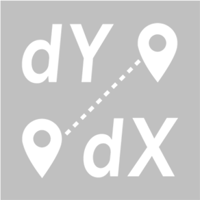
dYbydX
Status date: 04 September 2018
Routing information to navigate the urban environment in accordance with users’ personal mobility needs.

AMBROSIA
Status date: 14 August 2018
The ESA-Ambrosia food safety and traceability platform combines Blockchain technology, IoT, Satellite Earth Observation (SatEO) and GNSS Satellite Navigation to achieve maximum automation, security, and transparency of the food supply chains.
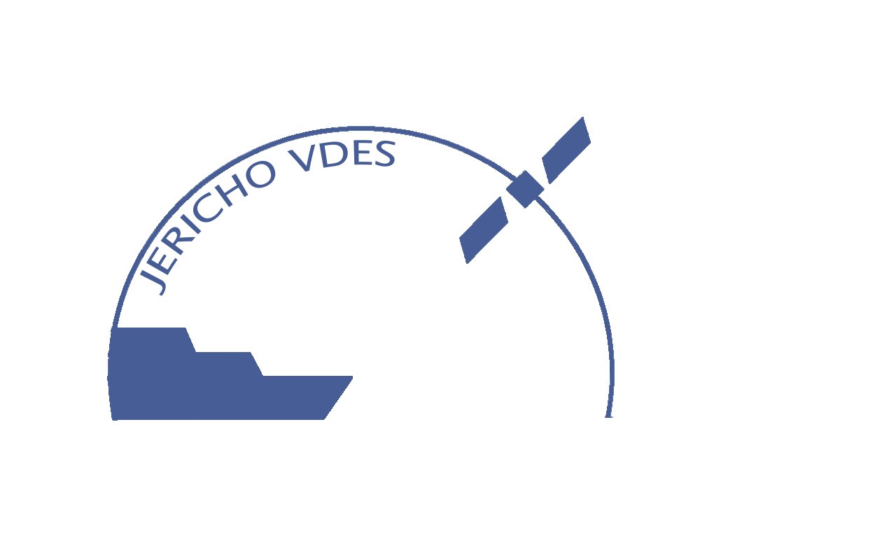
JERICHO VDE
Status date: 23 July 2018
Feasibility study, performed by a Polish team, providing a comprehensive overview of the VDES technology future maritime applications potential. Analysis regards two of the most interesting services, i.e. MSI (Maritime Safety Information) exchange, with particular emphasis on polar regions, and SAR (Search and Rescue) operation coordination – on-scene search patterns exchange.
WASTE IAP
Status date: 23 July 2018
The development of a service that uses Earth Observation data to detect and monitor legal waste sites, and GNSS technology to track the destination of high value waste items. The information is used to show evidence of legal operator compliance and illegal disposal or exportation of waste.
HelloBin
Status date: 11 July 2018
HelloBin services optimizes routing for waste collection for waste collectors and contributes to the ability to manage the waste stream more efficiently.
UTRAQ
Status date: 05 July 2018
RTICM
Status date: 19 June 2018
LuxSpace (LU), in cooperation with the project partners arviem (CH), OHB teledata (D) and megatel (D), develop an innovative container/cargo monitoring device which offers cargo localisation and condition monitoring capabilities via a wireless sensor network and reporting using satellite communication means and AIS (Automatic Identification System) data.
Apart from the technical development, a comprehensive customer tailored real time cargo monitoring service is offered, including analytics and operational support.
SENSE
Status date: 17 June 2018
The preservation of safety and information distribution in the maritime transport market is currently enabled by systems, which already show signs of overload, such as AIS. SENSE is a feasibility study to analyse and assess the use of space assets, and in particular VDES, for maritime navigation systems. The project aims at developing a viable system services concept closing the information gap between ship and shore. SENSE’s core value is information exchange using worldwide standardized dataflows and thus ensure easy scalability and integration of new vessels.

AgeSpot Feasibility Study
Status date: 18 May 2018
AgeSpot provides THE starting point for any innovative technological solution addressing ageing populations. It enables efficient targeting of the silver economy and offers precise demographic data on WHERE and HOW MANY age specific classes currently live and will likely live in the FUTURE. With AgeSpot a new Earth Observation (EO) supported business intelligence service is offered.
TeleRetail Delivery Robot
Status date: 17 May 2018
TeleRetail automates regional logistics to save millions of users billions of hours while minimizing the ecological footprint of transportation. Its activities include the development of automated on demand courier robots for same day delivery services in urban and sub-urban areas. The company's technology reduces the space, cost and energy requirements of local logistics by up to 90%.
SAFERDANUBE
Status date: 09 April 2018
The SAFERDANUBE system will provide assistance to river vessels operating on the Romanian sector of the Danube river. This is required in summer and winter, to cope with the appearance of ice/sand banks that difficult and/or prevent the navigation. The project’s pilot will demonstrate a service relying on the integration of Satellite Earth Observation data (SAR), Satellite Mobile Communication and Satellite Navigation Services to this aim.
SaMoLoSa
Status date: 06 April 2018
The Ovinto SaMoLoSa demonstration project addresses the use of satellite technology for the reduction of transport risk, security enhancement and optimisation of logistic operations by the tracking and monitoring of extremely dangerous goods in unpowered, mobile transport units such as rail tank cars and intermodal tank containers.
SatCom W-IFE
Status date: 03 April 2018
Airlines are embracing next generation connectivity in the cabin and cockpit. High capacity satellites are the key to meeting consumer demand for high speed, high quality and low cost connectivity in the air. Through this SatCom W-IFE ESA activity, Viasat’s satellite-based in-flight connectivity with Viasat Ireland’s in cabin applications is to provide an evolving range of services to the airborne market.
SatCorpAfrica
Status date: 15 March 2018
SatCorpAfrica (SATellite CORPorate services in AFRICA) is a Satcom Applications project by SatADSL (BE) aimed at developing, integrating and validating a satellite IP connectivity system and associated services allowing SatADSL to offer via local African Telecom Operators a solution targeting the WAN (Wide-Area-Network) market segment with a set of attractive and flexible offers.
Cycle route planning tool
Status date: 07 March 2018
Imagine yourself dumped in the middle of the Alps with your mountain bike. Now try and find a route that gives you 3 hours ride-time, 1200 meter elevation gain and a gnarly descent with epic scenery. Easy? Thought not. Beinn Bike delivers this capability quickly and efficiently allowing you to spend more time riding and less time planning.
WJETSS
Status date: 22 February 2018
WJETSS enables transportable, consumable and perishable “Things” or dangerous cargo (IoT) to “tell” their Whole-Journey Experience (WJE) from production to consumption, through sensor data monitoring and collection (“SenSourcing”) from all freight legs.
High Precision Navigation System for Trucks
Status date: 20 February 2018
Autonomous driving and reverse parking of truck-trailer combinations are very attractive for the transportation and logistics industry to reduce the transportation costs and to avoid accidents.
LiveLand
Status date: 20 February 2018
Transport operators across the UK face significant challenges in monitoring and detecting landslides and subsidence across their networks. LiveLand supports asset owners and operators to assess and monitor high-risk areas of their transport network providing improved geological hazard information at regional, network and local levels using integrated data from Earth observation satellites and GNSS.
International Satellite Derived Shallow Water Bathymetry Service
Status date: 15 January 2018
A web-based service to provide immediate, off-the-shelf, online access to shallow water depth data derived from very high resolution satellite imagery.
ASSIST WRM
Status date: 13 December 2017
According to the outcomes of the forerunner feasibility study, there is a potential market landscape for high-end services supporting the winter road maintenance. Intercepting then the real needs of users and stakeholders involved in winter maintenance, the follow-up ASSIST WRM demonstration project intends to address these opportunities by providing a set of advanced space-based services, specifically deploying a multi-sites pilot-demonstration over four different European countries during the 2016-2017 winter season.
URGED
Status date: 21 November 2017
URGED addresses an increasing global requirement for the provision of better predictive decision support tools for urban infrastructure managers to enable cities to become more resilient to environmental threats. Through the evolution of Rezatec’s geospatial data analytics and the incorporation of new satellite data sources, e.g. Sentinel 1 and 2, these tools will be accessed through the URGED online platform.
SBS-RailS
Status date: 16 October 2017
Space Based Services for Railway Signalling feasibility study shall assess technical feasibility and economic viability of an integrated satellite navigation and satellite communication solution complementing Level 2 European Rail Traffic Management System (ERTMS).
Satellite navigation systems can be integrated with the on-board and wayside signalling systems to guarantee the required level of safety (SIL4) that is today provided by the existing train detection systems, while satellite communication systems can complement or even replace terrestrial communications.
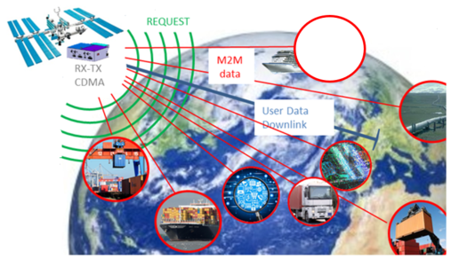
SatApps
Status date: 19 September 2017
Internet of Things/IoT – M2M – industry 4.0 – these headlines are representing large user groups which have an urgent need of a globally available, low-cost, secure data service, dedicated to very small data volumes per sensor and for use also in remote areas. The objective of the study is to perform an in depth requirements analysis on 2 focus pilot user groups: railway transportation and container/waste management.
SUMO
Status date: 05 September 2017
SUMO is a service to assist in the planning and monitoring of marine operations for offshore wind farms. The service integrates diverse information to allow the monitoring and forecasting of metoceanic conditions and track the locations of vessels and personnel involved.
This improves the management and coordination of the construction, operations and maintenance activities and leads to increased efficiency and safety.

Uam®
Status date: 27 July 2017
e2E intends to offer more affordable data communication services into niche markets currently underserved from existing infrastructure or where traditional satellite delivery is too expensive. The core of the service concept builds on two key technologies that have been developed with small airborne IDP networks in mind that incudes RPAS, HAPS and small satellites.
STEAM
Status date: 04 May 2017
The objective of this study is to investigate the technical feasibility, financial/non-financial viability and sustainability of a future service aiming at measuring the amounts of sulphur oxides components ejected by vessels travelling inside the Emission Control Areas (ECAs) as defined by the International Maritime Organization (IMO).
INSUTRAX
Status date: 19 January 2017
The INSUTRAX feasibility study objective is to investigate the technical feasibility and commercial viability of integrated applications utilizing various satellite data sources (GNSS, EO and Satcom) for cargo tracking in support of IT insurance products focusing on Polish insurance market.

SAT-AIS DPC
Status date: 18 January 2017
The SAT-AIS Data Processing Centre (DPC) Demonstrator is a development co-funded by EMSA (European Maritime Safety Agency) and ESA. The DPC collects SAT-AIS messages, ancillary information for generating and distributing enhanced data services to the maritime community.
European-wide Mobility, Safety and Efficiency Management for Logistics Enterprises
Status date: 16 January 2017
The objective of this project is to improve the energy efficiency and vehicle tracking capabilities of logistics and transport service providers in Europe. For this purpose, innovative ICT and climate protection technologies have been combined with space technologies, namely earth observation and satellite navigation, to offer a cost-efficient and flexible ‘one-stop-shop’ solution helping lorry drivers to achieve an eco-friendly driving style, while allowing fleet managers to monitor actual fleet fuel consumption and CO2 emission.
RPAS Intelligent Parcel Delivery
Status date: 11 January 2017
In the advent of the remotely piloted aircraft system (RPAS), the Unmanned Parcel Delivery (UPD) project seeks to utilise RPAS and satellite technology to establish a fast, safe and secure UPD service to customers in remote and hard-to-reach locations.

XcitID
Status date: 17 October 2016
The Xcit'ID project is dedicated to design, develop and validate a pre-operational integrated service platform aiming at significantly improving the management of the transport supply chain of temperature-sensitive pharmaceutical goods.
PROTECT
Status date: 28 September 2016
The PROTECT project aims to exploit existing systems and infrastructure in conjunction with applicable space based assets to provide cost-effective added-value technology centred services that provide improved situational awareness to both on-board and shore based stakeholders, based on real-time innovative integration of piracy and sensor information/data.
I-PORT
Status date: 07 September 2016
The I-PORT demonstration project involves creation and demonstration of IT services for optimisation of inter-modal container transport in Ports. The project is a collaboration between AIMES, Avanti Communications Group plc, ContainerPort, exactEarth and Atlantic Containers Ltd and involves deployment of systems within the UK and also in Germany, in collaboration with The Institute of Shipping Economics and Logistics (ISL) and DBH.
3INSAT
Status date: 07 June 2016
3InSat demonstration project developed, tested and verified a new satellite-based subsystem, based on the Ansaldo STS ERTMS solution, for allowing the SIL4 train localization function at Signalling System Level by using GNSS. 3InSat also implemented an integrated solution based on the combination of SatCom, 3G/4G systems and TETRA to realize the link between the on board train control system and wayside signalling infrastructure.
EO Crowd
Status date: 22 February 2016
Over 90% of our seas are unsurveyed. EO Crowd uses crowd sourcing, EO data and open data to fill this data gap.
SaMoLoSa FS
Status date: 28 January 2016
The Ovinto SaMoLoSa study addresses the use of satellite technology for the reduction of transport risk, security enhancement and optimisation of logistic operations by the tracking and monitoring of extremely dangerous goods in unpowered, mobile transport units such as rail tank cars and intermodal tank containers.

SEA SEARCH
Status date: 26 January 2016
SeaSearch provides detection and identification capabilities of small vessels, agnostic to vessels’ size.
Based on the mobile phone detectors and other sensors such as radars, AIS and SAR, SeaSearch builds Maritime Situational Awareness Pictures.
Sensors are using SeaSearch own developed technology based on Software Defined Radio (SDR).
EASY
Status date: 26 November 2015
Together with traditional chartering, new business lines like yacht brokering, manufacturing assistance, luxury cruising are emerging asking for the availability of innovative services on board. These new businesses require a higher grade of liability towards their customers, hence forcing the providers to put more emphasis on systems and services in order to increase the safety and availability of information during the cruise.
MAPP
Status date: 23 October 2015
The increase in piracy incidents in areas such as the Gulf of Aden and the Gulf of Guinea threatens life at sea and causes substantial cost to the shipping industry and governments as vessels transit through the High Risk Areas.
LMS
Status date: 07 October 2015
In compliance with European and national regulations, the GNSS based livestock transport online monitoring system as well as the related service elements allow the online control of (especially long distance) livestock transports as well as simplify livestock transport documentation. The solution can be integrated with other vehicle subsystems and transport information such as fuel consumption, temperature conditions, water level control, etc.

PloughStars
Status date: 04 August 2015
Plough Stars is a feasibility study and part ESA’s Integrated Applications Promotion (IAP) Programme. The industrial team led by Berner & Mattner investigates new services and applications for improving winter road maintenance. Existing, mainly terrestrial, systems are enhanced with space-based technologies. Users and stakeholders involved in winter road maintenance benefit from this system through increased performance and a simplified routine.
Arctic IAP
Status date: 08 July 2015
Telespazio VEGA UK are developing a range of value-added services using layers of geo-information and commercial data that can be customised to the needs of specific operators. The services include primarily satellite derived imagery VMS (24/7 Vessel Monitoring System) from the Telespazio Group, AIS (Automatic Identification System) provided by Canadian consortium member exactEarth Europe Ltd, and low bandwidth high fidelity image transfer system AnsuR, a Norwegian company.
Maritime expertise and access to the market through Marine South East and additional maritime data layers are provided by Stevenson Astrosat and HR Wallingford.
This solution presents a viable Arctic Integrated Situational Awareness Service building upon existing operational or semi-operational services provided by consortium members, and adding additional features believed to be of value to the user community that will help to differentiate and ensure the success of the service.
ASSIST WRM (FS)
Status date: 06 July 2015
The “Advanced Snow plough and Salt spreader based on Innovative Space Technologies“ (ASSIST) project aims to deliver a comprehensive feasibility study on the technical and economic sustainability of a winter road maintenance system based on space technologies.
ASSIST proposes a concept developed along with the improvement and integration of two main assets: Satellite Navigation (and related augmentation systems) and Earth Observations to get additional digital information about roads and weather forecasts.

SURMON
Status date: 18 June 2015
The SURMON Demonstration Project targets airborne Geophysical Survey (GS) and oil Pipeline Monitoring (PM) services based on the use of a Remotely Piloted Aircraft System (RPAS). Equipped with suitable sensors and making use of satellite communication and navigation, operation of the RPA beyond line-of-sight is enabled.
GeoSHM
Status date: 17 June 2015
GeoSHM (GNSS and Earth Observation for Structural Health Monitoring) is a Structural Health Monitoring (SHM) system that integrates GNSS and Earth Observation technologies to offer an integrated solution for the maintenance of different types of asset.
TIM
Status date: 16 June 2015
Efficient asset management is required to meet increasingly stringent demands on safety and reliable performance of new and ageing infrastructure under varying and sometimes hazardous environments. The Transport Infrastructure Management (TIM) Service is planned as a new generation of asset monitoring services that can be deployed across multinational organizations. The concept is based on the integration of location and mapping capabilities of space assets and ground local point sensor networks - delivering data in the most efficient manner.
DG-TRAC feasibility study
Status date: 11 June 2015
The DG-Trac project addresses the tracking and tracing of dangerous goods in the medical sector integrating and using existing space technologies (navigational services, communication services) with GSM/UMTS and Internet.

SELIAT
Status date: 13 April 2015
SELIAT stands for the feasibility study Safe Emergency Landing in Alpine Terrain. It has investigated a service in aviation that shall provide geographic information about suitable landing sites to support off-field landings in alpine areas with difficult terrain. This information will be available to pilots in their cockpit. The information may be required either as part of an operation of a search and rescue mission or in case of a technical failure in the aircraft.

i-enquire
Status date: 26 March 2015
The project, which is part of ESA's Newcomers initiative of the ARTES 3-4 Programme, is aimed at developing, integrating and validating a set of mobile applications onboard of vehicles such as cars, coaches and trucks, using the S-Band delivery platform of Solaris on the Eutelsat W2A satellite.
SafeRail
Status date: 14 January 2015
The objective of SafeRail is to improve the safety at Rail Level Crossings (RLC). In terms of accident prevention, RLC are demanding spots since two disparate transportation systems are intersecting (road, rail respectively) and neither of them completely controls the situation. In response to this, SafeRail provides a flexible and secure solution at a moderate price, using latest advancements in satellite technology.

LeCross
Status date: 10 September 2014

SATMODO
Status date: 08 September 2014
The SATMODO project is aimed specifically at the round-wood timber harvesting market, by facilitating ”live” monitoring of harvest processes. To date the SATMODO project addressed current harvesting issues in remote areas by utilizing both cellular and satellite transmission technology as a means of providing data transmission pathways for the live harvest data from the Harvester Machine.
ISABELIA
Status date: 27 June 2014
The ISABELIA Feasibility Study specified and validated the sustainability of services and that would provide users at sea with near real time information on dangerous ice situations, indicators of collision risk and on risk of grounding, thereby improving the safety of vessels in the Baltic Sea.
MATIST
Status date: 09 April 2014
The MATIST services provide ground motion information to operators of alpine transportation infrastructures such as railway companies, institutes representing the national roads and companies from the energy sector.

FlySafe
Status date: 18 March 2014
Bird strikes on aircraft pose a real safety threat for both military and civil aviation. Depending on specific circumstances such as the speed of the aircraft, the point of impact, the mass of the bird, the number of birds and the type of aircraft, bird strikes can result in devastating accidents.
Live Land
Status date: 29 November 2013
The objective of Live Land is to provide users with a suite of services that enables the management of hazards and the exposure of national transport infrastructure assets to landslide and subsidence events. During the feasibility stage, the Live Land consortium assessed the viability of developing a suite of services driven by the needs and requirements of end user organisations. Live Land proposed a ‘catalogue’ concept, to incorporate a suite of enabling technologies (including Space-borne, in-situ and geological datasets) that could improve the forecasting, monitoring and alerting of landslides and subsidence.
I-Port FS
Status date: 20 August 2013
This study addressed the feasibility and viability of an integrated solution consisting of space and terrestrial assets in support the optimisation of freight transport through European ports.

TWIM
Status date: 29 May 2013
Two Way Information Management (TWIM) is a Feasibility Study to assess the added value of receiving information regarding incidents, public safety issues, criminal behaviour etc. from the general public via their smartphones or other mobile devices, in support of operations of Civil Protection Services (Police, Fire Brigade, Ambulance Service etc).
IRISS
Status date: 14 June 2012
The IRISS feasibility project has identified the applications and requirements for an integrated information, communication and navigation gateway within the rail transport sector, designed and developed a solution and performed a proof of concept activity.
EuroPORT
Status date: 11 June 2012
The objectives of this feasibility study are to assess the technical feasibility and commercial viability of an integrated solution and associated services which support the optimization of freight transport through ports (e.g. routing and scheduling), based on a better understanding of users and stakeholders needs and transport conditions, and better information exchange.
iTRAQ
Status date: 25 May 2012
iTRAQ is a project to develop a dynamic traffic management system for optimising use of the road network whilst meeting growing demands to sustain high standards of air quality in urban environments.
S2BAS
Status date: 23 April 2012
The S²BAS project aims to develop, deploy and demonstrate (via proper test flights campaign) a platform for the provision of an integrated set of satellite-based low-cost services targeted to small and regional airports. The concept consists in supporting aspects related to the whole life-cycle of a flight, from its development and planning to its execution and control; with the aim of improve access, operations at the airport and increase safety at a low cost.

SSMART
Status date: 30 November 2011
The SSMART project will provide solutions for monitoring and managing multimodal (road, rail, waterways) transports of dangerous goods. Integrating and using available space technologies (satellite navigation, satellite communications, earth observation) with terrestrial systems SSMART will improve safety, coordination, information exchange, and communication for both routine transport operations as well as for emergency situations.
SINUE
Status date: 15 September 2010
The SINUE study will investigate the technical feasibility and economic / regulatory viability of integrating space based systems with UAS (Unmanned Aerial Systems) in order to enable their integration into non-segregated airspace and to relay payload data for new institutional and commercial services in near real-time.
Birdstrike
Status date: 20 May 2010
The present activity is concerned with reducing the risk to civil aviation of an accident in the airport airspace environment as a result of bird strike.

SECCOH
Status date: 10 October 2009
"Management Centre for the Transport of Hazardous Goods in the Alpine Region" is an activity dedicated to the identification of users and requirements for the definition of services regarding the transport of Hazardous goods in the Alpine region.