
Government bodies and agencies in charge of security related services like civil protection, border control, or demining issues, are challenged to guarantee acceptable standards in all aspects affecting human life. The effective integration of space-based systems and terrestrial resources can provide added value and sustainable service solutions to many of these relevant issues through enhanced monitoring, surveillance, and improved coordination.
MagWatch3D
Status date: 17 July 2026
Geomagnetic storms can disrupt electric power grids and other critical infrastructure. MagWatch3D delivers high-resolution – better than 10 km spatial resolution and 1 second cadence – near real-time physics-based space weather intelligence on geomagnetic disturbance, geoelectric fields and geomagnetically induced currents (GICs) for power grid operation, insurance, and other activities affected by Earth’s magnetic field such as magnetic surveys and navigation.
HALO Dashboard
Status date: 17 July 2026
Wildfire risk inspections and their effect on insurance premiums are currently carried out on ZIP-code level. The HALO dashboard allows a hypergranular inspection with dynamic risk factor analysis ensuring portfolios remain profitable and best practices are enforced.

AMSynchro
Status date: 10 July 2026
AMSynchro is a space-enabled assurance platform for hazardous metal powders used in additive manufacturing. It links monitoring, custody, genealogy, warning logic and audit-ready evidence to help operators understand whether materials remained safe, compliant and fit for use throughout storage, handling and movement.
DEEPSEA
Status date: 29 June 2026
DEEPSEA pioneers real-time maritime surveillance by using Distributed Acoustic Sensing (DAS) on subsea fibre cables. Combining AI, DAS, and satellite data, the system enables 24/7 monitoring of dark ships near fibre cables, enhancing security and environmental protection.
AUTOSEA
Status date: 25 June 2026
AUTOSEA demonstrated a space-enabled autonomous maritime service using the LM450 USV, DockMaster autonomous docking and AutomatePro mission control to support repeatable surveys, hull-inspection workflows and coastal/offshore monitoring with reduced crew exposure and lower operating cost.

XR4Emergency
Status date: 18 June 2026
XR4Emergency combines satellite intelligence, immersive XR simulation, and evidence-based AI-supported debriefing to strengthen firefighters’ soft skills through realistic training for climate-driven emergencies. Based on real historical events, the platform enables teams to train coordination, decision-making, and situational awareness in dynamic, high-fidelity wildfire scenarios, and to reflect on team performance.
OWL – ST
Status date: 15 June 2026
Half of Earth’s thermal dynamics happen at night. Constellr unlocks high‑resolution nighttime Land Surface Temperature at 10 and 30 m, daily. New insights for urban heat, agriculture resilience, and climate intelligence, after sunset.
BlueSentinel
Status date: 02 June 2026
BlueSentinel is a next-generation maritime surveillance system delivering persistent, high-resolution awareness beyond satellites and fixed infrastructure. Using modular sensors on infrastructure, ships, and drones, it detects and tracks cooperative and non-cooperative vessels in remote and sensitive waters, giving authorities, infrastructure owners and crews real-time visibility where it matters most.
Space to Subsea
Status date: 29 May 2026
UVisions underwater 3D scanner is sold worldwide and helps asset owners get a clear overview and understanding of the state of their underwater assets. Based on customer requests this project integrates satellite-based positioning ensuring: 3D-models referenced in the global coordinate system, Improved accuracy and increased ease-of-use.
SKYS.O.S.
Status date: 14 April 2026
SKYS.O.S. is a satellite-assisted safety service supporting the creation, transmission and handling of emergency cases towards the 112 / PSAP chain in complex outdoor and urban environments.
The service integrates connected devices, terrestrial communication networks and space-enabled assets with a central Relay Center platform, ensuring end-to-end delivery of structured emergency information, including position and event data, even when terrestrial connectivity is unavailable, insufficient or degraded through the use of an alternative NTN bearer.
EODT4Crises
Status date: 12 March 2026
Helyx and the University of Portsmouth (UoP) have developed “Earth Observation Digital Twins (DTs) for Crises” that focus on utility and transport networks. The DTs map the vulnerability of networks to natural hazards and the damage to these systems post-event. By using earth observation imagery, our DTs support the rapid global response of humanitarian teams to crises.

FireTrack
Status date: 12 March 2026
FireTrack is a satellite-based wildfire monitoring service delivering near-real-time maps of active fire fronts and burnt areas. By processing satellite data directly in space and transmitting results within minutes, it provides emergency services and risk managers with timely, high-resolution information to support operational decision-making during ongoing wildfire events.

GEOFENCE
Status date: 06 March 2026
GEOFENCE aims at achieving high-integrity, high-availability while maximizing land area utilization by intelligently fusing data from the core sensor suite, specifically addressing GNSS vulnerabilities in typical agricultural settings.
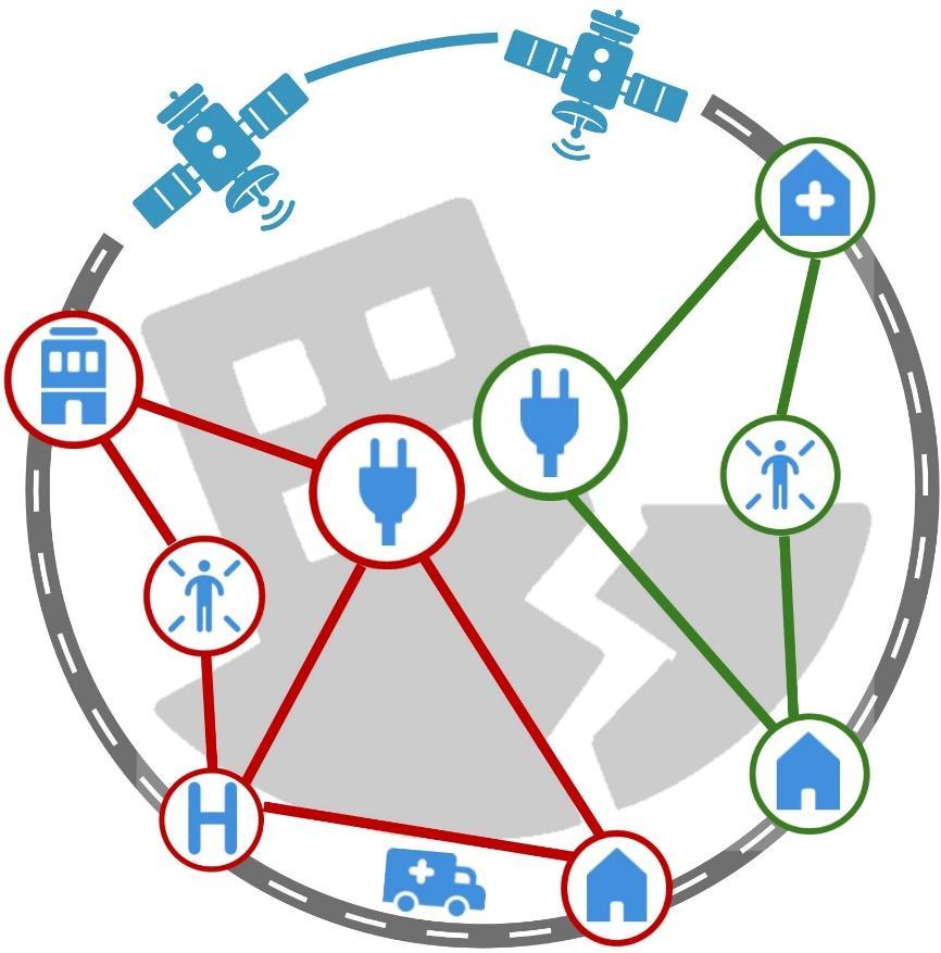
INST
Status date: 26 February 2026
Instantly Networked Smart Triage (INST) is a satellite-enabled service providing real-time casualty location, status, and triage information to emergency services during mass casualty incidents. INST is enabled by a low-cost lightweight device that can be associated with a casualty to indicate where they are, how urgently they require medical attention, and to report the number of casualties.

Dark Vision
Status date: 23 February 2026
Using innovative space-based nighttime imagery, Dark Vision will provide an understanding of how artificial light at night (ALAN) impacts our planet ranging from the effects on human health, ecology, the environment, biodiversity and the global economy.
Lunar-TARS
Status date: 11 February 2026
Lunar-TARS is a modular, autonomous robotic arm built for extreme environments. Its versatile design supports a wide range of missions, from lunar infrastructure assembly to regolith collection, driving the growth of a sustainable lunar economy.

RTIS
Status date: 10 February 2026
DataCosmos is Open Cosmos’ proprietary platform for storing and analysing satellite imagery.
RTIS is a near-real-time information system. By leveraging DataCosmos to detect and monitor oil spills and water turbidity in the middle east with rapid delivery time, RTIS will enable the rapid response to critical situations.
RESIST 2
Status date: 28 January 2026
RESIST provides worldwide coverage for detecting GNSS Spoofers and Jammers anywhere over the Earth’s surface. The system relies on the CMCU, Central Machine learning Computation Unit and ground and space recorded data. RESIST 2 is the demonstration project, including pilots demonstrations in the maritime port of Marin in Spain and the DLR airfield of Cochstedt in Germany.
DTM Tool
Status date: 26 January 2026
The DTM Tool service is a solution developed to address the challenges of the drone market. The service allows, through modern aviation surveillance technologies and geospatial data processing, to support safer and more efficient drone operations.

SITH
Status date: 26 January 2026
CORAC “SITH” service is a cloud-based software solution, designed to authenticate and trace Earth Observation (EO) data. It ensures data integrity and trustworthiness across the EO value chain, using keyless digital signing & verification, traceable data provenance, and trustworthiness evaluations. SITH aims to protect EO data from tampering, helping providers comply with complex EU cybersecurity and AI regulations while safeguarding critical decision-making processes.

Smart-Inno Expert Space Weather Service (SME SWS)
Status date: 21 January 2026
The mission of Smart-Inno Expert Space Weather Service is to protect Earth-based infrastructure, specifically Electricity Networks, from the destructive effects of Space Weather. The service delivers specialized intelligence to power system operators providing a comprehensive package including a Forecast, a Nowcast (real-time data), and a Scaled Alert System tailored to the operational needs and risk tolerance of the power networks.

SEFPAM
Status date: 15 January 2026
The project will enhance its Mitigrate’s Prevent platform by integrating river flood modelling, alert system, and preventive solutions scenarios. Using satellite imagery, geospatial data, and weather forecasts, the system delivers property-specific recommendations and loss reduction estimates. Piloted with insurers like Gjensidige, the project demonstrates scalable, actionable flood risk prevention across Europe’s insurance markets.

EO-ACT
Status date: 12 January 2026
Leveraging satellite imagery and AI analytics to detect and prevent child labour in global supply chains. The platform provides companies with real-time monitoring, risk assessment, and verification tools to ensure ethical sourcing compliance, protect vulnerable children, and strengthen corporate social responsibility commitments through transparent, data-driven insights.
VIRTUE
Status date: 08 January 2026
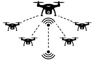
A system integrating AI, UAVs, and satellite assets to enhance real-time human detection to fundamentally improve Search and Rescue (SAR) missions in the benefit of SAR responders.
AROBS AlertBox
Status date: 30 October 2025
AROBS AlertBox aims to offer access to E-alert messages and 112 emergency service, in environments that lack reliable GSM (Global System for Mobile Communication). This product is an emergency alert box that connects, via two global satellite constellation systems (Iridium and Starlink), to the national emergency response systems in critical situations when communication channels are compromised.
TEMIS
Status date: 22 October 2025
Massive end-to-end IoT satellite services, fully operational in GNSS denied environment and very robust to jamming & interferences for highly scalable applications in numerous verticals such as logistics, transport, agriculture/smart farming, maritime, environmental, mining/oil/gas, smart cities, smart building, e-health, utilities, industry…
AIS
Status date: 12 September 2025
AIS verified the feasibility of using Galileo HAS for high-accuracy navigation of a tethered drone for infrastructure surveillance. The project engaged with users to confirm requirements and customer demand, establishing a clear path toward commercial deployment.
SAPS
Status date: 04 August 2025
The aim of the project is to create a system for tracking criminals using GNSS signal jamming devices to steal cars and kidnap civilians. The project involves exploring the possibility of creating a system for tracing the disturbed signal based on low-budget GNSS receivers. The system would make it possible to determine the time and direction of the offender's escape from the crime scene.

The Digital Worksite
Status date: 01 August 2025
The Digital Worksite project develops a satellite-enabled solution to improve safety and efficiency for railway maintenance teams by tracking people, vehicles and equipment in real-time during worksites.

Evento
Status date: 01 August 2025
Experience the future of ticketing with Evento – the secure digital marketplace using geofencing to stop fraud and duplicated tickets. No scams, no copies. Just safe purchases, easy ticket management, and real-time event info right at the venue.
VARESAS
Status date: 21 July 2025
VARESAS is an advanced solution designed to support rescue teams in crisis situations by providing real-time situational awareness. By integrating data from multiple sources and leveraging technologies such as augmented reality (AR), artificial intelligence (AI), and machine learning (ML), it enables teams to coordinate, manage, and execute operations with greater efficiency, precision, and speed.
GEOFENCE
Status date: 09 July 2025
GEOFENCE aims at conducting a KICKSTART study for the use of Galileo to deliver superior robustness of geopositioning in the context of a geofencing safety strategy for agricultural robots (agbots).

SENO
Status date: 25 June 2025
The SENO project demonstrates that a significant amount of meaningful social value is created when the humanitarian staff in areas with unreliable communication infrastructure is connected through a reliable, independent, and high-performance satellite service.
SES partnered with Red Cross Burkina Faso (CRBF) and implemented an end to end solution to connect 11 offices of humanitarian organizations in Dori, Seno province, Burkina Faso. Based on the market demand, the service is scalable to other locations worldwide.
RATIO
Status date: 16 June 2025
RATIO project aims to evaluate the technical and commercial feasibility of using satellites with the capability of detecting RF activity in various operational scenarios. Stakeholders within the maritime and humanitarian/rule of law domains are involved to define use cases of interest and requirements that are requested to be covered by technically and commercially feasible service solutions proposed by the Consortium.

SAFER
Status date: 16 June 2025
SAFER provides accurate, hyperlocal seismic hazard maps and forecasts. Leveraging GNSS, Earth Observation data and advanced AI models, SAFER enables proactive disaster preparedness, informed urban planning, improved infrastructure resilience and enhanced risk assessment for governments, municipalities, infrastructure operators, insurers and financial institutions globally.

SPACE4LIFE
Status date: 29 April 2025
This activity is a study aimed at assessing the feasibility of the development of a service based on satellite assets and cutting edge informatic technologies for a more effective management of level crossing monitoring and maintenance and the increase of road users’ safety at railroad intersections. The conceived service is proposed in response to the need of decreasing level crossing accident occurrence and, thus, making railroad intersection safer. The feasibility of service development is studied from a technical and economical point of view. The best compromise between costs and high performance is foreseen and finally achieved.

MCKS24/25
Status date: 16 April 2025
MyCoast is revolutionising coastal safety with satellite-enabled emergency response and environmental monitoring. Integrating AI-driven hazard detection, GNSS-IR tidal monitoring, and Satcom emergency connectivity, our smart beacons provide real-time safety alerts, ensuring vital information reaches those who need it—anywhere, anytime. Backed by ESA, MyCoast is pioneering next-generation technology to save lives and enhance global coastal resilience

Activity Tracking app
Status date: 09 April 2025
Most Activity Tracker apps overlook key physiological data, especially for physically impaired individuals. This project bridges this gap with cutting-edge biometric sensors measuring heart rate, core temperature, hydration, and stride mechanics – promoting safe, optimized physical activity. Backed by real-world athlete insights, this project enables smart and comprehensive performance tracking, redefining fitness tracking for all.

GHOST-4V
Status date: 31 March 2025
GHOST-4V brings satcom broadband connectivity to humanitarian vehicles, enabling new security and navigation applications.

XFACTorizer
Status date: 28 March 2025
The “Be a verifiable photojournalist!” project is about a possible application of GALILEO/OSNMA service. The authentic location and date/time data of OSNMA – embedded in EXIF tag of photos or videos – can be important help in fighting against fake news and disinformation.
Provide a brief description of the project in less than 60 words.
It will not appear on the project web page itself but is used in project lists e.g.
https://business.esa.int/projects and search results.
SJAR
Status date: 11 March 2025
UAV swarm-based humanitarian mine-detection and -recognition in GNSS-denied and communication-contested environments, as one module of the Dropla de-mining solution, which includes ground drones for terrain preparation and confirmation.

Space4LevelCrossing
Status date: 26 December 2024
Space4LevelCrossing is a feasibility study of technical and commercial viability of innovative solutions based on use of satellite data in combination with the train on-board environment perception system for improving safety of Level Crossings.
Rumore
Status date: 23 December 2024
Gain Unmatched Insights into Radar System Types and Locations: RUMORE provides intelligence on ground radio transmitters, including their key parameters, by analysing Synthetic Aperture Radar (SAR) images operating in the same band as the transmitters. The Pulse Descriptor Words (carrier frequency, bandwidth, duration, modulation type, Pulse Repetition Frequency, Polarization, TOA, DOA), are used to identify and expand transmitter type databases.

SGAM
Status date: 23 December 2024
SGAM is addressed to owners and managers of large infrastructural networks and is designed for the assessment of geohazards that may impact on geotechnical assets, focusing on the interaction between infrastructures and natural environment. It combines Earth Observation data, ground-based monitoring data, geohazard databases, and AI algorithms to identify critical issues allowing for cost-effective predictive maintenance investments. It features techniques such as A-DInSAR and PhotomonitoringTM for precise monitoring of surface changes, allowing for historical analysis and change detection.

MASAI
Status date: 23 December 2024
MASAI is a web platform designed to support national and international organisations that intervene in emergency situations (humanitarian crises due to war and natural disasters). This web platform uses automated Artificial Intelligence algorithms applied to VHR and SAR images to identify damage to buildings and infrastructures, estimating the extent of economic damage and affected population; Ukraine is the use case.
ASBCIMS
Status date: 21 December 2024
SuperVision Infrastructure - critical infrastructure monitoring system that utilizes satellite data and Earth Observation (EO) methods to develop an automated software solution for detecting and assessing damages and risks in close proximity to critical infrastructure. Exploring a fusion of optical and radar data with varying resolutions, the system serves as a rapid-response tool specifically designed for occupied and inaccessible territories.

SESIM
Status date: 20 December 2024
Revolutionize Incident Management on Industrial Sites!
Introducing our cutting-edge software platform tailored for large industrial sites. With a fusion of Earth Observation data and real-time GNSS tracking, gain unparalleled insight into site dynamics. Instantly locate personnel during emergencies, communicate crucial instructions swiftly, and optimize response strategies. Experience a new era of incident management efficiency and safety.
LucidEO
Status date: 27 November 2024
Space-enabled Productivity & Wellbeing leveraging satellites, wearables and AI
ISABHEL
Status date: 11 November 2024
ISABHEL is a continuous monitoring service that leverages 5G technologies and provides qualitative and quantitative information for the management of specific assets, identifies areas for predictive maintenance, supports asset financial resilience and disaster prevention. The proposal is based on the synergistic integration of different technologies enabling advanced monitoring of the structural health of bridges. The service is specifically aimed at monitoring the structural health of bridges located on the Po River, which are recognized as assets of interest for the City of Turin.
FB Eye
Status date: 23 October 2024
FB Eye – acronym of Fire-Bombing Eye – is a commercial initiative to improve the firefighting operations using innovative space-based and ground-based technologies.
FB Eye is an innovative platform-as-a-service commercial provision of integrated satellite/airborne Comms/Nav support to the precision water bombing of large wildfires.
FB Eye provides water bomber pilots with a near real time information map with precise geographical location of most radiating fire hotspots, being the most effective release target to extinguish rapidly the fire.

SCAF
Status date: 10 October 2024
Mitigrate, an InsureTech startup, pioneers flood risk management with its SaaS platform. Utilizing advanced technologies and earth observation data, it offers nature-based solutions reducing flood risks. Targeting insurance companies, Mitigrate's tool fills a crucial gap, providing pre- and post-flood disaster guidance. Beyond risk reduction, it aligns with global sustainability goals, positively impacting insurance performance metrics. An investment in Mitigrate is an investment in resilience, sustainability, and the future of flood risk management.
RAMar
Status date: 04 July 2024
RAMar has been assessing the introduction of space-based RF-data into the existing KSAT vessel detection service. The existing service based on SAR and AIS has been expanded to utilise RF-data as an additional source of information with the aim to enhance the detection and characterisation of dark vessels.

Remote Planet
Status date: 27 June 2024
Remote Planet from Secure Innovation offers real access without physical presence, allowing you to have control over your critical assets from anywhere in the world. Harnessing the power of satellite technology featuring Wi-Fi, GNSS, GSM and LEO functionality, this convenient solution provides 24/7 monitoring, management, protection and control to safeguard your assets and operations.
STREAMO
Status date: 21 June 2024
STREAMO provides advanced Earth Observation services from the Stratosphere, by using swarms of small and reusable High-Altitude-Pseudo-Satellite called CubeHAPS®, developed by Stratobotic. The solution improves regionally the Earth Observation services. The products offered are super-resolution, 3D models in real-time and SAR imagery at higher temporal and spatial resolution and lower costs, as almost no infrastructures are needed to use CubeHAPS®.

AIDA
Status date: 21 June 2024
The AIDA Feasibility study proposes two new services based on EO data and integrated with AI technologies, able to provide tools and value-added information helping damage assessment and monitoring in support to recovery efforts focused on agriculture and strategic infrastructures, specifically for areas prone to natural and man-made disasters and conflicts.

MOVE in SPACE
Status date: 03 June 2024
The project aims to develop a software that, combining user’s biological characteristics and trail information, provides customised advice and recommendations for physical outdoor activities. The main outputs are individual activity/hiking time recommendations, trail feasibility, calorie consumption as well as tips and precautionary measures also for subjects affected by chronic diseases.
EXTENSION
Status date: 26 April 2024
The project aims at the creation of services for the safeguard, conservation, promotion and enjoyment of the cultural heritage by using Space assets, AR and 5G network. The initiative has as its principal user the Municipality of L’Aquila, whose heritage is willing to be prevented and enhanced thanks to the development of the app, major outcome of the project Extension.

PeaceEye
Status date: 27 January 2024
Monitoring and understanding of armed conflicts, Humanitarian-Development-Peace nexus.
O-BOY
Status date: 10 January 2024
O-BOY is the first wrist-wearable that contains a satellite transmitter - therefore operates outside the range of mobile phones - and will offer a total package of services that can be lifesaving for athletes and adventurers in remote areas.
AlertSat Portal
Status date: 26 December 2023
The AlertSat satellite constellation is to deliver Alerts directly to its users, through AlertSat Portal - when critical information has been detected and there is still time to act upon it.

SiriusInsight®
Status date: 27 November 2023
90% of world trade goes by sea making it of great importance economically, strategically and environmentally but the maritime domain is vast and remote making persistent surveillance challenging. SiriusInsight® uses cutting edge artificial intelligence to analyse maritime data from multiple remote and autonomous sources in order to create actionable information for users about otherwise unobserved marine activity.
SES5G
Status date: 27 November 2023
SES5G prevents, detects and manages wildfires and illegal actions in forestall areas.
The solution relies on satellite observation, autonomous drones, advanced firefighting sensors, security gates with plate readers, mobile control rooms that, with Artificial intelligent algorithms that feed with geolocalized data stakeholders control rooms (Civil protections, Environment department, Public protection, … ).

EDGE-AI
Status date: 30 September 2023
Revolutionizing critical infrastructure protection and biomass monitoring with AI-powered drones. Leveraging cutting-edge technology to redefine security and efficiency in the energy sector. Welcome to the future of real-time surveillance and monitoring solutions.
GIP4 Smart Airports
Status date: 19 September 2023
Fourteen million flights are expected in 2035 in Europe. To increase airport capacity and efficiency, optimisation at every step must be carried on. GIP4SmartAirports projects aims at minimizing rotation time and smoothing real-time operations. Space technologies can be a valuable asset to support surveillance and safety, and help airport manager to maintain high quality and complete knowledge of their assets.
CRUISE
Status date: 19 September 2023
CRUISE intents is to design, develop and validate a CyberSec Test Range for UAS/RPAS. This technological framework combining ICT, EO and SATCOM, will be located in the Grottaglie Airport (Italy), a facility that experiments RPAS and studies the integration of UAS in non-segregated airspace. It will offer the overall assessment of vulnerability and resilience of UAS with respect to cyber-attacks.
VASP
Status date: 18 September 2023
In this project, Space Norway, together with the Norwegian Coastal Administration (NCA), the European Maritime Safety Agency (EMSA) and Kongsberg Seatex (KSX), have enabled a platform for Maritime VHF communications services using VDE-SAT, targeting the services the International Maritime Organization (IMO) has defined in the Maritime Service Portfolio (MSP). The following three services were demonstrated:
-
Ice chart distribution
-
SAR coordination
-
Mandatory Reporting System (MRS) information exchange
SMARTGRIDS-DEMO
Status date: 13 September 2023
The project develops technically and financially feasible services that can assist stakeholders of the energy network sector in their work practices. Earth Observation data and Artificial Intelligence techniques are the key assets for developing services that can help improve performance, reduce costs and mitigate problems, which arise from the management, maintenance and operation of the energy network infrastructures.

SeaWire DeepSea 5G LEO
Status date: 16 August 2023
Unleashing the power of 5G connectivity at sea, the SeaWire DeepSea 5G LEO solution transforms maritime communication. This innovative solution combines terrestrial and non-terrestrial networks for unmatched speed, seamless transitions, and lower costs. Beyond solving current maritime challenges, it anticipates future needs, promising an improved quality of life at sea, smarter transportation, and a revolution in the maritime industry.

PORT SENTINEL
Status date: 10 August 2023
The main objective of PORT SENTINEL is to estimate the technical and economic feasibility of new relative services to the "Port of the Future" that can take advantage of “space-based” data. The Consortium is proposed to serve the market with instrument for the monitoring of seabed, and in particular harbour, integrating data of satellite navigation and surveys of the state of the seabed.

RESIST
Status date: 25 July 2023
RESIST provides worldwide coverage for detecting GNSS Spoofers and Jammers anywhere over the Earth’s surface. The system relies on the CMCU, Central Machine learning Computation Unit and ground and space recorded data.

SmartMetRoadMap
Status date: 05 June 2023
SmartMetRoadMap is focused on updating a platform dedicated to the provision of tailored services for the operational management of meteorological risks on roads.
The updated platform is based on an AI-driven fusion of high-resolution NWP output and heterogeneous measurements captured in real-time, possibly also via 5G, and is specifically designed to make the most of satellite weather monitoring data.
BIGMIG-DEMO CCN
Status date: 08 May 2023
The project aims to establish a service leveraging Earth Observation data and Machine Learning techniques to support the news industry with measurable, testable, and independent satellite-derived information.
EM
Status date: 04 April 2023
This project followed a successful Feasibility Study in improving the GEOSATIS EM system/service, based on a next-generation GNSS bracelet, satellite communication/imagery; to enhance the current electronic monitoring system to a level where Geosatis has an edge over its competitors in terms of; communication, proximity, detail, signal broadcasting, bandwidth, and device use in a larger geographical area with limited. communication signals.
.
DOCS-2
Status date: 15 March 2023
Using civil aircraft to create constellations for providing high spatial & temporal Earth observation data and telecommunication services; a most ecological constellation re-using the most reliable platform.
DroSecMa
Status date: 13 March 2023
“The fence no longer defines the perimeter.” Exponential increase in capability and reduction in cost has made drones a truly disruptive technology. Their capabilities may be leveraged for significantly improved surveillance and data collection but that also
represent a significant and evolving threat. DroSecMa leverages the capabilities of drones while providing real-time threat mitigation.
SyriUS
Status date: 03 March 2023
SyriUS develops innovative data services for bathymetric mapping and seafloor characterization. Currently, these data are often outdated or unavailable for very shallow waters. SyriUS combines proven earth observation (EO) technology [EOMAP] with uncrewed maritime systems (UMS) [Maritime Robotics]. The created data products provide time- and cost-effective large area coverage with calibration and validation of EO data by UMS data.
CertiPro
Status date: 28 February 2023
In this truly European project, an innovative railway track worker protection system will be evaluated for its reliability and its ability to enhance the safety of railway track workers. The goal is to demonstrate the safety capabilities of the track worker protection system in a real environment, integrated into the challenging infrastructure of a railway operator in Italy.
MaSSha
Status date: 15 February 2023
Development of VDES satellite network roaming, VDES-based maritime IoT services, and maritime DSC distress alert detection for effective search and rescue.
Space Augmented UAM
Status date: 14 February 2023
Space Augmented UAM aims to determine the feasibility of a “Space Augmented” service enabling cities and regions to conduct U-Space integration assessment utilizing economic, technical and environmental simulations for predictive assessment considering the individuality of each city to generate a self-sustainable Urban Air Mobility ecosystem.
Space for Children
Status date: 02 February 2023
“Space For Children” is an innovative medical edutainment experience, based on Interactive Reality solution and playable by smartphones and tablets with iOS and Android operating systems, that give doctors and professionals the opportunity to analyze the emotional needs and the psychological support to be offered to children and the family community.
COSPARIN
Status date: 25 January 2023
The objectives of this project are firstly the improvement in developing vulnerability analysis using spatial data along with the development of a world-wide rainfall assessment in real-time. This is done via several al-gorithms that correlate infrared satellite images to obtain an operational flood risk management base. The data can be used by competent or-ganizations to ensure real-time crisis management.
SatNetMonitor
Status date: 02 January 2023
SatNetMonitor is a vegetation management and infrastructure risk detection service for electricity network companies. Disaster management service module is offered to Distribution Service Operators (DSO).
LifeLoS
Status date: 22 December 2022
LifeLoS is a new patient management and monitoring solution that can be used by any hospital or home care service to track and trace ‘free-to-move’ patients and other relevant people in indoor and outdoor spaces, reacting quickly to possible incidents or lost patients, and to dynamically plan new safe paths in case adverse events happen both indoor and outdoor.
SenTAct
Status date: 22 December 2022
SenTAct from Epic Blue gives you all the tools you need to keep your people safe and your operations efficient. SenTAct is a field team tactical awareness which ensures that teams in the field have the information they need for the local context. The embedded Artificial Intelligence engine locates your staff and assets, alerts on hazardous events, and generates mission intelligence.
StreamSonde
Status date: 22 December 2022
The world’s lightest weather sonde, the StreamSonde, is launched from balloon, airplane, drone or UAV and carried around by natural winds. It records winds at higher accuracy and in greater detail than ever before by using GNSS technology and IMU sensors. It also records a large number of weather parameters with multiple sensors. In this project, its benefits for storm and routine weather measurements was demonstrated, along with user benefits of obtaining better weather forecasts.
S-EDGE
Status date: 21 December 2022
S-EDGE is a demonstration project aims to contribute with innovative services to manage public security (Law Enforcement) through a solution, based on the use of Drones, which integrates new 5G broadband connectivity together with satellite technologies.
The service is conceived to support law enforcement operations for preventing and detecting crime and/or dangerous situations for the citizens, thanks to the provision of a Drone-based surveillance solution.
SOILRISK
Status date: 16 December 2022
SOILRISK is a high-resolution Predictive Model Application for Landslides that gathers atmospheric and environmental data and converts it into valuable intelligence in order to forecast landslide occurrence and provide a warning system for prevention.
SOILRISK is based on an innovative Machine Learning approach and a proprietary early-warning algorithm, using more than 20 conditioning factors dynamically.

SNOWtoWATER
Status date: 16 December 2022
SNOWtoWATER service provides high resolution and accurate snow water equivalent and snow cover data. SNOWtoWATER makes use of innovative A.I. algorithms fed by remote sensing data and quantitative sitespecific analysis, providing results through a digital platform.
eOdyn SeaWaze Offshore Demo Project
Status date: 16 December 2022
eOdyn SeaWaze Offshore Demo Project sought to develop a service called SeaOps by eOdyn. It is a new decision support tool to boost marine operations efficiency while supporting risk mitigation and cost reduction. This tool has been developed within the SeaWaze Offshore Demo Project. The pledge is to avoid unnecessary ocean currents and sea-state related weather down times, from bidding phase to execution.
AMOR
Status date: 28 November 2022
AMOR provides Public Institutions and Visitors with specific services for Cultural Heritage Safeguard and Fruition.
The Safeguard services (derived by satellite EO, UAV systems and GPR technologies)provide information and actionable data about the conservation status of historical monuments. The Fruition services (supported by 5G connectivity) offer to the CH Visitors an Augmented/Mixed Reality experiences via the dedicated mobile-App which is directly accessible through their mobile devices.
SCD
Status date: 28 November 2022
Unibap demonstrated the SpaceCloud-as-a-Service (SCaaS) business model and SpaceCloud ecosystem which brings edge, cloud, and storage capabilities with flexible analytics to satellites. SpaceCloud enables low latency, high value actionable information, better optimized and managed downlink bandwidth, and increased satellite utility. This benefits many different business verticals such as precision agriculture, crisis and disaster management, civil and defence security and environment preservation.

HOPE
Status date: 21 November 2022
Human safety is a critical factor that defines the iGRC (intristic Ground Risk Class) of the Unmanned Aircraft Systems operations. The HOPE project aims to integrate various source data, including satellite data (SatEO), to forecast human mobility over time, with the help of artificial intelligence and provide the derived information to operators&authorities.
Profumo
Status date: 04 November 2022
Profumo proposes novel weather-based services for the Mediterranean navigation with the aim of granting fuel saving, pollution reduction and improving safety for passengers, crew, goods and ships’ instruments.
The idea is to establish a cooperative schema (between commercial vessels) where meteo-marine data is collected from standard and non-standard on-board instrumentation.
Acquired data is used in the Profumo service center to produce reliable high resolution meteo-marine forecasts and nearly real time information, allowing the provision of helpful route optimization and navigation services also in a complex and constrained basin as the Mediterranean one.
To satisfy the demand of commercial customers, Profumo has conceived innovative services expressly for the middle short routes.
Dynamic Routing at Mediterranean scale.
The service provides pre-voyage route planning and updated information for optimal re-routing for vessels. This is possible due to the Profumo’s integrated approach involving weather observations, forecasts and optimal route computation through the modeling of ship’s characteristics, for predicting the vessel’s specific response to weather phenomena, in terms of seakeeping and fuel consumption.
Moreover, the system provides frequently refreshed meteo information allowing in-route corrections, therefore optimizing speed and course.
Navigation assistance
By using the navigation assistance service, the crew is fully supported in the route decision and planning. Profumo, integrating real time meteo-marine conditions, increases the safety and the navigation comfort through the application of the most recent guidelines for avoiding dangerous situations in adverse weather and sea conditions.
High definition weather products
Thanks to the cooperative meteo data injected in high resolution, local-scale forecasts, Profumo provides detailed predictions with a native (not rescaled) resolution of few kilometers.
Cert-EO
Status date: 21 October 2022
The aim of Cert-EO („Certified with Earth Observation”) is to apply Earth Observation solutions to support certification procedures of organic farming. The feasibility study project focuses on a service that can complement the personal on-the-spot checks with serving gap-filling data about a selected area, parcel or crop by automated analysis and evaluation of remote sensing (satellite) images.
TT-GSAT
Status date: 20 September 2022
TT-GSat offers a test and trial environment for emergency personnel and industry where it is possible to touch, try out and play with real building blocks to creatively find and implement new solutions. These building blocks can be individually combined with each other to try out and test the interaction of different equipment in different deployment scenarios.
DRONEAI
Status date: 19 September 2022
The DRONEAI project aims at providing an integrated approach to provide a close to real time assessment solutions for disaster relief and humanitarian interventions. It consists of a complete and state-of-the-art solution relying on Artificial Intelligence including a set of tools to enable its application in a time of tension and with high level of flexibility. DRONEAI is combined as an edge processing solution in HITEC’s Nomadic Satellite Communication (NoSaCo) terminal, it creates a unique solution to support the on-site analytics.
B-SURE
Status date: 11 August 2022
B-SURE can significantly reduce disaster management response time
The main B-SURE service is rapid collection and bandwidth-efficient secure communication of operationally relevant field information. The baseline field platform is a smartphone, while remote information managers access data and interact with the field users via Web browsers online on secure servers. The field users cover professionals, civil population and small UAV operators. A novel element is the specific focus on and support for remote disaster management support.
DRAMA (AMMO CCN#2)
Status date: 11 August 2022
DRAMA enables airports to address the drone challenge in a systematic, fact-based manner. All decisions concerning the management of drones and procurement of detection solutions are driven by risk assessment and ongoing risk monitoring. DRAMA provides airports with an easily adaptable solution that enables mitigation strategies and drone sensor selection.
BePI
Status date: 15 July 2022
BePI is a health and security service born to help public and private entities to address COVID-19 emergency. The synergic use of UAVs and UGVs (aerial and ground robots) assisted by AI, makes it possible to contactless measure people’s body temperature, blood oxygen saturation and heart rate and to detect specific alerts (presence of people’s gatherings and use of protective face mask). The service provides geo-referenced and aggregated data for each covered area.
ECO4CO
Status date: 11 July 2022
ECO4CO is an intelligent and autonomous end-to-end system. It combines data from satellites, Internet, traffic movements and medical information. The system provides end-users (authorities, civil protection) with notifications, warnings and timely/geolocalised information. ECO4CO aims at providing crucial advice to effectively prevent new outbreaks, to react in advance, and to predict critical situation regarding facilities, medical storage, or mass movements.

SWAIR
Status date: 30 June 2022
The aviation industry is becoming increasingly dependent on the GNSS-based technologies, at the same time being aware of its vulnerabilities, including those originating from Space Weather. SWAIR responds to that reality with a system providing GNSS and Space Weather monitoring and performance assessment products, compliant with international regulations and recommendations.
Safeblock
Status date: 02 May 2022
Safeblock improves Compliance Reporting by establishing physical frames of reference for IoT Data that can be assessed by both building owners and regulators. GNSS parent nodes anchor a reporting network of heterogeneous IoT sensors whose relationship to the parent nodes is established by data analysis of their ‘observed environment’. Data from compliance devices is stored immutably and data claims analysed before acceptance. Safeblock creates a record of safety data from source to approval which is transparent and auditable.
REACT2
Status date: 13 April 2022
React 2 provides satellite and emergency communications to deliver national and regional health bodies, to hospitals and first responders on the ground, a truly innovative pandemic response system. A fully integrated software suite which supports pandemic responses as well as major emergencies. React 2 provides a ‘Virtual Command and Control’ system for emergency management and a ‘Back-office’ system for Case Report Form and Contact Tracing Forms analytics.
Sat4Safety
Status date: 07 January 2022
This study has as its main objective to identify the real-life pragmatic needs of the public safety stakeholders within the Public Protection and Disaster Relief (PPDR) entities – on the specific topics of using (secure) satellite communication and satellite observation, to better address their own services offered to the public.
These PPDR stakeholders are identified and included as co-participants in the study – in order to make sure they represent a relevant set of end-users and that their indicated needs and requirements can be used to design and implement future satellite service that will benefit all/most of the (EU/world) PPDR entities.
EuroSim CBRN
Status date: 14 December 2021
The EuroSIM CBRN Project aims to develop the UrbanAware Incident Modelling Platform to provide lifesaving CBRNe/HazMat situational awareness and decision support.
AIDA-SHM
Status date: 14 December 2021
AIDA-SHM (Artificial Intelligence Data Analyser – Structural Health Monitoring) is an IoT artificial intelligence software solution for monitoring and predicting the health of reinforced concrete structures.
A-QKD-S
Status date: 13 September 2021
This project defines an ‘Augmented Quantum Key Distribution (AQKD)’ Satellite Service that uses nanosatellites to deliver cryptographic keys for fractions of the cost of traditional satellite constellations. This service, rather than compete with large service providers, aims to augment these larger networks and could be used for on a wide range of end applications with multiple market verticals.
FAST
Status date: 13 August 2021
The FAST study has the objective to identify and preliminary define new or enhanced applications, leveraging satellite communications capabilities, for the public safety sector with a focus on the three main verticals: Law Enforcement, Fire Brigades and Emergency Services.
ARIES
Status date: 04 June 2021
A project for an efficient system for prevention, monitoring and response against wildfires and landslides emergencies with focus on satellite assets, terrestrial 5G networks, drones and next generation IoT sensors.
FEST
Status date: 16 May 2021
Vake is making the oceans safer and more transparent by detecting and exposing IUU fishing activity. They deliver Deep Maritime Insights through automated data fusion of vessel trackers and satellite imagery. During the project, the work included activities towards NGOs and Government Agencies working on analyzing IUU fishing activities and other illegal or unreported activities.
Isolation Plus
Status date: 13 April 2021
Due to the Covid-19 pandemic, there is a new normal termed “Isolation Plus”. This project identifies the hidden vulnerable in communities and empowers local organisations to help those individuals who may have remained uncovered during the crisis. The solution offers new and unexpected insights into where the most vulnerable in local communities reside.
AlertSat
Status date: 13 April 2021
AlertSat is an earth observation change detection satellite constellation developed by the PandionAI corporation. The concept with on-orbit and autonomous image change detection, together with the instant delivery of information, gives end-users a tool to act efficiently in critical situations. AlertSat is designed with today’s challenges of rapid global changes in all areas, environment as well as business, in mind.
SAFES
Status date: 13 April 2021
The SAFES feasibility study has the objective to identify and define applications that use highly innovative Satellite Communication technologies to support essential services in the Energy & Utilities and Media & Entertainment sectors
ASTROCAST
Status date: 25 March 2021
Astrocast is developing an advanced Nanosatellite network for the Internet of things (IoT).
HoloCap pilotage application
Status date: 19 March 2021
A remote pilotage telepresence project, utilizing 3D game engine, volumetric video and Augmented Reality to bring maritime pilots virtually onboard a ship`s bridge from a remote location.
HumaNav-Next
Status date: 17 February 2021
HumaNav Next demo project addresses the Aid & Development community’s urgent need to increase the security of humanitarian missions. It will develop a fully integrated and reliable vehicle on-board solution, providing:
• Geo-location, fleet monitoring, management and security
• Telecommunications: voice, messaging and data
The solution will provide seamless world-wide coverage and full service regardless of the lack of any local infrastructure, by using Iridium satcom and GNSS location. It will be adapted to humanitarian vehicles deployed in field missions in underdeveloped regions and conflict areas. All services will be available while driving.
VisionV
Status date: 09 February 2021
VisionV integrates a combination of data provided by the end-user (spatial and non-spatial) and data derived from space-borne assets (VHR optical, elevation, structural health) to create new AR/VR visualisation capabilities in the context of:
- Situational awareness for Critical National Infrastructure (CNI) asset management
- Search & Rescue
ACABAS
Status date: 04 February 2021
Using civil aircraft as a platform to collect AIS data, complementing existing terrestrial and satellite solutions, enhancing AIS data availability.
GEWS
Status date: 26 January 2021
Greenhouse owners are in a very competitive market, in which unexpected costs due to damage and decay of the greenhouse assets can cause severe problems. This demonstration project aims at demonstrating how a notification service using space data can help greenhouse owners to prevent or mitigate non-insurable risks threatening their business, and thereby save costs.
ARCAmarine
Status date: 11 January 2021
The goal of the study is to develop an end-to-end solution mitigating cyber risks related to maritime communications via satellites. In particular navigation data are critical to improve the safety of maritime traffic and the reliability of downstream services.
MoSCI-ECOSPACE
Status date: 08 January 2021
The MoSCI - ECOSPACE product is a service for storage, processing, visualisation and analysis of Earth and airborne observation datasets. It aims at delivering meaningful information for overseeing and managing risks to critical infrastructure (CI) in coastal and riverine settlements. The service targets in priority the public water authorities responsible for managing coastal and riverine areas and resources; the utilities, contractors and engineering consultants; and the international financial institutions and insurance brokers.
MonICATO
Status date: 18 December 2020
MoniCATO proposes a backward compatible solution to secure the use of satellite-derived time in devices used by power grids (like Phasor Measurement Units and Intelligent Electronic Devices), combining authenticated Galileo signals, digital identity and Distributed Public Key Infrastructure (DPKI). Overall, the project proposes a new concept for the secure transmission of timing data among the nodes of the network and offers enhanced services for the monitoring of intentional interfering and cyber-attacks against GNSS signals and network devices.
ES-LR
Status date: 11 December 2020
ES-LR™ is an IoT dedicated to the equestrian community. Its aim is to improve the security and safety of search & rescue (S&R) operations and eventually save more lives.
ECDPIF
Status date: 10 December 2020
MONITORED AI is a space-based application aimed at Detection & Prevention of Illegal, Unregulated and Unreported (IUU) fishing for different stakeholders involved in the monitoring of Environmental Crimes in Europe and Beyond. The AI powered solution integrates Synthetic Aperture Radar (SAR) imagery and Automatic Identification System (AIS) to autonomously detect dark vessels (no AIS transmission) and spot suspicious behaviour.
CoDRIVE
Status date: 09 December 2020
Better travel experience for the public by providing reliable and efficient real-time situational awareness and traffic information for optimal decision making;
Providing car manufacturers with highly integrated low-cost geospatial information platform, which could be integrated with ADAS or CAVs;
Enabling smart network management for local authorities, promoting efficient traffic control, safer route planning, thereby reducing congestion and the carbon footprint.
MiLoW-RRS-DP
Status date: 04 December 2020
To enable the growing community of outdoor enthusiasts to better plan and prepare safe and enjoyable activities, MetGIS, DLR/DFD and Outdooractive developed a fully integrated one-stop-shop solution for weather-based trip planning and decision support on tour. The recommendation features, warning services, high resolution weather forecasts and snow cover maps are powered by space technologies and space derived data.

InsureApp Service
Status date: 10 November 2020
The objective of this project is to demonstrate a web-based Water Control Room which improves the efficiency of insurance claim management and water management before, during and after weather-related hazards. The key service offered is the Flood and Rain Report Generator which automatically generates reports for specific flood or rainfall events based on information from satellites, radars, gauges and crowdsourcing
MSaaS
Status date: 14 October 2020
Developments on Unmanned Maritime Systems (UMS) are flourishing. In MSaaS, economically and technically sustainable UMS based services are identified, defined and assessed creating business opportunities for manufacturers and suppliers of ship technology.
REACT 2
Status date: 25 September 2020
React 2 relies on satellite and emergency communications to deliver national and regional health bodies, to hospitals and first responders on the ground, a truly innovative pandemic response system.
B-LiFE - TEN
Status date: 24 August 2020
The B-LiFE Telecommunication Emergency Node is a new field communication and control system, integrating space assets and new tools for crisis and logistics management.
VARESAS
Status date: 13 May 2020
VARESAS is a remote support and situational awareness solution that uses newest innovative technologies such as Augmented or Virtual Reality and the direct integration of Earth Observation data.
STAP-ULD
Status date: 04 May 2020
STAP ULD-Watcher provides a new and patented solution for monitoring and tracking airfreight container (ULD) in all airports of the world. Supported by IATA regulations the ULD-Watcher will help to avoid delays, lost baggage or goods and will reduce insurance cost dramatically and increase general profit for the customers of STAP.
3TIMS
Status date: 17 April 2020
The project “3TIMS” focuses on the on-board monitoring of the completeness of freight trains, because the lack of electrical power supply at its wagons prevented a safe solution so far. 3TIMS involves rail stakeholders and investigates fusion of three technologies (GNSS, IMU, Brake Pipe monitoring), plus M2M radio link, to establish the design and consolidating it by a proof-of-concept analysis.
DeFROST
Status date: 16 April 2020
Based on satellite data, DeFROST delivers the ultimate snow monitoring solution for Outdoors Tourism digital businesses and Touristic Destinations. With DeFROST, such actors can help their users stay safe while planning and enjoying their next outdoor activity – while staying ahead of competition and helping them grow in off-peak seasons.
SyriUS Feasibility Study
Status date: 04 April 2020
SyriUS is developing innovative data services for bathymetric mapping, benthic mapping, seafloor characterization, habitat mapping, and environmental monitoring. Current end users experience a lack of such data availability. For example, bathymetric maps are often outdated and not available for very shallow waters. SyriUS proposes three innovative data services that combine proven earth observation (EO) technology from EOMAP GmbH & Co. KG with unmanned maritime systems (UMS) solutions from Maritime Robotics AS. Data products created via the SyriUS services provide larger area coverage than can be obtained using only UMS, and with greater accuracy than can be obtained using only EO solutions.
RESUCI
Status date: 04 March 2020
RESUCI is an undergoing project developed to prove the technical and commercial viability of using spate assets and technology in support of resilient and sustainable right of way corridors for powerlines and pipelines, while simultaneous contributing to mitigate the infrastructure related negative impacts to the surrounding environment.
OneWave
Status date: 28 January 2020
OneWave, is a complement to the Tsunami Early Warning Systems (TEWS), a system able to detect and monitor the front wave of a Tsunami created from a major geological event, earthquake, landslide or explosive volcano by using accurate satellite radar measurements and precise position of the spacecraft of Copernicus Program.
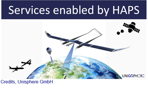
Services enabled by HAPS
Status date: 22 January 2020
HAPS platforms are evolving in the stratosphere to conduct earth observation. They provide large-scale images as a support to decision-making processes in domains like meteorology, security, safety, natural resource inventories, climate change or prevention and monitoring of natural disasters. They provide high versatility, near real-time information and high revisit frequency on their targets
MoSCI
Status date: 20 January 2020
MoSCI - ECOSPACE is a suite of web-based subscription services for storage, processing, visualisation and analysis of earth and airborne observation datasets - spanning over a range of spatial and temporal resolutions, with capacity to deliver meaningful information for overseeing and managing risks to critical infrastructure (CI) in coastal and riverine settlements and be an early-warning decision support system.
HAPS4ESA
Status date: 17 January 2020
A roadmap for combining High Altitude Pseudo-Satellites (HAPS) and satellites for ‘persistent surveillance’ monitoring scenarios.
River Nexus
Status date: 16 January 2020
River Nexus is a life changer for millions of people in the river basins in developing countries. River Nexus offers climate-services based on space-technology applications and the productive use of clean renewable energy to improve the local economy. Through a single infrastructure, we cover local essential needs for sustainable development, while targeting also national and international hydro meteorological value chains.
S4CI – Support for Critical Infrastructure
Status date: 13 January 2020
A monitoring service that provides Critical National Infrastructure (CNI) asset owners and operators with resilience against problems associated with structural health through the use of Earth Observation data and in-situ devices.
Accurate Solution for SUrface movements with tRusted E‐signature
Status date: 20 December 2019
The ASSURE project aims to integrate a space-based application device (GNSS and SatCom) with blockchain technology to continuous monitoring of surface displacements. ASSURE is used to monitor area subject to land deformation and on critical infrastructure subject to external forces endangering their stability with a certified device and thus with certified data.
Cerberus
Status date: 26 November 2019
BlackShore’s crowdsourcing platform Cerberus reinforces developing country economies utilizing satellite imagery amplifying sustainable food production while preserving the environment. This is achieved through the power of satellites, socially conscious gaming and the power of the crowd.
NG-RMP
Status date: 14 November 2019
The Next Generation Recognised Maritime Picture (NG-RMP) provides a real time marine solution for the monitoring of vessels, complemented with advanced decision support. The system provides for risk determination from the viewpoint of either navies and the security of countries EEZ or insurance organisation to determine risk exposure of their marine vessel portfolio in real time worldwide.
DEDALOS SAT
Status date: 28 October 2019
DEDALOS is a low-cost system based on GPS for the static monitoring and early-warning of movements and deformations of critical infrastructures induced by natural (landslides, subsidence, etc.) and/or man- made impacts (excavations, extraction/injection of gases, etc.). DEDALOS SAT project aims to upgrade current system in order to provide:
- full continuity of service by adding satellite data transmission;
- improve reliability through GALILEO data processing.
DeFROST
Status date: 26 September 2019
Based on satellite data, DeFROST delivers the ultimate solution for terrain status monitoring for the Outdoor Tourism Industry. Providers of Digital Outdoor Platforms as well as Outdoor Touristic Destinations require the most accurate and up-to-date data of terrain conditions to be able to take decisions like opening, closing or carrying on maintenance works on a trail, plan marketing campaigns and inform tourists, ultimately keeping them safe.
SnowSense DP
Status date: 23 September 2019
Provision of Snow, Run-off and Hydropower Information for Remote Areas: We are using In-Situ Snow Monitoring, Earth Observation and Model Techniques as innovative solution for the assessment of snow cover, the amount of water stored in it, it’s potential for energy production and the related risk of flood events.

Big data for migration study
Status date: 13 September 2019
“Big Data” refers to new computational capabilities, that warehouse huge set of data, technologies and analytics in order to extract added value from “bulky information” in a reasonable amount of time. The increasing possibilities offered by satellite technologies integrated with collateral data can support the complexity of the migration flow monitoring
GridWatch
Status date: 09 September 2019
GridWatch offers owners of high voltage power infrastructures a continuous monitoring and alarming system to support the inspection, maintenance and management procedures of power lines, and a management system providing the measurements of the parameters necessary to dynamically operate the power lines, i.e. ambient temperature, wind speed and direction, solar irradiance and conductor temperature.
Services Enabled by HAPS (Unisphere)
Status date: 02 September 2019
Within the context of satellites, terrestrial infrastructure and Remotely Piloted Aircraft Systems (RPAS), HAPS are a new platform offering unique advantages, but also complement existing services. Three major HAPS applications have been analyzed within this feasibility study. The concept of “HAPS as a Service” (HaaS) has been introduced and its unique requirements to highly automated flight management were detailed. A follow-up demonstration project with the focus on flight management has emerged from this feasibility study.
BIGMIG
Status date: 02 August 2019
The study aims at identifying possible applications of space data (imagery, navigation data, satellite communications etc.) and other (“big”) data sources to help and improve the mitigation, readiness and response to the human migration phenomena, and to assess their technical and economic viability.

SAFEDEM
Status date: 01 August 2019
Demining has been relying on traditional techniques in order to perform the critical task of Land release. Space assets, EO products above all, provide a practical and effective support in many phases of the demining activities, helping in surveying the mine affected areas in a more detailed and less expensive way.
UNDERSEE
Status date: 26 July 2019
UNDERSEE is committed to develop a scalable solution to bring knowledge about rivers, lakes and oceans to water dependent stakeholders by providing simple access to water quality data.
SatCBRN
Status date: 12 July 2019
SatCBRN explores the use of satellite services for surveillance and hazard management of incidents involving release of chemical, biological, radiological or nuclear threat agents.
SFM
Status date: 04 July 2019
The objective of the SFM project is to formulate an integrated system-service aimed at monitoring and providing real-time information to first responders and decision makers, about the status of the area impacted by a release of agent chemical, bacteriological, and radiological even with explosives (CBRNe).

eOdyn surface currents
Status date: 01 July 2019
eOdyn’s surface currents service enables saving costs and mitigate risks on offshore Oil & Gas marine operations. Simultaneously providing unique information onboard vessels and to onshore support teams, this satellite-based service supports decision making.
SenTAct
Status date: 12 June 2019
The services is a visual communications service for operational management. The service helps teams in the field assimilate information relevant for the local context. We aim to offer a communications platform which leverages Location Intelligence to provide the right information at the right time, and Augmented Reality to ease access and understanding of the information.
GeoSHM Demo Project
Status date: 10 June 2019
The GeoSHM Demo Project implements a pre-operational installation and demonstration across three of the longest bridges in the world. The primary purpose of the project is the integration of GNSS positioning and Earth Observation techniques to enable the Structural Health Monitoring (SHM) of long-span bridges. This project intends to bring the GeoSHM service to the global market incrementally.
Meandair
Status date: 27 May 2019
Every day, pilots have to take difficult decisions about their flight routes avoiding adverse weather and safeguarding fuel-efficiency of their flights. Meandair helps to quickly determine the safest and most fuel-efficient routes for general aviation flights with respect to the ever-changing weather.

ARCT.esa
Status date: 12 April 2019
The ARCTTM stakeholder mapping tool offers visualization of “Project Health” in the cross-roads between society, environment, business and policy. The unique de-risking tool combines climate change risks with other factors and makes them relevant, simple and visual for owner and decision makers of any infrastructure project.
ARCT has also found a fun and engaging way to score and report on the UN Sustainability Goal Climate Action goal #13. www.arct.tools.
ARC-REACH
Status date: 08 April 2019
A number of countries are making preparations to turn the rapidly warming Arctic into a busy global shipping route.
The objective of the ARC-REACH project is to validate the need and feasibility to setup a cost-effective low-power long-range dynamic radio network, tailored for tracking of cargo and maritime activity, complemented with remote sensing of the environment.
AUDROS
Status date: 02 April 2019
The “Autonomous Drone Services in the CBRNe operations” (AUDROS) Feasibility Study assessed the technical feasibility and commercial viability of space-based services in combination with the emerging RPAS technologies which become a game changer in many service domains to improve the monitoring, early warning, surveillance and reaction on CBRNe events and threats.
MIDAS
Status date: 02 April 2019
Land mines and IEDs are a global problem that impact individuals, nations and the international community.
The MIDAS programme uses space services to improve efficiency, coordination, assurance, traceability, autonomy and safety of clearance operations; reducing casualties and returning land to productive use around the world.
European Space-based Information Management System for CBRN (EuroSIM CBRN)
Status date: 22 March 2019
The aim of this project is to investigate the feasibility of developing the next generation of CBRN information management system through the provision of a web-based service model which enables a wide user community to have access to the type of advanced CBRN IM technology already available to the military in the UK, the USA and NATO.

ARCtic Sea-ice and CleAN monitoring
Status date: 17 January 2019
The project brings solution for a systematic and automatic detection of sea ice (including the identification of ice and marginal ice zone) and oil slicks in the Arctic from Sentinel-1 images. Based on Machine Learning (Support Vector Machines), it permits to process automatically thousands of images with high accuracy.

Building Stock Monitor Service
Status date: 09 January 2019
The proposed Building Stock Monitor Service is a service to aid municipalities with monitoring the entire building stock within their geographical borders by using satellite imagery from Sentinels 1 and 2.
The revisit time of these satellites give unprecedented update frequency as opposed to current technology that typically involves fly-bys at high costs.
EMUSER
Status date: 10 December 2018
EMUSER is an innovative obstacle detection system integrated with a satellite Broad Band link for the safety of active level crossings.
EMUSER provides increased resilience in case of natural disasters or damages to the rail infrastructure. It can be installed in areas that are uncovered by conventional communication networks.

SAT-DEFO FS
Status date: 26 November 2018
SAT-DEFO project purpose is to build an app with data-proven, valid, both historical and current information about ground deformations for the inhabitants of the areas who are exposed to such changes (especially in the localizations threatened by ground subsidence caused by mining activity).
RAPSODY
Status date: 19 November 2018
RAPSODY, a project led by TEKEVER, will demonstrate the use of remotely piloted aerial systems (RPAS) in a wide area maritime context, through the execution of search & rescue and pollution monitoring missions. The missions will be executed in near-real scenarios over the Atlantic Ocean. The Satcom-enabled RPAS will be fully prepared and customized to perform these maritime missions, including the integration of specific payloads and the usage of specially tailored mission-oriented data fusion, data compression and automatic feature recognition and identification algorithms.
MSW-Service
Status date: 30 October 2018
We study the feasibility of services that combine,
- High resolution now-casts of strong wind shear, turbulence and other severe weather phenomena, and information of large flocks of birds,
and
- Real-time information and forecasts of the global spatial distribution of space weather effects,
with
- accurate real time position information of aircraft,
to make aviation more safe, effective and economic, with less carbon footprint.

CountFloors
Status date: 22 October 2018
CountFloors (CF) is a service designed to collect and analyse GNSS-geocoded images of buildings acquired at street level together with Sentinel data. CF automatically retrieves ground-level and satellite images on urban areas of interest, and uses a machine learning approach to extract risk-relevant characteristics of buildings depicted in the images. These features are sought after by risk modellers and insurance companies; yet they are of interest also in the real estate market and to the municipalities for their planning.
COHABIT
Status date: 12 September 2018
COHABIT monitors and assesses in real-time the whereabouts of large wild animals and dynamically generates geo-fenced alerts for visitors to avoid dangerous encounters and for farmers to protects their crops and livestock. Wildlife – human cohabitation is made possible through the use of data analytics, image-recognition, animal tracking and space technology.
LUMEN
Status date: 28 August 2018
LUMEN provides a fully integrated end-to-end solution for real time monitoring and critical situation management with medium sized RPAS that can operate beyond line of sight.
The service is demonstrated with two specific use cases representative for the target market: flood extend mapping and maritime coastal monitoring.

SIS-SREM
Status date: 26 July 2018
To improve the safety and the information provision for people planning and undertaking outdoor activities in mountain resorts in the Eastern European market, the SIS-SREM project developed an advanced mountain rescue team management (MRTM) solution for organizations to better coordinate teams during search & rescue missions (S&R) and an Infotainment platform that provides 3D outdoor maps and mobile guidance for visitors, enables new forms of digital marketing and communication and integrates RPAS technology based services.
MiLoW-RRS
Status date: 23 July 2018
MiLoW-RRS is an innovative weather service based on space technologies and space derived data that provides outdoor enthusiasts a one-stop-shop solution for planning multi-day outdoor trips in complex terrains. The service combines maps, elevation profiles and route descriptions with accurate and reliable weather forecasts for planning and undertaking outdoor activities.

AirTracks
Status date: 05 July 2018
Situational awareness is key in the aviation industry. Whereas many flight information services for scheduled air services transporting passengers, mail or cargo already exist, solutions for other parts of the aviation industry are scarce good. AirTracks is a dedicated flight information service solution that focusses on customer information needs in the fields of UAV and general aviation.
Migration Radar 2.0
Status date: 29 May 2018
Migration Radar 2.0 services are aimed at optimizing the prognosis for different stakeholders involved in the field of migration, operating at different roles and capacities. Big datasets stemming from space assets and social media are combined with existing migration datasets to develop information-enriched products, customized to the user needs. Provisioning these products in the form of automated, user-intuitive and flexible services helps the stakeholders in optimizing their decision making processes in a timely and accurate manner.
Big data applications to boost preparedness and response to migration
Status date: 25 May 2018
The study aims at assessing the technical feasibility and economic viability of services enhancing human migration crisis management, through the use of Big Data solutions and RPAS.

AgeSpot Feasibility Study
Status date: 18 May 2018
AgeSpot provides THE starting point for any innovative technological solution addressing ageing populations. It enables efficient targeting of the silver economy and offers precise demographic data on WHERE and HOW MANY age specific classes currently live and will likely live in the FUTURE. With AgeSpot a new Earth Observation (EO) supported business intelligence service is offered.

SeaSearch
Status date: 11 May 2018
Based on mobile phone detectors and data correlation from other sources such as satellite, maritime and radar systems, SeaSearch focuses on the detection of small vessels at sea and generates Maritime Situation Awareness Pictures.
SAFERDANUBE
Status date: 09 April 2018
The SAFERDANUBE system will provide assistance to river vessels operating on the Romanian sector of the Danube river. This is required in summer and winter, to cope with the appearance of ice/sand banks that difficult and/or prevent the navigation. The project’s pilot will demonstrate a service relying on the integration of Satellite Earth Observation data (SAR), Satellite Mobile Communication and Satellite Navigation Services to this aim.
SaMoLoSa
Status date: 06 April 2018
The Ovinto SaMoLoSa demonstration project addresses the use of satellite technology for the reduction of transport risk, security enhancement and optimisation of logistic operations by the tracking and monitoring of extremely dangerous goods in unpowered, mobile transport units such as rail tank cars and intermodal tank containers.

SENSA
Status date: 05 March 2018
The SENSA project aims at a collaborative platform supporting âsustainable & responsible tourismâ in protected remote areas, such as natural parks, natural reserves and historical sites.
B-LiFE
Status date: 18 December 2017
The ESA IAP-ARTES 20 “Biological Light Fieldable Laboratory for Emergencies” (B-LiFE) Demonstration Project is the follow-on of the B-LiFE Feasibility Study and deals with a new service providing biological analytical capabilities with integrated space assets for emergency response during health crises and epidemics.

MAPP-DEMO
Status date: 11 December 2017
Following a pirates' attack, onboard communication equipments are destroyed: the vessel’s track is lost, the research area grows as time passes, making it harder to deploy rescue assets efficiently.
The challenge is to answer to the question: “Where is my ship?”
The ‘Keep in sight’ service combines a hidden tracker installed onboard and EO acquisitions to provide this critical information.

SIMONA
Status date: 17 November 2017
The aim of SIMONA project is to provide an information platform that based on the integration of satellite and terrestrial data can both complement and enhance existing Maritime situation awareness services operated by Italian Coast Guard and Navy over a wide area of the Mediterranean Sea and at the same time provide space-based services bringing functional advantages to private stakeholders like Merchant ships Insurance Companies and leisure boat users.
The technological key is represented by the integration of services from Earth Observation sensors (mainly Cosmo SkyMed Copernicus Landsat and WorldView) Satellite Communications (Orbcom or Iridium) Satellite Navigation (GPS EGNOS Galileo in the future) along with information andor operational services coming from other Institutional (AIS Cadastral Data) andor Private assets (Merchant Ship databases Port Info databases).
SBS-RailS
Status date: 16 October 2017
Space Based Services for Railway Signalling feasibility study shall assess technical feasibility and economic viability of an integrated satellite navigation and satellite communication solution complementing Level 2 European Rail Traffic Management System (ERTMS).
Satellite navigation systems can be integrated with the on-board and wayside signalling systems to guarantee the required level of safety (SIL4) that is today provided by the existing train detection systems, while satellite communication systems can complement or even replace terrestrial communications.
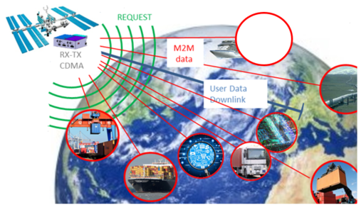
SatApps
Status date: 19 September 2017
Internet of Things/IoT – M2M – industry 4.0 – these headlines are representing large user groups which have an urgent need of a globally available, low-cost, secure data service, dedicated to very small data volumes per sensor and for use also in remote areas. The objective of the study is to perform an in depth requirements analysis on 2 focus pilot user groups: railway transportation and container/waste management.
SUMO
Status date: 05 September 2017
SUMO is a service to assist in the planning and monitoring of marine operations for offshore wind farms. The service integrates diverse information to allow the monitoring and forecasting of metoceanic conditions and track the locations of vessels and personnel involved.
This improves the management and coordination of the construction, operations and maintenance activities and leads to increased efficiency and safety.

Uam®
Status date: 27 July 2017
e2E intends to offer more affordable data communication services into niche markets currently underserved from existing infrastructure or where traditional satellite delivery is too expensive. The core of the service concept builds on two key technologies that have been developed with small airborne IDP networks in mind that incudes RPAS, HAPS and small satellites.
DeSIRE II
Status date: 27 June 2017
DeSIRE II, Second Element of the ESA EDA RPAS Demonstration Roadmap, aims at developing and demonstrating a service based on a Remotely Piloted Aircraft (RPA) flying in Beyond Radio Line of Sight (BRLOS) using a dual satcom link supporting Command and Control (C2) and Air Traffic Control (ATC) functions.
The project also aims at demonstrating to the users the potential of RPAS complemented by satellite applications (Satcom, Satnav and Earth Observation) for developing new services for operations.
Project objectives are pursued by means of a real flight campaign using Piaggio Aerospace P.1HH RPAS, and complemented by simulation and emulation activities.
DAMMINGS
Status date: 24 May 2017
The project designed, developed and carried out pre-operations of a service platform providing an automated and continuous monitoring service of dam infrastructure and its surroundings by integrating GNSS and InSAR space capabilities.
Urban DRR
Status date: 18 April 2017
Applying space based solutions to save lives and critical infrastructure by reducing the risk and impact of natural disasters in urban areas.
SMART
Status date: 22 March 2017
SMART is a system that aims to provide a decision support service targeting the “early warning" of a disaster or critical event (specifically hydro-geological events) and to improve the "first response" intervention capability. The system has the advantage of strengthening the procedures used today by the Civil Protection to collect and manage the data "monitored" without interfering with the current practice.
SafeSki
Status date: 27 February 2017
The SafeSki Demonstration Project covers the pilot implementation of Safety and Information Services for Ski Resorts and succeeds the successfully completed SafeSki Feasibility Study. The SafeSki pilot-demonstration stage aims at increasing the safety and security on slopes, increasing customers and thus revenue, saving time regarding data acquisition and documentation and reducing personnel costs through optimization of internal processes.
Eagle Space
Status date: 11 January 2017
Eagle Space aims at the integration of space based capabilities in crisis management to support the joint combat of natural flooding and wildfire disasters. The proposed concept is based on realising a harmonised awareness of the disaster area and emergency operations between the various emergency entities in different regions with own working cultures.
Intelligent sensor and satellite network (ISSN)
Status date: 02 December 2016
The project is a feasibility study in order to establish whether there are sufficient market opportunities, and the technological maturity for developing a flexible and reliable intelligent sensor network where satellites are among the nodes in the network (ISSN). ISSN has a number of potential application areas in connection with Offshore Oil & Gas exploration and production, environmental surveillance in general, safety, search and rescue, transportation etc.
PIMSIS
Status date: 01 September 2016
To demonstrate the added value of space assets for the monitoring of the integrity and safety of gas & oil transmission pipelines.
TT-GSAT
Status date: 21 July 2016
TT-GSAT facilitates rescue and emergency services as well as industry and service providers to leverage innovations along evaluated needs and requirements, which results in minimized risk for solution development and eases complex deployments in a mission critical environment.
Comprehensive services with scoping services for innovation driven procurement, test and operation support for SatCom and terrestrial communication, navigation, EO based solutions and training/simulation services are offered.
3INSAT
Status date: 07 June 2016
3InSat demonstration project developed, tested and verified a new satellite-based subsystem, based on the Ansaldo STS ERTMS solution, for allowing the SIL4 train localization function at Signalling System Level by using GNSS. 3InSat also implemented an integrated solution based on the combination of SatCom, 3G/4G systems and TETRA to realize the link between the on board train control system and wayside signalling infrastructure.
Electronic Offender Monitoring
Status date: 27 April 2016
Electronic Monitoring (EM) is used by several judicial government bodies worldwide to track offenders on probation or subjected to other forms of legal liberty constraints. This Feasibility Study analysed the technical feasibility and economic viability of an EM system/service featuring Galileo, the European Global Navigation Satellite System (GNSS) and using enhanced cartography and imagery obtained through Earth Observation (EO).
GridWatch FS
Status date: 22 March 2016
The solution intends to provide owners of High Voltage power infrastructures with useful information for supporting the management of both procedures for inspection and maintenance, and dispatching of electrical energy.
SaMoLoSa FS
Status date: 28 January 2016
The Ovinto SaMoLoSa study addresses the use of satellite technology for the reduction of transport risk, security enhancement and optimisation of logistic operations by the tracking and monitoring of extremely dangerous goods in unpowered, mobile transport units such as rail tank cars and intermodal tank containers.

SEA SEARCH
Status date: 26 January 2016
SeaSearch provides detection and identification capabilities of small vessels, agnostic to vessels’ size.
Based on the mobile phone detectors and other sensors such as radars, AIS and SAR, SeaSearch builds Maritime Situational Awareness Pictures.
Sensors are using SeaSearch own developed technology based on Software Defined Radio (SDR).
IDRC
Status date: 26 January 2016
Communication and access to information are key requirements for public safety services responding to an emergency. However communication capabilities are often compromised or destroyed. Reliable alternatives must be rapidly deployed.
The IDRC study defines and assesses the technical and business feasibility of an operational service providing a wider access to the benefits of space capabilities in the first 72 hours.

SASISA
Status date: 25 January 2016
SASISA (Small-Aircraft Service for Instant Situational Awareness) supplies airborne situational awareness support for civil protection operations in the early phases of disaster response. Remote sensing results have often only been accessible after several days. With delivery of georeferenced imagery via satellite broadband during flight and value-added mapping products within a day, SASISA offers transformational change to European emergency management services.

EASY
Status date: 26 November 2015
Together with traditional chartering, new business lines like yacht brokering, manufacturing assistance, luxury cruising are emerging asking for the availability of innovative services on board. These new businesses require a higher grade of liability towards their customers, hence forcing the providers to put more emphasis on systems and services in order to increase the safety and availability of information during the cruise.
SAPI&NS
Status date: 16 September 2015
The SAPI&NS study aims to improve the effectiveness of Search And Rescue operations for civil and military operators (so-called dual use). With satellite communication and satellite navigation, the involved personnel and vehicles (esp. helicopters and boats) can be tracked and status information can be collected.
The solution is conceived to be used across different scenarios (air, ground, sea) and will next to tracking services also offer tools for management and coordination of operations.

GIRP
Status date: 25 August 2015
Subsidence due to clay shrinkage is the largest ground instability issue affecting residential property in the UK (75% of all valid insurance claims) with rectification costs averaging £250m (295m Euro) p.a. Research by the insurance sector (Swiss RE and Lloyds of London) indicates that the extent of subsidence both in the UK and Europe will worsen in line with climate change forecast. The insurance sector equally recognizes the need for significantly improved profiling and predictive tools to identify and target risk mitigation management.
The Ground Instability Risk Profiler (GIRP) service is planned to enable an accurate and predictive ground stability risk profiling service to the insurance industry in a range of flexible formats through the integration of property data sources and satellite information.

EFFORS-FS
Status date: 25 August 2015
The aim of the present feasibility study is to develop an Enhanced Flood Forecasting System for Critical Infrastructures Protection in medium size Alpine catchments.The service is designed to address infrastructure located either on the river itself (e.g. bridge) or in the flood plan (e.g. a building).
Mimir 2.0
Status date: 18 August 2015
The project will continue the development of the Mímir server, Forsway’s solution for satellite hubs providing one-way Internet over satellite. The product will be extended to be a usable component in all types of one-way Internet over satellite deployments, covering deployments from small ISPs with a few hundred users to the largest operators with high performance multi-transponder services covering several million users.
SatResponse
Status date: 06 August 2015
The frequency and impact of natural and man-made disasters is increasing, resulting in needs for better response efforts.
Satellites provide a secure, resilient, always-on infrastructure for dealing with emergency situations; however cost and availability problems often hamper their effective use.
SatResponse investigated new technical, commercial and operational models for delivering better satellite communications and other space-based application services to Disaster Responders.
SAFETREE
Status date: 05 August 2015
Satellite Support to Forest Fires Airborne Patrol (SAFETREE) aims at improving efficiency of the airborne patrols within the Airborne Fire-fighting Service (AFS) that secure the forest fire prevention in the Czech Republic. SAFETREE service is designed to support AFS in the decision making on airborne patrol dispatch and routing based on integration of Earth Observation and Satellite Navigation technologies.

PloughStars
Status date: 04 August 2015
Plough Stars is a feasibility study and part ESA’s Integrated Applications Promotion (IAP) Programme. The industrial team led by Berner & Mattner investigates new services and applications for improving winter road maintenance. Existing, mainly terrestrial, systems are enhanced with space-based technologies. Users and stakeholders involved in winter road maintenance benefit from this system through increased performance and a simplified routine.
Salt Water Surface Water Monitoring
Status date: 16 July 2015
BlueLeg Monitor (BLM) from the Netherlands investigates the use of its proprietary remote sensing technology for water quality monitoring in aquaculture. In particular Hazardous Algal Blooms create serious damage to aquaculture by incidentally suffocating fish and the release of toxins. This tendency is expected to increase as a result of global warming and nutrients run off into surface water, as well as by transport of invasive species of algae due to the release of untreated ballast water from ocean ships.
Arctic IAP
Status date: 08 July 2015
Telespazio VEGA UK are developing a range of value-added services using layers of geo-information and commercial data that can be customised to the needs of specific operators. The services include primarily satellite derived imagery VMS (24/7 Vessel Monitoring System) from the Telespazio Group, AIS (Automatic Identification System) provided by Canadian consortium member exactEarth Europe Ltd, and low bandwidth high fidelity image transfer system AnsuR, a Norwegian company.
Maritime expertise and access to the market through Marine South East and additional maritime data layers are provided by Stevenson Astrosat and HR Wallingford.
This solution presents a viable Arctic Integrated Situational Awareness Service building upon existing operational or semi-operational services provided by consortium members, and adding additional features believed to be of value to the user community that will help to differentiate and ensure the success of the service.
SARONTAR
Status date: 19 June 2015
The SARONTAR (Situational Awareness and Command & Control of Rescue Forces in Alpine Regions) project comprises the demonstration and pilot implementation of a satellite-supported operations control system for a more effective and a more coordinated proceeding of the rescue forces in alpine rescue missions.
It is based on GNSS for positioning and navigation. Topographic maps and high resolution orthophotos form the basis for geoinformation. As communication techniques, terrestrial and satellite communication is used to provide a high level of reliability and thus seamless communication between rescue forces, mission controllers and emergency management centres.
TIM
Status date: 16 June 2015
Efficient asset management is required to meet increasingly stringent demands on safety and reliable performance of new and ageing infrastructure under varying and sometimes hazardous environments. The Transport Infrastructure Management (TIM) Service is planned as a new generation of asset monitoring services that can be deployed across multinational organizations. The concept is based on the integration of location and mapping capabilities of space assets and ground local point sensor networks - delivering data in the most efficient manner.

DDM
Status date: 03 June 2015
The Dam and Dike Monitor (DDM) is an innovative tool that aims at providing better information (in near real time) for dam and dike maintenance and flood management. An on-line interface is provided to the users showing the actual risks of dam and dike failures, based on dam and dike monitoring techniques and flood forecasting. As the Dam and Dike Monitor is internet based, there is no need to develop ad-hoc software and hardware infrastructure.
SIS-SREM Feasibility Study
Status date: 03 June 2015
The SIS-SREM (Safety and Information Systems for Ski Resorts in Emerging Markets) feasibility study investigates and assesses the technical feasibility and commercial viability of a sustainable service which will support the management of ski resorts (development, operation, maintenance) in order to reduce the operational cost and services which support safety and enjoyment of their visitors.

IAP-Copernicus
Status date: 08 May 2015
The IAP-Copernicus study addresses the use of space assets, combined with terrestrial « web2mobile » technologies, in the provision of reliable, ad-hoc information to all stakeholders involved in the monitoring of risks and mitigation of hazards impacting people. The study focuses on the development of an economically sustainable « Business Services Platform » for two use cases: public safety in Belgium and food security in Senegal.

SFEDONA
Status date: 25 March 2015
The SFEDONA project aims to design, develop, validate and demonstrate a complete end-to-end fire detection and alerting application which makes use of state-of-the-art fire detection technologies based on terrestrial optical cameras and sensors, data fusion, satellite and wireless communications as well as modern IT technologies.
CyMonS FS
Status date: 02 February 2015
The consortium, led by surface water quality specialist BlueLeg Monitor (BLM) from Sneek, the Netherlands, has executed a contract with the European Space Agency (ESA) under the Integrated Application Promotion (IAP) program to develop services for the monitoring of blue green algae or cyanobacteria under the project acronym CyMonS: cyanobacteria monitoring services.
SafeRail
Status date: 14 January 2015
The objective of SafeRail is to improve the safety at Rail Level Crossings (RLC). In terms of accident prevention, RLC are demanding spots since two disparate transportation systems are intersecting (road, rail respectively) and neither of them completely controls the situation. In response to this, SafeRail provides a flexible and secure solution at a moderate price, using latest advancements in satellite technology.
AAF
Status date: 03 December 2014
Snow avalanches kill people and damage infrastructure in mountainous regions worldwide. Avalanche warning services base their products mainly on numerical weather prediction outputs, networks of automatic stations and observers in the field. Presently many European networks are not dense enough and observations by people in the field are hindered by bad weather conditions or high avalanche danger.

SafeSki FS
Status date: 17 November 2014
SafeSki is a feasibility study aimed at creating an innovative concept for user-friendly information services, which support the operators of ski resorts in the management while increasing safety, the portfolio of services offered to skiers, snowboarders, etc., and reducing operational costs.
OTMOSERA
Status date: 29 August 2014
The purpose of the fast track feasibility study 'Open Trail Map / Open Solutions for enhanced Situation Awareness and efficient Emergency Response Actions in Mountainous Regions - OTM / OSERA' was to investigate and assess the technical feasibility and commercial viability of sustainable services to support the management and maintenance of hiking paths and trail maps, to support the safety and enjoyment of their visitors, to reduce the operational cost, and to prepare the follow-on steps for the implementation of such services.
SnowSense
Status date: 08 July 2014
SnowSense aims at the qualitative, spatial and temporal improvement of available snow information (snow covered area, snow parameters). It integrates space and ground-based assets to achieve this target. The project has won the 2013 ESA IAP IntegSpace Award.
ISABELIA
Status date: 27 June 2014
The ISABELIA Feasibility Study specified and validated the sustainability of services and that would provide users at sea with near real time information on dangerous ice situations, indicators of collision risk and on risk of grounding, thereby improving the safety of vessels in the Baltic Sea.
REACT
Status date: 14 April 2014
The REACT project involves the project consortium working with the Irish Dublin Fire Brigade to develop a system that will ensure constant and reliable communication for exchange of real-time information between deployed emergency response personnel and its relevant command centre during a crisis or disaster situation.
InsureApp Service
Status date: 01 April 2014
This feasibility study carries out an analysis of the most critical elements with respect to technical feasibility and viability (economic as well as non-economic) of a web application aimed at improving the efficiency of the management of insurance claims with a focus on weather-related hazards

LUMEN
Status date: 07 March 2014
LUMEN (Light UAS in non-segregated airspace for Maritime and Environmental surveillance) is a demonstration project aiming at promoting the operational use of a light RPAS (Remote Piloted Aircraft Systems) for Maritime surveillance and Environmental (Flood) monitoring delivering real-time information to the end-users. For this, the LUMEN system combines different space technologies: GNSS (Global Navigation Satellite Signals) for navigation of the RPAS and geo-correction of the acquired data and real-time satellite communication to transfer the acquired data from the Ground Control Station to the service provider.
SASISA FS
Status date: 13 June 2013
SASISA assesses and validates a new service that enables emergency and disaster relief organisations to exploit overhead remote sensing during the most critical initial response phase for improved situational awareness.
DeSIRE
Status date: 30 May 2013
The DeSIRE (Demonstration of Satellites enabling the Insertion of RPAS in Europe) demonstration project is a joint ESA-EDA initiative aimed at demonstrating the safe insertion of Remotely Piloted Aircraft Systems (RPAS) in non-segregated airspace using satellites capabilities for RPAS command and control, ATC communications and Mission data transfer to ground, in order to satisfy the needs of potential user communities. The demonstration will be carried out in Spain through several flights using a RPAS (Heron 1) providing airborne maritime surveillance services to the Spanish Users involved in the project.
FAAPS
Status date: 19 March 2013
Floods affect more people and cause more property damage than many other natural hazards. FAAPS (Fully Automatic Aqua Processing Service) proposes to support emergency management professionals with the provision of flood extent maps even in rain conditions and over large areas.

Integrating Space Assets for UK Civil Resilience
Status date: 24 September 2012
The project is aimed at integrating space assets in a manner that will better serve the UK resilience community during crisis response. The goal is to provide a service that enhances the responder and decision maker tool-kits through the integration of existing space capabilities.

SAFEDEM Feasibility Study
Status date: 27 August 2012
Nowadays landmines and Explosive Remnants of War (ERW) still represent a danger for civilians, even long after conflicts. In addition, both dramatically hinder the recovery of economies impacted by a conflict, because resources located within areas such as arable land, infrastructure and water suspected of mine contamination cannot be exploited. In the SAFEDEM project, innovative methodologies based on well suited space assets will be exploited for an integrated end-to-end demining assistance service.
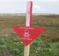
SADA
Status date: 22 June 2012
The SADA projects aim to improve the socio-economic impact of land release activities in Mine Action. Three parallel feasibility studies have been evaluating the use of space assets to assist the Mine Action community, with a broad scope, covering activities such as risk and impact analysis, planning, resource management, field operations and reporting.
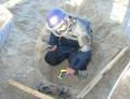
INSA
Status date: 15 June 2012
The project utilizes satellite images, in situ data and historical data dericing technical conclusions helping decision makers in their tasks of land prioritizing and allocating the use of mine action resources to improve socio-economic impact as well as avoiding unnecessary deployments of clearance activities in non-contaminated areas. Navigation and satellite communications help to streamline field activities, logging and shared database access, as well as to support collection and georeferencing of airborne data.
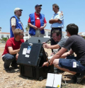
Infoterra
Status date: 21 May 2012
This study was designed to determine the feasibility of the use of space assets such as satellite communications, positioning, and Earth Observation to support the humanitarian mine action community.

Land Border Control
Status date: 12 January 2012
The surveillance of borders is an essential function of a state, and is a topic that has gained increased concern in recent years. This study focuses on land border surveillance - a multifaceted and complex topic touching on some of the most critical security challenges of the moment.
Birdstrike
Status date: 20 May 2010
The present activity is concerned with reducing the risk to civil aviation of an accident in the airport airspace environment as a result of bird strike.