
Food production and agriculture continues to be a key sector worldwide. The combination and integration of space-based systems and terrestrial resources provides an increasing potential for customized solutions and innovative service. Are as of interest include yield optimisation while minimising the impact on the environment based on precision farming and enhanced irrigation management. Services may also include crop monitoring and evaluation for agricultural statistics and regulatory aspects.
QualityTime
Status date: 10 July 2026
Farmers need reliable, timely insight into crop development to plan harvest, labour and sales with confidence. QualityTime helps them make these decisions by providing trusted monitoring of crop maturity using satellite and drone observations over time. By ensuring consistent data quality, the service supports growers and advisors with dependable information exactly when it matters most.

STELLAGRI
Status date: 07 July 2026
STELLAGRI delivers independent, AI-powered crop intelligence from satellite data.
Corporates gain seamless ERP integration and reliable supply insights — without farmer input.
Small farms access precise analytics for any field size.
From vegetation indexes to crop recognition and alerts, STELLAGRI turns raw imagery into actionable decisions across the entire agricultural value chain.
All-Weather COVER
Status date: 06 July 2026
All-Weather COVER demonstrates an Earth-observation service for parcel-level catch-crop monitoring. By combining satellite data, the service delivers frequent, auditable coverage indicators and early-warning signals that help reduce inconclusive cases, target inspections, and document compliance decisions.
CarbonTrace
Status date: 06 July 2026
CarbonTrace makes voluntary carbon markets accessible to small and medium-scale tropical agroforestry producers by replacing costly manual field surveys with satellite-derived carbon monitoring. Using ESA Sentinel-1 and Sentinel-2 data, the service produces investor-grade carbon accounts at a fraction of the cost of current methods, unlocking carbon revenue for farmers previously excluded by measurement costs.
AEODAS
Status date: 30 June 2026
AEODAS is an actionable disease alert service that prevents late blight outbreaks in potato and tomato cultivation by sending out localised alerts with detailed spraying advice at times when the crop is at risk. The service is powered by daily earth observation satellite imagery and hourly weather parameters. AEODAS targets large industrial players in the agricultural domain throughout Southeast Asia like crop processors, crop insurers and micro-finance providers who will be able to mitigate risk and enhance their business operations.
AgroSense
Status date: 25 June 2026
AgroSense is a satellite-based service that automates compliance monitoring of catch crops and rare agricultural land uses for the Danish Agency for Green Transition and Aquatic Environment (SGAV), supporting Denmark's delivery of the EU Common Agricultural Policy Area Monitoring System obligations.

CROPWATCH
Status date: 19 June 2026
CROPWATCH uses Earth Observation, field spectral measurements, IoT weather data and AI to support early detection and monitoring of crop pathogens. The service helps farmers, agronomists and food producers reduce crop losses, optimise plant protection treatments and support more sustainable agriculture.
EO4CarbonFarming
Status date: 16 June 2026
The project aims to develop a service for monitoring, reporting and verification (MRV) of agricultural measures to bind CO2 in the soil as a part of “Carbon Farming”. The tool will be able to monitor catch crops, report on farming practices for higher carbon sequestration and verify organic carbon build-up in the soil.
OWL – ST
Status date: 15 June 2026
Half of Earth’s thermal dynamics happen at night. Constellr unlocks high‑resolution nighttime Land Surface Temperature at 10 and 30 m, daily. New insights for urban heat, agriculture resilience, and climate intelligence, after sunset.
SAT-IS(F)ACTION
Status date: 12 June 2026
SAT-IS(F)ACTION™ delivers satellite-enabled tracking, predictive maintenance, and trusted insurance data for refrigerated food cargo. Combining GNSS, SatCOM, Edge AI, and blockchain, it improves cold-chain visibility, detects anomalies in real time, and certifies shipment data—reducing waste, costs, and claims while enabling new embedded insurance models.

GreenClaims
Status date: 10 June 2026
This project develops an ESG verification platform integrating Earth Observation data with AI-driven analytics to independently verify corporate environmental claims in land-intensive sectors including mining, oil & gas, agriculture, and renewable energy. By combining satellite imagery analysis with natural language processing of corporate disclosures, the service provides scalable, evidence-based verification to support regulatory compliance and combat greenwashing.

3C
Status date: 04 June 2026
3C provides the Parcel Sustainability Passport (PSP) that uses advanced remote sensing & geospatial technologies to give corporate buyers verified proof of climate smart farming practices for carbon accounting and supply chain MRV (Monitoring, Reporting, Verification). The PSP reduces costs, cuts fraud risk and increases credibility of MRV processes compared to classical methods (physical site visits, extensive soil sampling).
CoverCrop
Status date: 04 June 2026
HotPay
Status date: 03 June 2026
Using satellite Earth Observation and AI to generate auditable heat indices that trigger parametric insurance payouts during extreme heat events, enabling faster and more transparent climate risk protection.

ProveDMR_DP
Status date: 02 June 2026
ProvDMR provides continuous digital measurement, monitoring and reporting of immutable data for Nature-Based Solutions in the world’s grasslands.
This allows our customers to sustainably increase agricultural productivity, while protecting and restoring habitat and creating higher-value nature-based credits.
Our overall solution can lead to an increase in the performance and economic value of nature-based projects in the world's grasslands and wetlands.

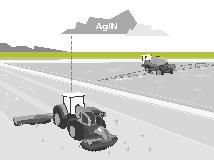
FarmBull
Status date: 29 May 2026
The FarmBull robot is designed for autonomous agricultural work across a wide range of applications. Its modular design can be tailored to specific customer requirements and configured with a variety of attachments for different tasks.
Robust, reliable and high-performing, it embodies engineering excellence and German quality.
SAiBees
Status date: 13 May 2026
SAiBees uses satellite Earth observation, environmental data and artificial intelligence to support sustainable beekeeping. By analysing environmental and climatic conditions, the service provides insights on nectar resource availability, habitat quality, and potential stress factors affecting bee colonies, helping beekeepers make more informed management decisions.
TRANSFORM
Status date: 08 May 2026
A circular indoor vegetable production system combining a space-designed adaptive greenhouse with a terrestrial microalgae wastewater treatment system, targeting both Earth and space-based food production optimization and water purification.
PREDIFAN
Status date: 08 May 2026
PREDIFAN is an ESA-supported project aiming to develop an operational early-warning service for harmful algal blooms (HABs) affecting salmon farming in Chile.
By combining satellite Earth observation data, in-situ measurements, and advanced modelling, the service delivers predictive insights and real-time alerts to help aquaculture operators anticipate risks, reduce fish mortality, and optimize farm management decisions.
MoReTraCeS
Status date: 08 May 2026
This project covered the market-driven product development activities for the soil carbon monitoring tool offered by CinSOIL, with a focus on understanding the needs and challenges of agrifood stakeholders like farmers, cooperatives, and small and medium companies in the agrifood sector.
STREAMO
Status date: 07 May 2026
STREAMO is a commercial downstream application seamlessly merging satellite and stratospheric Earth Observation data. Focusing on urban/mountain environments, the platform provides very-high-resolution, near real-time updated maps and insights like vegetation and thermal gradients. It offers a centralized marketplace for accessing archived products and requesting on-demand stratospheric tasking to bridge the gap between satellites and drones.

CropCloud
Status date: 07 May 2026
CropCloud delivers automated field boundary delineation and agricultural event marker detection from Copernicus Sentinel imagery using deep learning and proprietary super-resolution. The service supports Paying Agencies and enterprise platforms with scalable APIs, achieving 95%+ accuracy across 8 event markers in a pilot with the Lithuanian National Paying Agency.

EO-INSURE
Status date: 23 April 2026
EO INSURE is a service for the insurance world that combine Sentinel-1 SAR and Sentinel-2 optical imagery with weather and fielddata to detect abiotic damages in orchards, tailored to insurance workflows. This new feature opens the doors toward continuous monitoring, rapid event verification, fraud mitigation, and portfolio-level risk monitoring for insurers, brokers, and reinsurers.
RegenAg – MRV
Status date: 15 April 2026
The RegenAg – MRV service provides monitoring, reporting and verification of regenerative agricultural practices, such as cover cropping, no residue burn, crop rotation and improved irrigation. Through innovate use of satellite earth observation and geospatial analytics, cropping systems, irrigation techniques, soil treatment and residue management are monitored and evaluated. The service facilitates high-integrity farm carbon and sustainable farming projects.

SAIA DP
Status date: 14 April 2026
To support agricultural insurers in claim management and risk management, satellite data is used to support the assessment of current damage caused by weather events and to estimate the risk of future damage to a field.
OCTAVE
Status date: 07 April 2026
OCTAVE (Organic Cotton Tracking & Verification Engine) is a space-enabled traceability platform integrating Earth Observation, AI, blockchain, and isotopic science to verify organic cotton from farm to fibre. It delivers tamper-proof geo-traceability, fraud detection, and regulatory compliance for sustainable textile supply chains.

AgroMAP Pro
Status date: 07 April 2026
AgroMAP Pro is a space-enabled farm management solution leveraging Sentinel-2 satellite data and advanced analytics to automate monitoring, reporting, and compliance. The platform reduces administrative burden, improves data accuracy, and supports sustainable, data-driven agriculture while ensuring alignment with European Union subsidy requirements.
Next-Gen Coastal DEM
Status date: 17 March 2026
Ocean Ledger is developing a next-generation stochastic storm surge model underpinned by enhanced digital elevation models that account for erosion, seabed depth and coastal defenses using earth observation and AI. Their product enables precise underwriting, cost-effective risk engineering and asset-surveillance for property & infrastructure along the coastline.
MUPO
Status date: 13 March 2026
MUPO enables the digitalization of agriculture with smart livestock and stable management
by supporting robotics to:
+ Minimize physical labour for farmers and mitigate workforce shortages.
+ Provide appropriate housing for animals and support their welfare.
+ Contribute to reduce greenhouse gas emissions in livestock farming.
BioMoss
Status date: 10 March 2026
BioMosS provides accurate and scalable biodiversity monitoring by fusing ground-truth IoT BioT sensors with satellite data. The platform delivers automated species identification and microclimate telemetry to support corporate compliance and nature restoration, achieving near-perfect precision across a 10,000+ species library.
SAT2LEAF
Status date: 10 March 2026
SAT2LEAF (Urban and Peri-Urban Crops Monitoring through Satellite Earth Observation and Leaf-Level Data Fusion) combines satellite data from Copernicus Sentinel-2 with AI-driven plant-level diagnostics via Agrobit’s iAgro mobile app. It enables real-time monitoring and spatialization of crop health, CO₂ absorption, and diseases in urban and peri-urban farms, empowering cities and citizens with data-driven tools for sustainable food production.
MaizEO_demo
Status date: 10 March 2026
MaizEO_demo project aims to boost maize farming efficiency in Central Europe by offering precise advice in corn cultivation from sowing to harvests (the precise sowing, fertilization, protection, crop monitoring and yield prediction) using Earth Observation.

EM-Grow
Status date: 06 March 2026
The project demonstrates an herbicide-free robotic weed control service using GNSS and RTK for precision navigation. An autonomous fleet identifies and removes weeds, supporting organic farming, improving yield, and increasing livestock safety. The service is delivered through a Robots-as-a-Service (RaaS) model operated by trained contractors.
GEOFENCE
Status date: 06 March 2026
GEOFENCE aims at achieving high-integrity, high-availability while maximizing land area utilization by intelligently fusing data from the core sensor suite, specifically addressing GNSS vulnerabilities in typical agricultural settings.
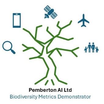
Pemberton Biodiversity monitoring tool
Status date: 05 March 2026
The Pemberton Biodiversity Portal leverages a time series of UAV, aerial, and satellite data, alongside derived data which is ground-truthed and then compiled into a federated biodiversity metrics dataset to provide data consumers with accredited automated remote measurement and tracking of biodiversity.
CropSnap
Status date: 26 February 2026
This service blends satellite insights with simple smartphone photos to monitor crops. By uniting Sentinel-1 and Sentinel-2 data with on-field images and weather trends, it delivers fast, accurate, and affordable loss assessments. The result: quicker claims, lower insurance costs, and stronger protection for smallholder farmers in India—scalable to global agriculture.

BirdWatch
Status date: 25 February 2026
BirdWatch is an early-warning system that uses satellite data and in-shed sensors to predict disease, environmental and welfare risks across poultry farms, helping integrators and farmers act earlier and reduce losses.
RTIS
Status date: 10 February 2026
DataCosmos is Open Cosmos’ proprietary platform for storing and analysing satellite imagery.
RTIS is a near-real-time information system. By leveraging DataCosmos to detect and monitor oil spills and water turbidity in the middle east with rapid delivery time, RTIS will enable the rapid response to critical situations.
CottonWISE
Status date: 26 January 2026
CottonWISE applies Earth Observation to quantify water use and water productivity in cotton cultivation. The project addresses the lack of objective, scalable water metrics in sustainability certification by providing independent monitoring to support irrigation management, benchmarking and verification across the cotton value chain.

SOCMo 4 RegAg
Status date: 04 December 2025
The SOCMO project aims to develop and validate a service to provide soil health information using Earth Observation data to monitor Soil Organic Carbon (SOC) of lands and crops. The final objective is to develop an easy-to-use and competitive framework for land restoration initiatives to keep track of the changes in SOC.
REALM
Status date: 14 November 2025
This project develops a digital tool that transforms satellite Earth Observation data into actionable insights for municipalities and farmers. It recommends regenerative land management practices, enhancing soil health, water retention, and climate resilience. By linking data with decision-making, it empowers sustainable landscape planning and supports long-term community benefits.

MFT-ESACA01
Status date: 14 November 2025
The project applies MinFarm Tech’s optimized LoRaWAN over SatCom software stack and network architecture for a demo project where an end-to-end remote livestock and wildlife tracking service is provided using IoT technology and Satellite Communications.
SoilZone
Status date: 11 November 2025
Soil variability in a field is a key source of information for the modern farmer. SoilZone helps farmers, advisors and soil laboratories to select the right spots to sample the soil. We also provide the means to actually use these soil data in smart farming solutions.

RASFarm
Status date: 07 November 2025
RASFarm is a collaborative robot system exploiting the integration of mechanical technologies, artificial intelligence and satellite navigation to autonomously carry out different agricultural operations (plants and fruits monitoring, spraying and picking).
Weed Detector
Status date: 01 November 2025
Weed Detector is an AI Camera based system that is detecting rumex obtusifolius in grassland. It creates a spot application map using satellite correction signals for the geo-reference of the weed plants.
BeeSentry
Status date: 01 November 2025
BeeSentry by Apisense Sp. z o.o. aims to help beekeepers detect and monitor Varroa mite infestations using IoT sensors, satellite imagery, and AI. The system provides real-time hive health data and alerts to mitigate parasite spread, supporting sustainable beekeeping practices.

SC
Status date: 24 October 2025
SmartCane a digital advisory service designed to help sugarcane farmers and millers make smarter, faster, and more sustainable decisions in the field. Using high-resolution satellite imagery and crop-specific models, SmartCane delivers weekly, easy-to-use reports that show exactly how your sugarcane is growing—and where it needs attention. Farmers using SmartCane record increased yields, against constant OPEX.
SmartCane supports sugarcane growers and millers by providing crop and management advice through SMS messages and phone-friendly PDF maps, based on remote sensing data, keeping the daily reality of the growers in mind. Messages offer practical advice and support for decision-making and resource management, promoting sustainable practices and problem-solving. Our approach allows farmers to quickly determine their next steps. With real-time data, estates and farmers can now make informed decisions for maximum impact.
OGOR WORKSPACE
Status date: 22 October 2025
OGOR Workspace addresses the overwhelming disconnect between the analytical aspect of agriculture (agronomy), farm operations, seasonal retrospective and the engagement of multiple stakeholders. Our solution is to upgrade our satellite data products to a live collaborative workspace that enables: a systematic approach to planning, executing and inspecting agricultural work, early response to deviations in crop evolution or unforeseen events, informed decision making and overall increase of yields and profitability.
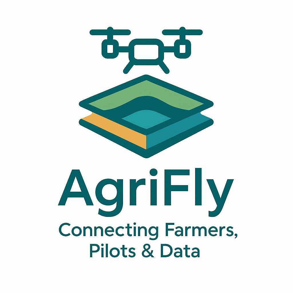
AgriFly
Status date: 25 September 2025
AgriFly is a digital marketplace that connects farmers, advisors, drone pilots and analytics providers through one automated workflow. Built on Plan2Fly, it turns drone imagery into ready-to-use outputs (e.g., spray maps, drainage layouts, tree inventories), leveraging GNSS/RTK and EO to deliver precise, scalable services at lower cost
FARMEX
Status date: 24 September 2025
FARMEX is the adapted version of the original Farmstar service, developed and operated in France by Airbus since 2005. As the leading Precision Agriculture service based on EO in France, Farmstar helps farmers in optimizing the nitrogen inputs in their fields, not only to comply with regulations but also to streamline their operating costs. This project aims to adapt Farmstar to multiple European countries.
https://business.esa.int/projects and search results.
SatMRV
Status date: 24 September 2025
SatMRV combines satellite imagery and in-situ observations to provide precise, cost-effective Soil Organic Carbon (SOC) mapping for Soil Carbon MRV (monitoring, reporting, and verification), enabling carbon credit creation and supporting regenerative agriculture.
HabiTracker
Status date: 04 September 2025
HabiTracker is a habitat mapping & biodiversity monitoring service concept that combines Earth Observation data with ground-based IoT sensors to help UK farmers meet environmental reporting requirements and unlock nature-based financial opportunities. Developed by Terrabotics, it provides real-time ecosystem insights, regulatory-compliant reports, and practical recommendations that enhance ecosystem health while supporting farm productivity and sustainability.
BasinMeter
Status date: 04 September 2025
BasinMeter is a platform that supports users to assess current water risks and trends for the basin they are active in. Furthermore, it defines possible actions to reduce their water footprint and water risks to achieve Net Positive Water Impact (NPWI) targets.

GEMS
Status date: 04 September 2025
GEMS is pioneering the development of advanced emissions tracking solutions. Leveraging cutting-edge Earth Observation data from the Copernicus satellite services, our platform enables near real-time detection, identification, and monitoring of NO2/NOx and SO2 emissions sources across Europe. GEMS platform, address a growing demand for accurate emissions tracking, driven by evolving environmental regulations and the increasing focus on sustainable industrial practices.
BodenPulse
Status date: 27 August 2025
BodenPulse is an agricultural technology project that provides farmers with a smart fertilization planner. The platform uses satellite data and in-situ soil measurements collected by an innovative soil enzymatic activity reader to create locally tailored plans. This optimizes fertilizer use, reduces costs, increases crop yield, and minimizes pollution from agricultural runoff and gas emissions.

GreenerCotton
Status date: 25 August 2025
GreenerCotton services support the implementation, certification, and transparency of sustainable cotton standards with satellite enabled technology. The EO-based platform developed within the project can be integrated into external IT systems like Farm Management software or Traceability systems via API. GreenerCotton is targeting two main use cases: 1. Supporting standardisation companies in implementation and certification 2. Supporting extension services (field advisory) to implement standards and improve production.

BAT
Status date: 08 August 2025
Unlock Nature’s Signals with Fauna’s Biodiversity Assessment Tool (BAT)
Forests are under pressure! From pests, disease, and climate stress. Fauna Smart Technologies is developing BAT: a groundbreaking digital tool that listens to nature through ecoacoustics,satellite imagery and machine learning to help forest managers detect early signs of ecosystem stress and protect biodiversity.
RaumZeit
Status date: 07 July 2025
RaumZeit develops advanced risk assessment for supply chain compliance with the EU Deforestation Regulation (EUDR). With the product offering TradeAware, LiveEO offers an End-to-End software solution for traders and operators of complex supply chains, where users can independently upload geolocations, request precision analytics of deforestation risk, and move straight to automated Due Diligence generation, all within the same system.

S4D and dMRV
Status date: 04 July 2025
Seqana delivers a cost-effective Monitoring, Reporting, and Verification (MRV) solution for agrifood companies, carbon project developers, and farming platforms. Using satellite data and machine learning, we map soil carbon levels and reduce the need for physical sampling, which cuts costs without compromising accuracy. Our approach enhances scalability, compliance, and transparency, enabling smarter, data-driven carbon farming.
GeoFusion
Status date: 01 July 2025
A geospatial intelligence platform leveraging satellite data to optimize CAP compliance, agricultural monitoring, and natural capital management. The project delivers scalable, data-driven solutions for farmers, policymakers, and businesses, enhancing efficiency, sustainability, and regulatory adherence while driving innovation in biodiversity and nature finance markets.
SIA4AGRI
Status date: 24 June 2025
SIA4Agri modernizes the use of irrigation to minimize farmers’ environmental impact and increase the plasticity of adaptation of this agro-industry to environmental climate changes, higher temperature and water shortage.
DWR
Status date: 17 June 2025
The Digitising Water Resilience project, led by Krucial in collaboration with SAS Analytics, Deep Planet, SRUC, and the University of Strathclyde, has demonstrated the feasibility of a globally scalable solution for monitoring water stress. Combining IoT sensors, Earth Observation (EO) data, and advanced analytics, the solution provides actionable insights to address water quality and quantity challenges. This innovative approach supports better decision-making, sustainability, and regulatory compliance in diverse sectors and geographies.
TAVAP
Status date: 16 June 2025
TAVAP optimises farm operations by utilising SAR-based crop growth models and weather forecasts. It helps farmers plan ahead, prioritise actions, create precision farming maps, and efficiently allocate resources like fertilizers and protective agents through variable rate applications.
AquaMap
Status date: 04 June 2025
AquaMap is Marble Imaging’s geospatial decision-support tool that uses Earth Observation (EO) data and environmental data to identify optimal aquaculture sites, supporting food security and reducing financial losses. With global seafood demand soaring and EO-based solutions still nascent, AquaMap taps into a high growth market with scalable, data driven analytics. By computing an Aquaculture Suitability Index (ASI), AquaMap presents an easily understandable scalable way to identify optimal locations, mitigate risks, and improve sustainability in aquaculture planning and investment

NUE Scope Project 1
Status date: 04 June 2025
A revolutionary data-driven Decision Support Tool that leverages EO and AI to enable food producers to increase yields whilst lowering costs and emissions due to nitrogen application.
DT4CMI
Status date: 29 April 2025
Leveraging space assets (Earth Observation and Satellite Communication) to develop a Digital Twin tool as a service, supporting sustainable and resilient agriculture in Africa.
AQUAFARM 2.0
Status date: 25 April 2025
Hidromod's AquaFarm project focuses on optimizing water management, integrating field-level monitoring and modeling with national-scale analysis. It enables sustainable resource use, and improved crop productivity through advanced simulation tools and decision-support systems tailored for water managers and policymakers.

nEmO
Status date: 25 April 2025
The ambition of nEmO is to deliver fish catch predictions through data models that integrate fishing activity and environmental data, complemented by an EO-based toolbox. This toolbox displays environmental maps and offers simple multivariate analysis for selected fish species, providing valuable insights for fishermen. Integrating fish catch predictions and EO-based information enables to create more accurate assessments of fish stock abundance and maximizing operational usability within the industry. This synergy strengthens the effectiveness of the service, increasing the likelihood of market acceptance and adoption.
Alizeti
Status date: 15 April 2025
The “Alizeti” project was designed to help smallholder farmers growing high-value crops in Kenya to produce better harvests and to sell them more efficiently to the organisations who further process and sell them. Four pilot clients in the project were provided with custom-built dashboards on the agriBORA platform based on in-situ and remotely sensed data.
AmmonEO
Status date: 07 March 2025
The purpose of the project is to validate the feasibility of using new Earth Observation (EO) products to monitor atmospheric ammonia concentrations from agriculture. This information can help farmers and government agencies understand emissions at the individual farm level. This is the potential catalyst for improved low-emission farm management practices.

SIDPPAI
Status date: 05 March 2025
A group of Agriculture analytics services using geospatial data and AI, provided through APIs to players of the Ag industry.
Scalable Earth Blox
Status date: 26 February 2025
Scalable Earth Blox has transformed the Earth Blox platform into a fully-fledged SaaS enabling non-coders to create, on the cloud and on-demand, customised geospatial solutions and insights with ease. This has enabled us to support a global market, targeting organisations of all sizes, as well as opening up EO to a wider non-technical audience.
FIELDOPS
Status date: 24 February 2025
AI co-pilot for the digitalization of complex food production operations of Consumer Packaged Goods (CPG) companies
Microtractor
Status date: 24 February 2025
Using space to help small farmers down on earth.
Galileo High Accuracy Service (HAS) offers a step change in the performance of non-ground assisted localization and that enables us to build new autonomous vehicles. The Microtractor is a small fully autonomous adaptable electric vehicle designed for small farmers and rural delivery. It operates without human intervention, reduces cost and increases efficiency.
With modular attachments for diverse applications, it revolutionizes sustainable agriculture and last-mile logistics in rural areas.
CoCuRA
Status date: 29 January 2025
CoCuRA uses machine learning and satellite data to remotely detect cotton fields in India and distinguish whether their cultivation standard is "organic" or "non-organic".
MyEasyBiomass
Status date: 29 January 2025
Unlock the potential of satellite remote sensing and advanced modeling for accurate and cost-effective biomass measurements in your RegenAg and Carbon programme. Gain precise insights into crop and cover crop biomass, as well as CO2 fluxes with our innovative solution.
HARVIC Essential
Status date: 23 December 2024
The potato industry has been continuously increasing through the introduction of improved varieties, extensive mechanization and improved cultivation techniques and farm management. In order for the sector to maintain a sustainable growth and act in the dynamic market, the sector is actively looking to become more data driven, making decisions based on technological information and relying less on human expertise.

Poderi
Status date: 21 December 2024
Poderi is a digital toolkit designed to assist agricultural advisors and farmers in adopting sustainable agricultural practices by providing Decision Support Systems (DSS) for planning agricultural operations and for optimising livestock management. It is an interoperable, space-based Farm Management System (FMS).
THIRSTY
Status date: 12 December 2024
With Project THIRSTY, Hydrosat is deploying two commercial products to enhance food security: 1) we provide accurate yield forecasts that help agribusinesses manage supply chains more efficiently, and 2) we implement a farm management system that helps growers increase crop production while conserving water.

Sat4Insur
Status date: 28 November 2024
The Sat4Insur project aims at delivering a risk assessment platform for agriculture insurance. It offers a complete decision tool to the Agriculture Market Manager of the insurance company and to adjusters to better evaluate crop yield and the financial impact of adverse weather events such as drought, excess water and storm.
SENTINEL HIVE-TECH
Status date: 27 November 2024
Using satellite images, 3Bee’s HIVE-TECH reports real-time information on the flowering status of the crop fields and manages the positioning of hives during pollination. This ensures optimal placement of the hive and enhanced productivity. HIVE-TECH Pollinator Platform connects beekeepers and farmers and optimises the pollination services on the basis of satellite images of crops and colony health data.

N-FLOW
Status date: 20 November 2024
N-Flow develops a satellite-based model that monitors nitrate run-off based on physical geologic characteristics and crop practices. Farmers and corporations can focus agricultural practice change to improve nitrogen use efficiency on the N run-off hotspots identified by the model to reduce nitrate pollution in water and improve business sustainability.
OGOR Yield
Status date: 19 November 2024
Yield forecast report for 3 major crops (maize, winter wheat, rapeseed, winter barley, sunflower) starting from 2 months before harvest. The forecast will be made at the field & farm level and automatically be available every two weeks. At the county level, OGOR will publish every 2 weeks yield forecasts, helping farmers
have a broad overview of the season to make the right decision when storing, transporting, or
selling the crops.

ProvGRASS_DP
Status date: 29 October 2024
ProvGrass generates multi-temporal maps of the grass platform or area of interest including sward quantity and quality to enable customers in the dairy and beef industry to provide products that positively influence sustainably productive farming through end-user (e.g., farmers or advisers) grass management This results in higher quality milk production at better margins, while adhering to increasingly stringent requirements to demonstrate improved sustainability.
Agrotechs
Status date: 10 October 2024
The Kick-Start activity aimed at developing driveability, site-specific application maps for herbicides, disease risk, harvest sequence and irrigation advise maps. These innovative Satellite Earth Observation (SatEO)-based products support precision farming technology. By leveraging advanced technology, these tools enhance agricultural efficiency, promote sustainability, and reduce input costs, enabling optimal farm management.
BasinMeter
Status date: 25 September 2024
eLEAF and partner 52impact are overcoming the challenge of obtaining accurate and relevant water-risk related data with ‘BasinMeter’. The project combines scalable Earth observation technology with local datasets to expose the vulnerability of local watersheds and the impact on local related agricultural production and the community WASH (Water, Sanitation and Hygiene). The project will enhance both strategic decision making and direct local intervention to mitigate water-stress.

SAIA KS
Status date: 25 September 2024
To support agricultural insurers in claim management and risk management, satellite data is used to support the assessment of current damage caused by weather events and to estimate the risk of future damage to a field.

Greener Cotton
Status date: 11 September 2024
Greener|Cotton aims to substantially improve sustainable cotton production by the application of satellite based digital agriculture technology. Integrated with cotton local traceability solutions, Greener|Cotton will help to reduce inputs and thus costs, allow to better manage production risks, reduce workers and environmental contamination, increase cotton quality, yields and revenues, lead to trusted production data and improving smallholder livelihood.
STELLAR
Status date: 30 August 2024
The STELLAR service ensures comprehensive and accessible crop information, enhancing decision-making and optimizing supply chain management within the agricultural sector.

e-RASM
Status date: 16 August 2024
e-RASM is a 100% sensors less automated tool that aims to provide to the farmers the soil water status of their different farm plots. This innovative tool based on artificial intelligence is helpful since it enables to optimize the irrigation they apply to their crops.

DAPV
Status date: 30 July 2024
An advanced data-driven AI enabled, earth observation and ground data based, software solution for forecasting of energy production, crop yield, O&M as well as design and economics of Agri-PV plants.
AgroMAP Quality Control
Status date: 15 July 2024
The AgroMAP Quality Control service revolutionizes agriculture with a cutting-edge Farm Management System (FMS). Leveraging satellite imagery and advanced analytics, it automates data management, enhances operational efficiency, and ensures regulatory compliance. This innovative solution empowers farmers and advisors with quality control functions for optimized productivity and sustainable farming practices. The AgroMAP Quality Control study was supported by ESA Space Solutions.
MFT-ESACA01
Status date: 28 June 2024
The activity applies MinFarm Tech’s optimized LoRaWAN over SatCom software stack and network architecture to develop a technically and commercially viable solution for remote livestock management anywhere in the world using IoT technology and Satellite Communications.
STREAMO
Status date: 21 June 2024
STREAMO provides advanced Earth Observation services from the Stratosphere, by using swarms of small and reusable High-Altitude-Pseudo-Satellite called CubeHAPS®, developed by Stratobotic. The solution improves regionally the Earth Observation services. The products offered are super-resolution, 3D models in real-time and SAR imagery at higher temporal and spatial resolution and lower costs, as almost no infrastructures are needed to use CubeHAPS®.

AIDA
Status date: 21 June 2024
The AIDA Feasibility study proposes two new services based on EO data and integrated with AI technologies, able to provide tools and value-added information helping damage assessment and monitoring in support to recovery efforts focused on agriculture and strategic infrastructures, specifically for areas prone to natural and man-made disasters and conflicts.
DIBAS
Status date: 19 June 2024
DDK Positioning Ltd. (DDK) provide GNSS hardware and Precise Point Positioning (PPP) services that improve GNSS positions from 10m to an accuracy of <5cm. DDK delivers its positioning service exclusively via the Iridium satellite communications constellation using Iridium’s 66 military grade LEO satellites to market sectors globally, from pole-to-pole.
ORCAS
Status date: 01 March 2024
Trade in Space creates NFTs on a blockchain, using SatEO analysis. But these aren’t works of art – they're tied to physical commodity crops still growing in the field and this new approach enables us to move into a new age of transactional insight®. In this project Trade in Space will show the value this new approach has in streamlining global coffee and cacao supply-chains.

5G Drone Safety Module
Status date: 14 February 2024
Currently drones are not electronically visible, and it is not possible to determine accountability of a drone without searching and hoping you can find the operator. The proposed activity for the ESA Kick-Start project is to solve the issue of electronically identifying and tracking of drones.
PeaSat
Status date: 05 February 2024
The PeaSat project will develop a yield prediction package which uses satellite imagery to forecast vining pea harvest volumes around two weeks before harvest.
GSM (Golden Soils Monitoring)
Status date: 16 January 2024
Seqana is a Berlin-based startup developing a digital Monitoring, Reporting and Verification (MRV) service for soil organic carbon offset and inset projects, using Machine Learning (ML) and Earth Observation technologies. This Kick-Start project aimed to enable Seqana to acquire new ground truth datasets and to calibrate its ML models in Cambodia, Germany, and Kenya/Tanzania in collaboration with its local partners, respectively SmartAgro, CO2-Land, and Justdiggit. The relative improvement in accuracy metrics that Seqana achieved for each of the three calibrated regional models were an average increase in the final point-level test R^2 of 160% and an average reduction in point-level test Root Mean Square Error of at least 20%.
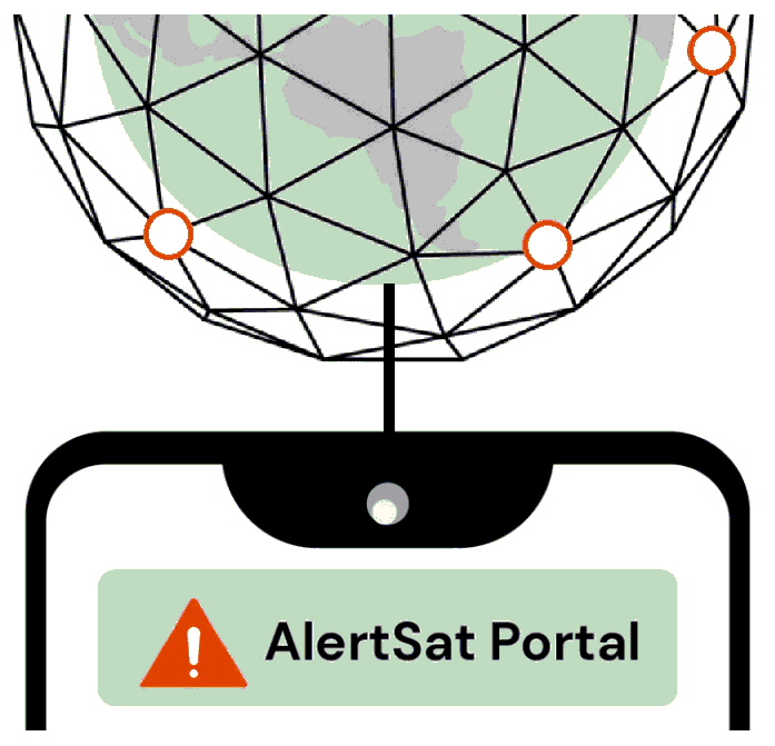
AlertSat Portal
Status date: 26 December 2023
The AlertSat satellite constellation is to deliver Alerts directly to its users, through AlertSat Portal - when critical information has been detected and there is still time to act upon it.
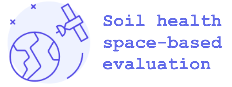
Soil health space-based evaluation
Status date: 12 December 2023
The Soil health space-based evaluation project leverages SatEO to generate time series capturing historical land use and farming practices on plots. These time series are then correlated to soil measurements in order to explain the impact of farming practices on the health of cultivated soils and identify improvement levers.
AGRO-BIOMES
Status date: 11 December 2023
The AGRO-BIOMES Kickstart activity aims at understanding the biodiversity market level readiness in four major agricultural markets segments, proposing a few architectures scenario based on the <geosys/> platform capabilities, testing biodiversity-related analytics with ground truth and Copernicus data and finally evaluating economical, technical, and scientific risks and mitigations plan to be considered prior to a go-to-market decision.
KARL Scheduler
Status date: 05 December 2023
KARL Scheduler provides farmers with satellite-based irrigation recommendations, ensuring they have a clear view of the irrigation needs of their entire farm. Calibrated with soil sensor data, KARL Scheduler ensures the highest quality satellite-based soil moisture estimates, creating a virtual soil moisture sensor for every 20m of a field, ensuring water resources can be used optimally.
C.O.R.E.
Status date: 02 December 2023
The CORE “Carbon Organic Resilient Ethereal” project aims to create an index (SCENARIO Index - Soil Carbon ProtEctioN And RestoratIOn) to map and classify soils according to their capacity to store ethereal and resilient carbon to facilitate carbon farming initiatives and investments.
CROP
Status date: 27 November 2023
The CROP project is aiming to provide a steering tool for agricultural crop rotation. The principle is to offer dashboards to cooperatives and traders to take better decisions thanks to an AI model, satellite data, data projection and the implementation of a data space to characterize the situation at different levels (climate, soil, soil cover in intercropping, cultural practices, irrigation…).
SA4D
Status date: 24 November 2023
The goal of the project “Space Acting for Decarbonisation (SA4D)” is to perform a feasibility study that will demonstrate the technical and economic viability of suitable satellite-based services for suggesting decarbonisation actions targeting agriculture, food production and building construction economic sectors.
ReSeNO Service
Status date: 01 November 2023
The ReSeNO kickstart project introduces a trustworthy service to manage, optimise and reduce the use of fertilisers in agriculture. Precise nitrogen estimation will strengthen agricultural sustainable practices to preserve earth’s natural resources, maintain soil quality, reduce chemical use, and save energy. It will also increase the economic profitability of agriculture and secure healthier land, helping on the food demand.

N-Base
Status date: 30 October 2023
N-base solution combines expertise in horticulture with advanced remote sensing technology and provides field maps for monitoring and optimization of nitrogen applications in apple orchards. This is how farmers gain actionable insights to facilitate precise and targeted nitrogen application.
SoilEO
Status date: 15 October 2023
SoilEO – Remote Soil Analysis. Generate fertility maps of your fields with a remote soil analysis.
The demonstration project is to validate and demonstrate the technology on real-life fields in real-life conditions in different countries. By using Remote Sensing and Hyperspectral spaceborne images processing one gets a visual and digital map of macronutrients: Mg, P2O5, K2O, Ca, Soil Organic Carbon and pH.
NGMP
Status date: 15 October 2023
To achieve better efficiency and reliability in monitoring the operation of an agricultural farm, we decided to utilize the potential of combining benefits of IoT sensors together with data from Earth observation. We propose collecting reliable basic data like soil moisture, temperature, humidity and nutrient levels using sensor inputs as well as Earth observation indexes. Our platform handles collection of data, combining them and It’s processing in cloud environment also, all with mobile access and management. We focus on providing effective and reliable monitoring, reporting and alarming, incl. growth status and environmental factors for mandatory public disclosure.

IBISA Phase 2
Status date: 04 August 2023
IBISA is a pioneering global climate insur-tech that shields businesses and communities against the impacts of climate change. Using satellite data, we measure weather conditions to design and operate cost-efficient, scalable insurance solutions.
Through partnerships with local, global insurers and distribution channels, IBISA creates tailored insurance products that are easy to understand, transparent, affordable and provide rapid payouts. Our innovative use of satellite imagery and actuarial tools results in robust insurance products that cater to real-world needs.
DigiFarm
Status date: 17 July 2023
DigiFarm develops deep neural network models for automatically detecting the highest accurate field boundaries and seeded acres worldwide, through our model for deeply resolving Sentinel-2 from 10m to 1m resolution. This reduces both the cost and time of current manual digitisation by over 95%.
SC
Status date: 28 June 2023
SmartCane helps sugarcane estates and farmers in Mozambique boost productivity and crop yields through remote sensing derived crop and management advice sent via SMS messages and phone-friendly pdf maps. These messages address actionable advice and support in decision-making and resource management, promoting sustainable practices and problem-solving within cooperatives. Estates and farmers can now make informed decisions based on real-time data for maximum impact.
Autocali
Status date: 30 May 2023
Autocali aims to automate the recalibration of irrigation models without user interference or additional hardware. By analyzing satellite images for soil moisture signals, the system detects deviations from existing irrigation models and readjusts them accordingly.
VLS
Status date: 30 May 2023
VerifEye enables producers, processors and retailers deliver the proof required by consumers in relation to provenance and other claims.
PREMIA
Status date: 29 May 2023
PREMIA project aims to fill the gap currently existing between satellite Earth Observation and the agro insurance market by providing an innovative and integrated end-to-end platform.
Economic Intelligence Factory
Status date: 12 May 2023
The objective of this demonstration project was the analysis of satellite data to create standardized indicators of economic activity, from the study of key sectors of the economy.
FOCUS
Status date: 03 April 2023
Project FOCUS seeks to prove the viability of funding the application of a new regenerative farming standard in African smallholder coffee farming through the voluntary carbon markets. The sequestration of atmospheric carbon will generate a new source of income from carbon credits, remotely monitored and verified through the application of satellite imagery and advanced data analytics.
SEIA
Status date: 27 March 2023
With ESA’s support, DryGro has launched a pilot high-protein crop system in Kenya. By applying earth observation and terrestrial data to the growth system, DryGro’s technology mitigates many of the factors which are currently limiting agricultural productivity. We have partnered with RHEATECH, Hyper Collective, and BuildX to delivery this breakthrough in sustainable agriculture.
DOCS-2
Status date: 15 March 2023
Using civil aircraft to create constellations for providing high spatial & temporal Earth observation data and telecommunication services; a most ecological constellation re-using the most reliable platform.
EOLO
Status date: 13 March 2023
EOLO aims to provide the corn growers with an agritech cloud-based platform which allows to save water and energy by predicting the optimal water needs, monitoring the crop health through the use of vegetational indexes and controlling the irrigation system remotely. These features are implemented by leveraging both EO and on-ground sensors data and by fusing them with machine learning algorithms.
OWASIS-NL CCN
Status date: 13 March 2023
OWASIS Water Auditing demonstration project made suitable for implementation in South Africa, Colombia and the Netherlands based on data availability and user needs.
SoilSignal
Status date: 13 March 2023
SoilSignal provides an accurate, scalable and reliable decision support tool for farmers, for soil health management including irrigation management and fertiliser management. Using Earth Observation data and Machine Learning/AI, SoilSignal, powered by Deep Planet’s AI platform, predicts soil health properties at 90% accuracy.
MEO-CS
Status date: 15 February 2023
MOE-CS is a service dedicated to monitoring carbon stocks and fluxes related to land use and cover changes, based on both local annual estimates and land cover dynamics. The service also offers a focus on favourable agricultural practices, additional carbon potential and related co-benefits.
InYouSeq
Status date: 15 February 2023
Fauna Smart Technologies is developing a whole new process in farming to deliver a cornerstone tool called “Increase Your Sequestration”: InYouSeq. It is based on satellite data measurements in order to help farmers monitor and improve CO2 sequestration capacity in horticulture i.e. orchards and vineyards.
CostCutting4Sugarcane
Status date: 14 February 2023
Optimizing mill revenue by improving harvest logistics and fertilizer management.
Earth Rover Concentrated Light Autonomous Weeding and Scouting
Status date: 31 January 2023
Earth Rover is developing an autonomous crop scouting and concentrated light weeding farm rover with an integrated Farm Intelligence System to allow for the gathering and analysis of real-time data.
Our company is targeting the high-value vegetable market and it is currently developing innovative technologies to provide prototypes of the farm rover to commercial organic farmers.
Earth Rover’s key benefit is to help growers increase their yields while reducing their costs.
BIGMIG-DEMO
Status date: 19 January 2023
The project aims to establish a service leveraging on big data from satellite and ground data to support migration management and prevention.

ForestMind
Status date: 19 January 2023
Enacted at the request of members of the UK food supply chain, ForestMind is a two year project with 10 partners who are focused on enabling commodity sourcing organisations to understand and act on deforestation risks in supply chains globally.

WS
Status date: 22 December 2022
WaterSentinel aims at providing satellite-powered water quality monitoring tools relevant for Environmental, Social and Governance (ESG) assessments as well as broader environmental monitoring applications.
Its falls within a broader goal of promoting the use of space data for sustainable finance decisions.
PALETTE
Status date: 21 December 2022
PALETTE is a technology and platform that uses satellite data to produce synthetic cloud-free images and deliver unique value to the earth observation industry and other industries. By combining satellite constellations, PALETTE can provide users with access to continuous, up-to-date imagery and simplify the data acquisition process.

SNOWtoWATER
Status date: 16 December 2022
SNOWtoWATER service provides high resolution and accurate snow water equivalent and snow cover data. SNOWtoWATER makes use of innovative A.I. algorithms fed by remote sensing data and quantitative sitespecific analysis, providing results through a digital platform.
SCD
Status date: 28 November 2022
Unibap demonstrated the SpaceCloud-as-a-Service (SCaaS) business model and SpaceCloud ecosystem which brings edge, cloud, and storage capabilities with flexible analytics to satellites. SpaceCloud enables low latency, high value actionable information, better optimized and managed downlink bandwidth, and increased satellite utility. This benefits many different business verticals such as precision agriculture, crisis and disaster management, civil and defence security and environment preservation.
YieldOptimizer
Status date: 21 November 2022
YieldOptimizer is a new service which is able to predict high, medium, or low potential yield areas and areas subject to high, medium or low water stress, based on the use of satellite data.
This new feature opens the doors toward efficient monitoring and better crop management for all those farmers who want to be part of a new Agritech world and optimize their benefits with a better understanding of the fields.
Cert-EO
Status date: 21 October 2022
The aim of Cert-EO („Certified with Earth Observation”) is to apply Earth Observation solutions to support certification procedures of organic farming. The feasibility study project focuses on a service that can complement the personal on-the-spot checks with serving gap-filling data about a selected area, parcel or crop by automated analysis and evaluation of remote sensing (satellite) images.
AdRefAS
Status date: 21 October 2022
Build-up of a geo-referenced agricultural database by using satellite-based monitoring and cloud information technologies for collecting reliable and timely statistical data on agricultural parcel level in Latin America, complemented by a web-based platform providing continuously up-to-date georeferenced agricultural data for users and stakeholders.
PickyRobot
Status date: 13 October 2022
We want to manufacture a harvesting tractor for strawberries. No one should do physically hard field work anymore. The Time has come to make a change. European companies should also be on the verge of this new technologies. We make use of high accuracy SatNav GNSS-technologies (GALILEO) to secure the robot operations.
SAT-IS(F)Action
Status date: 22 September 2022
Existing space technologies (SatNAV, SatCOM, SatEO) can be blended with the most innovative data intelligence and certification technologies (Edge AI, IoT and DLT) to offer next generation Remote Container Monitoring services (Container-as-a-Service, CaaS), hence increasing overall food supply chain safety and reliability, in the pursuit of the highest possible final customer “satisfaction”.
STEMBOT
Status date: 21 September 2022
In addition to a shortage of manual labour, tree nurseries, orchards and vineyards are facing challenges regarding their use of chemicals, which shall decrease to comply with EU regulations and decrease environmental impact. In this context, Exobotic Techologies aims to offer an agricultural robot and a web application using satellite images to help these actors to better monitor and treat their plants.
H2Orb
Status date: 20 September 2022
H2Orb tested the feasibility of developing a monitoring and alerting tool that harnesses satellite data to complement ground sensors in supporting the aquaculture sector. It used real-time data insights and early alerts to enable intervention measures for environmental and water quality to be applied to safeguard aquaculture stock whilst allowing farmers to monitor the results of their interventions.
Organic Plausibility Checker
Status date: 19 September 2022
Organic markets are growing all over the world. The frequency of organic food fraud is increasing as well. To counter this fraud, satellite-based new technology can play an important role. Our satellite-based organic Plausibility Checker will act as a third eye for ensuring the extra surveillance in the organic sector combined with a supply chain mass balance system that combines certification and product transaction data.

CoCuRA
Status date: 27 July 2022
CoCuRA uses machine learning to automatically detect cotton fields on satellite imagery and remotely classify these fields based on their environmental impact.
EO4CS
Status date: 15 July 2022
After decades of interventions in the cocoa sector and implementation of voluntary sustainability standards, the environmental impacts of cocoa production are still present. Supposedly sustainably produced cocoa is mislabelled and not produced according to sustainability standards. The EO4CS project aims at preventing food fraud of cacao by supporting the certification process for labels of sustainability with objective satellite-based earth observation information.
AlmEO
Status date: 05 July 2022
AlmEO is an innovative integrated service dedicated to the management of almond orchards using in situ Earth Observation and meteorological data. TerraNIS has developed two tools for the purpose of the AlmEO service provision 1) Vegetation Growth Monitoring and 2) Daily Water Status. Both tools have been developed in collaboration with end-users in order to monitor and compare the vegetative growth of almond plots and to provide irrigation recommendations.
Inference
Status date: 02 June 2022
Using new approaches to map sugar worldwide, focusing on the more complex regions, including Thailand and India.
AgriPoints
Status date: 27 May 2022
AgriPoints solution is designed to leverage the potential of crop fields, through utilising globally available satellite imagery and Artificial Intelligence techniques. AgriPoints analyses crop fields and forecasts their progression based on areas with similar conditions and identifies unexpected anomalies on crops, caused by weather, pest outbreaks, drought or soil nutrient deficiency. The solution targets individual farmers, consulting companies and investors.
SenZitall
Status date: 17 May 2022
The SenZitall integrated solution is envisaged as a one-stop-shop for integrated pest management. The unique selling points of the provided system and service are: a flexible and reliable data transfer solution (terrestrial or satellite without the need for user intervention) ensuring that no data is lost, high modularity in sensor type and node topology with easy deployment of extra nodes at any point in the product life-cycle, and a low-cost energy harvesting solution supporting a fully independent system. The data received from the sensor network combined with the earth observation data provides the users with a sophisticated solution for improving their pest management practices (SDSS).
Purlieu
Status date: 28 April 2022
The Farmeye Purlieu system delivers an innovative means to survey and monitor hedgerows. The system combines traditional well-established methodologies for surveying hedgerows with state-of-the-art precision GPS/GNSS, photogrammetric techniques and low-cost terrestrial lidar scanning (TLS).
MEO-Certif
Status date: 17 March 2022
MEO-Certif is a web mapping tool dedicated to organic farming players. Thanks to a panel of cartographic indicators, professionals can use the service during their decision-making process.
SpaceSense SOC
Status date: 14 February 2022
This Kick-Start Activity creates several satellite-based models that could be used to track Recommended Farming Practices (RFP) for carbon sequestration at a sub-field level (10m, based on Sentinel 1 & 2 data), and provide these information to companies creating Soil Organic Carbon (SOC) stock models. They will be focused on the three following detectors:
Cover Crop Flag: Is the field using cover crops between main crops?
Crop Rotation Diversity Indicator: How do the crops rotate in the field?
Tilling Flag: Is the field being tilled or not between crops?
SISMA2
Status date: 03 February 2022
The objective of the SISMA2 demonstration project was to implement cost-effective space-based tools and demonstrate the value of our smart-herding solution to monitor herd activities (large terrestrial animals raised outdoors, domestic, and wild) and their vulnerability factors, to modernize the herding industry and increase the plasticity of adaptation of reindeer husbandry to climatic changes in the environment and to the evolution of regional contexts.
WIS
Status date: 28 January 2022
WIS is creating an easy to deploy solution combining sophisticated global models, downscaled to regional areas, and fed by local IoT weather stations and earth observation satellite data, using machine learning techniques.
This innovative solution intends to offer high resolution and accurate predictive indicators tailored to the customers in the countries currently underserved on climate services.
DOSHP
Status date: 17 January 2022
We optimise harvest planning for farmers. We use Earth observation to map the terrain, altitude, NDVI and soil data, and satellite navigation (GNSS) to validate and to direct the machinery. We combine this with weather data, machine learning and dynamic resource allocation to produce a digital twin of the environment the farmers operate in, that allows them to make data-driven operational decisions on a day-to-day.
EO4CarbonFarming
Status date: 20 December 2021
EO4CarbonFarming offers calibrated maps of the organic carbon content in the soil by analysing Sentinel-2 time series. The service is provided through a digital platform and supports carbon farming certification, reducing the CO2 footprint of agriculture, promoting soil fertility and improving the resilience of farming systems to climate change.
AGRORADAR
Status date: 14 December 2021
The AgroRadar solution help farmers to be “Farm to Fork” compliant boosting agronomic processes optimizations.
HERMOSA
Status date: 14 December 2021
HERMOSA is a service platform dedicated to support activities on ecosystem restoration and biodiversity conservation in its larger sense and the positive impact it has on the issue of food security, creating sustainable jobs, mitigating and adapting to climate change and empowering communities in technologies. HERMOSA is built using Open Source Software, accessible through the internet, empowered by web-mapping and Remote Sensing technologies.
ClimField
Status date: 14 December 2021
The main objective of the ClimField service is to provide farmers and growers with the EO-based solution allowing for improved management of the irrigation process in a field crops production: mainly potatoes, cereals and vegetables. The solution is based on estimation of evapotranspiration using satellite data and on calculation of a field-scale water balance.
CropAI
Status date: 29 November 2021
CropAI uses Artificial Intelligence (AI) and Earth Observation (EO) satellite data to detect crop types throughout the European Continent. The service offers to commodity traders insights on crops, while it provides them assistance in making better trading decisions.
Fusion Platform®
Status date: 22 November 2021
The Fusion Platform® by Digital Content Analysis Technology Ltd, D-CAT, delivers a range of flexible, affordable B2B software services as APIs to: remotely detect and classify weeds; detect frost damage; provide remote predictions of yield months prior to harvest; estimate pasture biomass on demand. The price/performance service selections arise from both the algorithm/AI marketplace and the imagery Reverse Auction, where suppliers, end users and developers monetise and market their offerings globally.
SIITAg
Status date: 22 November 2021
Sub-optimal fertilization decisions are causing yield losses, environmental damage, contributing to climate change, and making agriculture unsustainable in the long run. Our farmers and crop advisors need smart technology to be able to make better and faster fertilization decisions. Agricultural fertilization decision making process is complex. Existing technologies are either too expensive or too much time intensive. As a result, majority of the farmers rely on their experience for fertilization decision, which is not data-driven thus involves lots of guess work. Spacenus wants to change that.
HARVIC
Status date: 31 October 2021
HARVIC aims to provide forecast and advisory services to potato value chain actors in the Benelux through Earth observations in combination with innovative in-situ data, enabling potato companies to better manage their raw material productivity and optimize business processes and operations.
HyperSOC
Status date: 22 October 2021
HyperSOC (Hyperspectral measurement of Soil Organic Carbon) is aiming to develop analytical solutions to serve carbon farming projects worldwide throughout their long carbon sequestration journey.
TERRA
Status date: 13 October 2021
Climate-related economic losses in agriculture have now reached €73bn/year. We need to build a climate-resilient agriculture now, by preparing for the evolving climate risk. TERRA is a SaaS risk-assessment and monitoring tool seamlessly integrating satellite data, reanalyses and seasonal forecasts, targeting insurance companies providing agricultural coverage.
ProvGRASS
Status date: 13 October 2021
ProvGrass provides white labelled, multi-temporal maps of sward quantity and quality to enable customers to provide branded products for end-users (in this case farmers) related to grassland management. The initial development is aimed at dairy farmers, but the principle also applies to other livestock, biorefinery feedstock and conservation applications as well.

CoffEO
Status date: 08 October 2021
Building a data intelligence & risk management platform for the coffee industry powered by AI, SatEO & cutting-edge agrometeorology to scale sustainable coffee production.
OGOR YIELD
Status date: 21 September 2021
OGOR YIELD estimates the maize yield at different levels: field, farm, county, region, country, for all agricultural seasons, starting with 2017.Knowing the yield at field level allows to decrease input costs, to optimize logistic and storage costs and ultimately to increase farmers profit.
Saturnalia
Status date: 15 September 2021
Saturnalia offers unique, hard-to-find insights on fine wines all in one place. The mission is to create a living atlas of fine wines, completed with quantitative data. Such a reliable and transparent tool helps all wine lovers and professionals obtain strategic information and unique predictions not typically accessible within the wine sector.
AGROMS
Status date: 08 September 2021
AGROMS aims to identify crop types among major ones, at the very beginning seed season, then to provide a forecast of the harvest size, by the mid-season, far before the actual harvest, with the best accuracy. All by using Artificial Intelligence.
CMM
Status date: 28 July 2021
Crop Mycotoxin Management (CMM) offers a service for an efficient management of mycotoxin contamination in wheat production. Satellite-based earth-observation data are derived to crop information and combined with terrestrial data sources to assess the infield disease risk during vegetative growth and the risk of mycotoxin accumulation at harvest. Such information support farmers in site-specific scouting activities, variable-rate applications of fungicides and selective harvesting to exclude mycotoxin contaminated grains. Furthermore, the service provides information on the regional yield in terms of quality level of wheat.
SmartCane
Status date: 28 July 2021
Every year, there is more to do and there are more demands. We aim to help farmers make the best use of their time, money, and energy by focusing on what's most important. We help improve sugarcane productivity by prioritising on the job.
SmartCane supports sugarcane estates and farmers by providing crop and management advice through SMS messages and phone-friendly PDF maps, based on remote sensing data. These messages offer practical advice and support for decision-making and resource management, promoting sustainable practices and problem-solving. Our approach allows farmers to quickly determine their next steps. With real-time data, estates and farmers can now make informed decisions for maximum impact.
BioScope
Status date: 27 April 2021
Farm managers need efficient and objective means to plan and monitor their crops, to evaluate the outcome of field operations and plan new ones for example how much and where to apply fertiliser, water and crop protection agents or how to optimise the soil. For monitoring crop status, farmers can use high resolution images.
INVENTA
Status date: 07 April 2021
The INVENTA project intends to carry out the feasibility study of an innovative service able to increase the fruition, accessibility and sustainability of historical/cultural sites through the integration of Virtual & Augmented Reality with Satellite Navigation and Earth Observation. The service will be based on an innovative mobile App using 5G network.
Ag|knowledge 4.0
Status date: 26 March 2021
Ag|knowledge 4.0 improves the agricultural risk management for the stakeholders of the agri-supply chain in emerging economies. The services provided exploit various EO-technologies from remote sensing, weather satellites to GNNS to close a big information gap on operational crop monitoring in support of smallholders. The focus of the pilot-demonstration service is on India.
ASTROCAST
Status date: 25 March 2021
Astrocast is developing an advanced Nanosatellite network for the Internet of things (IoT).
DAPPO
Status date: 09 March 2021
An AI & EO-based service that improves management of tuber supply to potato processing industry and potato storage facilities.
Earth Rover
Status date: 02 February 2021
Earth Rover is developing integrated crop scouting and laser weeding. We are targeting the high value vegetable market, and are currently testing commercial prototypes of tractor-mounted crop scouting with UK’s largest organic brassica farmer.
EDGE
Status date: 27 January 2021
The Nexlys’ advancED farminG intElligence(EDGE) aims to take the interaction between the farmers and their plantation fields to a new level. It will deliver an Artificial Intelligence(AI) based Decision Support System(DSS), enabled by the usage of space assets, which will allow farmers to maximise the benefit of existing operational assets and know how.
Quantified Farm
Status date: 26 January 2021
Quantified Farm uses the latest advancements in satellite image processing, modern ground sensors, 5G sensor networks, and artificial intelligence to deliver quantified farm information on a direct instance. This approach allows to make better and directly operational information products that help farmers in three targeted key applications: precise irrigation, fertilisation, and crop protection.
GEWS
Status date: 26 January 2021
Greenhouse owners are in a very competitive market, in which unexpected costs due to damage and decay of the greenhouse assets can cause severe problems. This demonstration project aims at demonstrating how a notification service using space data can help greenhouse owners to prevent or mitigate non-insurable risks threatening their business, and thereby save costs.
miBeez
Status date: 21 January 2021
Development and demonstration of a Integrated Precision Apiculture System including management, monitoring and decision support modules. Development of monitoring devices for installation in beehives and development of management software platform (desktop and mobile app) for use by beekeepers.
VinoSAT
Status date: 17 December 2020
VinoSAT transforms EO Sentinel-2 imagery into readily available information that will change decision making in vineyards.
VinoSAT services are tailored to address the main vineyard monitoring needs and become a powerful tool in the hands of grape growers and winemakers.
AIDOPS
Status date: 16 December 2020
AIDOPS provides monitoring services based on artificial intelligence for automatic detection of objects and patterns in satellite images. AIDOPS concentrates on the fields of agriculture and forestry. The long-term goal is to provide new automated ways of assessment for inventories and monitoring to detect damage caused by bugs or climate in crops and forests at an early stage.
CarbonSpace
Status date: 15 December 2020
CarbonSpace is an AI and satellite-powered B2B SaaS platform for remote carbon footprint tracking that provides organizations with actionable insights to tackle climate change.
CROP
Status date: 15 December 2020
The CROP project is aiming to provide a steering tool for agricultural crop rotation. The principle is to offer an exhaustive vision of past rotations but also to make a projection of the rotations in the one or two next years thanks to an AI model, satellite data and other data to characterize the situation (climate, soil, cultural practices, irrigation…).
GrassSignal
Status date: 14 December 2020
GrassSignal provides an accurate, scalable and reliable decision support tool for sustainable rangeland, grassland and pasture monitoring. Using Earth Observation data and Machine Learning/AI, GrassSignal, powered by Deep Planet’s AI platform, predicts grassland properties at 90% accuracy.
OPTIMAL4
Status date: 11 December 2020
Discover the most profitable crops and markets for you, just by drawing your site.
AGRONOBOTS
Status date: 31 October 2020
Agronobots integrates computer vision, robotics, ML & AI and combines them with air and ground based robotic systems to develop a state-of-the-art fully automated solution for non-destructive, accurate, and rapid phenotyping of potato, broadacre and vegetable crops under field trials conditions, which will provide a step change over manually collected data by qualified technicians.
FAMOS
Status date: 10 September 2020
The principal objective of the FAMOS project is to develop a comprehensive forest status monitoring system tailored to the requirements of commercial clients from the commodity sector, especially within the context of cocoa, palm oil, and rubber. Combining earth observation, IT technology and GNSS, the service supports target users by improving the efficiency of existing business processes.
MONITORED AI
Status date: 10 September 2020
Climate change poses a number of challenges for farmers worldwide. OPT/NET B.V developed an AI-driven platform that generates timely and valuable insights about farmland conditions to individual farmers & large agri producers in predominantly cloud covered high latitude coastal areas facing challenging weather patterns. The solution is expected to lead to up-to-10% increase of respective yields and more than 10% reduction of the associated costs and wastage.
B-LiFE - TEN
Status date: 24 August 2020
The B-LiFE Telecommunication Emergency Node is a new field communication and control system, integrating space assets and new tools for crisis and logistics management.
Map2Fish
Status date: 21 August 2020
Map2Fish is a service that consists of a WMS service and a web mobile application that provides to the corresponding customers and end-users near real time and forecast of pelagic fish concentration probabilities and parameters like sea surface temperature, dissolved oxygen, chlorophyll-a concentration, water transparency, currents and waves.
IBISA
Status date: 24 June 2020
IBISA enables agriculture index-based insurance for agricultural entrepreneurs, everywhere and in an easy manner, by leveraging Earth Observation data and blockchain technology
Soft-Alpha
Status date: 08 June 2020
Soft commodities, such as soy and sugar, and their related financial derivatives, are widely traded on exchanges worldwide. At present, production data is only made available at fixed points through the year (usually after the growing season). The Soft Alpha project, co-funded by the European Space Agency under its Business Applications programme, provides predictive analysis on soft commodity crop performance based on EO derived data, in a sector that is currently dependent on historical data.
Hawking
Status date: 17 April 2020
Hawking is a machine learning based solution for commercial growers analysing satellite imagery for better management of their crops.
GroWise
Status date: 27 February 2020
GroWise will give credit providers through the use of growth models for a variety of common African crops an accurate view of the crops in the ground. It will also allow them to deliver agronomic advice, via a new app, to farmers – something which is currently lacking with small/subsistence farmers.
Fully Automating Data Pipeline
Status date: 11 February 2020
In 2010, the United Nations explicitly designated that "safe, clean, accessible and affordable drinking water” is not only a necessity, but also a fundamental human right. However, we live in an imperfect world, in which man-made activities and natural disasters create conditions that limit our access to water and expose us to dangerous water events. Organisations around the world have recognised this challenge and shown their commitment to creating, as the World Bank terms it, “a water-secure world for all.”
IMGeospatial is honoured to be part of this movement and has partnered with three clients to address the biggest water-related threats to our livelihood: flooding, water scarcity and water quality. We provide business intelligence that enables them to proactively manage their water systems, build resilience in their communities and ultimately minimise risk and impact. We do so by automating the data pipeline, reducing the time and cost of turning earth-observed data into actionable insights.
DASF
Status date: 06 February 2020
Spacenus is a Germany-based Artificial Intelligence (AI) company that develops applications for Agriculture. The key competence of Spacenus is speed, practicality and a creative culture for problem solving. We offer AI solutions that incorporate mobile phone cameras and satellite imagery to digitize agriculture as and provide precise farming information. Our goal is to facilitate enhancing agricultural productivity while protecting the environment.
Poworganic
Status date: 28 January 2020
Poworganic is developing a circular micro-credit model powered by satellite imagery, tackling the energy, sanitation and health crisis in developing countries and further.
ALEEGO
Status date: 13 January 2020
ALEEGO online platform is for demanding companies caring for data safety and integrity wishing to inspect their assets using UAV technology, in a simple way.
InsSAT
Status date: 13 January 2020
The InsSAT project delivers a fully functional and operational system of automatic processing and analysis of satellite, meteorological and if needed also aerial data, focused on providing tools for assessment and settlement of insurance claims in the agricultural sector. The project is a CCN to the ASAP (“Advanced Sustainable Agriculture Production”) Demonstration Project that was completed in 2018.
FertiSat
Status date: 09 January 2020
The aim of FertiSat project is to provide farmers with site-specific application maps for nitrogen fertilization of cereal crops. Since absorption of nitrogen by plants is influenced by weather and moisture conditions, those variables are taken into account when determining precise doses of the fertilizer. The service is based mainly on multispectral, high resolution satellite imagery.

KORE
Status date: 07 January 2020
KORE improves UK and international agronomists’ and farmers’ crop management by exploiting new precision agriculture techniques to target inputs and increase crop yields.
KORE utilises remote sensing and satellite navigation techniques to survey fields easily and cost-effectively.
KORE provides simple interpretations of complex information on crop growth and crop health.
KORE replaces a successful, proven on-line agronomy service, EssentialsMap.
Track & Trust KS
Status date: 20 December 2019
Datarella’s Track & Trust product seeks to boost transparency between stakeholders and offer immutable trusted tracking for stakeholders in humanitarian supply chains. Track & Trust architecture leverages advanced blockchain technology and satellite connected IoT devices to guarantee that goods are continually accounted for even in the most exigent and adversarial conditions.
Village Data Analytics
Status date: 02 December 2019
Village Data Analytics (VIDA) is a software-enabled service that automatically identifies remote villages and determines their suitability for a micro-grid installation using earth observation data and machine learning algorithms.
VIDA can be scaled across large user-defined areas to find a portfolio of viable micro-grid sites. This data-driven knowledge de-risks projects, reduces time and planning costs and enables investment at scale.
Cerberus
Status date: 26 November 2019
BlackShore’s crowdsourcing platform Cerberus reinforces developing country economies utilizing satellite imagery amplifying sustainable food production while preserving the environment. This is achieved through the power of satellites, socially conscious gaming and the power of the crowd.
SOLAR3
Status date: 08 November 2019
SOLAR3 leverages core space assets including navigation, earth observation and satellite communication, as well as the recent advances in solar-powered unmanned flight and hyperspectral imaging technologies towards the realisation of large-scale diagnostics of vegetation for precision farming.
GLAUCUS: Smart Fishing and Route Planning System
Status date: 07 November 2019
GLAUCUS is an end-to-end system to help fisheries to optimise their navigation routes and identify the best fishing grounds, dynamically updated to know where it would be more convenient to fish during the fishing trip. The system allows fishermen to locate the fishing grounds and also provides the optimal route to navigate through the seas, between fishing grounds and/or to the ports.
CC RAFCo
Status date: 09 July 2019
The aim of CC RAFCo Kick-start activity is to assess the feasibility of a service which assist food and beverage industries monitor crops performance (their own or from suppliers), and plan for climate-related disruptions in the supply chain. CC RAFCo service offers a one-stop-shop for all climate-related data needs, to help companies integrate climate change impacts into their business planning: from contingency planning for seasonal climate variability to long-term climate change risk management.
UKSRI
Status date: 14 June 2019
Field-level seasonal weather predictions can empower growers to make better-informed decisions, reducing their food waste and greenhouse emissions. We have demonstrated a working pilot of a new seasonal forecast system that combines EC Copernicus model outputs with daily weather analytics to improve long-term rainfall predictability. Applications include summer planning for irrigation, cultivar selection and decisions about crop mixes to mitigate crops losses from drought, floods or climate-linked pathogens. UKSRI has identified British growers, producers and agronomists who could benefit from these services.
DROMAS
Status date: 12 June 2019
DROMAS services aim at periodical full country monitoring of agricultural vegetation to serve decision makers on national level

AgroRadar
Status date: 07 June 2019
Space Innovation System to Monitor Animals
Status date: 23 May 2019
SISMA2 provides a series of cost-effective space-based tools to facilitate the management of the pastoralism livestock industry, and cope with the future.
Invisible Worlds
Status date: 09 May 2019
Rezatec and the Eden Project will explore how geospatial data analytics could benefit individual growers or forest owners with small areas under management, by providing commercially valuable and actionable decision support tools accessed via a self-service, digital platform. In addition, these analytics could be provided as an operational service to other creative visual installations at museums and institutions around the world.
Vialone
Status date: 08 May 2019
Vialone leverages Big Earth Observation Data to support European organic rice farming and trade. Copernicus data and tailored in-situ sensors keep rice paddy fields constantly monitored from both space and ground. Vialone unlocks best practices of organic paddy management and supplies early information on growth trends. Thanks to Vialone, the so-called mature consumer will be able to make healthy and informed choices based on reliable traceability information on top-tier organic rice.
PASST
Status date: 08 May 2019
Precise Apiculture Supported by Space Technologies (acronym: PASST) is a mobile application that enables the implementation of precise apiaries management based on the latest satellite technologies and geolocation in connection with close cooperation with agricultural producers.
VtDaws
Status date: 07 May 2019
VtDaws is a service developed on a SaaS model. VtDaws includes in its features the access to EO data (especially Sentinel and Copernicus Services data), a change/anomalies detection engine based on machine learning techniques, a warning service transforming data into information to the users and community sourcing features to add in-situ data and share information on smartphones or tablets.
Greenhouse Early Warning Service
Status date: 09 April 2019
Greenhouse owners are in a very competitive market, in which unexpected costs due to damage and decay of the greenhouse assets can cause severe problems. This feasibility study aims to provide insights into how an early warning service using space data can help greenhouse owners to prevent or mitigate non-insurable risks threatening their business.
SSFIS
Status date: 02 April 2019
Smallholders are underserved by credit providers as lenders are unable to assess their risk. Sensonomic’s system uses predictive and prescriptive simulations to assess system effects of credit deployment and open the market. With its dynamic data consumption, and iterative and reactive simulations, the service provides a continually updated prediction of how robust the credit providers portfolio is.
HiVaCroM
Status date: 18 March 2019
HiVaCroM uses a time series of Sentinel-1 SAR observations as the basis for generating field-level canopy cover measurements for high value potato crops on a national scale. The canopy cover measurements are required frequently, throughout the growing season, as input to yield models and to inform crop performance metrics. The yield model and crop performance metrics provided important information that growers and supply chain can use to manage crop-related risk during the growing season.
Project Impactor
Status date: 11 March 2019
Impactor deliver a prototype/credit scoring tool based on locally collected data, weather data and remote sensing data works. With this, we can provide financing to smallholders – and support traders in taking over financing activities to these smallholders – Impactor could in a later stage expand to advice, which after then can be presented to impact investors (via a platform).
SCS
Status date: 18 February 2019
Smart Coop Solutions (SCS) is an Internet of Things (IoT) based sensing service enabling the organic farmer to monitor and maintain mobile chicken coops remotely and to guarantee suitable conditions for the animals. Animal welfare under organic standards has strict regulations and requires that coops offer a suitable indoor climate and outdoor environment. Real-time monitoring through the SCS provides farmers with relevant statistics, actionable information and peace of mind through a simple mobile app.
DateGIS Demo
Status date: 12 February 2019
DateGIS Demo is the follow-on demonstration project from the ARTES 20 DateGIS feasibility study completed in 2016.
DateGIS is an integrated Geo-information System (GIS) for Date Palm precision agriculture. Objective of DateGIS is to provide information products and services on date farms and palm trees for:
- Government institutions, specifically for the following needs:
- Date farm and palm registration service;
- Regional / national Red Palm Weevil control management program;
- Date sector (farmers), specifically for the following needs:
- Increase yield, productivity and quality of date farming;
- Reduction of date farm losses due to Red Palm Weevil infestation.
Currently the main threat for the global date sector is the Red Palm Weevil plague, so the first focus of DateGIS is on service items 1.b and 2.b (the most urgent needs), with a clear and sustainable long-term growth model for service items 1.a and 2.a.
The key asset of the DateGIS is information supply chain management (“from big data to farm information”) which includes building a strong network of remote sensing data suppliers, aerial survey service providers, knowledge partners and local network / sales channels.
NITREOS
Status date: 16 January 2019
NITREOS is a service platform that serves organic farmers, as well as conventional, in carrying out daily activities in a more efficient, profitable and sustainable way, as compared to the practices they used until now.
NITREOS provides the following services to farmers and agricultural consultants: i) Irrigation Scheduling; ii) Variable Rate Fertilization; iii) Crop Growth Monitoring; and iv) Yield Estimation.
Wild boar project
Status date: 14 January 2019
The key product/service is to provide a monitoring of damages to agricultural and environmental areas caused by wild boar (Sus scrofa) using remote sensing data. The technical key idea is to upscale from the investigation of local areas via high resolution aerial images to larger areas via satellite data.
Entocycle - Accelerating Insect-Based Protein Production
Status date: 05 December 2018
Entocycle has assessed the viability of space-based services for the production of sustainable protein.

Space Applications using Animal tracking data
Status date: 30 November 2018
The aim of the feasibility study is to evaluate a service for monitoring wildlife and farm animals. The service consists of a hardware part (collars for the animals, buy or lease) and a software to be offered as software as a service. For users these two parts are transparent, and they rent an overall service for animal tracking.
MAPCAM
Status date: 29 November 2018
MAPCAM provides crop identification and crop productivity information through the growing season to support a number of different regulatory, policy, planning and protection functions aimed at ensuring food security and adaptation to above-average climate change impacts.
ClimField
Status date: 29 November 2018
ClimField was a project aimed at assessing feasibility of development a portfolio of EO-based irrigation supporting services addressed to Polish field crops producers. Effects of climate change on the situation of farmers and treatments they undertake were taken into account during the study.
AquaFarm
Status date: 16 November 2018
Aquafarm brings together satellite data and Soil-Plant-Air models to provide operational services to Farmers’ service providers as well as national institutions related with crop development and forecast.
SFCS
Status date: 06 November 2018
Satellite Fruit Control System (SFCS) based on the use of smartphone, image processing and EGNSS technology combined in developed application will allow to estimate the quantity, physical and qualitative parameters of fruits planned for harvest.

TELEKAIROS®
Status date: 29 October 2018
TELEKAIROS® Fintech is a tool for financial and (re)insurance contracts that derive value from an underlying asset such a traditional stock, a bond or stock index. TELEKAIROS is capable to manage different kinds of risks, for example by increasing the efficiency of the underlying market because they lower unforeseen costs of purchasing an asset outright.
SIITAg
Status date: 17 September 2018
Agriculture is the most important core industry in the world. With feeding 9.5 billion people globally by 2050, it faces a tremendous challenge. Food production must increase by 75%. To that end, Spacenus develops sustainable operational services which addresses agricultural plant nutrient deficiency (PND) with an Artificial Intelligence (AI) system connected with earth observation, navigation and IoT.
COHABIT
Status date: 12 September 2018
COHABIT monitors and assesses in real-time the whereabouts of large wild animals and dynamically generates geo-fenced alerts for visitors to avoid dangerous encounters and for farmers to protects their crops and livestock. Wildlife – human cohabitation is made possible through the use of data analytics, image-recognition, animal tracking and space technology.

Ibisa-ks
Status date: 31 August 2018
Crop protection for smallholder farmers with low fees and fast payments
SolumScire (SC)
Status date: 31 August 2018
SolumScire makes soil data more valuable and useful. This service is based on better referenced and new spatial soil data and combines this with plant performance information to get insights on soils and plant management as well as their important interactions. The data aggregation and use improves modelling for precision farming to increase yield and to lower emissions.
TransparentSea
Status date: 22 August 2018
TransparentSea develop an innovative fishery monitoring system.
AMBROSIA
Status date: 14 August 2018
The ESA-Ambrosia food safety and traceability platform combines Blockchain technology, IoT, Satellite Earth Observation (SatEO) and GNSS Satellite Navigation to achieve maximum automation, security, and transparency of the food supply chains.
BioDiv Checker
Status date: 01 August 2018
The BioDiv Checker is a service to acquire and analyze remote sensing images for supply chain integrity within ecological farming.
DFMS4i
Status date: 18 July 2018
The project investigated how drought and flood prediction and monitoring services derived from in-situ and space-based Earth Observation data - in from the Sentinel satellites - could support the uptake of agriculture insurance in developing countries, with an initial focus on Uganda.
GFaaS
Status date: 17 July 2018
Geospatial Framework as a Service (GFaaS) aims to bridge the gap between the geospatial data providers, service providers and the intermediate/end-users to ensure painless access to processed geospatial data for addressing agricultural productivity concerns.

Pi-Link
Status date: 13 July 2018
Collection and transmission of ocean water column data opens up new data-based revenue streams across a range of industrial sectors and stakeholders. The Pi-Link activity explores the market and technical feasibility around sustainably gathering and supplying such data using a sensor-equipped version of SNTech’s Pisces device, called Pi-Sense.

SiPeCon
Status date: 12 July 2018
SiPeCon offers information services based on a fully operational sensor information supply chain to support crop protection agents and their clients (farmers) who want to increase crop production yield by reducing yield losses caused by pests and embrace Integrated Pest Management (IPM) innovations to reduce reliance of chemical pesticides, which is a novel business approach for crop protection.

DSE IOT Project
Status date: 11 July 2018
DryGro is commercializing a novel method of agriculture that produces a soy-alternative crop in areas where land is water-scarce, arid, or otherwise non-arable. This project aims to determine the suitability of satellite-enabled IOT, earth observation, and numerical weather prediction technologies for facilitating the application of DryGro’s horticultural approach in such remote, inhospitable climates.
GREENSPIN Agri Planet
Status date: 11 July 2018
GREENSPIN AGRI PLANET: a global service for field-level agricultural insights based on Earth Observation, crowd information and artificial intelligence.
Saturnalia
Status date: 28 June 2018
Saturnalia leverages on Earth Observation Data to predict wine quality before bottling. Copernicus data and tailored in-situ sensors keep vineyards constantly monitored from both space and ground. Saturnalia unlocks best practices of vine management and supplies early information on next season’s fine wine. Tech-savvy wine investors and distributors rely on Saturnalia to access the most promising sales before their competitors.
EO-li
Status date: 28 June 2018
EO-li (Earth Observation based location identifier) is an open source web-based,global platform matching demand and supply of identifying, selecting and reporting in the land restoration context. It has four components, namely the (i) identification of a location area to be restored, the (ii) selection of an area and the actors involved in the restoration activity, the (iii) monitoring and reporting on the progress of the project using earth observation and geospatial data and (iv) a learning component providing guidance and capacity strengthening.
MYFoodS
Status date: 25 June 2018
EO-based information service based on monitoring Micro Yields for assessing Food Security and Malnutrition (MYFoodS) in rural subsistence farming areas in Burkina Faso
SenZitall
Status date: 15 June 2018
The SenZitall integrated solution is envisaged as a one-stop-shop for smart IPM and horticulture management. It will operate as a fully independent, low power WSN providing high resolution, near real-time environmental data as input to an integrated Spatial Decision Support System (SDSS). The sensors will run with a multi-constellation GNSS and a dual uplink SATCOM system.
agriloc
Status date: 22 May 2018
agriloc targets significant improvements in agriculture through automation supported by satellites. For this purpose, a thorough market analysis and numerous user surveys have been carried out to identify current problems and needs of farmers. Projected agriloc systems and services have been validated through requirements definition, design, and field demonstrations in various user workshops and public forums at agricultural fairs. The solutions are aimed at supporting farming processes through integration of highly accurate Guidance, Navigation, and Control, with reliable connectivity utilising telecommunication satellites, and supported by new test systems and services to support farmers in their purchasing decisions.

SISMA
Status date: 12 March 2018
SISMA is a low-cost solution to monitor domestic and wild herds that includes regional analysis to help dependent populations and state agencies to manage animal safety and welfare and mitigate climate change. It combines IoT and satellite technologies to track the movement, activities and biometrics of the animals. It enables data sharing between herders, veterinaries, local – state authorities, scientists, consultants…
GrazingSpace
Status date: 19 January 2018
GrazingSpace is a satellite based information service that supports dairy farmers that want to keep their cows grazing in pastures instead of indoor feeding.
The service supports optimizing the grazing management by delivering timely information to the farmer on where to graze his cows and when to move them to another field. Biomass information determines the estimated size of the strip/field, and the cow movement tracks, translated into grazing behaviour data indicate if cows are still efficiently grazing or have to be moved.
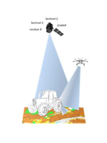
SolumScire
Status date: 14 December 2017
SolumScire makes use of latest satellite- and positioning technologies to better understand soil and soil conditions in crop production. The project collects and combines high resolution satellite and soil analysis data to provide soil spatial information and to create a service for farmers to feed spatial soil information automatically into their farm management system (FMS) to then improve field related precision farming activities.
SAR crop index
Status date: 11 December 2017
This demonstration project is a progression of a number of feasibility studies conducted by AgSpace Agriculture and The Satellite Applications Catapult into the application of Synthetic Aperture Radar (SAR) data for agriculture. The project demonstrates the new crop growth index on 20 UK farms throughout the 2016 and 2017 growing seasons.
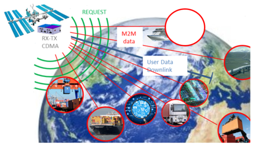
SatApps
Status date: 19 September 2017
Internet of Things/IoT – M2M – industry 4.0 – these headlines are representing large user groups which have an urgent need of a globally available, low-cost, secure data service, dedicated to very small data volumes per sensor and for use also in remote areas. The objective of the study is to perform an in depth requirements analysis on 2 focus pilot user groups: railway transportation and container/waste management.
MarIA
Status date: 15 September 2017
This project has developed a cloud-based system to support more efficient management of sustainability standards in commercial fishing and processing operations. The system developed allows for the inputting of information manually into smartphones/tablets and the capture of information from sensors on-board fishing vessels (including GPS position), whilst at sea, which is sent via satellites to a central database. This database is viewable by prospective customers before the catch is landed.

SATLAS
Status date: 05 September 2017
SATLAS is an Idea Incubator, developed for and offered to innovators who want to “Start, Integrate and Test” their SatCom related concepts in an easy, light and quick way, taking benefit from the support, mentoring, services and tools made available from the SATLAS consortium (SES Techcom, SatADSL, Newtec).
ASAP DP
Status date: 24 May 2017
The proposed Agricultural Service is designed as a “One-stop-shop” for actors in the Agricultural sector, providing information on crop status and their growing conditions based on EO and ancillary data. The System flexibility and comprehensiveness ensure its applicability for a variety of problems faced by Users in different Agricultural sectors.
STAR-FISH Feasibility Study
Status date: 11 May 2017
STAR-FISH is a management system that will automatically monitor and record fishing activity and fish discarding, in order to verify compliance with discarding regulations. The STAR-FISH service will consist of:
- A Remote Monitoring System (RMS) (hardware and software) installed on board vessels to monitor, record, identify and transmit fish discard data
- On-shore software which monitors fishing and discarding data from vessels and can provide alerts to fishing regulators
- Interfacing with databases/platforms to support fish sustainability and traceability statistics
M3i
Status date: 12 April 2017
M3i is an end-to-end, one-stop service that reduces the fieldwork required to gather information on critical Landscapes of Interest. Satellite imagery, analysed in conjunction with a minimal set of ground-based data, significantly reduces the time and money required to perform surveys, and thus greatly improves the potential for all forms of land use to be incorporated into sustainable management schemes.
PalmOilVision
Status date: 24 November 2016
PalmOilVision aims at providing the palm oil sector with innovative, reliable and cost efficient services for increasing production sustainability and efficiency, through the integration of Earth observation imagery and Remotely Piloted Aircraft Systems (RPAS).
DateGIS -
Status date: 22 October 2016
DateGIS is an integrated Geo-information System (GIS) for Date Palm precision agriculture. Objective of DateGIS is to provide information products and services on date farms and palm trees for:
a) Provide date farm management information to increase date production, quality and yield;
b) Development and management of a national RPW control program;
c) Reduction of farm financial losses caused by RPW infestation;
d) Improve water use efficiency, irrigation and fertilizing management.
Saltwater
Status date: 05 October 2016
Saltwater is a service for aquaculture companies using Earth Observation and hyperspectral in situ instruments for the monitoring of harmful phytoplankton. Monitoring results are provided on a high spatial and temporal resolution. When combined with other environmental data the users can predict the movement of harmful phytoplankton, thereby reducing loss of stock and increasing feeding days.
agriloc FS
Status date: 24 August 2016
agriloc targets significant improvements in agriculture through automation. For this purpose a thorough user survey was carried out to identify current problems and needs of farmers. Projected agriloc systems and services were then validated in a user workshop. The solutions are aimed at supporting farming processes through integration of highly accurate Guidance, Navigation, and Control, reliable communications utilising communication satellites, weather and satellite data, and automation of farm management and process planning.
BIOSCOPE
Status date: 05 July 2016
Agriculture is becoming more and more data driven and farmers are in demand of relevant, fresh information about their crops for location specific treatment. BIOSCOPE sets up a unique service based on satellite imagery when possible and drone imagery as backup when clouds prevent an undisturbed view.
BIOSCOPE FS
Status date: 05 July 2016
BIOSCOPE investigated the technical and economical viability of a vegetation monitoring system based on the integrated use of satellites and Remotely Piloted Aircraft Systems (RPAS).
Cerberus: Forest Falcon FS
Status date: 05 January 2016
If you care about the future, you also care about our planet. Greenhouse gas emissions caused by forest degradation and deforestation are one of the largest causes of global warming. Many organizations have a negative impact on the extent and quality of our forests. It is time we change that. We map what matters. Through our crowd — a big, global community of people who care about our planet just as much as we do — we build maps and information products of high quality and reliability. Our forest monitoring services can be adjusted to your specific needs, so you will get exactly the information you need.
LMS
Status date: 07 October 2015
In compliance with European and national regulations, the GNSS based livestock transport online monitoring system as well as the related service elements allow the online control of (especially long distance) livestock transports as well as simplify livestock transport documentation. The solution can be integrated with other vehicle subsystems and transport information such as fuel consumption, temperature conditions, water level control, etc.
DROMAS
Status date: 05 August 2015
DROMAS services aim at periodical full country monitoring of agricultural vegetation to serve decision makers on national level and to provide historical and current year crop analysis to support farm management at agricultural parcel level.
IAP-Copernicus
Status date: 08 May 2015
The IAP-Copernicus study addresses the use of space assets, combined with terrestrial « web2mobile » technologies, in the provision of reliable, ad-hoc information to all stakeholders involved in the monitoring of risks and mitigation of hazards impacting people. The study focuses on the development of an economically sustainable « Business Services Platform » for two use cases: public safety in Belgium and food security in Senegal.
ASAP-FS
Status date: 16 April 2015
The ASAP service aims to deliver in a ‘one-stop-shop’ approach reliable information to actors in the Polish agricultural market to optimize the production, reduce input costs, and increase income. The service aims to deliver information on condition and status of vegetation, soil moisture and surface temperature, data for fertilization and amount of fertilizers, condition of vegetation before and after winter (frozen vegetation).
FarmingTruth
Status date: 14 October 2014
FarmingTruth is a precision agriculture service that furnishes end users (e.g. farmers, growers, agronomists, agricultural consultants, etc.) with a web-based soil and crop information system to enable the optimisation of land production for increasing yield at reduced input cost.
SATMODO
Status date: 08 September 2014
The SATMODO project is aimed specifically at the round-wood timber harvesting market, by facilitating ”live” monitoring of harvest processes. To date the SATMODO project addressed current harvesting issues in remote areas by utilizing both cellular and satellite transmission technology as a means of providing data transmission pathways for the live harvest data from the Harvester Machine.
TalkingFields
Status date: 09 May 2014
TalkingFields aims to increase the efficiency of agricultural production via precision farming by means of geo-information services. It integrates space and ground-based assets to achieve this target. The TalkingFields Demonstration Study is the result of a feasibility study which was successfully concluded in 2009.
FruitLook
Status date: 17 August 2012
Water is a critical resource in South Africa, which challenges the agricultural sector to reduce irrigation water consumption while keeping production sustainable. Adequate information on the crop water, growth and nutrient status is crucial to improve water management.The FruitLook pre-operational service demonstrates to Western Cape grape and deciduous fruit farmers the benefits of integrated satellite technologies in their daily water and farm management.
GrapeLook
Status date: 17 August 2011
This project focuses on the operational monitoring of crop water and nitrogen use of vineyards in the Western Cape province of South Africa. Based on the daily management of irrigation water resources and on-farm nitrogen by means of satellite remote sensing technologies, satellite communications and satellite positioning the project aims to assist various end-users.
TalkingFields Feasibility Study
Status date: 21 May 2009
TalkingFields is an initiative trying to increase the efficiency of agricultural production via precision farming by means of geo-information services integrating space and ground-based assets in an integrative way.