
Services, infrastructure and facilities provided by satellite communications, satellite navigation, earth observations, or human spaceflight can be utilized for new applications and solutions to health-related problems. "Combining different space-based systems and integrating them with terrestrial systems creates capabilities that are greater than the sum of their part", forms the cardinal rule of IAP. It enables and enhances a broad range of viable services that are sustainable in the long term, providing benefits to the individual and to society as a whole.
Forest HD
Status date: 24 July 2026
ForestHD, a geospatial tool developed by NGIS in partnership with the European Space Agency. It helps timber operators comply with the EU Deforestation Regulation (EUDR) by using satellite data and AI to distinguish legal harvesting from illegal deforestation and degradation, reducing false positives and improving supply chain traceability.
RELECT
Status date: 23 July 2026
Rheticus® Electric Towers (RELECT) is a demonstration project aimed at developing an Earth Observation service using very-high-resolution SAR imagery and AI to rapidly detect damage to power lines after extreme events. It enables Transmission System Operators to assess affected infrastructure within 24 hours, improving response times, reducing costs, and enhancing the resilience and sustainability of energy networks.
TruPaG
Status date: 22 July 2026
TruPaG improves truck parking by combining historical and real-time truck movement data to predict availability across a wide network of locations. The project builds on Aparkado’s existing solution and expands coverage beyond highways to deliver more reliable parking insights.
MagWatch3D
Status date: 17 July 2026
Geomagnetic storms can disrupt electric power grids and other critical infrastructure. MagWatch3D delivers high-resolution – better than 10 km spatial resolution and 1 second cadence – near real-time physics-based space weather intelligence on geomagnetic disturbance, geoelectric fields and geomagnetically induced currents (GICs) for power grid operation, insurance, and other activities affected by Earth’s magnetic field such as magnetic surveys and navigation.
HALO Dashboard
Status date: 17 July 2026
Wildfire risk inspections and their effect on insurance premiums are currently carried out on ZIP-code level. The HALO dashboard allows a hypergranular inspection with dynamic risk factor analysis ensuring portfolios remain profitable and best practices are enforced.
SWAS
Status date: 07 July 2026
The Space Weather Alert System feasibility study investigates the industrial desirability of space weather services in the domain of electricity networks, aviation and GNSS dependent systems in Austria.
Remote Ecological Surveys with EO
Status date: 06 July 2026
o restore and protect biodiversity, we need reliable, scalable data. Traditional ecological surveys are labour-intensive, slow, and constrained by geography.
Gentian transforms biodiversity monitoring by harnessing satellite imagery and AI to deliver fast, accurate ecological surveys at scale.
The company’s fully remote approach eliminates logistical barriers, ensuring precision-driven insights that empower informed decision-making.
AHMOS
Status date: 03 July 2026
The project assesses the feasibility of a scalable "hydrogen-safety-as-a-service" system. It integrates a Raman LiDAR sensor with AmbaSat’s satellite communication and cloud analytics platform. Teesside University provides critical validation and net-zero expertise, ensuring continuous, early detection of industrial hydrogen leaks

SPACES
Status date: 02 July 2026
SPACES is an ESA co funded demonstration project developing a smart, inclusive approach to accessible parking management. The system combines sensor enabled parking bays, Bluetooth supported permit validation, and satellite informed mapping to support real time monitoring, improve data accuracy, and reduce misuse of accessible parking spaces. Piloting with Dún Laoghaire Rathdown County Council and South Dublin County Council, SPACES is led by Access Earth in partnership with iConnect101, with a focus on equitable mobility, evidence-based planning, and accessibility by design.
SCULPT
Status date: 29 June 2026
BuildWind’s project SCULPT (Satellite-based CFD Urban Landscape Processing Tool) brings Sentinel satellite data into high-resolution urban simulations. The goal: transforming complex space data into an accessible, near real-time environmental monitoring tool that empowers city officials, private businesses, and everyday citizens with actionable daily insights.
ARI
Status date: 25 June 2026
A space-enabled, AI-powered decision-support service to map the presence of asbestos-containing materials and evaluate their vulnerability to fiber dispersion under complex multi-hazard climate events to proactively guide risk management and remediation.
AUTOSEA
Status date: 25 June 2026
AUTOSEA demonstrated a space-enabled autonomous maritime service using the LM450 USV, DockMaster autonomous docking and AutomatePro mission control to support repeatable surveys, hull-inspection workflows and coastal/offshore monitoring with reduced crew exposure and lower operating cost.

Preflet LEO
Status date: 23 June 2026
A new macro‑intelligence layer that answers which buildings from the portfolio lose energy, why it happens, and where to act first. LEO integrates surface‑temperature from satellite data with real energy‑weather behaviour to help organizations identify abnormal heat‑loss patterns remotely across large building portfolios.
OWL – ST
Status date: 15 June 2026
Half of Earth’s thermal dynamics happen at night. Constellr unlocks high‑resolution nighttime Land Surface Temperature at 10 and 30 m, daily. New insights for urban heat, agriculture resilience, and climate intelligence, after sunset.

GRailMon
Status date: 12 June 2026
The GRailMon project aims to fine-tune and demonstrate an innovative GNSS-based solution for monitoring
the 3D position of sections of railway tracks with millimeter precision.
5GBRAINS
Status date: 12 June 2026
Infrastructure monitoring system that integrates state-of-the-art technologies such as sensors, AI, drones, and satellite data to provide a comprehensive, real-time overview of structural health of bridges in Turin. The system includes a variety of sensors that monitor both dynamic and static aspects of structures like bridges and uses AI to analyse the data collected. Any detected anomalies trigger the deployment of drones for immediate visual inspection. The data, along with satellite imagery, is then processed to predict potential issues, enhancing maintenance strategies and ensuring structural safety. The visualization platform offers an intuitive, user-friendly interface that displays real-time data, historical trends, and 3D models, tailored to facilitate proactive decision-making and maintenance planning in both urban and non-urban environments.

uSmart Revenue
Status date: 09 June 2026
uREVEAL is an AI-powered SaaS platform developed by UrbanTide that uses satellite imagery, GPS mobile application data and address datasets to automatically detect missing or under-assessed rateable properties across England and Wales. By integrating Earth Observation data with Non-Domestic Rates and Council Tax registers, uREVEAL helps Local Authorities and their service providers identify and recover lost revenue at scale. The service is live at https://usmart.io/org/ureveal/
Netcarbon Intelligence
Status date: 09 June 2026
Netcarbon Intelligence is a solution that enables developers to simulate, improve and certify the environmental impact of development projects by analysing a range of indicators such as carbon sequestration, heat islands and biodiversity.
iQoL
Status date: 05 June 2026
iQoL enables satellite network operators to increase their Service Level Agreement (SLA) capacity while offering a new tier of hybrid SLA’s with Quality of Experience support. Same networks, delivering increased differentiation, with higher margins. For Automotive OEM’s they gain resilient, seamless on the move connectivity that is essential for software defined vehicles and autonomous driving
AIMS
Status date: 29 May 2026
AIMS is an autonomous drone-based monitoring system for biomass facilities, delivering daily volumetric and thermal measurements. Using RGB and thermal sensing with secure outbound data delivery, it provides accurate, repeatable “inventory state” outputs to support logistics planning and safety monitoring, replacing hazardous and inconsistent manual inspections.
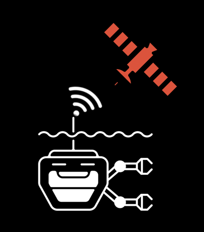
Space to Subsea
Status date: 29 May 2026
UVisions underwater 3D scanner is sold worldwide and helps asset owners get a clear overview and understanding of the state of their underwater assets. Based on customer requests this project integrates satellite-based positioning ensuring: 3D-models referenced in the global coordinate system, Improved accuracy and increased ease-of-use.

ATLASCast
Status date: 08 May 2026
ATLASCast, by Enable My Team (EMT), is a proposed project with the European Space Agency (ESA) delivering hyper-local climate forecasting for renewable energy infrastructure. It integrates nano-satellite data, AI, and ground systems to optimise site selection, improve safety, enable predictive maintenance, and support scalable, cost-effective, sustainable energy solutions.

SWIM
Status date: 08 May 2026
SWIM (Surface Water Information Management) is a satellite-enabled water quality monitoring and decision-support platform for lakes, reservoirs, and bathing waters. Combining continuous WAMO in-situ sensing, Sentinel-2 Earth Observation, and AI-driven predictive analytics, SWIM delivers 2–7 days advance warnings before harmful algal bloom onset enabling preventive action, automated regulatory compliance, and significant cost avoidance for water authorities and private operators.
AERIUS
Status date: 08 May 2026
AERIUS transforms satellite Earth observation, in-situ, and municipal GIS data into ready-to-use intelligence for managing and restoring urban green. Municipalities apply AERIUS to monitor vegetation vitality, water quality, and mitigate heat stress, maintain tree inventories, and fulfil EU Nature Restoration Law reporting — demonstrating “no net loss” and measurable “net gain” of urban green and tree canopy cover.
SETSITS
Status date: 08 May 2026
SETSITS develops Lanternn for Networks (LbV) - Valerann’s Advanced Traffic Management System (ATMS) engineered to resolve critical inefficiencies in road network management using real-time data fusion and analytics. Offering a transformative solution for national and urban road operators, LbV enables hyper-accurate data management to enhance safety, efficiency, and sustainability while leveraging proprietary technology to overcome the limitations of outdated processes.

G-PARK
Status date: 08 May 2026
G-PARK improves the positioning accuracy of micro-mobility vehicles in parking areas, enabling operators and city authorities to reliably verify correct parking, even in complex urban environments where traditional localisation systems face limitations.
STREAMO
Status date: 07 May 2026
STREAMO is a commercial downstream application seamlessly merging satellite and stratospheric Earth Observation data. Focusing on urban/mountain environments, the platform provides very-high-resolution, near real-time updated maps and insights like vegetation and thermal gradients. It offers a centralized marketplace for accessing archived products and requesting on-demand stratospheric tasking to bridge the gap between satellites and drones.

Belmap4EU
Status date: 07 May 2026
They project expands Belmap, GIM’s geospatial digital twin platform, across Europe to deliver harmonised, property-level intelligence on buildings, parcels and addresses. By integrating national open datasets with Earth Observation–derived features and scalable full-country processing, the platform enables consistent property insights across multiple European countries.

Bumble Bee
Status date: 07 May 2026
Bling Automated is offering an automated on-demand delivery solution for urgent B2B use cases, where parts or items are needed fast for a job. The company provides faster, safer, and more cost-efficient deliveries, at a time when demand for speed, automation, regulatory readiness, and improving unit economics are aligning.

SURGEON
Status date: 06 May 2026
SURGEON develops an autonomous drone delivery system for time-critical medical goods in healthcare logistics. By combining onboard AI, visual inertial odometry, and semantic satellite Earth Observation data, the system enables reliable GNSS-independent navigation. One operator can supervise up to 30 drones simultaneously, delivering lab samples and pharmaceuticals directly to hospital windows in under 10 minutes.
ADMONS-TI
Status date: 23 April 2026
The project develops an automated monitoring system for transport infrastructure (road, rail, waterways). It combines UHD Model of TI, vehicle sensor data, and satellite imagery to detect risks, changes, and maintenance needs. Available as on-premises or SaaS, the solution enhances inspections, lowers costs, and extends infrastructure lifespan.

Origin Aura
Status date: 20 April 2026
Origin is developing Origin Aura to enable autonomous data collection and global data transmission via Satcom, supporting the expansion of its trenchless pipeline repair and satellite leak detection technologies. Equipped with advanced sensors, the tool will capture precise location and operational data, ensuring accurate real-time reporting and allowing Origin maintain the high standards associated with its technology.

CEROC
Status date: 07 April 2026
Evaluation of operational feasibility and value of supervising multiple autonomous electric ferries from a centralized Remote Operation Centre.

E-Mobility SpaceLink
Status date: 30 March 2026
he project, led by Archimede, entails designing a solar-powered canopy for charging electric vehicles in remote areas lacking access to the power grid. Satellite imagery analysed by Planetek Italia will identify optimal installation sites, while satellite connectivity will enable deployment in emerging electric mobility markets, supported by Arthur D. Little’s sector-specific research.

CarbonTrust
Status date: 24 March 2026
CarbonTrust is an Earth Observation and AI-powered service that assesses forest carbon storage and climate-driven risks affecting carbon permanence. By combining satellite biomass estimation, wildfire risk modelling, and climate scenario projections, the service supports carbon markets, ESG due diligence, and climate risk management.

Coastal Futures
Status date: 24 March 2026
Coastal Futures uses very high-resolution satellite imagery and machine learning to monitor coastal dunes at scale. The platform provides coastal managers with frequent, high-resolution insights on sand movement, dune boundaries, and storm-driven change through an online viewer delivering over a decade of data at far lower cost than traditional field surveys.

Geo-Shield
Status date: 17 March 2026
OPTIMAIZE develops GEO-SHIELD, a satellite-enabled risk intelligence service that uses Sentinel-1 InSAR data to detect seasonal ground deformation and deliver dynamic, building-level vulnerability scores for clay shrink–swell hazards. The solution supports insurers in underwriting, claims validation, and proactive loss prevention, providing objective, scalable, and cost-efficient geotechnical drought risk assessment.
IoT Trust+
Status date: 12 March 2026
IoTtrust+ delivers quantum-safe encrypted satellite communications for IoT/OT systems and remote healthcare. Building on CyberHive's Connect VPN, it creates zero-trust networks between security-hardened endpoints through application fingerprinting and sandboxing - protecting against supply chain attacks.
EODT4Crises
Status date: 12 March 2026
Helyx and the University of Portsmouth (UoP) have developed “Earth Observation Digital Twins (DTs) for Crises” that focus on utility and transport networks. The DTs map the vulnerability of networks to natural hazards and the damage to these systems post-event. By using earth observation imagery, our DTs support the rapid global response of humanitarian teams to crises.

FLAMINGO
Status date: 12 March 2026
The FLAMINGO project increases automation in drone and vertiport operations by creating a digital twin of flight operations that integrates satellite, weather, and navigation data. This digital twin provides a foundation for the automated evaluation of operational risk and impact of weather conditions, facilitating the safe and scalable remote operation of drones and vertiports.

ROAD SYSTEM Mobile App
Status date: 10 March 2026
The ROAD SYSTEM™ Mobile App transforms how cities and infrastructure experts assess cycling conditions. Leveraging AI, smartphone sensors, and high-precision GNSS data, the app enables real-time, cost-effective evaluations of cycle lanes. With its intuitive interface and ability to scale without the need for dedicated hardware, it empowers urban planners, engineers, and auditors to make data-driven decisions that enhance safety, mobility, and sustainability.
HeatScan
Status date: 05 March 2026
Using satellite thermal data and AI to detect urban heat hotspots and identify overheated buildings to support energy efficiency and climate adaptation strategies.
INST
Status date: 26 February 2026
Instantly Networked Smart Triage (INST) is a satellite-enabled service providing real-time casualty location, status, and triage information to emergency services during mass casualty incidents. INST is enabled by a low-cost lightweight device that can be associated with a casualty to indicate where they are, how urgently they require medical attention, and to report the number of casualties.

OCTAGON
Status date: 25 February 2026
OCTAGON is a suite of intelligent tools and services available in Cloud in the form of SaaS, to facilitate the decision-making process and the management of energy assets, where "intelligent" means: optimal design, dimensioning and management of the energy system, simulation and management of multiple scenarios/sites (“behind” and “beyond” the meter) and easy to use for all players in the energy system, decision makers and users.

Dark Vision
Status date: 23 February 2026
Using innovative space-based nighttime imagery, Dark Vision will provide an understanding of how artificial light at night (ALAN) impacts our planet ranging from the effects on human health, ecology, the environment, biodiversity and the global economy.

Tunnll
Status date: 18 February 2026
Tunnll provides an innovative, efficient, and user-friendly local transit solution for small towns. Tunnll is a next-generation public bus service that achieves higher efficiency with advanced technologies.
Lunar-TARS
Status date: 11 February 2026
Lunar-TARS is a modular, autonomous robotic arm built for extreme environments. Its versatile design supports a wide range of missions, from lunar infrastructure assembly to regolith collection, driving the growth of a sustainable lunar economy.

RTIS
Status date: 10 February 2026
DataCosmos is Open Cosmos’ proprietary platform for storing and analysing satellite imagery.
RTIS is a near-real-time information system. By leveraging DataCosmos to detect and monitor oil spills and water turbidity in the middle east with rapid delivery time, RTIS will enable the rapid response to critical situations.

SATV2X
Status date: 04 February 2026
Today there are many roads, especially in rural areas, where cellular network coverage is inadequate to sustain reliable Intelligent Transport Systems (ITS). The SATV2X pilot aims to address this issue by integrating satellite and 5G terrestrial networks. This integration provides ubiquitous V2X (vehicle-to-everything) radio coverage, enhancing road safety use cases through a C-ITS Platform.
WILDFIRE ALARM
Status date: 02 February 2026
Wildfire Alarm delivers real-time alerts from ground-based optical detectors in both remote and populated areas. By combining multiple communications technologies, it achieves affordable, low-power operation with strong signal penetration through dense forests and highly reliable, instant transmission. This approach provides an accessible, cost-effective early warning system to protect lives, property, and infrastructure from wildfires.
RESIST 2
Status date: 28 January 2026
RESIST provides worldwide coverage for detecting GNSS Spoofers and Jammers anywhere over the Earth’s surface. The system relies on the CMCU, Central Machine learning Computation Unit and ground and space recorded data. RESIST 2 is the demonstration project, including pilots demonstrations in the maritime port of Marin in Spain and the DLR airfield of Cochstedt in Germany.

HOPE
Status date: 26 January 2026
HOPE is a solution, accelerating drone specific category flight authorization. We use the fusion of Satellite Earth Observation (EO) and Artificial Intelligence to accurately forecast human mobility and population density. This provides UAS operators and authorities with the objective data needed to define the Intrinsic Ground Risk Class (iGRC) under the SORA 2.5 framework, simplifying complex regulatory processes. complex regulatory fffffcompliance and opening up more airspace for safe operations.
DTM Tool
Status date: 26 January 2026
The DTM Tool service is a solution developed to address the challenges of the drone market. The service allows, through modern aviation surveillance technologies and geospatial data processing, to support safer and more efficient drone operations.

ENVIROSCORES – By HETWA
Status date: 21 January 2026
ENVIRO-SCORES provide cities and stakeholders with a transparent, data-driven scoring system powered by satellite, local data and advanced algorithms, delivering precise ecosystem insights (1–30 m) via the MEWISO platform. From water risks to climate resilience, they help local authorities prioritize restoration. The Prioritisation Score guides unsealing strategies, targeting heat islands, corridors, and vulnerable populations for smarter land use.

HeManEO
Status date: 13 January 2026
The activity aims to transform Earth Observation (EO) data into a reliable product for various business clients, including large corporations and the financial sector. It addresses compliance with auditing, legal standards, and emerging ESG regulations, offering End-to-end validation ensuring data security, compliance, immutability, and nonrepudiation.
SpaceAware Resilience (SWiiFT)
Status date: 08 January 2026
Feasibility study to investigate commercial uses of Space Weather Data in various industries, understanding the impacts of Space Weather on critical nation infrastructure and how leveraging and utilising space weather data can address these problems and gaps.
DRIPIN-D
Status date: 17 December 2025
Ground movements threaten buried pipes; new satellite radar analysis helps utilities predict and prevent failures.
BGI-Monitor
Status date: 16 December 2025
BGI-Monitor is a platform that transforms fragmented data and manual inspections into a clear view of urban green infrastructure. By combining Copernicus and Sentinel satellite observations with in-situ monitoring, it delivers dashboards, alerts, and scenario simulations that help asset managers, and green solution providers reduce costs, prevent damage, and demonstrate the impact of climate adaptation investments.
PYRNEXAT
Status date: 10 December 2025
The project developed a smart sanitation management platform by leveraging IoT and data analysis. It integrates earth observation, telemetry, and GNSS-referenced pathogen data with collected metrics on toilet user behaviour, providing dashboards to improve sanitation system monitoring and management
InsurEO
Status date: 09 December 2025
The InsurEO project applies innovative Earth Observation (EO) services to provide detailed insights into buildings and their surroundings—ranging from flood and landslide risks to environmental health, climate change, and sustainability. Through an intuitive web platform, organisations will be able to visualize and monitor these insights, whether for a single building or an entire property portfolio. Sectors such as insurance, banking, real estate, and energy service companies (ESCOs) will use these insights to make more informed decisions.
CCN1 SPARKme
Status date: 25 November 2025
The project proposes a new service designed to establish and operate the Space Data Information Centre (SDIC) in Nairobi (KE) to foster the utilization of space data, expertise and knowledge to catalyse commercial services in multiple sectors and generate revenues strengthening the SPARKme service offering.
Wildfire Preparedness
Status date: 14 November 2025
WEO’s Wildfire Preparedness service helps infrastructure managers, utilities, and landowners reduce the risk of wildfires by combining space data, artificial intelligence, and on-the-ground expertise. The tool identifies vegetation that poses a fire hazard to critical infrastructure, calculates flammability and connectivity risks, and supports prioritisation of preventive measures.
SCIRES
Status date: 01 November 2025
SCIRES is an innovative portfolio of services designed to support the management of the integrated water cycle. It leverages Earth Observation data, in-situ sensors, advanced data fusion models and Artificial Intelligence to deliver actionable insights.
All services are provided through a cloud-based Decision Support System (DSS) tailored for the management of critical infrastructures.

E-Spacement
Status date: 01 November 2025
E-Spacement enables the location optimization of electric vehicle (EV) charging infrastructure using spatial data, including space assets, and artificial intelligence (AI).
ImpactMaps
Status date: 30 October 2025
The solution will be used to identify disused and abandoned mines and environmental pollution, as well as determining the best locations for photovoltaics and quantifying investment volumes and ROI automatically.
AROBS AlertBox
Status date: 30 October 2025
AROBS AlertBox aims to offer access to E-alert messages and 112 emergency service, in environments that lack reliable GSM (Global System for Mobile Communication). This product is an emergency alert box that connects, via two global satellite constellation systems (Iridium and Starlink), to the national emergency response systems in critical situations when communication channels are compromised.
TEMIS
Status date: 22 October 2025
Massive end-to-end IoT satellite services, fully operational in GNSS denied environment and very robust to jamming & interferences for highly scalable applications in numerous verticals such as logistics, transport, agriculture/smart farming, maritime, environmental, mining/oil/gas, smart cities, smart building, e-health, utilities, industry…
app.52
Status date: 22 October 2025
Vertical52 develops a platform that equips journalists and civil society with satellite imagery and analysis. The project focuses on enabling secure access, tailored visualisation, and verification tools, ensuring that evidence from space can be used for fact-based reporting on environmental and human rights issues in regions where ground access is restricted.
DSOE-WPM
Status date: 25 September 2025
A feasibility study by SatVu to assess the use of high-resolution nighttime thermal satellite imagery for detecting water pollution outflows. The project aims to evaluate technical, commercial, and environmental value, engaging stakeholders and delivering a proof of concept using data from the HotSat satellite constellation.
AgriFly
Status date: 25 September 2025
AgriFly is a digital marketplace that connects farmers, advisors, drone pilots and analytics providers through one automated workflow. Built on Plan2Fly, it turns drone imagery into ready-to-use outputs (e.g., spray maps, drainage layouts, tree inventories), leveraging GNSS/RTK and EO to deliver precise, scalable services at lower cost
ASB
Status date: 24 September 2025
The Autonomous Safety Barrier (ASB) provides a virtual perimeter for vehicles in airport environments. Using GNSS-RTK and integrity monitoring, the system ensures safe, autonomous mowing and ground operations without physical barriers, enhancing safety, reducing costs, and supporting sustainable airport management.
ONUR
Status date: 12 September 2025
Supporting cities, communities, and climate stakeholders to identify, prioritise, and evaluate nature-based solutions using AI-enhanced satellite data.

FASTWIND
Status date: 04 September 2025
FASTWIND is a validated cloud-based tool to deliver satellite SAR derived wind products and automatically deliver them in into engineering and financial analysis tools. In collaboration, software developer Exceedence, Simply Blue Group, a leading blue economy developer, and NORCE Norwegian Research Centre, have used satellite data from ESA’s satellite network to showcase the great potential of satellite data as an information source for offshore wind development.
Heibjerg APW Robot
Status date: 04 September 2025
The pavement weeding efforts in gravel and stone pavement can be significantly reduced, if robotic technology can be used to automate large parts of this tedious task. Utilizing GNSS navigation and sensor fusing, and combining it with intelligent water dispensing, Heibjerg has enabled a small robots to carry out this task.
SpaceEPC
Status date: 11 August 2025
SatVu is collaborating with the Urban Big Data Centre (Part of the University of Glasgow) to enhance the analysis of building energy efficiency.
The study will drive the development of the Heat Loss Index (HLI), a pioneering metric designed to identify buildings with high thermal energy wastage, enabling policymakers and urban planners to focus retrofitting efforts where they will have the greatest impact.

Verisat.AI
Status date: 11 August 2025
Verisat is a tool that detects AI-generated or manipulated satellite imagery. It helps journalists, analysts, and decision-makers verify visual content using advanced machine learning models trained on real and synthetic satellite data.

CAPRI
Status date: 08 August 2025
Safer, faster, and cost-effective bridge inspections using AI-driven drone formations with cooperative localization, even in GNSS-denied areas.
SAPS
Status date: 04 August 2025
The aim of the project is to create a system for tracking criminals using GNSS signal jamming devices to steal cars and kidnap civilians. The project involves exploring the possibility of creating a system for tracing the disturbed signal based on low-budget GNSS receivers. The system would make it possible to determine the time and direction of the offender's escape from the crime scene.

The Digital Worksite
Status date: 01 August 2025
The Digital Worksite project develops a satellite-enabled solution to improve safety and efficiency for railway maintenance teams by tracking people, vehicles and equipment in real-time during worksites.
Travel Hands
Status date: 30 June 2025
Travel Hands is a service designed to ease the outdoor commute of VIP (Visually Impaired People) by pairing them with sighted & verified volunteers to travel together outdoors ensuring a safe, convenient, and inexpensive travel experience. The VIP pay for the service and Volunteer help in a flexible way and walk more. Volunteers are vetted through Enhanced DBS and trained by us.
Urban Green & Liveability Tracker
Status date: 30 June 2025
Enabling the Smart Green Cities of the future by tracking the urban green revolution, adaptation to climate change and liveability.
INVENTA
Status date: 23 June 2025
The INVENTA Demo Project implements innovative services able to increase the fruition, accessibility and sustainability of historical/cultural sites through the integration of Virtual & Augmented Reality with Satellite Navigation and Earth Observation. The service is based on an innovative mobile App leveraging SatCom technologies and the 5G network.

CACHE Net Zero
Status date: 17 June 2025
CACHE Net Zero is focused on the development and commercial deployment of a subscription-based service, aimed at Maritime Port Authorities, Port Operators and Shipping Operators. The service informs and contributes to port and shipping operation environmental sustainability and energy efficiency, leveraging access to satellite data sources, while also responding to the linked concerns about air pollution and progression towards net zero emissions in maritime ports and harbours. CACHE Net Zero data intelligence inform Port de-carbonisation and pathway towards Net Zero.
Global Water Quality Digital Twin (GWDT)
Status date: 17 June 2025
Water quality digital twin bridges together AMR abundance values with EO observation water quality markers extracted from Copernicus Marine. This project proved the feasibility to predict AMR abundance values in water utilizing machine learning model (random forest decision tree, xgboost) trained on 30 water quality, oceanographic, biochemistry parameters such as alkalinity, water pH, turbidity, sea water salinity, sea water velocity. etc.)
AGL
Status date: 16 June 2025
In this feasibility study, Agilica develops a local UWB based GNSS-like positioning system as an alternative Positioning, Navigation, Timing (APNT) solution, to enable autonomous drone landing for drone services companies that struggle to land manually on a vessel at sea, as well as for drone providers and eVTOL manufacturers operating in challenging GPS-denied indoor or outdoor environments.

SAFER
Status date: 16 June 2025
SAFER provides accurate, hyperlocal seismic hazard maps and forecasts. Leveraging GNSS, Earth Observation data and advanced AI models, SAFER enables proactive disaster preparedness, informed urban planning, improved infrastructure resilience and enhanced risk assessment for governments, municipalities, infrastructure operators, insurers and financial institutions globally.

Robust Scatterer InSAR
Status date: 16 June 2025
Ground deformation is a hidden risk that can cause severe damage to our infrastructure. Satellite-based deformation measurements using the InSAR-technology allow us to map deformation over large areas with staggering precision. However, a fundamental flaw in the technology is that it assumes a static scene. With RS-InSAR, we have integrated change detection to allow the mapping of dynamic scenes.
SMART
Status date: 16 June 2025
Feasibility study for an innovative climate communication AI-based service

SPACE4LIFE
Status date: 29 April 2025
This activity is a study aimed at assessing the feasibility of the development of a service based on satellite assets and cutting edge informatic technologies for a more effective management of level crossing monitoring and maintenance and the increase of road users’ safety at railroad intersections. The conceived service is proposed in response to the need of decreasing level crossing accident occurrence and, thus, making railroad intersection safer. The feasibility of service development is studied from a technical and economical point of view. The best compromise between costs and high performance is foreseen and finally achieved.
TIGRIS
Status date: 09 April 2025
Spaceline Labs (SPL) will deliver Earth Observation (EO) data to customers through SPLs software platform. The platform will provide access to EO data from satellites and a fleet of proprietary balloon-borne Satellites based in the stratosphere - developed and operated by SPL. The first iteration of this stratospheric technology is described as TIGRIS in this KickStart study.
IN: BIKE Discovery
Status date: 24 March 2025
A collaborative effort to gather data for insights, knowledge, and evaluation based on moving bicycles u nlocking the potential of bicycle data to revolutionise infrastructure and management decisions for active and micro-mobility.

MALIBU
Status date: 24 March 2025
AI-enabled services for private companies responsible for roads surveillance and monitoring, for Municipalities responsible for safety and comfort aspects towards the roads’ users but, at the same time, also needing to safeguard the municipality cash balance.
MALIBU leverages on the most up to date technologies (from satellites to AI) to provide users with agile, flexible, effective and economically advantageous solutions for road defects detection, both through an own web platform, or to be integrated in already available user’s systems (e.g., GIS).
The MALIBU on-board unit, thought and designed for the monitoring of asphalt’ s defects, can be installed on cars, vans or, for the mapping of a large part of the urban road fabric, on local buses fleet; that means an adaptive and functional solution that can provide an overall view and always updated status information of roads travelled daily by equipped vehicles.
All the information can be easily accessed on a web platform that allows users to search and filter the data, download it and visualize it as plots, in a tabular format and/or in GIS (directly on the map). Additionally, the platform provides periodic reports, in CSV or PDF format, concerning the data produced by the main services.
In addition to the defects’ detection service, also a set of other sub-services is provided.

SPACES
Status date: 14 March 2025
SPACES enhances accessible parking through sensor-enabled monitoring, satellite imagery analysis, and a Bluetooth-integrated parking permit system. By combining real-time data with geospatial insights, the project improves enforcement, reduces misuse, and ensures equitable access for people with disabilities. Developed with ESA, Dún Laoghaire-Rathdown County Council, and Expleo, SPACES prioritizes smart, inclusive urban mobility.
CTAPP
Status date: 11 March 2025
The CTAPP will be specifically tailored to urban environments, addressing the unique challenges that cities face in the context of climate change. Using the CICs methodology, EO and non-EO data, it will systematically analyze and model the cascading effects of climate-related events in urban environments and provide critical insights into the vulnerability of urban areas to climate-related disasters.
Drone parcel distribution in a closed area
Status date: 24 February 2025
The project prepares a feasibility study for Technology for Drone parcel distribution in a closed area on designed Drone Helipads. The helipads and Navigation System for drones are satellite-based on GNSS and Earth observation data to ensure safe, precise landings in urban environments. Designed for commercial drone operations, it enhances logistics efficiency while minimizing risks. The system is tested in real-world conditions through Brno Exhibition Centre.
ARIES
Status date: 03 February 2025
The aim of ARIES project is to provide to the end users, i.e. Italian Civil protection (IPC) - Servizio Emergenze Protezione Civile Abruzzo, Italian Fire brigades (VVF), Carabinieri – Corpo Forestale (CUFA), Parco Naturale Regionale Sirente Velino, Municipality of Celano, an efficient set of services to improve the prevention and detection, monitoring and response to landslides and wildfire emergencies. This will be achieved through the combined use of new technologies (terrestrial and satellite both) to enhance the quality and interoperability of the tools for forecasting and monitoring wildfires and hydrogeological risks.
Wildfire emergencies
The proposed services will support forest fire emergency management through the integration of different data sources (i.e. Sentinel-2, PRISMA and IoT sensors data, drones) to provide target End Users actionable information (alert and precise localization of hazard, risk indexes, fire front propagation, etc. ) on a dedicated dashboard.
Landslide emergencies
The proposed services will support landslides emergency management through the integration of different data sources (i.e. COSMO-SkyMed, IoT sensors data, drones) to provide target End Users actionable information (alert and precise localization of hazard, risk indexes, etc).
SCOTSS
Status date: 21 January 2025
The project introduces a 5G-enabled satellite educational platform to deliver academic experiences. Integrating space education, satellite navigation, and Earth observation enhances environmental awareness. Utilizing AI and VR/AR, it tackles educational challenges and offers personalized learning paths. Ensuring accessibility for students with disabilities and those in remote areas, it includes a ground station monitoring facility for satellite communication and data acquisition.
Smart Urban Tree Management
Status date: 21 January 2025
WEO’s TreeMonitor enables municipalities and asset managers to optimise tree maintenance and management by tracking tree growth and health with space data. Spot trees posing a risk to critical infrastructure, track progress towards tree planting goals and identify trees in poor health all from one tool.

Inteliports PORTAL
Status date: 17 January 2025
Inteliports develops autonomous, heavy lift drones and drone ports for the future of aerial logistics. The PORTAL project is seeking to trial demonstration of multimodal, collaborative logistics involving unmanned, aerial drones and micromobility with advanced robotics, automated infrastructure and SATCOMS enabled technologies. The project is a collaboration between Inteliports and Vodafone.
WSDSI
Status date: 16 January 2025
Wastewater market intelligence company Klarifi has conducted a Kick-start activity to do Wastewater Structure Detection from Satellite Imagery (WSDSI). By accurately mapping the structures at 100,000+ wastewater facilities, we will provide highly valuable data to our clients and gain a unique competitive edge in the wastewater market intelligence space.
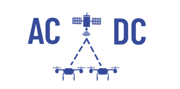
AC-DC
Status date: 16 January 2025
The AC-DC project focuses on applying various types and techniques of GNSS combinations, including the new Galileo High Accuracy Service (HAS), in operational scenarios to improve the performance and reliability of a dynamic high-accuracy positioning service and reduce separation distancing in and around air/vertiports and logistical nodes that could be considered congested areas.

SaturnX
Status date: 15 January 2025
SaturnX is a drone-based wind turbine inspection service collecting high-resolution RGB images from an offshore wind farm-resident Launch/Recovery/Recharge Platform (LARRP), thereby replacing traditional inspections involving technicians manually climbing turbines using ropes or semi-manual inspections via drones operated from a pilot on the vessel deck. SaturnX inspection flights are conducted BVLOS, enabled by satcom technology and operated from an onshore Control Centre.
Space Technology Aided 3D Underwater Scanning
Status date: 26 December 2024
The project evaluates how 3D models of underwater assets produced for inspection and maintenance purposes can be enhanced by using satellite-based position technologies to improve the accuracy of the models themselves as well as position them in the global coordinate system. It also evaluates scan data transfer to the cloud, from remote locations, using satellite communication technology.

VertiRapid
Status date: 26 December 2024
VertiRapid is a cutting-edge service designed to facilitate safe and efficient flight operations around vertiports (vertical landing/starting areas) for drones and Vertical Take Off and Landing aircraft. Leveraging available geodata and verified with Earth Observation (EO) techniques, VertiRapid swiftly determines operational parameters crucial for safe flight, aligning with ISO/DIS 5491 standards and European Aviation Safety Agency guidelines.
Linking Drones Last Mile Delivery
Status date: 26 December 2024
Having already created a groundbreaking drone delivery solution that combines proprietary drone technology with a user-friendly mobile application, Linking Drones are now looking to expand their service offering by allowing offline satellite imagery maps, providing live telemetry from the drone, and enabling the use of third-party drones via our easy-to-use mobile app.

AMR-Sweeper
Status date: 26 December 2024
Our cities have more paved land than lawns, and although the lawns have spurred an exponentially growing market for robotic lawnmowers, no similar robotics solution exists for autonomous maintenance of paved areas. O-Robotics has a mission to develop the AMR-Sweeper, a multipurpose Autonomous Mobile Robot (AMR) to sustainably address the maintenance needs of paved areas in our cities.

SGAM
Status date: 23 December 2024
SGAM is addressed to owners and managers of large infrastructural networks and is designed for the assessment of geohazards that may impact on geotechnical assets, focusing on the interaction between infrastructures and natural environment. It combines Earth Observation data, ground-based monitoring data, geohazard databases, and AI algorithms to identify critical issues allowing for cost-effective predictive maintenance investments. It features techniques such as A-DInSAR and PhotomonitoringTM for precise monitoring of surface changes, allowing for historical analysis and change detection.
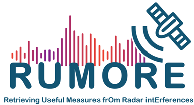
Rumore
Status date: 23 December 2024
Gain Unmatched Insights into Radar System Types and Locations: RUMORE provides intelligence on ground radio transmitters, including their key parameters, by analysing Synthetic Aperture Radar (SAR) images operating in the same band as the transmitters. The Pulse Descriptor Words (carrier frequency, bandwidth, duration, modulation type, Pulse Repetition Frequency, Polarization, TOA, DOA), are used to identify and expand transmitter type databases.
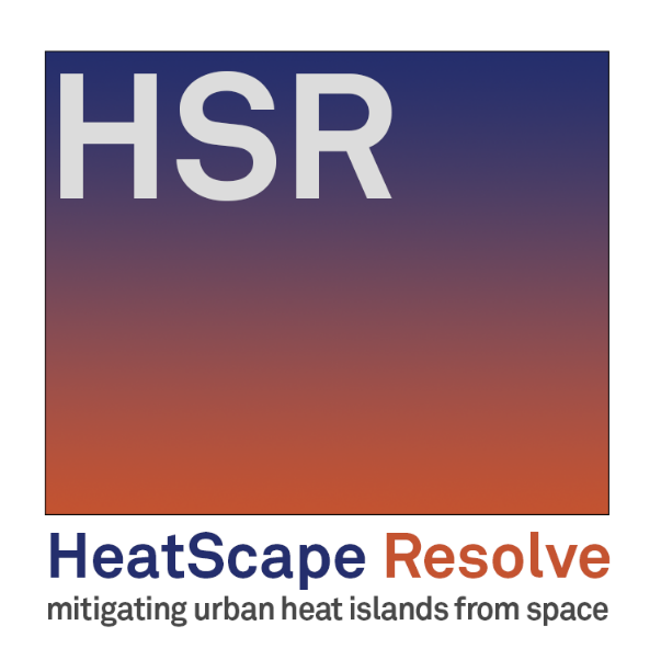
HSR
Status date: 23 December 2024
HeatScape Resolve project is developed jointly by Paulinyi&Partners cPlc. and Envirosense Hungary Ltd. to provide a solution for mapping and mitigating the urban heat island effect using satellite earth observation imagery, aiming to improve the effectiveness of existing predictive simulations. It makes use of Earth Observation data as input parameters for microclimate simulations for large scale urban real estate developments.

IPAS
Status date: 21 December 2024
IPAS (Interruption Prevention Alert Service) is a next-generation risk alert solution, developed with support from major UK utilities, to alleviate risk within proximity to critical assets across entire networks.
The platform harnesses satellite technology, asset geo-data and other third-party data intelligence to identify third party interference within close proximity to critical utility assets and enable more rapid operational response.
MEMT
Status date: 21 December 2024
MEMT is an intelligent digital tool that provides near real time operational information from the mining site to the mine management, to support fast and objective decision-making, with the purpose of enhancing operational efficiency.
ASBCIMS
Status date: 21 December 2024
SuperVision Infrastructure - critical infrastructure monitoring system that utilizes satellite data and Earth Observation (EO) methods to develop an automated software solution for detecting and assessing damages and risks in close proximity to critical infrastructure. Exploring a fusion of optical and radar data with varying resolutions, the system serves as a rapid-response tool specifically designed for occupied and inaccessible territories.

ENTEL
Status date: 20 December 2024
ENTEL combines EO satellite imagery and geospatial data to improve the effectiveness and resilience of large energy infrastructure operators, supporting their activities during the whole network life-cycle.
BrightEarth
Status date: 20 December 2024
BrightEarth is a web-based application that generates cartographic data from high-resolution satellite imagery. The data are available on demand from anywhere in the world, and include 3D vectors, GIS raster and textured 3D building models.

SESIM
Status date: 20 December 2024
Revolutionize Incident Management on Industrial Sites!
Introducing our cutting-edge software platform tailored for large industrial sites. With a fusion of Earth Observation data and real-time GNSS tracking, gain unparalleled insight into site dynamics. Instantly locate personnel during emergencies, communicate crucial instructions swiftly, and optimize response strategies. Experience a new era of incident management efficiency and safety.

CORISCLIM
Status date: 12 December 2024
Rapid Assessment of Future Coastal Flood Risks Around the World To Build Coastal Resilience
TruewaveGPR
Status date: 27 November 2024
The fusion of positioning, inertial and subsurface data sets at a singular point.
A consortium of Europe’s leading ground penetrating radar and electronic developers have teamed up with the UKs most high-profile horizontal drilling operations to create the world’s leading terrain compensating subsurface inspection system capable of creating 3D data sets for analysing buried assets below challenging terrain.
LucidEO
Status date: 27 November 2024
Space-enabled Productivity & Wellbeing leveraging satellites, wearables and AI
ISABHEL
Status date: 11 November 2024
ISABHEL is a continuous monitoring service that leverages 5G technologies and provides qualitative and quantitative information for the management of specific assets, identifies areas for predictive maintenance, supports asset financial resilience and disaster prevention. The proposal is based on the synergistic integration of different technologies enabling advanced monitoring of the structural health of bridges. The service is specifically aimed at monitoring the structural health of bridges located on the Po River, which are recognized as assets of interest for the City of Turin.

SUPER
Status date: 11 November 2024
SUPER focuses on using Earth Observation (SatEO) and Satellite Navigation (SatNav) for Urban Air Mobility (UAM) infrastructure planning and integration into public transport, and in planning and monitoring aspects of UAM operations. Relying on SatEO (archived and near real-time) data provides diverse geospatial, environmental, weather and mapping information, and allows combining it with SatNav data from air traffic (once available).
safeBACK
Status date: 31 October 2024
With safeBACK, our integrated Safety Alert and Flood Forecasting Engine, we empower local authorities and civil protection agencies to act proactively in case of flooding. By combining real-time water levels, precipitation forecasts, and Earth observation data, safeBACK provides accurate alerts and probabilistic flood forecasts for brooks and creeks. This enables authorized users to anticipate and understand flooding situations, enhancing response readiness and protecting communities before disaster strikes.

B2B Bike Navigation
Status date: 04 October 2024
This project developed an end-to-end navigation service which can be fully integrated into business customers’ own 2-wheeled vehicle products/services, including best-in-class routing optimisation (tailored to user needs) and navigation for 2-wheeler use-cases.
This makes it easier, safer and more convenient for people and goods to travel by light, 2 wheeled transport rather than by cars, vans and trucks.
EPOS
Status date: 25 September 2024
Europe requires clean, independent energy sources now more than ever. EPOS is a software-as-a-service solution that provides energy planning in buildings and cities. It combines state-of-the-art energy modelling with Earth Observation data, enabling engineers and decision makers to ideate, analyse the current situation and create diverse supply concepts. EPOS centralises essential data and includes AI algorithms for more efficient energy transformation.

LUNESA
Status date: 16 August 2024
Producing 2D and 3D Digital Elevation Maps (DEMs) based on merging EO data with real-time image capture from thousands of shared e-scooters, e-bikes, e-mopeds etc to develop up-to-date mapping and terrestrial imaging solutions
M3S
Status date: 24 July 2024
The proposed service utilizes Earth Observation (EO) satellites and geospatial technologies to optimize micro-mobility planning and fleet management in urban areas. Its goal is to offer sustainable and efficient solutions for the growing micro-mobility sector, encompassing electric cars, bicycles, and scooters.
OPVIDA
Status date: 23 July 2024
This kick-start activity centred around Luna Systems' computer vision solution which is designed to improve the safety of shared micromobility vehicles. The system employs computer vision to identify patterns in shared vehicle rider behavior, focusing on sidewalk riding, travel speed, and proximity to pedestrians. This data provides valuable insights for shared mobility operators, enabling them to enforce safer riding practices among their ridership. Recognizing the limitations of Global Navigation Satellite Systems (GNSS) in urban environments, the activity centred on exploring the feasibility of AI-based techniques such as Visual Wayfinding and Map Matching to enhance positioning accuracy to ensure robust ride safety assessments.
PARK
Status date: 22 July 2024
PARK uses GNSS Raw measurement for improving positioning accuracy of micro-mobility vehicles for parking purpose and to prevent micro-mobility urban cluttering. Added value of a GNSS accuracy positioning service, through GNSS Raw measurement, is that it can be implemented by avoiding costly infrastructure and with zero-impacts for users.

Forests from Space
Status date: 08 July 2024
Treedom is the first non-productive, privately financed online planting platform that allows consumers and businesses to plant trees remotely and follow their storylines. Satellite images and their elaboration will provide engagement and transparency tools to our customers and users

AIDA
Status date: 21 June 2024
The AIDA Feasibility study proposes two new services based on EO data and integrated with AI technologies, able to provide tools and value-added information helping damage assessment and monitoring in support to recovery efforts focused on agriculture and strategic infrastructures, specifically for areas prone to natural and man-made disasters and conflicts.
STREAMO
Status date: 21 June 2024
STREAMO provides advanced Earth Observation services from the Stratosphere, by using swarms of small and reusable High-Altitude-Pseudo-Satellite called CubeHAPS®, developed by Stratobotic. The solution improves regionally the Earth Observation services. The products offered are super-resolution, 3D models in real-time and SAR imagery at higher temporal and spatial resolution and lower costs, as almost no infrastructures are needed to use CubeHAPS®.
DIBAS
Status date: 19 June 2024
DDK Positioning Ltd. (DDK) provide GNSS hardware and Precise Point Positioning (PPP) services that improve GNSS positions from 10m to an accuracy of <5cm. DDK delivers its positioning service exclusively via the Iridium satellite communications constellation using Iridium’s 66 military grade LEO satellites to market sectors globally, from pole-to-pole.

WaaS
Status date: 19 June 2024
The project aims for a future where managing the micro-mobility system, makes walking a convenient, accessible, and attractive option for short urban journeys, complementing other transportation modes seamlessly.
RebuildCost
Status date: 14 June 2024
The Commercial Property Insurance project is developing a management platform for the insurance industry, providing Digital Twins of several datasets including crime, fire and rateable value, as well as Earth Observation and sensor-based data on natural catastrophe aspects (river flow, flooding, landslip, earthquake). The two main goals of the platform are to support parametric loss adjustment and improve rebuild cost validation.
DINAMO
Status date: 26 May 2024
DINAMO is a multi-sensor multi-temporal platform representing an operational tool designed for the early-warning and detection of possible structural failures designed with the purpose to provide a solution to the growing need of reliable and durable operational tools for bridges and viaducts continuous

ASPEN2
Status date: 10 May 2024
ASPEN is an affordable and reliable measurement tool for pavement condition monitoring. Our smartphone app allows road infrastructure authorities to gather high-quality data for maintenance planning at a fraction of the price spent today.
Digital Port Platform
Status date: 07 May 2024
The Digital Port Platform is a Hub of maritime modules to improve port operations and lower their environmental impacts.
This Hub gathers space assets and other sources of data to transform them into key indicators thanks to advanced AI technologies.
It allows real-time situational awareness to solve major environmental and performance issues.
PWP APPIDE CCN
Status date: 06 May 2024
APPIDE is an AI-powered tool designed to increase the efficiency of thermographic inspections of photovoltaic plants (both ground- and roof-mounted). Using radiometric, RGB, and GPS data acquired from drones, APPIDE generates detailed reports in a matter of hours, identifying exactly where and what the performance problems are on solar sites. Our AI-based solution drastically reduces the inspection times by human inspection and increases the reliability of reports. Overall, APPIDE allows you to make more inspections with fewer human resources, maximising the return on investment of your drones and your business.

SA4D
Status date: 16 April 2024
What short and long-term actions can be implemented to foster opportunities for the space sector in aiding the green transition and decarbonisation of the economy, with a particular focus on the Buildings and Energy & Utilities sectors?
THERMALEEGO
Status date: 07 March 2024
Revolutionize energy asset inspection with ThermAleego: AI-powered software using thermal imaging and space assets for precise anomaly detection, optimal maintenance, and cost savings.
Energy SCOUT
Status date: 22 February 2024
Energy SCOUTTM is a modular set of services which transform daily and weekly feeds of raw satellite sensor and spatial data into a series of value-added information products, targeting different activities along the oil & gas supply chain.

Maritime port container activity zones
Status date: 26 December 2023
This geo fencing data base provides the shipping industry with container door opening event qualification, operational deficiencies tracking, container mishandling events locations and CO2 shipment emission data tracking.

SP4GO
Status date: 26 December 2023
SP4GO is a solution to support the maintenance of electric power distribution infrastructures. SP4GO uses cost-effective and high-resolution satellite data to reduce inefficiencies and maintenance costs of high voltage power lines by detecting potentially dangerous situations related to the overgrowth of vegetation, the construction of new buildings that come too close to infrastructure and detecting land terrain change.
SP4GO is targeted to electric power Transmission System Operators (TSO) and electric power Distribution System Operators (DSO).
AlertSat Portal
Status date: 26 December 2023
The AlertSat satellite constellation is to deliver Alerts directly to its users, through AlertSat Portal - when critical information has been detected and there is still time to act upon it.

Space-to-Tree S-2-3
Status date: 26 December 2023
S-2-3 a multi-scale/parametric system aimed at monitoring the health status of trees within parks of historical-cultural or naturalistic interest. Objectives: defend the beauty of the tree, archaeological and monumental heritage; monitor the environment; manage risks to people or property. The data is enjoyed through webGIS platform with dual functionality: cataloguing trees; Monitoring the dynamics of trees with respect to wind.
WaSat
Status date: 12 December 2023
The Norwegian company Ocean Oasis is developing a wave powered desalination technology to increase access to safe and affordable water in water scarce coastal regions. The capacity to efficiently evaluate the wave resource in specific locations allows for production forecasting and pricing. Earth Observation data has been used to improve the accuracy of the analysis tool.
VADUS
Status date: 11 December 2023
The project VADUS provides to tourists the opportunity to enjoy cultural heritage that is not easily accessible to improve the enhancement of archaeological and museum sites. VADUS,realizes a metaphorical safe “way” of a virtual nature that overcomes physical and cultural barriers related to difficult access, reduced comprehensibility for the lack of some significant parts, presence of hidden or difficult to interpret cultural aspects.

Origin Orbit™
Status date: 04 December 2023
Origin Orbit™ is an advanced cloud based B2B software platform, revolutionizing gas and water pipeline management through satellite remote sensing, machine learning, and our integrity management expertise. The platform aims to offer faster, more cost-efficient, and environmentally conscious solutions in line with relevant regulatory and legislative requirements, vastly surpassing traditional survey and assessment methods.

Visu8
Status date: 28 November 2023
Satellite enabled smart autonomous micro-particulate analysis for real-time and remote water quality monitoring.
Ecosystems – CPV
Status date: 27 November 2023
Ecosystems – CPV provides data and modelling capabilities for utilizing coastal ecosystems as vital green infrastructure for protecting critical assets, business activities and people along coastal zones. The solution provides quantitative data and flexible modelling approaches to the insurance and infrastructure sectors, facilitating the effective and sustainable use of coastal ecosystems for disaster risk reduction and climate adaptation.
SES5G
Status date: 27 November 2023
SES5G prevents, detects and manages wildfires and illegal actions in forestall areas.
The solution relies on satellite observation, autonomous drones, advanced firefighting sensors, security gates with plate readers, mobile control rooms that, with Artificial intelligent algorithms that feed with geolocalized data stakeholders control rooms (Civil protections, Environment department, Public protection, … ).

VunaNexus
Status date: 27 November 2023
Urine contains all the nutrients needed to fertilise plants. However it is considered a waste and most of these nutrients are currently discharged in nature. VunaNexus develops technologies that enable the recycling of all nutrients contained in urine to transform them into natural fertilisers. One of the first pilot systems is installed at the ESA HQ in Paris.

ARcade
Status date: 27 November 2023
Information and entertainment at the right time, in the right place. A platform providing a series of geolocated interconnected virtual spaces, called ‘Arcades’: virtual spaces overlaid on reality, activated by GNSS, where users access images, films, text and sound, using a smartphone/iPad. Turning everyday locations into virtual cinemas, classrooms, music venues, galleries, information hubs or marketing billboards.
SA4D
Status date: 24 November 2023
The goal of the project “Space Acting for Decarbonisation (SA4D)” is to perform a feasibility study that will demonstrate the technical and economic viability of suitable satellite-based services for suggesting decarbonisation actions targeting agriculture, food production and building construction economic sectors.

SPOTLITE
Status date: 30 October 2023
Spotlite is an infrastructure monitoring system based on satellite imagery. It uses InSAR (Interferometric Synthetic Aperture Radar) data to assess structural stability and ground subsidence over transportation networks (road and rail infrastructure), including pavement and adjacent slopes.

EDGE-AI
Status date: 30 September 2023
Revolutionizing critical infrastructure protection and biomass monitoring with AI-powered drones. Leveraging cutting-edge technology to redefine security and efficiency in the energy sector. Welcome to the future of real-time surveillance and monitoring solutions.

FWM
Status date: 27 September 2023
Currently, surveys of floating weeds are carried out from boats or helicopters. The service supplies weekly maps and metrics of free-floating weeds using a combination of radar and optical images from ESA Sentinel satellites. Floating Weed Manager is a web service that offers customers across the globe a range of products supporting enhanced weed management programmes.
GIP4 Smart Airports
Status date: 19 September 2023
Fourteen million flights are expected in 2035 in Europe. To increase airport capacity and efficiency, optimisation at every step must be carried on. GIP4SmartAirports projects aims at minimizing rotation time and smoothing real-time operations. Space technologies can be a valuable asset to support surveillance and safety, and help airport manager to maintain high quality and complete knowledge of their assets.

EFFORS
Status date: 18 September 2023
A real-time flood forecasting system has been developed and is operated at the computational centre of the Austrian national weather service GeoSphere Austria.
EFFORS brings together experts in the field of meteorology, hydrology, hydrodynamics and satellite communication. Within a coherent modelling chain, the EFFORS system couples the individual numerical models and provides relevant data about flood evolution on short time scales.
SMARTGRIDS-DEMO
Status date: 13 September 2023
The project develops technically and financially feasible services that can assist stakeholders of the energy network sector in their work practices. Earth Observation data and Artificial Intelligence techniques are the key assets for developing services that can help improve performance, reduce costs and mitigate problems, which arise from the management, maintenance and operation of the energy network infrastructures.

SeaWire DeepSea 5G LEO
Status date: 16 August 2023
Unleashing the power of 5G connectivity at sea, the SeaWire DeepSea 5G LEO solution transforms maritime communication. This innovative solution combines terrestrial and non-terrestrial networks for unmatched speed, seamless transitions, and lower costs. Beyond solving current maritime challenges, it anticipates future needs, promising an improved quality of life at sea, smarter transportation, and a revolution in the maritime industry.
APPIDE
Status date: 07 August 2023
APPIDE is an AI-powered tool designed to increase the efficiency of thermographic inspections of photovoltaic plants. Using radiometric, RGB, and GPS data acquired from drones, APPIDE generates detailed reports in a matter of hours, identifying exactly where and what the performance problems are on solar sites. Our AI-based solution drastically reduces the inspection times by human inspection and increases the reliability of reports. Overall, APPIDE allows you to make more inspections with fewer human resources, maximising the return on investment of your drones and your business.

CUES
Status date: 04 August 2023
The Real Estate value chain is currently unable to tap into and utilize the efficiency potentials inherent in the urban built environment. Many office buildings are underutilized – void periods are often long and costly. CUES provides stakeholders in real estate with a surface to visualize and understand and improve asset utilization.
Space for UAM
Status date: 04 August 2023
The main objectives of the Space for UAM Feasibility Study is to carry out an in-depth analysis on the technical feasibility and economic viability of space-based services and solutions in support of the development and/or operations of UAM for use cases of interest to the user communities, and/or its integration into the air traffic.
Intelligent Roadworks-Smart Infrastructure Planning
Status date: 31 July 2023
This study investigated the feasibility of using Synthetic Aperture Radar (SAR) images to assess the roughness, as a proxy of quality, of roads in the Flanders region (Belgium). Road authorities could benefit from this solution as follows: (i) The need for (expensive) manual inspection decreases, and (ii), this provides a high-level objectivized overview of road quality in their operating area.

RESIST
Status date: 25 July 2023
RESIST provides worldwide coverage for detecting GNSS Spoofers and Jammers anywhere over the Earth’s surface. The system relies on the CMCU, Central Machine learning Computation Unit and ground and space recorded data.

SkyWake
Status date: 10 July 2023
For the detections of water leaks, Earth-Observation can play a fundamental role. By boarding on General Aviation Aircrafts Thermographic, Optical and Synthetic Aperture Radars sensor, and crossing their high-resolution outcomes with satellite interferometric data analyses, sub-surface phenomena may be investigated, understanding how water distributes across the networks of urban environments allowing to potentially address water losses location.

GridEyeS
Status date: 10 July 2023
GridEyes delivers satellite-enabled situational awareness for electricity transmission and distribution operators worldwide. By combining Earth Observation data with advanced artificial intelligence and weather intelligence, the service enables faster, safer and more cost-efficient vegetation and risk management along power lines — reducing operational risk and environmental footprint.
Following a successful ESA-supported demonstration, GridEyeS is commercially available and serving customers globally.

UpGreen
Status date: 19 June 2023
UpGreen helps cities to realize more effective urban green policies. It is based on actionable insights on the actual and future state of urban green as well as on the greenery vision model proposition, enabling strategic decision-making, and identification of the most effective urban green projects and policies.

SmartMetRoadMap
Status date: 05 June 2023
SmartMetRoadMap is focused on updating a platform dedicated to the provision of tailored services for the operational management of meteorological risks on roads.
The updated platform is based on an AI-driven fusion of high-resolution NWP output and heterogeneous measurements captured in real-time, possibly also via 5G, and is specifically designed to make the most of satellite weather monitoring data.
MOWGLI
Status date: 31 May 2023
From planning to monitoring: the exploitation of satellite technologies in urban and rural microgrid life cycle.
Proteus
Status date: 16 May 2023
Proteus builds on the success of the SEDDCR project and introduces a significantly increased operating area by leveraging novel space technology such as Iridium NEXT. Integrating with the NHS Highlands, Skyports is delivering to six medical facilities where drone deliveries facilitated by space technology has the potential to significantly enhance patient care.
Economic Intelligence Factory
Status date: 12 May 2023
The objective of this demonstration project was the analysis of satellite data to create standardized indicators of economic activity, from the study of key sectors of the economy.
Anywhere Care
Status date: 12 May 2023
The Anywhere Care Mobile Alarm Service using GNSS assets will enable vulnerable people to be continuously monitored wherever they may be, creating both automatic and user generated alerts for action by Social Care and family carers. This will facilitate a step change in the deployment of social care teams and improve outcomes for recipients.
GISSMoR
Status date: 28 April 2023
We want to utilize mobile robots for performing two distinct services simultaneously: 1) Creating or refining the precision of GNSS-based GIS maps of sidewalks using our mobile robots for data collection via adequate sensors/cameras. 2) Collect data on the quality of the sidewalks using accelerometers already in the robot, coupled with an AI camera for visual confirmation.

Netcarbon Intelligence
Status date: 15 April 2023
NetCarbon revolutionises global carbon sequestration measurement through our Carbon Intelligence Platform, which utilises satellite data to help Cities measure their carbon storage, plan improvements, and manage implementation. Our technology meets the dual challenge of contributing to carbon neutrality while respecting regulatory constraints to fight climate change, together.
IMMAGINA
Status date: 14 April 2023
IMMAGINA is a digital platform including software modules, surveillance devices, satellite systems and 5G components that combine detection and monitoring functions with the most modern tools for Control Room and Operation Centres. It offers the most complete range of imaging and image-based analysis services to government and private law enforcement agencies.
Telecense
Status date: 31 March 2023
Telecense allows Companies, Authorities, International Organizations and Labs to assess and anticipate population growth and migration in emerging countries.
Diginove has developed earth observation algorithms and demographic models in order to build Telecense, a service that provides geo-localized population estimation where censuses are unavailable or outdated.
GreenUP
Status date: 27 March 2023
One of our cities' challenges is to design integrated urban environments that balance between growth ambitions, an increasing population and climate emergency, and at the same time introducing new standards for green growth, biodiversity, inclusion and quality of life. The GreenUP project aims to shed light on how satellite technology can be transformed into flexible and user-relevant tools to support local authorities and other stakeholders involved in the development of sustainable urban environments.

FlexCurb CurbX
Status date: 27 March 2023
FlexCurb CurbX evaluates the technical and commercial feasibility of an app for cities to digitize curb assets and regulations more easily in cities. By using augmented reality and postprocessing with Earth Observation the app enables highly accurate and standardized curb data generation.
GIADA
Status date: 15 March 2023
GIADA exploits gravity field observations, mainly derived from GOCE mission, with others in situ data to build a 3D model of the Earth crust at regional scale. The service results help oil & gas and mining companies in the preliminary exploration activities to identify regions with high potential in terms of natural resources exploitation.
Other industries which can take benefit from the service results are mining companies, or more in general companies requiring a good knowledge of the geological setting at regional scale for resource exploitation purposes.
DOCS-2
Status date: 15 March 2023
Using civil aircraft to create constellations for providing high spatial & temporal Earth observation data and telecommunication services; a most ecological constellation re-using the most reliable platform.
SequOIA-CAM
Status date: 14 March 2023
SequOIA-CAM offers an end-to-end biological carbon accounting, vegetation monitoring and carbon stocks sequestration rate simulation service for sustainable cities, regions, forest owners, and forest-related companies. SequOIA-CAM leverages the unique capabilities of Satellite-based Earth Observation (EO) that provides the necessary high spatial and temporal resolution and cost-effective monitoring capacity to ensure that nature-based solutions are implemented correctly and to ensure accurate quantification of carbon stocks in forests.

MoSCI-ECOSPACE
Status date: 06 March 2023
MoSCI-ECOSPACE is a service tool to assess the condition of ecosystems – like beaches, dunes or controlled flood plains – and man-made structures – like seawalls or dikes – in coastal territories and inform decision-making in case of ill-condition, damage or destruction, based on products derived from earth- and airborne- observing systems.
S4UG
Status date: 28 February 2023

UnitGate Satellite Broker
Status date: 18 February 2023
Satellite Broker - Easy Access to Any Satellite Service.

U-space2
Status date: 14 February 2023
The U-space2 study aims to identify and analyse the technical and economic feasibility of an Advanced and Specialized Traffic Information Service (A/S-TIS) exploiting space services such as SATNAV, SATEO, SATCOM, METEOSAT and ground services (5G) in support of UAM. The expected result is a A/S-TIS preliminary mock-up of the, its service and system architecture design, its development and business plan.
Space Augmented UAM
Status date: 14 February 2023
Space Augmented UAM aims to determine the feasibility of a “Space Augmented” service enabling cities and regions to conduct U-Space integration assessment utilizing economic, technical and environmental simulations for predictive assessment considering the individuality of each city to generate a self-sustainable Urban Air Mobility ecosystem.
Sustainable Tourism Indicators
Status date: 31 January 2023
Have you ever had environmental considerations while on vacations? Most travellers are keen on preserving the area they are visiting but very few have reliable information on the actual environmental situation. Within this project the use of Earth Observation data is assessed to quantify the environmental situation and deliver this information in a simple way to all tourism stakeholders.
Urban Green Quality Tracker
Status date: 25 January 2023
Enabling the Smart Green Cities of the future by providing a dashboard of the health, extent and impact of the cities urban green.
Space For Buildings
Status date: 23 January 2023
In the Space for Buildings study, ACS will investigate the usefulness of satellite pollution data in combination with a 5g connection, for reducing pollution in buildings. In particular particulate matter(<2.5um). The Tropomi and CAMS projects will be used in combination with a local sensor, to supply the already existing Climatics building management platform of data. Which can then adapt its control loops to the local pollution outside air.
SatNetMonitor
Status date: 02 January 2023
SatNetMonitor is a vegetation management and infrastructure risk detection service for electricity network companies. Disaster management service module is offered to Distribution Service Operators (DSO).

WS
Status date: 22 December 2022
WaterSentinel aims at providing satellite-powered water quality monitoring tools relevant for Environmental, Social and Governance (ESG) assessments as well as broader environmental monitoring applications.
Its falls within a broader goal of promoting the use of space data for sustainable finance decisions.
LifeLoS
Status date: 22 December 2022
LifeLoS is a new patient management and monitoring solution that can be used by any hospital or home care service to track and trace ‘free-to-move’ patients and other relevant people in indoor and outdoor spaces, reacting quickly to possible incidents or lost patients, and to dynamically plan new safe paths in case adverse events happen both indoor and outdoor.
RESUCI DEMO
Status date: 21 December 2022
RESUCI – DEMO is focused on the implementation of pre-operational services that aim at improving recurrent daily operations of critical infrastructures’ managers, including energy operators and forest managers.
For this, two services have been implemented using Earth Observation (EO) imagery:
-
Service 1: Right of way monitoring for obstacles and activity detection – standing as an alternative to traditional methods of characterizing and monitoring the rights-of-ways of linear networks, this EO based service provides faster updated characterization of the land use, when compared to traditional methods
-
Service 2: Field maintenance operations management and control - this service fills a gap and stands a high value management tool that prevents the need for common monitoring approaches, typically by deployment of field teams. Also, this service is designed to be provided continuously, providing users with up-to-date information on the status of the maintenance tasks
eOdyn SeaWaze Offshore Demo Project
Status date: 16 December 2022
eOdyn SeaWaze Offshore Demo Project sought to develop a service called SeaOps by eOdyn. It is a new decision support tool to boost marine operations efficiency while supporting risk mitigation and cost reduction. This tool has been developed within the SeaWaze Offshore Demo Project. The pledge is to avoid unnecessary ocean currents and sea-state related weather down times, from bidding phase to execution.

ITS EQUANT
Status date: 16 December 2022
By leveraging satellite communications and geo-positioning, the ITS (Intelligent Transportation System) Equant consortium aims to make Valerann’s technology more scalable and capable in roads where there is limited cellular connectivity. In doing so, the consortium will make the benefits of active traffic management available to all roads.
SOILRISK
Status date: 16 December 2022
SOILRISK is a high-resolution Predictive Model Application for Landslides that gathers atmospheric and environmental data and converts it into valuable intelligence in order to forecast landslide occurrence and provide a warning system for prevention.
SOILRISK is based on an innovative Machine Learning approach and a proprietary early-warning algorithm, using more than 20 conditioning factors dynamically.
AMOR
Status date: 28 November 2022
AMOR provides Public Institutions and Visitors with specific services for Cultural Heritage Safeguard and Fruition.
The Safeguard services (derived by satellite EO, UAV systems and GPR technologies)provide information and actionable data about the conservation status of historical monuments. The Fruition services (supported by 5G connectivity) offer to the CH Visitors an Augmented/Mixed Reality experiences via the dedicated mobile-App which is directly accessible through their mobile devices.

HOPE
Status date: 21 November 2022
Human safety is a critical factor that defines the iGRC (intristic Ground Risk Class) of the Unmanned Aircraft Systems operations. The HOPE project aims to integrate various source data, including satellite data (SatEO), to forecast human mobility over time, with the help of artificial intelligence and provide the derived information to operators&authorities.
Climate-proofing of buildings
Status date: 21 November 2022
To make existing buildings more environmentally and socially sustainable, we need to know how efficiently they work with energy. Energy auditing is used for this purpose. It determines a building’s energy performance and identifies energy-saving opportunities.
The key component to energy auditing is climate data.
Outdoor temperatures are used to assess the energy performance of heating systems.
Solar radiation is used to assess the energy performance of photovoltaic systems.
The availability and accuracy of these data are crucial.
Using MeteoInsight, there is no need to use data from distant weather stations and waste time manually processing the data.
LOOP
Status date: 17 November 2022
LOOP solution provides a worldwide observatory of air quality, weather conditions, and environmental/regional insights for supporting implementation of air quality policies and decision making for land spatial management, to reach low environmental impact.
GeoAI_Watloss
Status date: 12 November 2022
GeoAI_Watloss - Location of leaks in water supply networks using artificial intelligence algorithms based on satellite and aerial imagery and GNSS positioning. The aim of the project is to build a product supporting the process of locating water leaks in water supply networks by improving the procedure of their detection.

POMERIUM
Status date: 27 October 2022
The POMERIUM project aims to realise a complex monitoring system for Cultural Heritage (CH) management in order to support managers in the daily and extraordinary activities and expert decisions. The system will be based on the added value given by the integration of different technologies: satellites, Remotely Piloted Aircraft Systems (RPAS), in-situ Internet of Things (IoT) monitoring, image recognition, advanced modelling, and 5G.
ZOE
Status date: 24 October 2022
The ZOE project focuses on the development of a self-powered water grid management system that enables continuous remote monitoring and leakage detection of water pipelines through decisions based on both terrestrial and satellite data. We aim to identify water leaks both in urban areas and the countryside.
LUCI
Status date: 22 September 2022
Project LUCI aims to assess land use around railway infrastructure and detect changes that could be hazardous to the safe running of the railway. The project aims to give trackside managers crucial information to enhance the decision making process and ultimately make the railways a safer place to work and travel.
TT-GSAT
Status date: 20 September 2022
TT-GSat offers a test and trial environment for emergency personnel and industry where it is possible to touch, try out and play with real building blocks to creatively find and implement new solutions. These building blocks can be individually combined with each other to try out and test the interaction of different equipment in different deployment scenarios.
DRONEAI
Status date: 19 September 2022
The DRONEAI project aims at providing an integrated approach to provide a close to real time assessment solutions for disaster relief and humanitarian interventions. It consists of a complete and state-of-the-art solution relying on Artificial Intelligence including a set of tools to enable its application in a time of tension and with high level of flexibility. DRONEAI is combined as an edge processing solution in HITEC’s Nomadic Satellite Communication (NoSaCo) terminal, it creates a unique solution to support the on-site analytics.
BePI
Status date: 15 July 2022
BePI is a health and security service born to help public and private entities to address COVID-19 emergency. The synergic use of UAVs and UGVs (aerial and ground robots) assisted by AI, makes it possible to contactless measure people’s body temperature, blood oxygen saturation and heart rate and to detect specific alerts (presence of people’s gatherings and use of protective face mask). The service provides geo-referenced and aggregated data for each covered area.

Virtual Post-It
Status date: 13 July 2022
The Virtual Post-Its project seeks to develop a solution that allows construction foremen and technical building inspectors to create location-anchored, interpersonal digital rework messages or “virtual post-its” during the review of construction work. These digital rework messages or “virtual post-its” are thus linked to the location of rework in real 3D space using alphanumeric content and semantic signs based on a set of rework typology.

AIBROINFRA
Status date: 13 July 2022
Quicklink proposes to develop Artificial Intelligence (AI) that will both optimise the quality of remote video contribution and dramatically reduce costs for the production customer. The solution will be tested on the OneWeb network to enable high quality news interviews to be transmitted to and from remote locations.

City DT4DT
Status date: 29 June 2022
City DT4DT is an advanced package of services developed for the urban utilities and municipalities. The package includes a 3D environment, complemented by three space-based monitoring modules, for predictive analyses.
SAT-DEFO
Status date: 29 June 2022
SAT-DEFO application delivers information about mining-induced ground deformations to customers: citizens of the areas which are exposed to such changes, local authorities from mining regions as well as law offices. The service is based on satellite imagery from Sentinel-1 mission to generate subsidence maps and then deliver the information in form of a reports or alerts to the customers.
SenZitall
Status date: 17 May 2022
The SenZitall integrated solution is envisaged as a one-stop-shop for integrated pest management. The unique selling points of the provided system and service are: a flexible and reliable data transfer solution (terrestrial or satellite without the need for user intervention) ensuring that no data is lost, high modularity in sensor type and node topology with easy deployment of extra nodes at any point in the product life-cycle, and a low-cost energy harvesting solution supporting a fully independent system. The data received from the sensor network combined with the earth observation data provides the users with a sophisticated solution for improving their pest management practices (SDSS).
Orbital Assets
Status date: 02 May 2022
Earth Observation (EO) technology holds significant potential to map and monitor building assets and material stocks in urban environments, at scale - thus providing key information to improve resource efficiency and circularity within the building and construction sector. Orbital Assets will pilot and prototype new EO solutions to systematically map and monitor building objects, elements, and types in urban areas.
inSAR4insurance
Status date: 28 April 2022
Stability Monitor is web application delivering information regarding ground movement of client’s area of interest, assessing not only the risk of the territory to move or fail, but the long-term trend of such movement and related statistical information. The potential clients of the solution are insurance and development companies (spatial/urban planning, architectural and engineering offices), taking care of real estates.
Stability Monitor is to be a web-based solution (web application) delivering information regarding ground movement on specific areas.
FLAMES
Status date: 28 April 2022
With the FLAMES project, the consortium of Unisphere, Matternet and Nordic Unmanned demonstrated how simulation technologies can be used to increase the automation of drone flights in an urban and maritime environment.
For the first time, high-resolution weather data, the Copernicus digital elevation model, aircraft performance models and trajectory simulations were combined to create a digital twin of drone flights. This forms the basis for automated flight planning, which is offered as a SaaS service. Moreover, the validated simulation technology is the basis for autonomous flight operations in the future and enables a reliable transfer of pilot knowledge into software. As a result, a broader customer base will be able to use drone technology.
Smart-GAM
Status date: 13 April 2022
Smart GAM aims at offering an innovative and semi-automatic decision-making supporting system for asset management and predictive maintenance purposes to improve the financial resilience of assets, taking advantages of innovative data-fusion algorithms, satellite Earth Observation technologies and their integration with ground-based monitoring/database segment. SGAM focuses on the risks related to structures and infrastructures, analysing their interaction with the local geological and environmental context, by automatically evaluating the direct or potential future interferences with geohazards such as landslides, floods, sinkholes, fires etc. The service aims to support Decision Makers in defining and prioritizing the maintenance operations based on the asset vulnerability and loss scenarios, with a philosophy that may be summarized as “FROM HAZARDS TO MANAGEMENT SOLUTIONS”.
DANPREIT
Status date: 17 March 2022
DANPREIT digital twin is a Prop-tech that prevents, mitigates, and manages Real Estate Investment Trusts (REITs) disputes. Our digital platform uses satellite and non-satellite data to create simulations that can predict exposure to litigious or arbitration procedures.
EO4Belmap
Status date: 14 March 2022
Enhancing Belmap, GIMs’ geo digital twin of the built-up environment, through Artificial Intelligence techniques applied on earth observation data. Resulting in four new Belmap data modules: Greenfields, Building Age, Roofs and Gardens.
KSAT DECOM
Status date: 28 February 2022
KSAT DECOM aims to help operators and regulators to monitor offshore decommissioning activities by combining oil spill detection, vessel monitoring, multi-mission SAR and EO data, weather condition and greenhouse emissions to reduce costs, increase efficiency of operations, develop safer methods for execution and reduce environmental impacts during decommissioning.
atPACE
Status date: 14 February 2022
A project-centric, situational awareness portal aiding construction and decommissioning of offshore installations. Rich insights are engineered from Earth Observations, AIS, weather, sea state and various GIS data repositories and combined with in-situ surveys and sensor data. All information is dynamically shared amongst project stakeholders creating common understanding, transparency, and improved efficiency.
SAQM
Status date: 03 February 2022
Man-made air pollution leads to 5.5-8.5 million deaths each year and causes countless chronic respiratory conditions. Traffic is the most important source of this pollution. Using satellite data, Satellite Air Quality Models (SAQM) are the most detailed air pollution maps for cities around the globe. Our portal allows users instant access to the air pollution data, benefiting everyone.

DeMoFloRa
Status date: 31 January 2022
KickStart activity exploring end-to-end earth observation monitoring solutions for the insurance and the mining industry.
OPTIMAL CITIES
Status date: 17 January 2022
Companion enabling the development of Healthy, Wealthy and Wise cities.
SIM
Status date: 17 December 2021
The objective of SIM is to use satellite imagery in order to provide an innovation to infrastructure monitoring of railways, electricity and pipelines. The product provides a solution which empowers the operators to save operational expenses by observing dangers from vegetation, height changes and third-party interactions along the network.
PoF
Status date: 16 December 2021
A consortium consisting of Arthur D. Little, CLS and Marlink are performing a study on how space-based technologies can be leveraged in the modernization of ports. The study includes a full range of Space-based technologies including satellite communications GNSS, SAT-AIS and Earth Observation and how these technologies could be applied in combination with terrestrial assets.
AITO
Status date: 14 December 2021
Service for automation of logistics tasks in industrial and urban environments using a fully autonomous driving transport system.
AIDA-SHM
Status date: 14 December 2021
AIDA-SHM (Artificial Intelligence Data Analyser – Structural Health Monitoring) is an IoT artificial intelligence software solution for monitoring and predicting the health of reinforced concrete structures.
UrbanAI for Green Buildings
Status date: 14 December 2021
UrbanAI for green buildings is a data fusion tool to model close to real time green buildings or city states in terms of environment, emissions, energy consumption, traffic, all in one place. UrbanAI can be tailored to any area of interest on the Earth. Software goes beyond data fusion and has embedded analytics functionalities such as time series & reporting possibilities, environmental/energy impact calculator.
mylo
Status date: 29 November 2021
mylo is end-to-end project management software for the construction industry. It connects every human resource (regardless of role) via a centralised system of work that focuses on the harvesting and measurement of granular project data. The data informs big-picture decision making to reduce risk and consequent cost.
Green Buildings Services - Optimising Vacant Land
Status date: 23 August 2021
The growing urban population and the impacts of climate change are putting increasing pressure on cities.
Vacant, underutilised and brownfield land provide an opportunity to create transformative interventions that contribute to addressing urban challenges and enhance the resilience of cities.
Green Buildings Services - Biodiversity Net Gain
Status date: 23 August 2021
The Biodiversity Net Gain service aims to develop a rapid, accurate and efficient approach to the mapping of biodiversity baselines and biodiversity change for Biodiversity Net Gain, facilitated by remote sensing technology.
Beeline
Status date: 27 July 2021
The Beeline Cycle Routing project involves creating a routing engine and underlying mapping data to mimic human intelligence in route selection for cyclists. Traditional routing engines simply optimize for shortest distance or time. Beeline’s solution is intended to allow for optimization for safety, pleasantness, quietness of route and other parameters important to cyclists.
PREMUSOS
Status date: 20 July 2021
PREMUSOS uses GNSS and EO imagery in order to identify the best locations in which to place environmental sensors that detect phenomena such as flooding, to accurately place those sensors as they are installed; and to use current EO data to enhance maintenance procedures.
Pre-Loc
Status date: 13 July 2021
Loss of water through damaged pipes is one of the biggest problems in the global distribution of drinking water. To make leak detection easier, we sell our customers a T.O.M.-System for use by own specialist staff or offer a qualified service for leak detection through Turn-off metering. Necessary information about the pipe network is documented in an online portal.
Gentian
Status date: 21 June 2021
Using satellite earth observation to measure the biodiversity contribution of green infrastructure, mitigate stormwater risks, and identify sites for retrofitting green roofs.
AVISAR
Status date: 11 June 2021
AVISAR is a pre-operational demonstration project enabling primarily Mexican and other Energy stakeholders to understand and adopt Earth Observation to solve their oil & gas challenges onshore and offshore.
ARIES
Status date: 04 June 2021
A project for an efficient system for prevention, monitoring and response against wildfires and landslides emergencies with focus on satellite assets, terrestrial 5G networks, drones and next generation IoT sensors.
AlertSat
Status date: 13 April 2021
AlertSat is an earth observation change detection satellite constellation developed by the PandionAI corporation. The concept with on-orbit and autonomous image change detection, together with the instant delivery of information, gives end-users a tool to act efficiently in critical situations. AlertSat is designed with today’s challenges of rapid global changes in all areas, environment as well as business, in mind.
AgeSpot
Status date: 07 April 2021
AGESPOT is a completely new technological development based on satellite earth observation data offering services that allow access to precise data on WHERE and HOW MANY people, under consideration of their ages and socio-economic attributes, currently live and will likely live in the FUTURE.
Sustainable Tourism Indicators FS
Status date: 07 April 2021
Have you ever had environmental considerations while on vacations? Most travellers are keen on preserving the area they are visiting but very few have reliable information on the actual environmental situation. Within this project the use of Earth Observation data is assessed to quantify the environmental situation and deliver this information in a simple way to all tourism stakeholders.
INVENTA
Status date: 07 April 2021
The INVENTA project intends to carry out the feasibility study of an innovative service able to increase the fruition, accessibility and sustainability of historical/cultural sites through the integration of Virtual & Augmented Reality with Satellite Navigation and Earth Observation. The service will be based on an innovative mobile App using 5G network.
airUTM
Status date: 30 March 2021
airUTM is an Unmanned Traffic Management system that allows for equitable use of airspace for both manned and unmanned aircraft in Africa. We enable large numbers of drones to safely and securely conduct operations in compliance with aviation regulations.
3DE
Status date: 29 March 2021
3DE is a Platform-as-a-Service (PaaS) solution targeted at the energy sector that facilitates the management of geospatial data for Right of Way Management and Asset Inspection. Using remote sensing technologies (satellite, aircraft, and drones) combined with machine learning techniques, 3DE improves predictive maintenance work practices, increases the safety of operational personnel, and reduces Operations and Maintenance (O&M) costs.
ASTROCAST
Status date: 25 March 2021
Astrocast is developing an advanced Nanosatellite network for the Internet of things (IoT).
FreeBreath
Status date: 24 March 2021
FreeBreath is a technical and economic feasibility study of a service improving the real-time understanding of air quality status and forecast in areas not covered by terrestrial sensors thanks to satellite EO, GNSS data and predictive analysis.
HRIDE
Status date: 19 March 2021
HRIDE has demonstrated the use of ionospheric products collected by Spire’s LEO satellites. These satellites measure the total electron content by monitoring signals from GNSS. Spire has developed an ionospheric data assimilation model and a space weather API that permits users to extract data. The project has demonstrated the use of the ionospheric model to provide corrections for positioning algorithms.
SAIUDMA
Status date: 11 March 2021
A new ground-to-space air quality (AQ) analytics platform for city and traffic planning departments with the purpose of positioning data insights at the heart of managing resilient urban environments. Our analytics products form the decision making basis for investing in initiatives that help reduce harmful pollution and push for the design of new infrastructure sensitive to local residential communities and vulnerable population cohorts whilst allowing for sustainable economic development.

Orbital Witness
Status date: 11 March 2021
This project is working to provide archives of high-resolution satellite imagery alongside complementary property and legal datasets to allow real estate lawyers to conduct legal due diligence on property assets in a faster and more pain-free fashion.
CubeHAPS
Status date: 25 February 2021
A constellation of mini HAPS that provides a low-latency and low-cost telecommunication service over areas not covered by terrestrial infrastructures.
Liveland CCN
Status date: 25 February 2021
The scope of the Liveland CCN has been to further develop and refine the GMV NSL STICK service previously developed under the Liveland Demonstration project in order to improve its commercial viability.
This included the overhaul of the STICK architecture to function in stand-alone, the improvement of the service accessibility to the clients and the enhancement of the STICK firmware functionalities making the service further appealing.
SEDDCR
Status date: 18 February 2021
In the SEDDCR project, space-enabled delivery drones were used to assist the National Health Service (NHS) in rural Scotland in the fight against COVID-19. The delivery drones carried critical COVID-19 pathology tests and related medicine between hospitals and medical practices, ensuring that the NHS had access to a fast, frequent and reliable medical logistics system.
DARTT
Status date: 15 February 2021
DARTT (DemAnd-Responsive rural Transport for Tourism) is a demand-responsive transport solution to improve the viability of public transport in rural areas, focussing on a tourism target audience. It combines a new experience for discovering tourism destinations, with booking bus tickets in rural areas.
VisionV
Status date: 09 February 2021
VisionV integrates a combination of data provided by the end-user (spatial and non-spatial) and data derived from space-borne assets (VHR optical, elevation, structural health) to create new AR/VR visualisation capabilities in the context of:
- Situational awareness for Critical National Infrastructure (CNI) asset management
- Search & Rescue
Seco
Status date: 08 February 2021
SECO is a novel system that integrates three EO services and five EO technologies with the sole purpose to prevent and detect water leaks. The services are delivered directly to customers systems via an API and/or a web platform. SECO integrates satellite optical and radar datasets delivering a short to long-term intelligent alert system for water leaks prevention and detection.
ACABAS
Status date: 04 February 2021
Using civil aircraft as a platform to collect AIS data, complementing existing terrestrial and satellite solutions, enhancing AIS data availability.
SoURCE
Status date: 02 February 2021
SoURCE - the concept of the service is to fulfill growing demand in the real estate market for having information concerning utility infrastructures which are provided in real time, updated and with high accuracy, via a user-friendly mobile application. The service combines different technologies (EGNSS, Earth Observation, Augmented Reality, Computer Vision) to enable simplification of gathering and proper interpretation of dispersed information about utilities in real time at current user location.
Floodly AI
Status date: 15 January 2021
Detection of subsurface water using satellites and AI, for the purpose locating new sources of drinking water and pipe leaks.
Cityfier
Status date: 14 January 2021
Cityfier is a digital service to analyse and forecast the value of a city district or a single property. Cityfier combines GIS data, earth observation data and Urban Master Plans in order to evaluate and forecast the value of residential real estates.
MoSCI-ECOSPACE
Status date: 08 January 2021
The MoSCI - ECOSPACE product is a service for storage, processing, visualisation and analysis of Earth and airborne observation datasets. It aims at delivering meaningful information for overseeing and managing risks to critical infrastructure (CI) in coastal and riverine settlements. The service targets in priority the public water authorities responsible for managing coastal and riverine areas and resources; the utilities, contractors and engineering consultants; and the international financial institutions and insurance brokers.
GREy (former BFPaaS)
Status date: 07 January 2021
The terrain profiles play increasingly critical role in the risk assessment of Unmanned Aerial Vehicles (UAV) operations planning and related risk assessment.
The BFPaaS project is a continuation of the feasibility study on the same topic and will end up in a creation of an automated system providing terrain profile (derived from the Sentinel-1 radar imagery and other data sources) along the pre-defined route.
Space for Sanitation - Woodco
Status date: 18 December 2020
This Feasibility Study explores business opportunities for the utilisation of satellite earth observation data, satellite communication and terrestrial communications to link toilets and sewage treatment facilities to wider sensor networks, to significantly augment sanitation management and the monitoring of public health.
MonICATO
Status date: 18 December 2020
MoniCATO proposes a backward compatible solution to secure the use of satellite-derived time in devices used by power grids (like Phasor Measurement Units and Intelligent Electronic Devices), combining authenticated Galileo signals, digital identity and Distributed Public Key Infrastructure (DPKI). Overall, the project proposes a new concept for the secure transmission of timing data among the nodes of the network and offers enhanced services for the monitoring of intentional interfering and cyber-attacks against GNSS signals and network devices.
CoDRIVE
Status date: 09 December 2020
Better travel experience for the public by providing reliable and efficient real-time situational awareness and traffic information for optimal decision making;
Providing car manufacturers with highly integrated low-cost geospatial information platform, which could be integrated with ADAS or CAVs;
Enabling smart network management for local authorities, promoting efficient traffic control, safer route planning, thereby reducing congestion and the carbon footprint.
4D Urban Insights
Status date: 09 December 2020
4D Urban Insights creates maps of fast growing areas and makes urban dynamics visible and actionable. By applying Machine Learning, changes in horizontal and vertical spread can be detected automatically and early warnings can be shown to users.
Safeblock
Status date: 27 November 2020
Building safety is opaque and insufficient with constant reports of those responsible for safety failing in their duties. In light of recent tragedies like the Grenfell fire, improving trust in building safety for all stakeholders is key to enabling a strong and continuous safety culture in the housing sector.
PV Forecast Service
Status date: 09 November 2020
The global deployment of solar PV electricity generation is hampered by the unpredictability of the power generated. Better PV forecasts would allow electricity system operators to schedule alternative electricity generation earlier, hence reducing system costs and carbon intensity. Addressing climate change as effectively as possible is at the core of Open Climate Fix’s mission.
Careview
Status date: 05 November 2020
Careview is a web-app that uses GNSS positioning to improve the accuracy of outreach and door-knocking to identify socially isolated residents in a city, helping councils save money. This satellite technology is vital to improve the statistical chances of finding socially isolated residents. Careview was the only non-clinical solution to win an NHS Innovation Award in 2017. As a result of the ESA co-funded Demonstration Project, Careview has now been deployed in Leeds and Bury in Greater Manchester.
SENECA
Status date: 24 August 2020
SENECA (Space Enabling blockchaiN for Emobility appliCAtions) aims to provide blockchain-enabled services to manage the energy flow between e-vehicles and the grid using space-assets. The goal of the services derived from this kick-start, is to allow in the future users to perform energy-transactions in a secure and agile blockchain environment, where smart contracts will enable the utilization of e-vehicles battery in relationship with renewable energy availability, facilitate e-vehicles fleet management needs, and finally support the electrical grid necessities.
B-LiFE - TEN
Status date: 24 August 2020
The B-LiFE Telecommunication Emergency Node is a new field communication and control system, integrating space assets and new tools for crisis and logistics management.
Buildspot
Status date: 13 July 2020
Thanks to Copernicus data, The Buildspot service
- Optimize the construction sites surveillance
- Be aware of all existing construction sites
- Quantify the urbanization status of specific area
- Watch for the geographic development of the construction market
Satlab
Status date: 07 July 2020
Floating-Lab: AI-powered field deployable bio-sensor technology for remote bio-imaging of water samples at microscopic scale for the automatic real-time detection of pathogens.
PaaS
Status date: 15 June 2020
The SatADSL value proposition is to offer to Teleports a unique Platform As A Service (PaaS) service that they can use for improving service offering to their own customers while at the same time monetizing their unused satellite capacity with a new customer, SatADSL, and its network of ISPs and Teleport’s partners.
MERSAI
Status date: 26 May 2020
Satellite Earth observation data and artificial intelligence tools are used to monitor effluence and untreated sewage flow into rivers, lakes and reservoirs. As water becomes increasingly scarce, it has become important to manage this resource. The problem of accessing safe drinking water is a major concern, there is a need to reuse treated wastewater and prevent pollution of water sources.
ProDiRec
Status date: 22 May 2020
Within the retail landscape, the distribution of products in stores is in constant change. Producers and distributors take great efforts to stay informed about the current distribution of their products. The ProDiRec AI service provides the possibility to recognize product distribution in retail stores by analysing crowdsourced retail shelf photos and detecting products on these photos automatically.
DIGITAL MINE
Status date: 19 May 2020
Hypervine creates a digital twin of the quarry enabling companies to understand the physical site and their operations better. The digital twin is created through the use of a number of technologies including Space assets as well as distributed ledger technologies that bring high levels of transparency, trust and security to the digital twin.
NetVR
Status date: 30 April 2020
NetVR is an easy to use and intuitive virtual reality application that can visualise underground assets of one or more utilities. It receives data from a cloud database and shows the data in 3D extended reality, with high accuracy, on a mobile device. Positioning is based on standard GPS in a standard device (e.g. tablet) and corrected using a calibration algorithm and reference points.
ERMS
Status date: 30 April 2020
KVS Technologies automates drones, enabling them to deliver emergency response services for power grid operators in case of power outages or problems on the grid. To further strengthen this offering, KVS Technologies explored the use of satellite communication and Earth observation, to allow it to operate even in emergency situations where the cellular network is down.

aircheckr
Status date: 15 April 2020
aircheckr provides detailed outside air quality information and tools needed to effectively reduce your exposure to air pollution. It empowers people to actively or passively make better decisions and take actions in order to breathe better air. People are no longer defenceless. Improving the air at home/office or car, or reducing your exposure during biking or exercising is now possible. Together with its partners, aircheckr is working hard to integrate air quality information into a wide range of services, applications or devices.

RECIPE
Status date: 30 March 2020
RECIPE provides low cost 3D models of cultural assets through a COTS tool.
Input data shall be EO satellite images and photos taken by tourists, via mobile phone cameras.
ERP
Status date: 23 March 2020
The ERP kick starts aims at delivering solution blueprints for forecasting
- the utilization of public fast-charging sites for Electric Vehicles (EV) and cover methods for the provision of EV navigation to the next suitable charging site
- on suitable geographical areas for new fast-charging infrastructure
- on EV public fast-charging energy demand (incl. peaks/lows)
RESUCI
Status date: 04 March 2020
RESUCI is an undergoing project developed to prove the technical and commercial viability of using spate assets and technology in support of resilient and sustainable right of way corridors for powerlines and pipelines, while simultaneous contributing to mitigate the infrastructure related negative impacts to the surrounding environment.
C-HCN
Status date: 20 February 2020
SatADSL project with the objective to commercially offer a highly competitive High Capacity Networking (HCN) service with enhanced functionalities, latency and monitoring capabilities. The value proposition is based on the use of the SatADSL multi-satellites, multi-technologies, multi-frequencies Cloud-based Service Delivery Platform or C-SDP
SP4GO
Status date: 14 February 2020
SP4GO feasibility study addresses the needs of Distribution System Operators (DSO) and Transmission System Operators (TSO) using innovative solutions.
Demand/Response and e-Mobility needs will be addressed in the context of Smart-grid area, while for the infrastructure operation and maintenance (O&M) the services considered are vegetation monitoring, electric consumption estimation, impact of weather events such as lightning on energy infrastructure, and satellite backup platforms for data exchange and communication.
Fully Automating Data Pipeline
Status date: 11 February 2020
In 2010, the United Nations explicitly designated that "safe, clean, accessible and affordable drinking water” is not only a necessity, but also a fundamental human right. However, we live in an imperfect world, in which man-made activities and natural disasters create conditions that limit our access to water and expose us to dangerous water events. Organisations around the world have recognised this challenge and shown their commitment to creating, as the World Bank terms it, “a water-secure world for all.”
IMGeospatial is honoured to be part of this movement and has partnered with three clients to address the biggest water-related threats to our livelihood: flooding, water scarcity and water quality. We provide business intelligence that enables them to proactively manage their water systems, build resilience in their communities and ultimately minimise risk and impact. We do so by automating the data pipeline, reducing the time and cost of turning earth-observed data into actionable insights.
OneWave
Status date: 28 January 2020
OneWave, is a complement to the Tsunami Early Warning Systems (TEWS), a system able to detect and monitor the front wave of a Tsunami created from a major geological event, earthquake, landslide or explosive volcano by using accurate satellite radar measurements and precise position of the spacecraft of Copernicus Program.
TIKKA Service
Status date: 27 January 2020
The TIKKA's service is dedicated to support forest users during their operational task inherent to the development of timber logging plans. The service benefits from the integration of LIDAR, SAR and GNSS technologies. The project output (the maps, analysis and reports) will be published and available for all the authorized person via the web geoportal.
MoSCI
Status date: 20 January 2020
MoSCI - ECOSPACE is a suite of web-based subscription services for storage, processing, visualisation and analysis of earth and airborne observation datasets - spanning over a range of spatial and temporal resolutions, with capacity to deliver meaningful information for overseeing and managing risks to critical infrastructure (CI) in coastal and riverine settlements and be an early-warning decision support system.
River Nexus
Status date: 16 January 2020
River Nexus is a life changer for millions of people in the river basins in developing countries. River Nexus offers climate-services based on space-technology applications and the productive use of clean renewable energy to improve the local economy. Through a single infrastructure, we cover local essential needs for sustainable development, while targeting also national and international hydro meteorological value chains.

ADS-B Xplore
Status date: 14 January 2020
ADS-B Xplore elaborates innovative service ideas targeting:
- Big data applications based on air traffic surveillance data
- A global communication solution accessible for every aircraft to support safety and flight route optimization
- Safe coexistence of manned and unmanned air traffic
S4CI – Support for Critical Infrastructure
Status date: 13 January 2020
A monitoring service that provides Critical National Infrastructure (CNI) asset owners and operators with resilience against problems associated with structural health through the use of Earth Observation data and in-situ devices.
ALEEGO
Status date: 13 January 2020
ALEEGO online platform is for demanding companies caring for data safety and integrity wishing to inspect their assets using UAV technology, in a simple way.
Accurate Solution for SUrface movements with tRusted E‐signature
Status date: 20 December 2019
The ASSURE project aims to integrate a space-based application device (GNSS and SatCom) with blockchain technology to continuous monitoring of surface displacements. ASSURE is used to monitor area subject to land deformation and on critical infrastructure subject to external forces endangering their stability with a certified device and thus with certified data.
AIMEE
Status date: 16 December 2019
In 2010, the United Nations explicitly designated that "safe, clean, accessible and affordable drinking water” is not only a necessity, but also a fundamental human right. However, we live in an imperfect world, in which man-made activities and natural disasters create conditions that limit our access to water and expose us to dangerous water events. Organisations around the world have recognised this challenge and shown their commitment to creating, as the World Bank terms it, “a water-secure world for all.”
IMGeospatial is honoured to be part of this movement and has partnered with three clients to address the biggest water-related threats to our livelihood: flooding, water scarcity and water quality. We provide business intelligence that enables them to proactively manage their water systems, build resilience in their communities and ultimately minimise risk and impact. We do so by automating the data pipeline, reducing the time and cost of turning earth-observed data into actionable insights.
ThermCERT
Status date: 12 December 2019
Fuel poverty is an increasingly large social problem in the Great Britain, as well as in the rest of Europe. Ageing, inefficient building stock and rising fuel prices are pushing more and more households into fuel poverty.
ThermCERT reduces the complexity, cost and time spent identifying households who may qualify for Energy Company Obligation (ECO) support, allowing energy suppliers to deliver their obligation more efficiently.
ThermCERT Feasibility Study
Status date: 11 December 2019
The European Commission established a long-term objective of decreasing the CO2-emission levels for the building sector by 27% by 2030.
Every third building in Europe is in need of deep renovation (older that sixty years). People in these houses are overpaying for the heating many times. That is both economically and environmentally harmful. Buildings account for 40% of the EU's energy consumption, 36% of its CO2 emissions. Current annual building renovation rate in Europe is below 2%.
The actual thermal performance of building stock is the critical element for situation awareness, impacting progress on energy efficiency measure uptake.
Utilising Earth observation, satellite navigation and ground level data, ThermCERT represents a crucial aid in helping to understand the true thermal performance of the city built environment, highlighting the energy efficiency problematic areas and issues.

SAQM FS
Status date: 27 November 2019
The project aims to test the feasibility of providing accurate and high resolution global air quality modelling services using vehicles extracted from very high-resolution earth observation imagery. Providing detailed air quality modelling for a large number of cities will improve decision making, enable efficient and cost effective urban growth and reduce the air pollution impact on human health.
IoT4Verticality
Status date: 18 November 2019
IoT4verticality is a decision support solution to improve the current inspection procedures and enable condition-based maintenance of critical infrastructures; it monitors the verticality of structures, which is particularly important in tall structures such as flanged poles and guyed poles/towers.
DEDALOS SAT
Status date: 28 October 2019
DEDALOS is a low-cost system based on GPS for the static monitoring and early-warning of movements and deformations of critical infrastructures induced by natural (landslides, subsidence, etc.) and/or man- made impacts (excavations, extraction/injection of gases, etc.). DEDALOS SAT project aims to upgrade current system in order to provide:
- full continuity of service by adding satellite data transmission;
- improve reliability through GALILEO data processing.
Broadband Africa
Status date: 26 September 2019
The Broadband Africa service provides Internet in a pay as you go format to customers in Africa, to permit them to flexibly choose the capacity, the connection speed in both transmission and reception, and the duration of the service.
GridWatch
Status date: 09 September 2019
GridWatch offers owners of high voltage power infrastructures a continuous monitoring and alarming system to support the inspection, maintenance and management procedures of power lines, and a management system providing the measurements of the parameters necessary to dynamically operate the power lines, i.e. ambient temperature, wind speed and direction, solar irradiance and conductor temperature.
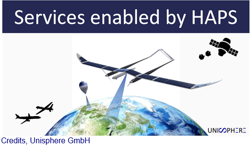
Services Enabled by HAPS (Unisphere)
Status date: 02 September 2019
Within the context of satellites, terrestrial infrastructure and Remotely Piloted Aircraft Systems (RPAS), HAPS are a new platform offering unique advantages, but also complement existing services. Three major HAPS applications have been analyzed within this feasibility study. The concept of “HAPS as a Service” (HaaS) has been introduced and its unique requirements to highly automated flight management were detailed. A follow-up demonstration project with the focus on flight management has emerged from this feasibility study.
MOWGLI Feasibility Study
Status date: 09 August 2019
MOWGLI is a solution that provides a set of services for optimal microgrid planning, designing and operational and maintenance (O&M) applications in urban and rural areas of developing countries, with particular focus on India user case. The activities have been implemented in cooperation with the India Energy Storage Alliance (IESA) and funded by European Space Agency (ESA) within ARTES IAP programme.
UNDERSEE
Status date: 26 July 2019
UNDERSEE is committed to develop a scalable solution to bring knowledge about rivers, lakes and oceans to water dependent stakeholders by providing simple access to water quality data.
SFM
Status date: 04 July 2019
The objective of the SFM project is to formulate an integrated system-service aimed at monitoring and providing real-time information to first responders and decision makers, about the status of the area impacted by a release of agent chemical, bacteriological, and radiological even with explosives (CBRNe).
PLIMM
Status date: 24 June 2019
‘Helping to find the important needles within the InSAR time series haystack’
The PLIMM services developed within the project provide users with unique information on the performance of their assets. Using a set of proprietary workflows and algorithms on processed InSAR data the system is able to identify critical insights within the millions of individual measurement points. Developed in close collaboration with the user community, the system provides earth observation outputs in a format that is most appropriate for the target sectors.
Poolspot
Status date: 14 June 2019
INVITE ALL SWIMMING POOL OWNERS IN YOUR (E-)SHOP
We automatically detect swimming pool owners at wide scale thanks to our identification algorithms using satellite imagery.
Take the opportunity to reach new clients with our direct marketing service.
SenTAct
Status date: 12 June 2019
The services is a visual communications service for operational management. The service helps teams in the field assimilate information relevant for the local context. We aim to offer a communications platform which leverages Location Intelligence to provide the right information at the right time, and Augmented Reality to ease access and understanding of the information.
GeoSHM Demo Project
Status date: 10 June 2019
The GeoSHM Demo Project implements a pre-operational installation and demonstration across three of the longest bridges in the world. The primary purpose of the project is the integration of GNSS positioning and Earth Observation techniques to enable the Structural Health Monitoring (SHM) of long-span bridges. This project intends to bring the GeoSHM service to the global market incrementally.
RailSAT
Status date: 07 May 2019
RailSAT intends to enhance the current practices of monitoring railway track geometry and the surrounding environment by using Earth observation satellite data, in particular Interferometric Synthetic Aperture Radar (InSAR), and satellite navigation.

ARCT.esa
Status date: 12 April 2019
The ARCTTM stakeholder mapping tool offers visualization of “Project Health” in the cross-roads between society, environment, business and policy. The unique de-risking tool combines climate change risks with other factors and makes them relevant, simple and visual for owner and decision makers of any infrastructure project.
ARCT has also found a fun and engaging way to score and report on the UN Sustainability Goal Climate Action goal #13. www.arct.tools.

Building Stock Monitor Service
Status date: 09 January 2019
The proposed Building Stock Monitor Service is a service to aid municipalities with monitoring the entire building stock within their geographical borders by using satellite imagery from Sentinels 1 and 2.
The revisit time of these satellites give unprecedented update frequency as opposed to current technology that typically involves fly-bys at high costs.
WONDER
Status date: 21 December 2018
The targeted solution is an automated, cloud-based digital service for water quality monitoring which could be utilized globally. The solution builds on earth observation, global positioning, crowd sourcing, internet of things (IoT) and predictive analysis.
AIR-Portal
Status date: 20 December 2018
AIR-Portal provides extremely local (100m resolution) air quality monitoring and forecasting, delivering actionable insight for citizens, governments and industry.
The delivered historical, real-time and expected air quality data is based on a unique down scaling algorithm which integrates satellite data, local sensing, land use data, meteorological models, and dispersion models.

ESA-IoT
Status date: 19 December 2018
The study intends to understand the future of a satellite-based IoT solution and the market for related products in multiple industries that require monitoring and in particular the monitoring of assets in remote areas. Through the study we engaged with major industrial companies providing them with a small demo of the proposed IoT product to validate business opportunities.

SAT-DEFO FS
Status date: 26 November 2018
SAT-DEFO project purpose is to build an app with data-proven, valid, both historical and current information about ground deformations for the inhabitants of the areas who are exposed to such changes (especially in the localizations threatened by ground subsidence caused by mining activity).

IDiSPUTE
Status date: 06 November 2018
IDiSPUTE supports land use planning and identification of hazards for the population through the application of an innovative algorithm based on artificial intelligence applied to images from earth observation satellites.

TELEKAIROS®
Status date: 29 October 2018
TELEKAIROS® Fintech is a tool for financial and (re)insurance contracts that derive value from an underlying asset such a traditional stock, a bond or stock index. TELEKAIROS is capable to manage different kinds of risks, for example by increasing the efficiency of the underlying market because they lower unforeseen costs of purchasing an asset outright.

CountFloors
Status date: 22 October 2018
CountFloors (CF) is a service designed to collect and analyse GNSS-geocoded images of buildings acquired at street level together with Sentinel data. CF automatically retrieves ground-level and satellite images on urban areas of interest, and uses a machine learning approach to extract risk-relevant characteristics of buildings depicted in the images. These features are sought after by risk modellers and insurance companies; yet they are of interest also in the real estate market and to the municipalities for their planning.
Curio Canopy
Status date: 11 October 2018
Combining analysis of satellite imagery with crowdsourced data, this urban tree montioring platform connects communities and urban forestry professionals. It provides an open data service that drives improved understanding of urban trees and access to better information in order to: i) increase tree planting and tree care; ii) improve environmental conservation management and planning; iii) support educational and communication resources for learning and knowledge-sharing.
dYbydX
Status date: 04 September 2018
Routing information to navigate the urban environment in accordance with users’ personal mobility needs.

AMBROSIA
Status date: 14 August 2018
The ESA-Ambrosia food safety and traceability platform combines Blockchain technology, IoT, Satellite Earth Observation (SatEO) and GNSS Satellite Navigation to achieve maximum automation, security, and transparency of the food supply chains.
WASTE IAP
Status date: 23 July 2018
The development of a service that uses Earth Observation data to detect and monitor legal waste sites, and GNSS technology to track the destination of high value waste items. The information is used to show evidence of legal operator compliance and illegal disposal or exportation of waste.
HelloBin
Status date: 11 July 2018
HelloBin services optimizes routing for waste collection for waste collectors and contributes to the ability to manage the waste stream more efficiently.

UTRAQ
Status date: 05 July 2018
EO-li
Status date: 28 June 2018
EO-li (Earth Observation based location identifier) is an open source web-based,global platform matching demand and supply of identifying, selecting and reporting in the land restoration context. It has four components, namely the (i) identification of a location area to be restored, the (ii) selection of an area and the actors involved in the restoration activity, the (iii) monitoring and reporting on the progress of the project using earth observation and geospatial data and (iv) a learning component providing guidance and capacity strengthening.
COMBO-SBB
Status date: 06 June 2018
COMBINED CONNECTION SAT and DSL for SMART BALANCING and BACK UP project aims to develop a complete and innovative end to end platform to combine dynamically traffic between a SAT connection and a xDSL connection available in the user premises to guarantee improved overall link capacity and link continuity

AgeSpot Feasibility Study
Status date: 18 May 2018
AgeSpot provides THE starting point for any innovative technological solution addressing ageing populations. It enables efficient targeting of the silver economy and offers precise demographic data on WHERE and HOW MANY age specific classes currently live and will likely live in the FUTURE. With AgeSpot a new Earth Observation (EO) supported business intelligence service is offered.
TeleRetail Delivery Robot
Status date: 17 May 2018
TeleRetail automates regional logistics to save millions of users billions of hours while minimizing the ecological footprint of transportation. Its activities include the development of automated on demand courier robots for same day delivery services in urban and sub-urban areas. The company's technology reduces the space, cost and energy requirements of local logistics by up to 90%.
SatBAMS
Status date: 21 February 2018
The Battery Array Management System automates the storage and distribution of power. Unlike existing battery arrays, the BAMS will maintain better Security of Supply, ensure that the reserve does not loose capacity over time and extends operation of batteries by 50%-100%.
LiveLand
Status date: 20 February 2018
Transport operators across the UK face significant challenges in monitoring and detecting landslides and subsidence across their networks. LiveLand supports asset owners and operators to assess and monitor high-risk areas of their transport network providing improved geological hazard information at regional, network and local levels using integrated data from Earth observation satellites and GNSS.

International Satellite Derived Shallow Water Bathymetry Service
Status date: 15 January 2018
A web-based service to provide immediate, off-the-shelf, online access to shallow water depth data derived from very high resolution satellite imagery.
ASSIST WRM
Status date: 13 December 2017
According to the outcomes of the forerunner feasibility study, there is a potential market landscape for high-end services supporting the winter road maintenance. Intercepting then the real needs of users and stakeholders involved in winter maintenance, the follow-up ASSIST WRM demonstration project intends to address these opportunities by providing a set of advanced space-based services, specifically deploying a multi-sites pilot-demonstration over four different European countries during the 2016-2017 winter season.
URGED
Status date: 21 November 2017
URGED addresses an increasing global requirement for the provision of better predictive decision support tools for urban infrastructure managers to enable cities to become more resilient to environmental threats. Through the evolution of Rezatec’s geospatial data analytics and the incorporation of new satellite data sources, e.g. Sentinel 1 and 2, these tools will be accessed through the URGED online platform.
SatApps
Status date: 19 September 2017
Internet of Things/IoT – M2M – industry 4.0 – these headlines are representing large user groups which have an urgent need of a globally available, low-cost, secure data service, dedicated to very small data volumes per sensor and for use also in remote areas. The objective of the study is to perform an in depth requirements analysis on 2 focus pilot user groups: railway transportation and container/waste management.
DAMMINGS
Status date: 24 May 2017
The project designed, developed and carried out pre-operations of a service platform providing an automated and continuous monitoring service of dam infrastructure and its surroundings by integrating GNSS and InSAR space capabilities.
SMART
Status date: 22 March 2017
SMART is a system that aims to provide a decision support service targeting the “early warning" of a disaster or critical event (specifically hydro-geological events) and to improve the "first response" intervention capability. The system has the advantage of strengthening the procedures used today by the Civil Protection to collect and manage the data "monitored" without interfering with the current practice.
STC
Status date: 15 March 2017
Space-Tech for Cycling investigates the technical feasibility and commercial viability of a bike-benefit model with associated GNSS-data analyses as a means to increase the modal share of cycling in cities. The approach rewards cycling by offering tempting benefits to the cyclists. The cyclists’ GNSS-track-data are further processed to offer a foundation for traffic planning projects, public health measures, and marketing and sales campaigns.
aircheckr
Status date: 07 December 2016
Aircheckr creates & opens up the best available air quality data in the EU. Aircheckr translates the air quality data to the specific needs of a broad range of applications like real estate, health or sports. The data is enhanced by the power of the crowd, and it is easily interpretable & include personal recommendations.

AIR-Portal
Status date: 02 November 2016
The economic and technical feasibility of AIR-Portal, an air quality dashboard for European cities, was shown in this study. The consortium developed in a demand driven development the requirements of three major European cities into a working proof of concept. With this proof of concept the technical feasibility was proven, furthermore a business case was developed proving the economic feasibility.

TRISS
Status date: 20 July 2016
Humans spend energy and money to plant and manage trees in their habitat. Tree information is essential to enable rational management: Tree numbers, their position, height, crown size, health, habitat condition and species are relevant to professionals managing both urban and rural environments. This feasibility study focused on satellite based services providing or updating tree information.
HAMS
Status date: 01 July 2016
Using Satellite applications in conjunction with terrestrial sensors to better monitor and understand heritage assets. The nature of maintaining a large portfolio of heritage assets provides a large opportunity to use remote sensing techniques to deliver a more efficient method for monitoring distributed assets.
GridWatch FS
Status date: 22 March 2016
The solution intends to provide owners of High Voltage power infrastructures with useful information for supporting the management of both procedures for inspection and maintenance, and dispatching of electrical energy.

OWASIS-UK
Status date: 02 October 2015
OWASIS – UK is a Feasibility Study aiming at developing a sustainable service line improving the monitoring of water availability, quality and distribution by integrating satellite images and innovative terrestrial sensors and information technologies.
This study focuses on the UK market and it targets all types of user groups such as industrial users, public water authorities or regulatory organisms.

EFFORS-FS
Status date: 25 August 2015
The aim of the present feasibility study is to develop an Enhanced Flood Forecasting System for Critical Infrastructures Protection in medium size Alpine catchments.The service is designed to address infrastructure located either on the river itself (e.g. bridge) or in the flood plan (e.g. a building).

GIRP
Status date: 25 August 2015
Subsidence due to clay shrinkage is the largest ground instability issue affecting residential property in the UK (75% of all valid insurance claims) with rectification costs averaging £250m (295m Euro) p.a. Research by the insurance sector (Swiss RE and Lloyds of London) indicates that the extent of subsidence both in the UK and Europe will worsen in line with climate change forecast. The insurance sector equally recognizes the need for significantly improved profiling and predictive tools to identify and target risk mitigation management.
The Ground Instability Risk Profiler (GIRP) service is planned to enable an accurate and predictive ground stability risk profiling service to the insurance industry in a range of flexible formats through the integration of property data sources and satellite information.
Forsway S2
Status date: 18 August 2015
The objective of this project is to develop a Satellite modem for Internet access in rural areas using DVB-S2 technology. The product is intended to complement existing ADSL terrestrial based solutions. Where it is too expensive and /or too time consuming to get a terrestrial infrastructure for broadband, the Forsway modem offers a cost effective, easy to use solution to access the Internet based on satellite DVBS2 distribution associated with a multi-standard terrestrial return link.

PloughStars
Status date: 04 August 2015
Plough Stars is a feasibility study and part ESA’s Integrated Applications Promotion (IAP) Programme. The industrial team led by Berner & Mattner investigates new services and applications for improving winter road maintenance. Existing, mainly terrestrial, systems are enhanced with space-based technologies. Users and stakeholders involved in winter road maintenance benefit from this system through increased performance and a simplified routine.
TIM
Status date: 16 June 2015
Efficient asset management is required to meet increasingly stringent demands on safety and reliable performance of new and ageing infrastructure under varying and sometimes hazardous environments. The Transport Infrastructure Management (TIM) Service is planned as a new generation of asset monitoring services that can be deployed across multinational organizations. The concept is based on the integration of location and mapping capabilities of space assets and ground local point sensor networks - delivering data in the most efficient manner.
SafeRail
Status date: 14 January 2015
The objective of SafeRail is to improve the safety at Rail Level Crossings (RLC). In terms of accident prevention, RLC are demanding spots since two disparate transportation systems are intersecting (road, rail respectively) and neither of them completely controls the situation. In response to this, SafeRail provides a flexible and secure solution at a moderate price, using latest advancements in satellite technology.

Lift Off
Status date: 08 September 2014
Internet penetration growth curve is still on the steeper side: people require more and more affordable and fast connection to the Internet, independently from where they are. The key characteristics of what is expected by an Internet connection are speed, affordability and reliability. In this sense the Lift Off Project tries to bring further the innovation brought by the recent satellites investigating on how DPI (Deep Packet Inspection) can be introduced by a Satellite Service Provider. The scope of this innovative “next step” on top of the KA-SAT is to optimize the existing services and to generate innovative market offers for satellite internet connectivity maximizing the user experience while improving the ratio cost/performances.
SHM Telecom Towers
Status date: 02 July 2014
The project “SHM for Telecom Towers” aims at developing a remote monitoring service to support the assessment of the structural integrity of assets, as the towers for Radio-TV Broadcasting or other metal infrastructures, in order to increase safety and optimize the maintenance procedures and promote the transition from a time-based maintenance to a condition-based one.
Live Land
Status date: 29 November 2013
The objective of Live Land is to provide users with a suite of services that enables the management of hazards and the exposure of national transport infrastructure assets to landslide and subsidence events. During the feasibility stage, the Live Land consortium assessed the viability of developing a suite of services driven by the needs and requirements of end user organisations. Live Land proposed a ‘catalogue’ concept, to incorporate a suite of enabling technologies (including Space-borne, in-situ and geological datasets) that could improve the forecasting, monitoring and alerting of landslides and subsidence.