
Availability of water and good water management are well acknowledged global challenges. Thus there is a need to ensure efficient use of water resources through irrigation strategies and demand side management. Customized solutions utilising space-based systems und are able to provide end-to-end services for optimal water resources management through dispatchable control and monitoring irrigation systems. In addition demand side management systems targeting water flow monitoring and prediction systems of hydropower production and water management organizations are able to reduce the need for new power plants and dependence on foreign energy, reduced air and noise pollution through the integrated utilisation of space-based systems.
Forest HD
Status date: 24 July 2026
ForestHD, a geospatial tool developed by NGIS in partnership with the European Space Agency. It helps timber operators comply with the EU Deforestation Regulation (EUDR) by using satellite data and AI to distinguish legal harvesting from illegal deforestation and degradation, reducing false positives and improving supply chain traceability.
Pheno-AI
Status date: 17 July 2026
Pheno-AI turns free satellite Earth Observation and climate data into clear, field-level phenology and yield forecasts — emergence, flowering and harvest windows plus a yield range — helping growers and their advisors decide when to plant, fertilise and harvest. The service is validated with growers in Kenya and calibration sites in Portugal and Germany.

CoCoNARC
Status date: 17 July 2026
AOE
Status date: 14 July 2026
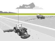
The "Agronomy on the Edge" project delivers a retrofittable, edge-AI precision farming system that integrates real-time tractor sensor data with satellite inputs. Designed specifically for small to medium-sized arable operations, the system optimizes variable-rate spraying and input management, enabling significant chemical reductions and enhanced crop yields even in areas with limited connectivity.

Remote Ecological Surveys with EO
Status date: 06 July 2026
o restore and protect biodiversity, we need reliable, scalable data. Traditional ecological surveys are labour-intensive, slow, and constrained by geography.
Gentian transforms biodiversity monitoring by harnessing satellite imagery and AI to deliver fast, accurate ecological surveys at scale.
The company’s fully remote approach eliminates logistical barriers, ensuring precision-driven insights that empower informed decision-making.
CarbonTrace
Status date: 06 July 2026
CarbonTrace makes voluntary carbon markets accessible to small and medium-scale tropical agroforestry producers by replacing costly manual field surveys with satellite-derived carbon monitoring. Using ESA Sentinel-1 and Sentinel-2 data, the service produces investor-grade carbon accounts at a fraction of the cost of current methods, unlocking carbon revenue for farmers previously excluded by measurement costs.
ARI
Status date: 25 June 2026
A space-enabled, AI-powered decision-support service to map the presence of asbestos-containing materials and evaluate their vulnerability to fiber dispersion under complex multi-hazard climate events to proactively guide risk management and remediation.

XR4Emergency
Status date: 18 June 2026
XR4Emergency combines satellite intelligence, immersive XR simulation, and evidence-based AI-supported debriefing to strengthen firefighters’ soft skills through realistic training for climate-driven emergencies. Based on real historical events, the platform enables teams to train coordination, decision-making, and situational awareness in dynamic, high-fidelity wildfire scenarios, and to reflect on team performance.
OWL – ST
Status date: 15 June 2026
Half of Earth’s thermal dynamics happen at night. Constellr unlocks high‑resolution nighttime Land Surface Temperature at 10 and 30 m, daily. New insights for urban heat, agriculture resilience, and climate intelligence, after sunset.

GreenClaims
Status date: 10 June 2026
This project develops an ESG verification platform integrating Earth Observation data with AI-driven analytics to independently verify corporate environmental claims in land-intensive sectors including mining, oil & gas, agriculture, and renewable energy. By combining satellite imagery analysis with natural language processing of corporate disclosures, the service provides scalable, evidence-based verification to support regulatory compliance and combat greenwashing.
HotPay
Status date: 03 June 2026
Using satellite Earth Observation and AI to generate auditable heat indices that trigger parametric insurance payouts during extreme heat events, enabling faster and more transparent climate risk protection.
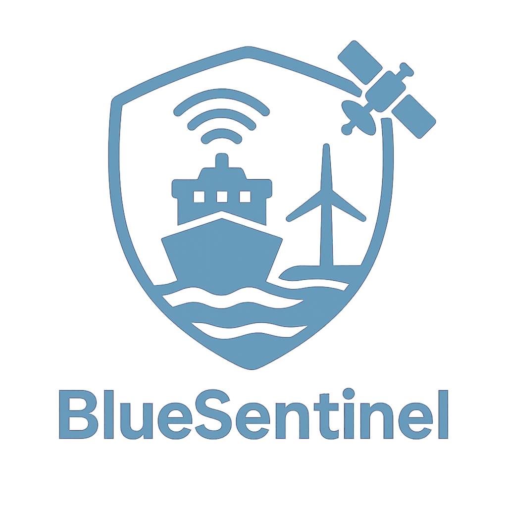
BlueSentinel
Status date: 02 June 2026
BlueSentinel is a next-generation maritime surveillance system delivering persistent, high-resolution awareness beyond satellites and fixed infrastructure. Using modular sensors on infrastructure, ships, and drones, it detects and tracks cooperative and non-cooperative vessels in remote and sensitive waters, giving authorities, infrastructure owners and crews real-time visibility where it matters most.

Sustainable forestry with PicterraTrace
Status date: 02 June 2026
An end-to-end geospatial AI platform that monitors forestry activities to improve supply chain traceability, mitigate deforestation, and accurately estimate forest carbon stocks for global sustainability and regulatory compliance.
Space to Subsea
Status date: 29 May 2026
UVisions underwater 3D scanner is sold worldwide and helps asset owners get a clear overview and understanding of the state of their underwater assets. Based on customer requests this project integrates satellite-based positioning ensuring: 3D-models referenced in the global coordinate system, Improved accuracy and increased ease-of-use.
SAiBees
Status date: 13 May 2026
SAiBees uses satellite Earth observation, environmental data and artificial intelligence to support sustainable beekeeping. By analysing environmental and climatic conditions, the service provides insights on nectar resource availability, habitat quality, and potential stress factors affecting bee colonies, helping beekeepers make more informed management decisions.
AERIUS
Status date: 08 May 2026
AERIUS transforms satellite Earth observation, in-situ, and municipal GIS data into ready-to-use intelligence for managing and restoring urban green. Municipalities apply AERIUS to monitor vegetation vitality, water quality, and mitigate heat stress, maintain tree inventories, and fulfil EU Nature Restoration Law reporting — demonstrating “no net loss” and measurable “net gain” of urban green and tree canopy cover.
Terma BCTaaS
Status date: 08 May 2026
ProUST UniverSAS® is a modular, software-defined power supply platform designed to enable high-efficiency, scalable, and flexible battery testing for e-mobility and space-related applications. The system combines advanced power electronics, digital control, and integrated analytics to support a wide range of battery testing scenarios, from laboratory validation to industrial-scale operations.
SUMMIT
Status date: 08 May 2026
The Consortium offer services that integrate GNSS, satellite, and snow/weather data to monitor avalanches, snow parameters and ground movement risks. Solutions include:
-
SAD: Automatic avalanche detection from satellite imagery
-
SNOW: Monitoring and mapping of key snow parameters (SWE, snow depth, wet snow conditions) through multi-sensor integration (GNSS technology, satellite data, automatic weather stations, weather forecast data)
-
SNOW&MOVE: Compact and cost-effective systems combining snow monitoring with ground displacement detection through GNSS technology and satellite remote sensing
TRANSFORM
Status date: 08 May 2026
A circular indoor vegetable production system combining a space-designed adaptive greenhouse with a terrestrial microalgae wastewater treatment system, targeting both Earth and space-based food production optimization and water purification.
STREAMO
Status date: 07 May 2026
STREAMO is a commercial downstream application seamlessly merging satellite and stratospheric Earth Observation data. Focusing on urban/mountain environments, the platform provides very-high-resolution, near real-time updated maps and insights like vegetation and thermal gradients. It offers a centralized marketplace for accessing archived products and requesting on-demand stratospheric tasking to bridge the gap between satellites and drones.

Origin Aura
Status date: 20 April 2026
Origin is developing Origin Aura to enable autonomous data collection and global data transmission via Satcom, supporting the expansion of its trenchless pipeline repair and satellite leak detection technologies. Equipped with advanced sensors, the tool will capture precise location and operational data, ensuring accurate real-time reporting and allowing Origin maintain the high standards associated with its technology.
RegenAg – MRV
Status date: 15 April 2026
The RegenAg – MRV service provides monitoring, reporting and verification of regenerative agricultural practices, such as cover cropping, no residue burn, crop rotation and improved irrigation. Through innovate use of satellite earth observation and geospatial analytics, cropping systems, irrigation techniques, soil treatment and residue management are monitored and evaluated. The service facilitates high-integrity farm carbon and sustainable farming projects.
GTMS
Status date: 14 April 2026
The Global Tailings Monitoring Service provides tailings storage facilities with comprehensive and consistent monitoring using a combination of remote sensing technologies and environmental datasets. Built for worldwide scalability, GTMS is designed to be suitable for all sites within a global portfolio.

SOCBIO-MAP
Status date: 07 April 2026
SOCBIO-MAP delivers scientifically rigorous, satellite-enhanced mapping of soil organic carbon stocks and biodiversity in forest ecosystems. By integrating Earth observation with optimised field sampling and laboratory analysis, the project makes high-quality soil health MRV feasible, scalable, and cost-effective for carbon project developers, conservation organisations, and corporate sustainability programmes worldwide.
OCTAVE
Status date: 07 April 2026
OCTAVE (Organic Cotton Tracking & Verification Engine) is a space-enabled traceability platform integrating Earth Observation, AI, blockchain, and isotopic science to verify organic cotton from farm to fibre. It delivers tamper-proof geo-traceability, fraud detection, and regulatory compliance for sustainable textile supply chains.

PURLIEU
Status date: 07 April 2026
The Purlieu project utilises a combination of remote-sensing and low-cost ground survey technologies to determine on-farm carbon sinks (hedgerows, vegetation, tree cover) and biodiversity indicators
Coastal Futures
Status date: 24 March 2026
Coastal Futures uses very high-resolution satellite imagery and machine learning to monitor coastal dunes at scale. The platform provides coastal managers with frequent, high-resolution insights on sand movement, dune boundaries, and storm-driven change through an online viewer delivering over a decade of data at far lower cost than traditional field surveys.
SREC
Status date: 24 March 2026
SREC provides independent, satellite-enabled verification of soil management practices to supportregenerative agriculture, insurance analytics, carbon monitoring and public compliance systems.
By combining Copernicus Earth Observation data with AI-based analytics, SREC detects tillage events and soil disturbance at field level, enabling scalable and transparent

Geo-Shield
Status date: 17 March 2026
OPTIMAIZE develops GEO-SHIELD, a satellite-enabled risk intelligence service that uses Sentinel-1 InSAR data to detect seasonal ground deformation and deliver dynamic, building-level vulnerability scores for clay shrink–swell hazards. The solution supports insurers in underwriting, claims validation, and proactive loss prevention, providing objective, scalable, and cost-efficient geotechnical drought risk assessment.
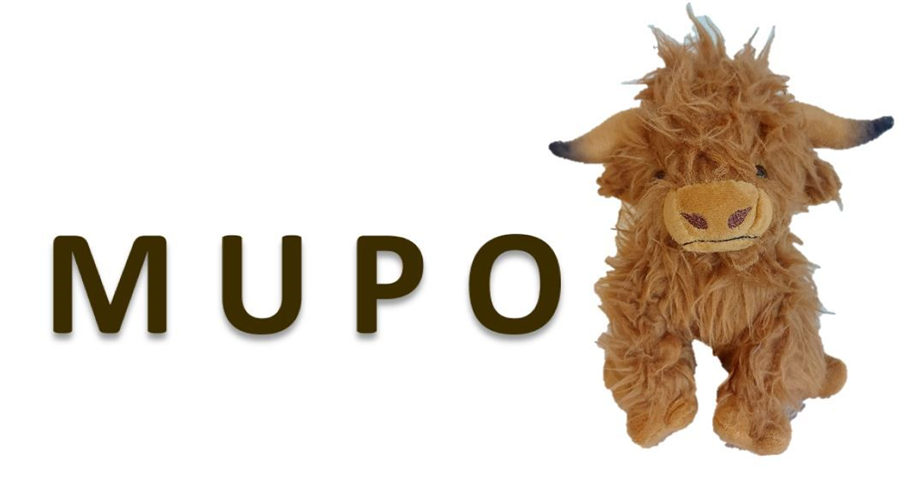
MUPO
Status date: 13 March 2026
MUPO enables the digitalization of agriculture with smart livestock and stable management
by supporting robotics to:
+ Minimize physical labour for farmers and mitigate workforce shortages.
+ Provide appropriate housing for animals and support their welfare.
+ Contribute to reduce greenhouse gas emissions in livestock farming.
FireTrack
Status date: 12 March 2026
FireTrack is a satellite-based wildfire monitoring service delivering near-real-time maps of active fire fronts and burnt areas. By processing satellite data directly in space and transmitting results within minutes, it provides emergency services and risk managers with timely, high-resolution information to support operational decision-making during ongoing wildfire events.
BioMoss
Status date: 10 March 2026
BioMosS provides accurate and scalable biodiversity monitoring by fusing ground-truth IoT BioT sensors with satellite data. The platform delivers automated species identification and microclimate telemetry to support corporate compliance and nature restoration, achieving near-perfect precision across a 10,000+ species library.

ÆRON
Status date: 09 March 2026
Project ÆRON is developing autonomous, remotely operated platforms for eDNA sampling in remote and extreme environments. This increases access to important biodiversity data for monitoring and managing natural environments and industry such as aquaculture.
INGURU PREDICT
Status date: 06 March 2026
Optimization of Port Activities in Real Time to Reduce Environmental Impact on specific parameters, Using Artificial Intelligence and Satellite Images
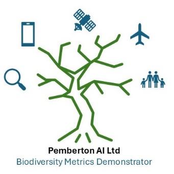
Pemberton Biodiversity monitoring tool
Status date: 05 March 2026
The Pemberton Biodiversity Portal leverages a time series of UAV, aerial, and satellite data, alongside derived data which is ground-truthed and then compiled into a federated biodiversity metrics dataset to provide data consumers with accredited automated remote measurement and tracking of biodiversity.

Dark Vision
Status date: 23 February 2026
Using innovative space-based nighttime imagery, Dark Vision will provide an understanding of how artificial light at night (ALAN) impacts our planet ranging from the effects on human health, ecology, the environment, biodiversity and the global economy.
EO MA Track
Status date: 20 February 2026
EO-MA Track is a web-based monitoring service that delivers independent, satellite-derived evidence to strengthen ESG verification. It transforms Earth Observation data into structured, assurance-ready indicators (i.e., maps, KPIs, and trends) that support risk-based assessment of asset-level sustainability claims. Designed for verification bodies, it adds a transparent, traceable spatial layer to ESG disclosures.

SEM
Status date: 13 February 2026
SEM develops BathyScope, a satellite-AI SaaS service for bathymetry and sedimentation monitoring, specifically designed for rivers and inland reservoirs. The platform combines remote sensing with physics-informed models to deliver mapped depth, sediment accumulation, uncertainty layers, and time-series analytics, supporting hydropower operators, water authorities, and NGOs with faster, lower-cost evidence for maintenance planning and reporting.

Scope 3
Status date: 12 February 2026
Measuring and controlling GHG scope 3 emissions is crucial for the chemical industry goal of achieving carbon neutrality by 2050. Reliable monitoring mechanisms built from precise, trusted data, allow to calculate their precise product carbon footprints, and conduct truthful life cycle assessments. Scope 3 services fully cover the evolving needs from the industry with a user-friendly monitoring and simulation platform specialized on multi-modal transport emissions.
RTIS
Status date: 10 February 2026
DataCosmos is Open Cosmos’ proprietary platform for storing and analysing satellite imagery.
RTIS is a near-real-time information system. By leveraging DataCosmos to detect and monitor oil spills and water turbidity in the middle east with rapid delivery time, RTIS will enable the rapid response to critical situations.
DECOM
Status date: 26 January 2026
KSAT DECOM aims to help operators and regulators to monitor offshore decommissioning activities by combining oil spill detection, vessel monitoring, multi-mission SAR and EO data, weather condition and greenhouse emissions to reduce costs, increase efficiency of operations, develop safer methods for execution and reduce environmental impacts during decommissioning activities.

DECOM
Status date: 22 January 2026
KSAT DECOM aims to help operators and regulators to monitor offshore decommissioning activities by combining oil spill detection, vessel monitoring, multi-mission SAR and EO data, weather condition and greenhouse emissions to reduce costs, increase efficiency of operations, develop safer methods for execution and reduce environmental impacts during decommissioning activities.
ENVIROSCORES – By HETWA
Status date: 21 January 2026
ENVIRO-SCORES provide cities and stakeholders with a transparent, data-driven scoring system powered by satellite, local data and advanced algorithms, delivering precise ecosystem insights (1–30 m) via the MEWISO platform. From water risks to climate resilience, they help local authorities prioritize restoration. The Prioritisation Score guides unsealing strategies, targeting heat islands, corridors, and vulnerable populations for smarter land use.
Regen Atlas
Status date: 19 January 2026
The Regen Atlas project aims to develop advanced analytics that provide critical insights into the future risks facing carbon sequestration projects. By leveraging forward-looking analytics, Regen Atlas enables participants in carbon markets—including investors, project developers, and marketplaces—to better understand and mitigate risks such as wildfires, cyclones, pests, insects, and seismic events.

SEFPAM
Status date: 15 January 2026
The project will enhance its Mitigrate’s Prevent platform by integrating river flood modelling, alert system, and preventive solutions scenarios. Using satellite imagery, geospatial data, and weather forecasts, the system delivers property-specific recommendations and loss reduction estimates. Piloted with insurers like Gjensidige, the project demonstrates scalable, actionable flood risk prevention across Europe’s insurance markets.

EV-WaterFill
Status date: 19 December 2025
WaterFill is an Earth Observation-enabled, AI-driven platform that helps public authorities and utilities to monitor, forecast, and manage water resources with precision. By integrating Copernicus/IRIDE satellite data with IoT sensors and machine learning, it delivers real-time digital twins of river basins, empowering smarter decisions, early warnings, and sustainable water resilience.

TREESCAN
Status date: 16 December 2025
Goodforest is a precision forestry SaaS platform combining satellite remote sensing and AI to help forest owners and managers protect and sustainably manage their forests. The solution provides continuous health monitoring, early detection of dieback, multi-risk assessment and decision support for proactive forest management.
BGI-Monitor
Status date: 16 December 2025
BGI-Monitor is a platform that transforms fragmented data and manual inspections into a clear view of urban green infrastructure. By combining Copernicus and Sentinel satellite observations with in-situ monitoring, it delivers dashboards, alerts, and scenario simulations that help asset managers, and green solution providers reduce costs, prevent damage, and demonstrate the impact of climate adaptation investments.

Climate Smart Forestry
Status date: 11 December 2025
Climate Smart Forestry enhances the ForestHQ forest management platform through seamless integration of IoT sensors, satellite imagery, and accessible climate data. The new system delivers real-time insights on forest growth, soil moisture, weather trends, climate models, and fire risk, facilitating proactive risk assessment and informed, climate-resilient management decisions.
PYRNEXAT
Status date: 10 December 2025
The project developed a smart sanitation management platform by leveraging IoT and data analysis. It integrates earth observation, telemetry, and GNSS-referenced pathogen data with collected metrics on toilet user behaviour, providing dashboards to improve sanitation system monitoring and management
MFT-ESACA01
Status date: 14 November 2025
The project applies MinFarm Tech’s optimized LoRaWAN over SatCom software stack and network architecture for a demo project where an end-to-end remote livestock and wildlife tracking service is provided using IoT technology and Satellite Communications.
NERTHUS
Status date: 14 November 2025
Commercialization of a prediction solution capable of estimating the risk of a cyanobacterial bloom event in the medium term & a water management consulting service.
This document is based on the NERTHUS pre-production environment.
Since the last release, many changes have been implemented, such as profile editing, the ability to reset your password, and notification management.
That is why WME and SCALIAN have redrafted the document for the final review.
Before rolling out these changes in production, SCALIAN is awaiting validation from WME.
It is therefore possible that at the time of the defence, some of these screenshots may no longer be up to date (as they will have been modified in the pre-production environment for production).
Since the last release, many changes have been implemented, such as profile editing, the ability to reset your password, and notification management.
Wildfire Preparedness
Status date: 14 November 2025
WEO’s Wildfire Preparedness service helps infrastructure managers, utilities, and landowners reduce the risk of wildfires by combining space data, artificial intelligence, and on-the-ground expertise. The tool identifies vegetation that poses a fire hazard to critical infrastructure, calculates flammability and connectivity risks, and supports prioritisation of preventive measures.
Weed Detector
Status date: 01 November 2025
Weed Detector is an AI Camera based system that is detecting rumex obtusifolius in grassland. It creates a spot application map using satellite correction signals for the geo-reference of the weed plants.

FBET
Status date: 30 October 2025
FBET aims to develop an ML-supported analysis process for quantifying above-ground biomass. Ultimately, the technology shall serve project developers for carbon dioxide removals (CDR) in global forests. Unique about FBET is the fusion of ground truth and satellite imagery to build the most robust and accurate models.
TEMIS
Status date: 22 October 2025
Massive end-to-end IoT satellite services, fully operational in GNSS denied environment and very robust to jamming & interferences for highly scalable applications in numerous verticals such as logistics, transport, agriculture/smart farming, maritime, environmental, mining/oil/gas, smart cities, smart building, e-health, utilities, industry…
CarbonEagle
Status date: 22 October 2025
Harnessing the power of carbon maps, satellite data, and machine learning, CarbonEagle offers a digital MRV platform to identify and monitor optimal REDD+ project sites globally. It allows investors and project developers to make well-informed decisions for sustainable forest conservation and climate transition.

TSI2IFCCBM
Status date: 21 October 2025
Developing an AI-powered SaaS platform to enhance forest carbon and biodiversity measurement using satellite imagery, making it scalable, cost-effective, and reliable for global compliance and voluntary carbon markets.
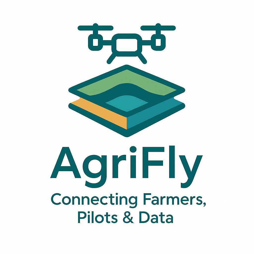
AgriFly
Status date: 25 September 2025
AgriFly is a digital marketplace that connects farmers, advisors, drone pilots and analytics providers through one automated workflow. Built on Plan2Fly, it turns drone imagery into ready-to-use outputs (e.g., spray maps, drainage layouts, tree inventories), leveraging GNSS/RTK and EO to deliver precise, scalable services at lower cost
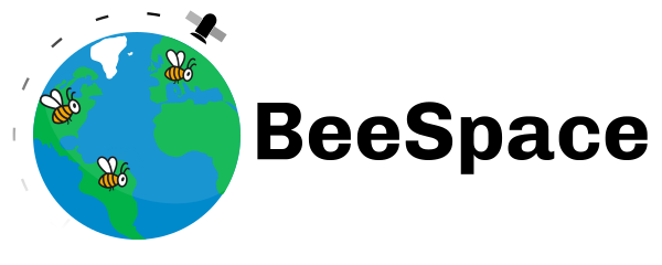
BeeSpace
Status date: 25 September 2025
The BeeSpace project is a solution that leverages SatCom IoT and EO to automatically monitor bees’ activity and health while maintaining affordability. This not only benefits beekeepers by improving their beekeeping practices but also helps farmers adopt eco-friendly methods by evaluating the impact of their practices on biodiversity, leading to better data collection for all parties involved.
DSOE-WPM
Status date: 25 September 2025
A feasibility study by SatVu to assess the use of high-resolution nighttime thermal satellite imagery for detecting water pollution outflows. The project aims to evaluate technical, commercial, and environmental value, engaging stakeholders and delivering a proof of concept using data from the HotSat satellite constellation.
SatMRV
Status date: 24 September 2025
SatMRV combines satellite imagery and in-situ observations to provide precise, cost-effective Soil Organic Carbon (SOC) mapping for Soil Carbon MRV (monitoring, reporting, and verification), enabling carbon credit creation and supporting regenerative agriculture.
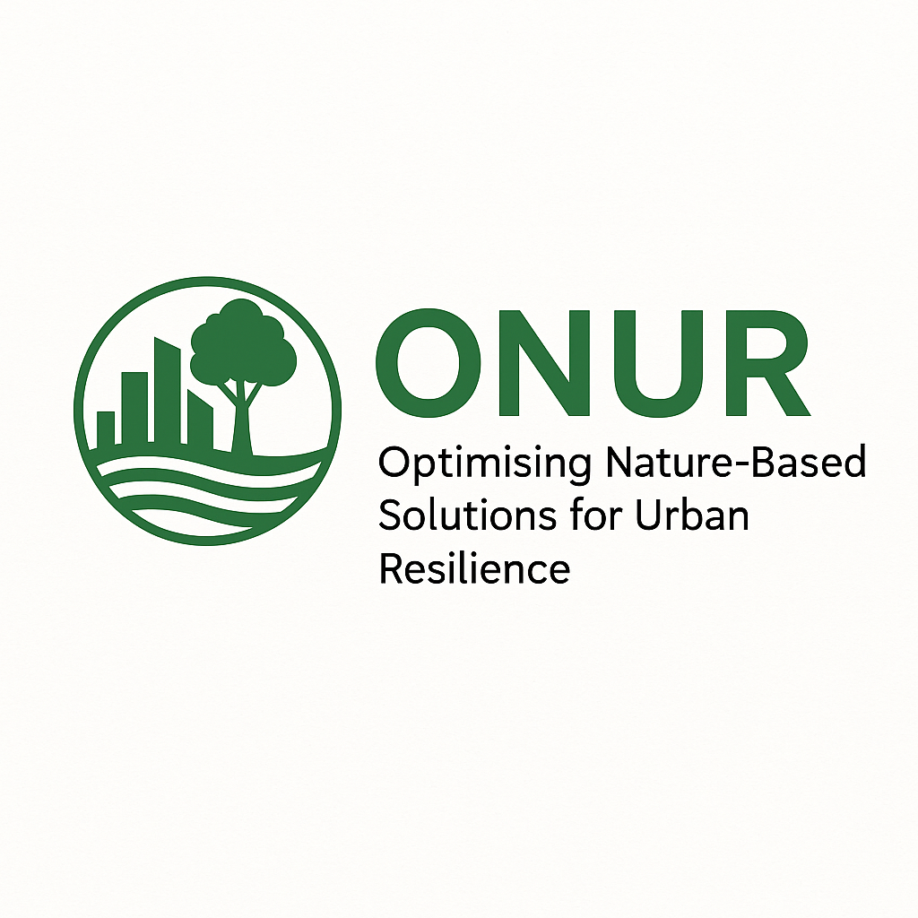
ONUR
Status date: 12 September 2025
Supporting cities, communities, and climate stakeholders to identify, prioritise, and evaluate nature-based solutions using AI-enhanced satellite data.
HabiTracker
Status date: 04 September 2025
HabiTracker is a habitat mapping & biodiversity monitoring service concept that combines Earth Observation data with ground-based IoT sensors to help UK farmers meet environmental reporting requirements and unlock nature-based financial opportunities. Developed by Terrabotics, it provides real-time ecosystem insights, regulatory-compliant reports, and practical recommendations that enhance ecosystem health while supporting farm productivity and sustainability.
BasinMeter
Status date: 04 September 2025
BasinMeter is a platform that supports users to assess current water risks and trends for the basin they are active in. Furthermore, it defines possible actions to reduce their water footprint and water risks to achieve Net Positive Water Impact (NPWI) targets.

GEMS
Status date: 04 September 2025
GEMS is pioneering the development of advanced emissions tracking solutions. Leveraging cutting-edge Earth Observation data from the Copernicus satellite services, our platform enables near real-time detection, identification, and monitoring of NO2/NOx and SO2 emissions sources across Europe. GEMS platform, address a growing demand for accurate emissions tracking, driven by evolving environmental regulations and the increasing focus on sustainable industrial practices.

GreenerCotton
Status date: 25 August 2025
GreenerCotton services support the implementation, certification, and transparency of sustainable cotton standards with satellite enabled technology. The EO-based platform developed within the project can be integrated into external IT systems like Farm Management software or Traceability systems via API. GreenerCotton is targeting two main use cases: 1. Supporting standardisation companies in implementation and certification 2. Supporting extension services (field advisory) to implement standards and improve production.
ACT
Status date: 18 August 2025
ACT is an AI-powered platform that transforms Earth observation data into precise, scalable and transparent forest carbon estimates. Designed to support feasibility assessment and monitoring across the project lifecycle, ACT helps developers and stakeholders generate high-integrity credits faster, at lower cost, and with greater credibility.
SpaceEPC
Status date: 11 August 2025
SatVu is collaborating with the Urban Big Data Centre (Part of the University of Glasgow) to enhance the analysis of building energy efficiency.
The study will drive the development of the Heat Loss Index (HLI), a pioneering metric designed to identify buildings with high thermal energy wastage, enabling policymakers and urban planners to focus retrofitting efforts where they will have the greatest impact.
OSHI
Status date: 06 August 2025
SeaSat’s Ocean Sentinel Health Index (OSHI) provides real-time, high-resolution satellite monitoring and predictive insights for coastal ocean health. Our service helps aquaculture operators mitigate risks from harmful algal blooms, temperature fluctuations, and water quality changes, ensuring sustainable and profitable marine farming operations.
Data4Water
Status date: 04 August 2025
Data4Water is a next-generation solution transforming how India’s Godavari River Basin is managed. Building on a successful feasibility study, this demonstrator delivers high-resolution forecasts, data, and insights on rivers and streams to support smarter, more sustainable decisions in agriculture, hydropower, irrigation, and fisheries. By combining satellite technology, in-situ monitoring, and AI, Data4Water unlocks the full potential of continental freshwater systems for resilience and impact.

SCORE
Status date: 24 July 2025
SCORE is your satellite-powered ally to identify, rate, and manage high-quality carbon projects—smarter, faster, and globally. Unlock nature’s carbon potential and turns satellite insights into climate-smart carbon strategies.
5SEnSES
Status date: 22 July 2025
5SEnSES is a service (SaaS) based on cloud-native platform for the gas and oil extraction sector. It integrates seismic, satellite (SAR), GPS and IoT data in real time, correlating ground-surface movements, seismic activity and pore pressure through an AI engine. The platform delivers faster, cost-effective, environmentally responsible monitoring and predictive simulation, surpassing traditional assessment methods and complying with all regulatory and legislative requirements.
VARESAS
Status date: 21 July 2025
VARESAS is an advanced solution designed to support rescue teams in crisis situations by providing real-time situational awareness. By integrating data from multiple sources and leveraging technologies such as augmented reality (AR), artificial intelligence (AI), and machine learning (ML), it enables teams to coordinate, manage, and execute operations with greater efficiency, precision, and speed.

ForestBioIndex-NE
Status date: 10 July 2025
Project successfully validated and tested a comprehensive Forest Biodiversity Index for Nordic and Baltic markets using Earth Observation data. The solution provides forest stakeholders with biodiversity analytics, regulatory compliance support, and management recommendations across multiple countries.
Project acronym or abbreviation
Status date: 08 July 2025
Vertify.Earth tracks the interaction between production or conservation activities and nature. Using satellite data and ground insights, it provides detailed assessments of biodiversity, land use, and ecosystem impacts to support nature-positive strategies and align with global ESG frameworks. Applications range from agroecological practices to evaluating industrial impacts on ecosystems and indigenous communities.
GeoFusion
Status date: 01 July 2025
A geospatial intelligence platform leveraging satellite data to optimize CAP compliance, agricultural monitoring, and natural capital management. The project delivers scalable, data-driven solutions for farmers, policymakers, and businesses, enhancing efficiency, sustainability, and regulatory adherence while driving innovation in biodiversity and nature finance markets.
Urban Green & Liveability Tracker
Status date: 30 June 2025
Enabling the Smart Green Cities of the future by tracking the urban green revolution, adaptation to climate change and liveability.
DWR
Status date: 17 June 2025
The Digitising Water Resilience project, led by Krucial in collaboration with SAS Analytics, Deep Planet, SRUC, and the University of Strathclyde, has demonstrated the feasibility of a globally scalable solution for monitoring water stress. Combining IoT sensors, Earth Observation (EO) data, and advanced analytics, the solution provides actionable insights to address water quality and quantity challenges. This innovative approach supports better decision-making, sustainability, and regulatory compliance in diverse sectors and geographies.

ACT
Status date: 17 June 2025
ACT is an AI-powered cloud platform transforming satellite data into precise, transparent, and verifiable forest carbon credit estimates. It supports planning, simulation, and monitoring needs across the carbon project lifecycle, helping project developers and stakeholders generate high-quality credits with improved efficiency and credibility.

In-terra-gate
Status date: 05 June 2025
In-terra-gate is a software which enables users to interact with satellite data using common natural language. It builds on recent advances in large language models (LLMs), natural language processing (NLP) and visual foundation models in order to make it possible to ask questions about terrestrial and geospatial features and phenomena in satellite images and get a generated answer with relevant information.

Nature Capital
Status date: 05 June 2025
Symbiose is a one-stop shop for forest owners to understand the true value of their forests. Using satellite data and AI models, our platform tracks forest health, predicts future growth with climate scenarios, and identifies risks like fires or pests early. It provides real-time insights to boost both ecological and financial value.
Coastal Ecosystems – MRV
Status date: 04 June 2025
The Coastal Ecosystems – MRV service provides monitoring, reporting and verification of conservation and restoration of coastal ecosystems such as mangroves and saltmarshes. Through innovate use of satellite earth observation, key ecosystem characteristics, such as ecosystem extent, above-ground biomass and ecosystem changes are measured. The service supports the development of functional natural capital markets by providing valuable inputs for establishing the integrity of carbon and biodiversity credits.
SWALUM
Status date: 02 May 2025
Surface Water and Land Use Monitoring (SWALUM) integrates deep learning with Sentinel-2 satellite imagery to detect small water bodies that traditional satellite monitoring misses. This innovative service provides municipalities, agricultural technology providers, and environmental services with reliable, cost-effective water mapping for flood management, irrigation optimization, and carbon credit verification, addressing critical needs in climate adaptation and water resource management.
AGT
Status date: 22 April 2025
AquaGuard Technologies revolutionizes maritime safety and environmental protection. Our AI-powered geospatial SaaS platform proactively detects abandoned derelict vessels (ADV’s), minimizing environmental pollution & damage, helping to advance a circular economy and enhancing resilience to climate change.
Contact us to learn more.

MCKS24/25
Status date: 16 April 2025
MyCoast is revolutionising coastal safety with satellite-enabled emergency response and environmental monitoring. Integrating AI-driven hazard detection, GNSS-IR tidal monitoring, and Satcom emergency connectivity, our smart beacons provide real-time safety alerts, ensuring vital information reaches those who need it—anywhere, anytime. Backed by ESA, MyCoast is pioneering next-generation technology to save lives and enhance global coastal resilience
Landfill Methane Monitor (LMM)
Status date: 16 April 2025
Methane Monitor enhances landfill methane emission estimation using satellite observations combined with on-ground tracer gas measurements. This innovative approach accounts for daily and seasonal variations, improving accuracy over traditional methods. The project, co-funded by ESA Kickstart, supports policymakers, regulators, and waste operators in assessing landfill emissions and promoting waste-to-energy as a lower-GHG alternative.
PLESS DEMO
Status date: 15 April 2025
Provide a brief description of the project in less than 60 words.
It will not appear on the project web page itself but is used in project lists e.g.
https://business.esa.int/projects and search results.
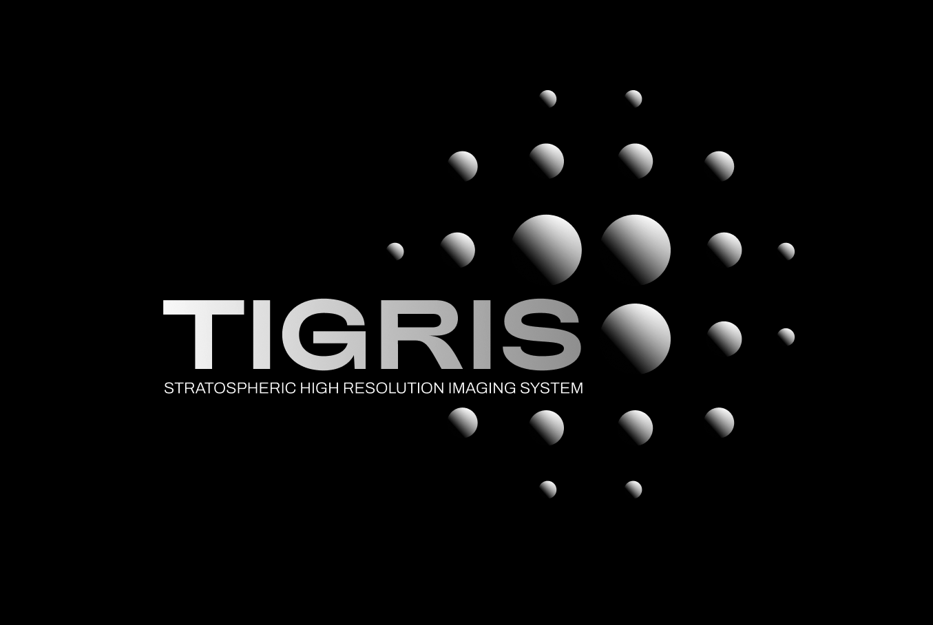
TIGRIS
Status date: 09 April 2025
Spaceline Labs (SPL) will deliver Earth Observation (EO) data to customers through SPLs software platform. The platform will provide access to EO data from satellites and a fleet of proprietary balloon-borne Satellites based in the stratosphere - developed and operated by SPL. The first iteration of this stratospheric technology is described as TIGRIS in this KickStart study.
Eyes on Plastic
Status date: 09 April 2025
Eyes on Plastic provides a service solution, which combines multiple sensor components into a joint mapping and monitoring solution for plastic in the aquatic environment. By flying high and diving deep, plastic litter can be monitored at all angles and scales. On top, the service invites everybody to actively keep the eyes open on plastic spanning local info to a global reach.
CTAPP
Status date: 11 March 2025
The CTAPP will be specifically tailored to urban environments, addressing the unique challenges that cities face in the context of climate change. Using the CICs methodology, EO and non-EO data, it will systematically analyze and model the cascading effects of climate-related events in urban environments and provide critical insights into the vulnerability of urban areas to climate-related disasters.
MinFarm Tech Smart Water over SatCom
Status date: 06 March 2025
The project objective is to develop MinFarm Tech’s optimized IoT over SatCom bridge for Smart Water Management deployments anywhere in the world regardless of access to the power grid and terrestrial networks.
Scalable Earth Blox
Status date: 26 February 2025
Scalable Earth Blox has transformed the Earth Blox platform into a fully-fledged SaaS enabling non-coders to create, on the cloud and on-demand, customised geospatial solutions and insights with ease. This has enabled us to support a global market, targeting organisations of all sizes, as well as opening up EO to a wider non-technical audience.
ARIES
Status date: 03 February 2025
The aim of ARIES project is to provide to the end users, i.e. Italian Civil protection (IPC) - Servizio Emergenze Protezione Civile Abruzzo, Italian Fire brigades (VVF), Carabinieri – Corpo Forestale (CUFA), Parco Naturale Regionale Sirente Velino, Municipality of Celano, an efficient set of services to improve the prevention and detection, monitoring and response to landslides and wildfire emergencies. This will be achieved through the combined use of new technologies (terrestrial and satellite both) to enhance the quality and interoperability of the tools for forecasting and monitoring wildfires and hydrogeological risks.
Wildfire emergencies
The proposed services will support forest fire emergency management through the integration of different data sources (i.e. Sentinel-2, PRISMA and IoT sensors data, drones) to provide target End Users actionable information (alert and precise localization of hazard, risk indexes, fire front propagation, etc. ) on a dedicated dashboard.
Landslide emergencies
The proposed services will support landslides emergency management through the integration of different data sources (i.e. COSMO-SkyMed, IoT sensors data, drones) to provide target End Users actionable information (alert and precise localization of hazard, risk indexes, etc).

SeaScope
Status date: 31 January 2025
Viridien’s SeaScope service increases knowledge on the presence, characteristics and behaviour of oil pollution in marine and coastal environments by combining deep interpretative understanding with the unique spatial, spectral and textural information contained within historical and frequently acquired contemporary satellite images.
CoCuRA
Status date: 29 January 2025
CoCuRA uses machine learning and satellite data to remotely detect cotton fields in India and distinguish whether their cultivation standard is "organic" or "non-organic".
Smart Urban Tree Management
Status date: 21 January 2025
WEO’s TreeMonitor enables municipalities and asset managers to optimise tree maintenance and management by tracking tree growth and health with space data. Spot trees posing a risk to critical infrastructure, track progress towards tree planting goals and identify trees in poor health all from one tool.
WSDSI
Status date: 16 January 2025
Wastewater market intelligence company Klarifi has conducted a Kick-start activity to do Wastewater Structure Detection from Satellite Imagery (WSDSI). By accurately mapping the structures at 100,000+ wastewater facilities, we will provide highly valuable data to our clients and gain a unique competitive edge in the wastewater market intelligence space.

Firemapper
Status date: 26 December 2024
Firemapper delivers real-time, high-resolution and cost-efficient wildfire mapping and analytics, leveraging space assets for enhanced crisis response and mitigation of CO2 emissions and environmental fallout.
Space Technology Aided 3D Underwater Scanning
Status date: 26 December 2024
The project evaluates how 3D models of underwater assets produced for inspection and maintenance purposes can be enhanced by using satellite-based position technologies to improve the accuracy of the models themselves as well as position them in the global coordinate system. It also evaluates scan data transfer to the cloud, from remote locations, using satellite communication technology.

Autonomous Offshore USV
Status date: 23 December 2024
The SenseBOAT Offshore USV System offer a versatile method for autonomous monitoring of water quality and biodiversity at open sea. Equipped with optical, visual and acoustic sensors the solution offers offshore industries a precision method for year long monitoring of marine nature at wind farms, floating solar farms and aquaculture production at open sea.
ForEOSt
Status date: 23 December 2024
ForEOSt empowers sustainable forest management with a diverse range of services designed to meet all your forest monitoring needs. SPACEBEL leverages advanced models using spaceborne and airborne data combined with in-situ information. Also, SPACEBEL provides AI-powered services for a selection of prioritized regions where models pre-developed and pre-trained in-house offer faster and cost-effective solutions than ever before.
Our services utilize dynamic Earth observation data, aerial imagery, and/or drone imagery to provide frequent updates on forest vitality, reliable tree counts, density measurements, and species identification. These insights enhance forest management practices in urban, agricultural, and rural settings, addressing the challenges posed by climate change and biodiversity loss. ForEOSt supports national and regional authorities, industries, and private landowners alike.
Let SPACEBEL help you monitor your forests and trees with the utmost efficiency
HSR
Status date: 23 December 2024
HeatScape Resolve project is developed jointly by Paulinyi&Partners cPlc. and Envirosense Hungary Ltd. to provide a solution for mapping and mitigating the urban heat island effect using satellite earth observation imagery, aiming to improve the effectiveness of existing predictive simulations. It makes use of Earth Observation data as input parameters for microclimate simulations for large scale urban real estate developments.
MEMT
Status date: 21 December 2024
MEMT is an intelligent digital tool that provides near real time operational information from the mining site to the mine management, to support fast and objective decision-making, with the purpose of enhancing operational efficiency.

CORISCLIM
Status date: 12 December 2024
Rapid Assessment of Future Coastal Flood Risks Around the World To Build Coastal Resilience
THIRSTY
Status date: 12 December 2024
With Project THIRSTY, Hydrosat is deploying two commercial products to enhance food security: 1) we provide accurate yield forecasts that help agribusinesses manage supply chains more efficiently, and 2) we implement a farm management system that helps growers increase crop production while conserving water.
ANNE MARIE
Status date: 26 November 2024
A mobile application and web-based data platform for collecting, cross-referencing, and displaying social and environmental data. The mobile application allows individuals - also via gamification - to provide ground-truthing data which is cross-validated against other data streams (e.g. remote sensing, bioacoustics, etc.), aggregated, and structured for GIS visualization, scaled up for more accurate environmental monitoring.
Orbio Earth Platform
Status date: 19 November 2024
The OE Platform uses satellites to track methane emissions from the oil & gas industry. This enables management of methane and associated energy transition risks using global, asset-level, highly frequent emissions data embedded into a deep regulatory, supply chain, portfolio exposure and operations analytics.
AVISAR
Status date: 19 November 2024
AVISAR is a demonstration project which aims to provide solutions to support clean and safe operations within the energy sector through carefully selected services, for both onshore and offshore operations. AVISAR is a product suite based on multi-mission, multi-sensor Earth Observation assets to address the challenges faced to reduce costs, increase efficiency and develop safer and cleaner methods of operation.

TSMF_10CM DP: WaldCursor
Status date: 11 November 2024
TSMF_10CM DP is Tama Group’s core project to develop, test and test market the WaldCursor product. The project covers development, test and field test of a cloud & app based remote sensing analytics information platform for forestry and environmental applications.
DITCH
Status date: 28 October 2024
The newly developed DITCH - Digital Twin Catchment service consists of an online accessible digital representation of basins providing static and dynamic variables like topography, land use and cover, hydrological and ecological conditions (water level, discharge, sediment concentrations, algal blooms) of water bodies, and soil characteristics provided through earth observation (EO) including potential dynamics next to past and present situations.
This physical twin is then also combined with socio-economic information to provide relevant decision support tools for resilient basin management of water-related stakeholders.
FB Eye
Status date: 23 October 2024
FB Eye – acronym of Fire-Bombing Eye – is a commercial initiative to improve the firefighting operations using innovative space-based and ground-based technologies.
FB Eye is an innovative platform-as-a-service commercial provision of integrated satellite/airborne Comms/Nav support to the precision water bombing of large wildfires.
FB Eye provides water bomber pilots with a near real time information map with precise geographical location of most radiating fire hotspots, being the most effective release target to extinguish rapidly the fire.

SCAF
Status date: 10 October 2024
Mitigrate, an InsureTech startup, pioneers flood risk management with its SaaS platform. Utilizing advanced technologies and earth observation data, it offers nature-based solutions reducing flood risks. Targeting insurance companies, Mitigrate's tool fills a crucial gap, providing pre- and post-flood disaster guidance. Beyond risk reduction, it aligns with global sustainability goals, positively impacting insurance performance metrics. An investment in Mitigrate is an investment in resilience, sustainability, and the future of flood risk management.

B2B Bike Navigation
Status date: 04 October 2024
This project developed an end-to-end navigation service which can be fully integrated into business customers’ own 2-wheeled vehicle products/services, including best-in-class routing optimisation (tailored to user needs) and navigation for 2-wheeler use-cases.
This makes it easier, safer and more convenient for people and goods to travel by light, 2 wheeled transport rather than by cars, vans and trucks.
NbS Monitoring
Status date: 30 September 2024
The NbS Monitoring service delivers a streamlined Earth Observation-based approach to provide accurate, timely, and comprehensive assessments of medium to large-scale NbS peatland projects, increasing the confidence and transparency of project outcomes, and saving costs and time for customers.

WHIS
Status date: 25 September 2024
The Water Health Indicator Service (WHIS) provides a continuous data stream of environmental health indicators for inland water bodies. This service is an API with monitoring and reporting capabilities that allows you to track a set of specialised and highly descriptive Water Health Indicators.

Methane Watch
Status date: 18 September 2024
Methane Watch is the world’s first monitoring system to measure the methane footprint of the energy sector. It combines Earth Observation data from the Copernicus constellation, NASA, NOAA and commercial satellites with advanced analytics to monitor emissions from oil, gas and coal with unprecedented accuracy, and provides unique insights to decarbonise the energy industry on a global scale.

Greener Cotton
Status date: 11 September 2024
Greener|Cotton aims to substantially improve sustainable cotton production by the application of satellite based digital agriculture technology. Integrated with cotton local traceability solutions, Greener|Cotton will help to reduce inputs and thus costs, allow to better manage production risks, reduce workers and environmental contamination, increase cotton quality, yields and revenues, lead to trusted production data and improving smallholder livelihood.

Data4Water
Status date: 20 August 2024
Data4Water is a groundbreaking initiative addressing the complex water challenges in India's Godavari River Basin. Recognized as a priority basin by the Water Resilience Coalition, the Godavari River Basin faces significant issues such as water scarcity, pollution, and fluctuating river discharge levels. Data4Water aims to enhance water management by providing accurate river discharge forecasts through BWI’s advanced services. By leveraging cutting-edge satellite data, in-situ observations, and machine learning, we offer a holistic approach to tackling these challenges, supporting farmers, agribusinesses, and local authorities in managing water resources sustainably.

e-RASM
Status date: 16 August 2024
e-RASM is a 100% sensors less automated tool that aims to provide to the farmers the soil water status of their different farm plots. This innovative tool based on artificial intelligence is helpful since it enables to optimize the irrigation they apply to their crops.

Hand for U
Status date: 16 August 2024
“Hand for U” is an application that allows People in Need and Volunteers to easily contact each other and respectively, express their needs and offer their help on behalf of the Volunteering Organisations. “Hand for U” aims to facilitate the creation of a helping community.
GreySat
Status date: 08 August 2024
Waste is a growing problem globally, and demands effective strategies to mitigate waste related risks. GreySat provides waste information to organisations, which enables the effective development and implementation of waste management strategies and projects.
WARM
Status date: 12 July 2024
WARM uses Machine Learning to identify water stress based on satellite and remote sensing data. The result is a water resilience map that covers entire basins and shows water quantity, water quality, and climate factors in detailed areas.
WaterSIM
Status date: 12 July 2024
Water is an essential resource under multiple stress factors, and the cause of multiple crises & conflicts. To manage the water risk and because the rivers often cross multiple countries and serves multiple usage, the stakeholders encounter difficulties to acquire accurate information about water to monitor and survey its quantity (availability & accessibility) and quality. Thanks to the combination of space-based tools and ground measurements, WaterSIM (Water Spatial and In Situ Monitoring Service) can leverage several issues & drastically improve the performance of ou customers and users for an ongoing monitoring and control of the water cycle of rivers and reservoirs and its state. The first service proposed is a flood demonstrator to monitor the water flow from rivers, raise alerts upon stress levels and associate this alert with high-value spatial indicators to support planning and prevention for flood risk, for improved decision-making for water resources management.
Forests from Space
Status date: 08 July 2024
Treedom is the first non-productive, privately financed online planting platform that allows consumers and businesses to plant trees remotely and follow their storylines. Satellite images and their elaboration will provide engagement and transparency tools to our customers and users
STREAMO
Status date: 21 June 2024
STREAMO provides advanced Earth Observation services from the Stratosphere, by using swarms of small and reusable High-Altitude-Pseudo-Satellite called CubeHAPS®, developed by Stratobotic. The solution improves regionally the Earth Observation services. The products offered are super-resolution, 3D models in real-time and SAR imagery at higher temporal and spatial resolution and lower costs, as almost no infrastructures are needed to use CubeHAPS®.
DIBAS
Status date: 19 June 2024
DDK Positioning Ltd. (DDK) provide GNSS hardware and Precise Point Positioning (PPP) services that improve GNSS positions from 10m to an accuracy of <5cm. DDK delivers its positioning service exclusively via the Iridium satellite communications constellation using Iridium’s 66 military grade LEO satellites to market sectors globally, from pole-to-pole.
SEEDS
Status date: 14 June 2024
Streamlining tree vegetation management with accurate insights using geospatial analytics.

ILDAP
Status date: 14 June 2024
Uncovering illegal logging in the past, present and future.
Rapid response. Anticipate to mitigate.

Biomass Watch
Status date: 14 June 2024
Biomass Watch is a global forest monitoring system that tracks changes in biomass carbon stock at the scale of a nature-based solutions project.

MOVE in SPACE
Status date: 03 June 2024
The project aims to develop a software that, combining user’s biological characteristics and trail information, provides customised advice and recommendations for physical outdoor activities. The main outputs are individual activity/hiking time recommendations, trail feasibility, calorie consumption as well as tips and precautionary measures also for subjects affected by chronic diseases.
Digital Port Platform
Status date: 07 May 2024
The Digital Port Platform is a Hub of maritime modules to improve port operations and lower their environmental impacts.
This Hub gathers space assets and other sources of data to transform them into key indicators thanks to advanced AI technologies.
It allows real-time situational awareness to solve major environmental and performance issues.
MIRORES
Status date: 30 April 2024
MIRORES consortium launches a geological prospecting-consulting company focusing on space resources. The expertise is built around a proprietary far-IR spectroscope for remote detection of sulfide and oxide ores containing key resources for planetary ISRU (titanium, iron, oxygen, sulfur, PGMs and energy resources - pyrite and helium-3). Proper supply of these resources is also essential for Earth’s transition into zero-carbon economy.
ABLE ACTIVE
Status date: 17 April 2024
ABLE ACTIVE promotes accessible trails and amenities to people with disabilities, uniquely by disability. Feedback captured from users helps to inform and inspire, making it easier for others to find opportunities suitable for their specific needs, and helping amenity operators to better understand and support their user community.
SA4D
Status date: 16 April 2024
What short and long-term actions can be implemented to foster opportunities for the space sector in aiding the green transition and decarbonisation of the economy, with a particular focus on the Buildings and Energy & Utilities sectors?
EO4CSR
Status date: 12 March 2024
The EO4CSR project aimed to assess the potential of Earth observation (EO) derived information to enable companies and financial institutions to facilitate due diligence and reporting requirements deriving from the European CSR Directive (Corporate Social Responsibility - CSRD) and European Deforestation Regulation (EUDR).
Energy SCOUT
Status date: 22 February 2024
Energy SCOUTTM is a modular set of services which transform daily and weekly feeds of raw satellite sensor and spatial data into a series of value-added information products, targeting different activities along the oil & gas supply chain.
ABG
Status date: 30 January 2024
A data product harnessing wildfire impact data for carbon credit verification, estimation, and above-ground biomass change analysis in the growing carbon market.
GSM (Golden Soils Monitoring)
Status date: 16 January 2024
Seqana is a Berlin-based startup developing a digital Monitoring, Reporting and Verification (MRV) service for soil organic carbon offset and inset projects, using Machine Learning (ML) and Earth Observation technologies. This Kick-Start project aimed to enable Seqana to acquire new ground truth datasets and to calibrate its ML models in Cambodia, Germany, and Kenya/Tanzania in collaboration with its local partners, respectively SmartAgro, CO2-Land, and Justdiggit. The relative improvement in accuracy metrics that Seqana achieved for each of the three calibrated regional models were an average increase in the final point-level test R^2 of 160% and an average reduction in point-level test Root Mean Square Error of at least 20%.
ABSeaD
Status date: 26 December 2023
ABSeaD focuses on environmental conservation. It utilizes advanced machine learning models to analyse Earth Observation data for the strategic management of Posidonia Oceanica seagrass beds, crucial for carbon sequestration.
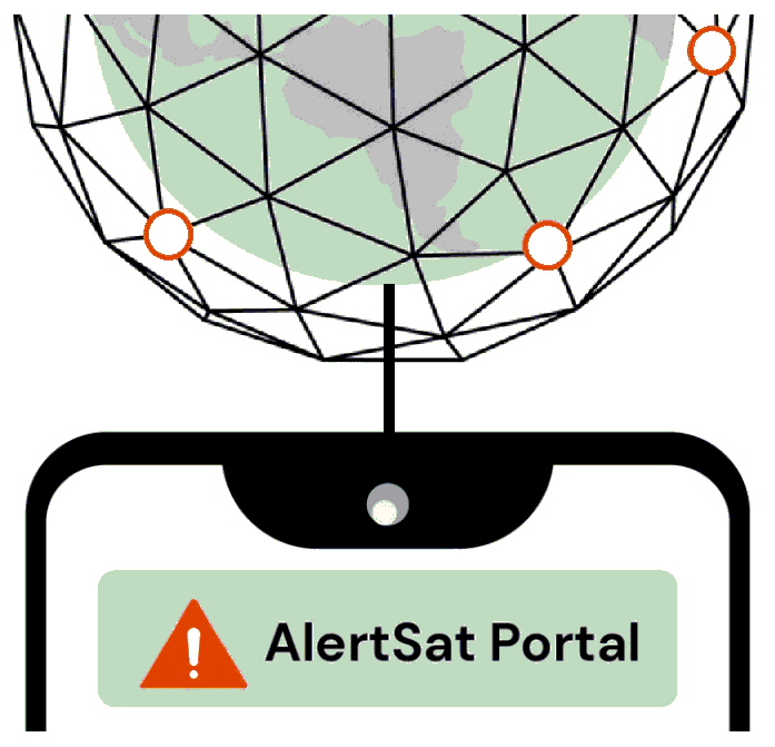
AlertSat Portal
Status date: 26 December 2023
The AlertSat satellite constellation is to deliver Alerts directly to its users, through AlertSat Portal - when critical information has been detected and there is still time to act upon it.
WaSat
Status date: 12 December 2023
The Norwegian company Ocean Oasis is developing a wave powered desalination technology to increase access to safe and affordable water in water scarce coastal regions. The capacity to efficiently evaluate the wave resource in specific locations allows for production forecasting and pricing. Earth Observation data has been used to improve the accuracy of the analysis tool.
AGRO-BIOMES
Status date: 11 December 2023
The AGRO-BIOMES Kickstart activity aims at understanding the biodiversity market level readiness in four major agricultural markets segments, proposing a few architectures scenario based on the <geosys/> platform capabilities, testing biodiversity-related analytics with ground truth and Copernicus data and finally evaluating economical, technical, and scientific risks and mitigations plan to be considered prior to a go-to-market decision.
C.O.R.E.
Status date: 02 December 2023
The CORE “Carbon Organic Resilient Ethereal” project aims to create an index (SCENARIO Index - Soil Carbon ProtEctioN And RestoratIOn) to map and classify soils according to their capacity to store ethereal and resilient carbon to facilitate carbon farming initiatives and investments.

Visu8
Status date: 28 November 2023
Satellite enabled smart autonomous micro-particulate analysis for real-time and remote water quality monitoring.
ARcade
Status date: 27 November 2023
Information and entertainment at the right time, in the right place. A platform providing a series of geolocated interconnected virtual spaces, called ‘Arcades’: virtual spaces overlaid on reality, activated by GNSS, where users access images, films, text and sound, using a smartphone/iPad. Turning everyday locations into virtual cinemas, classrooms, music venues, galleries, information hubs or marketing billboards.
SES5G
Status date: 27 November 2023
SES5G prevents, detects and manages wildfires and illegal actions in forestall areas.
The solution relies on satellite observation, autonomous drones, advanced firefighting sensors, security gates with plate readers, mobile control rooms that, with Artificial intelligent algorithms that feed with geolocalized data stakeholders control rooms (Civil protections, Environment department, Public protection, … ).
Ecosystems – CPV
Status date: 27 November 2023
Ecosystems – CPV provides data and modelling capabilities for utilizing coastal ecosystems as vital green infrastructure for protecting critical assets, business activities and people along coastal zones. The solution provides quantitative data and flexible modelling approaches to the insurance and infrastructure sectors, facilitating the effective and sustainable use of coastal ecosystems for disaster risk reduction and climate adaptation.
SA4D
Status date: 24 November 2023
The goal of the project “Space Acting for Decarbonisation (SA4D)” is to perform a feasibility study that will demonstrate the technical and economic viability of suitable satellite-based services for suggesting decarbonisation actions targeting agriculture, food production and building construction economic sectors.
ReSeNO Service
Status date: 01 November 2023
The ReSeNO kickstart project introduces a trustworthy service to manage, optimise and reduce the use of fertilisers in agriculture. Precise nitrogen estimation will strengthen agricultural sustainable practices to preserve earth’s natural resources, maintain soil quality, reduce chemical use, and save energy. It will also increase the economic profitability of agriculture and secure healthier land, helping on the food demand.

N-Base
Status date: 30 October 2023
N-base solution combines expertise in horticulture with advanced remote sensing technology and provides field maps for monitoring and optimization of nitrogen applications in apple orchards. This is how farmers gain actionable insights to facilitate precise and targeted nitrogen application.
EFFORS
Status date: 18 September 2023
A real-time flood forecasting system has been developed and is operated at the computational centre of the Austrian national weather service GeoSphere Austria.
EFFORS brings together experts in the field of meteorology, hydrology, hydrodynamics and satellite communication. Within a coherent modelling chain, the EFFORS system couples the individual numerical models and provides relevant data about flood evolution on short time scales.
Hand for U
Status date: 31 July 2023
“Hand for U” is an application that allows People in Need and Volunteers to easily contact each other and respectively, express their needs and offer their help on behalf of the Volunteering Organisations. “Hand for U” aims to create a safe space for People in Need and Volunteers to self-organise and create an empathetic community.
OWASIS WDS
Status date: 23 July 2023
The service provides forecasts of essential water availability and water demand information for water managers. It contributes in creating an essential window of opportunity for end users to timely anticipate, take the right measures and minimise the impact of future events, either droughts or floods.

UpGreen
Status date: 19 June 2023
UpGreen helps cities to realize more effective urban green policies. It is based on actionable insights on the actual and future state of urban green as well as on the greenery vision model proposition, enabling strategic decision-making, and identification of the most effective urban green projects and policies.
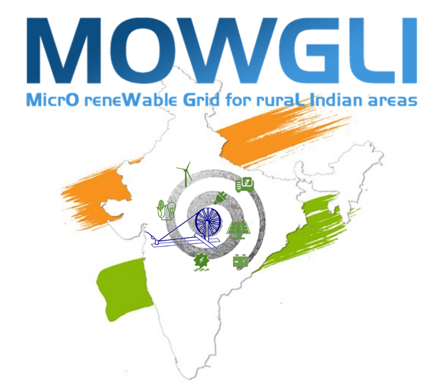
MOWGLI
Status date: 31 May 2023
From planning to monitoring: the exploitation of satellite technologies in urban and rural microgrid life cycle.
OPAT
Status date: 30 May 2023
The aim of the project is to detect and Track the Plastic litter at sea.
SarSentry demonstration project in Para
Status date: 29 May 2023
The SarSentry project in Para demonstrates the complementary value of the SarSentry deforestation and forest degradation system to the existing forest monitoring system of the Secretariat for Environment and Sustainability of the State Pará in Brazil (SEMAS). Demonstrations have been provided for 3 pilot themes/trials: Nature conservation, Forest plantations and selective logging, and Agricultural areas.
The project has been conducted by SarVision and Wageningen University and Research.

FLARE
Status date: 16 May 2023
FLARE is an easy-to-use software analytics platform that provides earth observation data and analyses derived from it in a geospatial context. It offers governmental data and data intelligence that are directly accessible, making it possible to conduct feasibility studies, plan renewable energy opportunities faster, and assess suitability by looking beyond the solar and wind resources. FLARE is valuable for those looking to find and share renewable energy land opportunities with energy developers.
Monitoring and verification of carbon credits from forestry CO2 sequestration projects
Status date: 28 April 2023
The project involved developing a pilot system for using satellite imagery from the EU Copernicus programme to monitor forests in the Halo Verde Project (Timor-Leste) to assess the carbon sequestration potential through biomass growth. The output of the system was used to document, assess and verify whether monitored forest plots grew as described in the carbon credit project model specification.
DeGAS
Status date: 24 April 2023
DELPHI IMM is developing a service to estimate GHG removal from afforestation projects using remote sensing. The service is aimed to provide insights on carbon storage in vegetation for all entities along the carbon offsetting value chain and present the results in an appealing user-interface including maps, time-series, and reports.
SatMRV
Status date: 24 April 2023
Soil is critical in combating climate change. It can capture carbon from the atmosphere and store it in the soil while growing food. Carbon farming requires continuous measurement of Soil Organic Carbon (SOC) and rewarding farmers for positive change. Now, how to measure SOC on a regular basis at cost and scale? Because “if we can't Measure it, we can't Manage it”.

SBWS
Status date: 15 April 2023
In the era of access to huge data resources, advanced analysis and data-to-information processing are essential in the decision-making process. SBWS in the form of friendly web portal, provides advanced analytical tools and a structured data repository, designed to support environmental monitoring using remote sensing data.

Netcarbon Intelligence
Status date: 15 April 2023
NetCarbon revolutionises global carbon sequestration measurement through our Carbon Intelligence Platform, which utilises satellite data to help Cities measure their carbon storage, plan improvements, and manage implementation. Our technology meets the dual challenge of contributing to carbon neutrality while respecting regulatory constraints to fight climate change, together.
FOCUS
Status date: 03 April 2023
Project FOCUS seeks to prove the viability of funding the application of a new regenerative farming standard in African smallholder coffee farming through the voluntary carbon markets. The sequestration of atmospheric carbon will generate a new source of income from carbon credits, remotely monitored and verified through the application of satellite imagery and advanced data analytics.
GreenUP
Status date: 27 March 2023
One of our cities' challenges is to design integrated urban environments that balance between growth ambitions, an increasing population and climate emergency, and at the same time introducing new standards for green growth, biodiversity, inclusion and quality of life. The GreenUP project aims to shed light on how satellite technology can be transformed into flexible and user-relevant tools to support local authorities and other stakeholders involved in the development of sustainable urban environments.
DOCS-2
Status date: 15 March 2023
Using civil aircraft to create constellations for providing high spatial & temporal Earth observation data and telecommunication services; a most ecological constellation re-using the most reliable platform.
SequOIA-CAM
Status date: 14 March 2023
SequOIA-CAM offers an end-to-end biological carbon accounting, vegetation monitoring and carbon stocks sequestration rate simulation service for sustainable cities, regions, forest owners, and forest-related companies. SequOIA-CAM leverages the unique capabilities of Satellite-based Earth Observation (EO) that provides the necessary high spatial and temporal resolution and cost-effective monitoring capacity to ensure that nature-based solutions are implemented correctly and to ensure accurate quantification of carbon stocks in forests.
OWASIS-NL CCN
Status date: 13 March 2023
OWASIS Water Auditing demonstration project made suitable for implementation in South Africa, Colombia and the Netherlands based on data availability and user needs.
SyriUS
Status date: 03 March 2023
SyriUS develops innovative data services for bathymetric mapping and seafloor characterization. Currently, these data are often outdated or unavailable for very shallow waters. SyriUS combines proven earth observation (EO) technology [EOMAP] with uncrewed maritime systems (UMS) [Maritime Robotics]. The created data products provide time- and cost-effective large area coverage with calibration and validation of EO data by UMS data.
S4UG
Status date: 28 February 2023
MEO-CS
Status date: 15 February 2023
MOE-CS is a service dedicated to monitoring carbon stocks and fluxes related to land use and cover changes, based on both local annual estimates and land cover dynamics. The service also offers a focus on favourable agricultural practices, additional carbon potential and related co-benefits.
Space Augmented UAM
Status date: 14 February 2023
Space Augmented UAM aims to determine the feasibility of a “Space Augmented” service enabling cities and regions to conduct U-Space integration assessment utilizing economic, technical and environmental simulations for predictive assessment considering the individuality of each city to generate a self-sustainable Urban Air Mobility ecosystem.
FATE
Status date: 10 February 2023
FATE develops a digital ecosystem to preserve and disseminate cultural heritage sites, realizing an open, participatory and interactive marketplace platform, using best of breed innovative technologies and smart interconnections between service providers, merchants, customers, users and stakeholders, realized on a cloud-based AI supported virtual platform that store, share, manage and maintain historical sites digital twins and related metadata.
Sustainable Tourism Indicators
Status date: 31 January 2023
Have you ever had environmental considerations while on vacations? Most travellers are keen on preserving the area they are visiting but very few have reliable information on the actual environmental situation. Within this project the use of Earth Observation data is assessed to quantify the environmental situation and deliver this information in a simple way to all tourism stakeholders.
Urban Green Quality Tracker
Status date: 25 January 2023
Enabling the Smart Green Cities of the future by providing a dashboard of the health, extent and impact of the cities urban green.

ForestMind
Status date: 19 January 2023
Enacted at the request of members of the UK food supply chain, ForestMind is a two year project with 10 partners who are focused on enabling commodity sourcing organisations to understand and act on deforestation risks in supply chains globally.
BIGMIG-DEMO
Status date: 19 January 2023
The project aims to establish a service leveraging on big data from satellite and ground data to support migration management and prevention.
StreamSonde
Status date: 22 December 2022
The world’s lightest weather sonde, the StreamSonde, is launched from balloon, airplane, drone or UAV and carried around by natural winds. It records winds at higher accuracy and in greater detail than ever before by using GNSS technology and IMU sensors. It also records a large number of weather parameters with multiple sensors. In this project, its benefits for storm and routine weather measurements was demonstrated, along with user benefits of obtaining better weather forecasts.

WS
Status date: 22 December 2022
WaterSentinel aims at providing satellite-powered water quality monitoring tools relevant for Environmental, Social and Governance (ESG) assessments as well as broader environmental monitoring applications.
Its falls within a broader goal of promoting the use of space data for sustainable finance decisions.
RESUCI DEMO
Status date: 21 December 2022
RESUCI – DEMO is focused on the implementation of pre-operational services that aim at improving recurrent daily operations of critical infrastructures’ managers, including energy operators and forest managers.
For this, two services have been implemented using Earth Observation (EO) imagery:
-
Service 1: Right of way monitoring for obstacles and activity detection – standing as an alternative to traditional methods of characterizing and monitoring the rights-of-ways of linear networks, this EO based service provides faster updated characterization of the land use, when compared to traditional methods
-
Service 2: Field maintenance operations management and control - this service fills a gap and stands a high value management tool that prevents the need for common monitoring approaches, typically by deployment of field teams. Also, this service is designed to be provided continuously, providing users with up-to-date information on the status of the maintenance tasks
PALETTE
Status date: 21 December 2022
PALETTE is a technology and platform that uses satellite data to produce synthetic cloud-free images and deliver unique value to the earth observation industry and other industries. By combining satellite constellations, PALETTE can provide users with access to continuous, up-to-date imagery and simplify the data acquisition process.
SNOWtoWATER
Status date: 16 December 2022
SNOWtoWATER service provides high resolution and accurate snow water equivalent and snow cover data. SNOWtoWATER makes use of innovative A.I. algorithms fed by remote sensing data and quantitative sitespecific analysis, providing results through a digital platform.
SEOS
Status date: 05 December 2022
SEOS is an initiative led by Ecometrica to advance applications of Earth Observation in Scotland aiming to increase the consistency, continuity, extent and usefulness of geospatial content through the provision of services that address environment and land management challenges faced by a number of Scottish public and private organisations. Global Surface Intelligence is a project partner, providing advanced satellite data processing.
WatAspace
Status date: 05 December 2022
How much water is flowing in the river? What is the water level in the reservoir?
The answer to these questions is not always easy to find, especially on ungauged rivers and on reservoirs managed by third parties. WatAspace answers these questions by using satellite data, without the need of in-situ sensors
SCD
Status date: 28 November 2022
Unibap demonstrated the SpaceCloud-as-a-Service (SCaaS) business model and SpaceCloud ecosystem which brings edge, cloud, and storage capabilities with flexible analytics to satellites. SpaceCloud enables low latency, high value actionable information, better optimized and managed downlink bandwidth, and increased satellite utility. This benefits many different business verticals such as precision agriculture, crisis and disaster management, civil and defence security and environment preservation.
FiELD
Status date: 21 November 2022
Finding Intelligent Environment-led Data (FiELD) initiative delivers a cooperative framework in rural hubs to facilitate implementation of space data by end users through the “citizen science” concept. The range of services is built around the principles of consolidation, facilitation, education and innovation of appropriate earth observation (EO) data, to enhance local authority and citizen decision-making.
Climate-proofing of buildings
Status date: 21 November 2022
To make existing buildings more environmentally and socially sustainable, we need to know how efficiently they work with energy. Energy auditing is used for this purpose. It determines a building’s energy performance and identifies energy-saving opportunities.
The key component to energy auditing is climate data.
Outdoor temperatures are used to assess the energy performance of heating systems.
Solar radiation is used to assess the energy performance of photovoltaic systems.
The availability and accuracy of these data are crucial.
Using MeteoInsight, there is no need to use data from distant weather stations and waste time manually processing the data.
LOOP
Status date: 17 November 2022
LOOP solution provides a worldwide observatory of air quality, weather conditions, and environmental/regional insights for supporting implementation of air quality policies and decision making for land spatial management, to reach low environmental impact.
GeoAI_Watloss
Status date: 12 November 2022
GeoAI_Watloss - Location of leaks in water supply networks using artificial intelligence algorithms based on satellite and aerial imagery and GNSS positioning. The aim of the project is to build a product supporting the process of locating water leaks in water supply networks by improving the procedure of their detection.
INSURE
Status date: 04 November 2022
INSURE aims to provide an extensive set of services to any company involved in the decommissioning of their oil and gas operation, as well as photovoltaic, wind and green energies offshore and onshore platforms. INSURE service implements a set of functional blocks for the monitoring of the environment, the platform status and support the management of the platforms off-shore during all the phases of activity through an advanced telecommunication system.
POMERIUM
Status date: 27 October 2022
The POMERIUM project aims to realise a complex monitoring system for Cultural Heritage (CH) management in order to support managers in the daily and extraordinary activities and expert decisions. The system will be based on the added value given by the integration of different technologies: satellites, Remotely Piloted Aircraft Systems (RPAS), in-situ Internet of Things (IoT) monitoring, image recognition, advanced modelling, and 5G.
UNDERSEE
Status date: 21 October 2022
In the same way we check the weather forecast and take preventive measures, so we will do for the water.
H2Orb
Status date: 20 September 2022
H2Orb tested the feasibility of developing a monitoring and alerting tool that harnesses satellite data to complement ground sensors in supporting the aquaculture sector. It used real-time data insights and early alerts to enable intervention measures for environmental and water quality to be applied to safeguard aquaculture stock whilst allowing farmers to monitor the results of their interventions.
SAGRESSMART
Status date: 01 September 2022
Powered by artificial intelligence and earth observation, SAGRESSMART provides solutions to improve efficiencies and success in seafloor mineral exploration and investment. As a way to increase knowledge, reduce risk and uncertainty, and assess mineral potential, SAGRESSMART is design to simplify and reduce the time spent compiling, managing and interpreting data and concentrate efforts on the evaluation and raking of high-value targets.

CoCuRA
Status date: 27 July 2022
CoCuRA uses machine learning to automatically detect cotton fields on satellite imagery and remotely classify these fields based on their environmental impact.
EO4CS
Status date: 15 July 2022
After decades of interventions in the cocoa sector and implementation of voluntary sustainability standards, the environmental impacts of cocoa production are still present. Supposedly sustainably produced cocoa is mislabelled and not produced according to sustainability standards. The EO4CS project aims at preventing food fraud of cacao by supporting the certification process for labels of sustainability with objective satellite-based earth observation information.
Inference
Status date: 02 June 2022
Using new approaches to map sugar worldwide, focusing on the more complex regions, including Thailand and India.
EnviNavigator
Status date: 01 June 2022
In the project, self-learning AI engine and services for providing up-to-date information on the current state of forests, their risks, and changes in them have been produced for the needs of forest professionals and forest owners by combining satellite data with other data sets relating to forestlands.
SenZitall
Status date: 17 May 2022
The SenZitall integrated solution is envisaged as a one-stop-shop for integrated pest management. The unique selling points of the provided system and service are: a flexible and reliable data transfer solution (terrestrial or satellite without the need for user intervention) ensuring that no data is lost, high modularity in sensor type and node topology with easy deployment of extra nodes at any point in the product life-cycle, and a low-cost energy harvesting solution supporting a fully independent system. The data received from the sensor network combined with the earth observation data provides the users with a sophisticated solution for improving their pest management practices (SDSS).
ECOP
Status date: 17 May 2022
ECOPlayer (ECOP) - ecological, virtual educational platform for children and young people. The activity is based on the use of synergy resulting from the integration of modern satellite solutions aimed at creating an educational platform based on three methods of content presentation: Virtual Reality, Augmented Reality and a combination of features of both solutions in the form of Mixed Reality.
The proposed product is based on two key space programmes carried out by ESA: Earth Observation as part of the Sentinel mission and GNSS global positioning systems. The proposed solution envisages exploiting the synergy of the Sentinel project's products with the Galileo and EGNOS satellite navigation systems to provide integrated geo-information to the users.
EMLM
Status date: 22 March 2022
EMLM investigated the technical feasibility and commercial viability of Earth observation satellites to detect, monitor and model the movement of large accumulations of floating marine plastic litter as it travels from the source, along rivers and estuaries, and into the Oceans.
PlastEcoTrack
Status date: 21 March 2022
This project assesses the technical and commercial feasibility of space-related services to support the reduction of marine litter. A multi-technology approach is studied to detect and track marine litter in the coastal area. An integrated economic channel from the collect to the revalorization is evaluated, including the tracking solution and involving local fishing communities to boost efficiency.
DANPREIT
Status date: 17 March 2022
DANPREIT digital twin is a Prop-tech that prevents, mitigates, and manages Real Estate Investment Trusts (REITs) disputes. Our digital platform uses satellite and non-satellite data to create simulations that can predict exposure to litigious or arbitration procedures.
PLESS
Status date: 28 February 2022
Marine pollution in the form of plastics is a devastating problem that not only affects the whole planet ecosystem, but also represents a great socio-economic impact on human activities
It is considering this ever increasing problem that there is an urge for new conceptual and technological solutions that can help to detect, monitor and mitigate the consequences of marine plastics pollution and, ultimately, contribute for the establishment of adequate policies that can contribute for its mitigation.
SMOCGEO
Status date: 15 February 2022
SMOCGEO is enabling a transparent assessment of the sustainability of global commodities supply chains, using geospatial analytics. The project fuses satellite data, geospatial data and machine learning techniques to transform complex climate data into meaningful outcomes for enterprise corporates and financial institutions.
SISMA2
Status date: 03 February 2022
The objective of the SISMA2 demonstration project was to implement cost-effective space-based tools and demonstrate the value of our smart-herding solution to monitor herd activities (large terrestrial animals raised outdoors, domestic, and wild) and their vulnerability factors, to modernize the herding industry and increase the plasticity of adaptation of reindeer husbandry to climatic changes in the environment and to the evolution of regional contexts.
SAQM
Status date: 03 February 2022
Man-made air pollution leads to 5.5-8.5 million deaths each year and causes countless chronic respiratory conditions. Traffic is the most important source of this pollution. Using satellite data, Satellite Air Quality Models (SAQM) are the most detailed air pollution maps for cities around the globe. Our portal allows users instant access to the air pollution data, benefiting everyone.
PoF
Status date: 16 December 2021
A consortium consisting of Arthur D. Little, CLS and Marlink are performing a study on how space-based technologies can be leveraged in the modernization of ports. The study includes a full range of Space-based technologies including satellite communications GNSS, SAT-AIS and Earth Observation and how these technologies could be applied in combination with terrestrial assets.
HERMOSA
Status date: 14 December 2021
HERMOSA is a service platform dedicated to support activities on ecosystem restoration and biodiversity conservation in its larger sense and the positive impact it has on the issue of food security, creating sustainable jobs, mitigating and adapting to climate change and empowering communities in technologies. HERMOSA is built using Open Source Software, accessible through the internet, empowered by web-mapping and Remote Sensing technologies.

WAMcam
Status date: 29 November 2021
WAMCam™ is an innovative solution integrating satellite communication and machine learning technologies to radically improve wildlife research and conservation. Researchers and conservationists in remote regions can deploy AI-enabled cameras to fight poaching, monitor animal traps, and study wildlife. Receiving prompt notifications by the cameras revolutionizes the effectiveness of these groups of users.
ForestAI
Status date: 21 September 2021
The ForestAI project uses Artificial Intelligence (AI) and Earth Observation (EO) to provide an advanced forest monitoring solution globally. The service offers customers in the forestry domain with new tools to more efficiently manage their forests through up-to-date maps, deforestation alerts, and risk assessments.
SNAPPED
Status date: 25 August 2021
This project is a technical, economic and commercial feasibility assessment into an adaptive Load Reduction Device (LRD) for Floating Offshore Wind (FLOW) mooring systems that can significantly reduce Levelized Cost of Energy (LCOE).
Green Buildings Services - Optimising Vacant Land
Status date: 23 August 2021
The growing urban population and the impacts of climate change are putting increasing pressure on cities.
Vacant, underutilised and brownfield land provide an opportunity to create transformative interventions that contribute to addressing urban challenges and enhance the resilience of cities.
Green Buildings Services - Biodiversity Net Gain
Status date: 23 August 2021
The Biodiversity Net Gain service aims to develop a rapid, accurate and efficient approach to the mapping of biodiversity baselines and biodiversity change for Biodiversity Net Gain, facilitated by remote sensing technology.
GWSS
Status date: 30 July 2021
With rapidly growing wildfire disasters in Europe and worldwide, we see an increasing need for new technologies and applications to better monitor these fires. OroraTech is developing an innovative all-in-one global wildfire detection, alerting and monitoring service from space.
Pre-Loc
Status date: 13 July 2021
Loss of water through damaged pipes is one of the biggest problems in the global distribution of drinking water. To make leak detection easier, we sell our customers a T.O.M.-System for use by own specialist staff or offer a qualified service for leak detection through Turn-off metering. Necessary information about the pipe network is documented in an online portal.
Gentian
Status date: 21 June 2021
Using satellite earth observation to measure the biodiversity contribution of green infrastructure, mitigate stormwater risks, and identify sites for retrofitting green roofs.
Linda Forest
Status date: 05 June 2021
CollectiveCrunch is an AI leader in the forestry industry. Our product is called Linda Forest and is delivered via a SaaS platform. Using Linda Forest our customers make better buying and selling decisions, use wood-based raw material more efficiently, and overall reduce their costs. Linda Forest can be adopted to new opportunities such as prediction of risks from climate change.
ARIES
Status date: 04 June 2021
A project for an efficient system for prevention, monitoring and response against wildfires and landslides emergencies with focus on satellite assets, terrestrial 5G networks, drones and next generation IoT sensors.
Plastic Less Society
Status date: 28 May 2021
This project assesses the technical and commercial feasibility of space-related services to support the reduction of marine litter. A multi-technology approach is studied to detect and track marine litter in the coastal area. An integrated economic channel from the collect to the revalorization is evaluated, including the tracking solution and involving local fishing communities.
Xylene EO
Status date: 16 May 2021
Xylene is a SaaS providing European importers of raw materials, a smart supply chain with transparency and control to comply with regulations and consumer demands and protect companies' brand reputation. This innovative approach combines supply chain data gathering and analytics with satellite technology (SatNav and EO) and blockchain to create supply chain transparency.
FEST
Status date: 16 May 2021
Vake is making the oceans safer and more transparent by detecting and exposing IUU fishing activity. They deliver Deep Maritime Insights through automated data fusion of vessel trackers and satellite imagery. During the project, the work included activities towards NGOs and Government Agencies working on analyzing IUU fishing activities and other illegal or unreported activities.
Oresome
Status date: 16 May 2021
Increasing mining productivity through acquisition and analysis of operational data over a converged satellite/terrestrial communications architecture.
AI4Sendai
Status date: 30 April 2021
From portfolio or project analysis down to single asset, Ai4Sendai helps key industries such as Energy, Oil And Gas, Insurance and banking, Real estate, Agriculture as well as Public authorities and NGO making the best informed decision by providing a timely and accurate planetary intelligence for precisely locate their assets, identify their vulnerabilities to climate change and rate risks to specific natural hazard.
AlertSat
Status date: 13 April 2021
AlertSat is an earth observation change detection satellite constellation developed by the PandionAI corporation. The concept with on-orbit and autonomous image change detection, together with the instant delivery of information, gives end-users a tool to act efficiently in critical situations. AlertSat is designed with today’s challenges of rapid global changes in all areas, environment as well as business, in mind.
Sustainable Tourism Indicators FS
Status date: 07 April 2021
Have you ever had environmental considerations while on vacations? Most travellers are keen on preserving the area they are visiting but very few have reliable information on the actual environmental situation. Within this project the use of Earth Observation data is assessed to quantify the environmental situation and deliver this information in a simple way to all tourism stakeholders.
INVENTA
Status date: 07 April 2021
The INVENTA project intends to carry out the feasibility study of an innovative service able to increase the fruition, accessibility and sustainability of historical/cultural sites through the integration of Virtual & Augmented Reality with Satellite Navigation and Earth Observation. The service will be based on an innovative mobile App using 5G network.
ASTROCAST
Status date: 25 March 2021
Astrocast is developing an advanced Nanosatellite network for the Internet of things (IoT).
ChAI Price Predictions
Status date: 23 March 2021
ChAI is using satellite imagery to help the nickel supply chain, a crucial ingredient in the batteries that power electric vehicles, laptops and phones. With mines located in inhospitable or remote locations where traditional sources of information have been hard to come by, buyers and sellers of nickel can now use ChAI to help reduce their risk.
MEMT
Status date: 23 February 2021
MEMT (Mobile Equipment Monitoring & Maintenance Tool) improves decision making for mine managers and foremen on operational efficiency of their mobile heavy machinery fleet. The easy to deploy system allows to gain visibility on various aspects of the working conditions and working environment. The main target is to increase the fleet performance, preserving the good health condition of their machinery.
HeraSpace IUU
Status date: 17 February 2021
HeraSpace IUU helps the identification of illegal unreported and unregulated fishing supporting EU legislation and environmental protection.
ZPR
Status date: 08 February 2021
The aim of the project is to give MPAs (Marine Protected Areas), National Research Institutes, NGO and as well as marine operators access to advanced technologies as artificial intelligence (AI), robotics and space technologies, that could help, favourite and accelerate marine conservation.
Specifically, the project will allow the data mining of coastal marine habitats through embedded AI on satNav localized underwater explorer-class drones and surface vessels whose autonomous survey are optimized by cloud AI and Earth Observations (EO), creating web dashboards for MPAs to access all the marine habitats data, trends and alerts, and share them all within their community.
Seco
Status date: 08 February 2021
SECO is a novel system that integrates three EO services and five EO technologies with the sole purpose to prevent and detect water leaks. The services are delivered directly to customers systems via an API and/or a web platform. SECO integrates satellite optical and radar datasets delivering a short to long-term intelligent alert system for water leaks prevention and detection.
Aquax
Status date: 03 February 2021
AQUAX is an integrated system of robots, satellites and artificial intelligence, intended for monitoring and identifying anomalous discharges within lakes, rivers and reservoirs.
360blue
Status date: 02 February 2021
360blue is an information and software suite to determine water related risks, support optimization of water management, and asses water replenishment activities.
OWASIS-NL
Status date: 27 January 2021
The lack of proper information on water availability is one of the most challenging obstacles for water management practices. To fight this challenge, OWASIS-NL uses space assets in two innovative water availability services that support effective water resource management in the Netherlands and South Africa.
POREWIT
Status date: 26 January 2021
POREWIT is satellite-based services aiming to support the monitoring of forestry activities and supply chains, the detection of non-compliant behaviours and the implementation of law enforcement operations (investigation & evidence) in relation to forestry law.
MoMoRib®
Status date: 26 January 2021
Monitoring and alert system for river bank. MoMoRib® uses a calculation programme based on the multi-methodological comparative analyses applied to geodetic, hydrological and soil-properties patterns, then links the information to the AI processed satellite datasets in the river zones prone to failure and/or where plastic and/or toxic waste can be concentrated.
COLD-ML
Status date: 15 January 2021
The COLD-ML project has implemented one of the first approaches for the development of a fully automated, AI-based application for detecting the retreat of outlet glaciers on a global scale using EO. The project is an important step forward for timely and near-real time data provision on Greenland cryosphere changes, one of the most visible global indicators of climate change.
Floodly AI
Status date: 15 January 2021
Detection of subsurface water using satellites and AI, for the purpose locating new sources of drinking water and pipe leaks.
PrepaCoast
Status date: 14 January 2021
An online tool is developed to visualize coastal erosion and accretion in Togo, Senegal and the Maldives. The tool is powered by Google Earth Engine platform and will provide information relevant to coastal zone management, institutions involved in financial planning of infrastructure projects, the tourism industry and entities involved in early warning and resilience.
MoSCI-ECOSPACE
Status date: 08 January 2021
The MoSCI - ECOSPACE product is a service for storage, processing, visualisation and analysis of Earth and airborne observation datasets. It aims at delivering meaningful information for overseeing and managing risks to critical infrastructure (CI) in coastal and riverine settlements. The service targets in priority the public water authorities responsible for managing coastal and riverine areas and resources; the utilities, contractors and engineering consultants; and the international financial institutions and insurance brokers.
RiPolMin
Status date: 18 December 2020
RiPolMin is a smart remote monitoring tool aimed at detecting pollution of rivers by mines. It is being developed and tested on abandoned mines in Cornwall, UK, and is designed for land, environmental and liability management. The tool applies novel processing to Sentinel-2 and drone-borne spectral signatures, to identify problem sites and track pollution at a local level.
Space for Sanitation - Woodco
Status date: 18 December 2020
This Feasibility Study explores business opportunities for the utilisation of satellite earth observation data, satellite communication and terrestrial communications to link toilets and sewage treatment facilities to wider sensor networks, to significantly augment sanitation management and the monitoring of public health.
AIDOPS
Status date: 16 December 2020
AIDOPS provides monitoring services based on artificial intelligence for automatic detection of objects and patterns in satellite images. AIDOPS concentrates on the fields of agriculture and forestry. The long-term goal is to provide new automated ways of assessment for inventories and monitoring to detect damage caused by bugs or climate in crops and forests at an early stage.
CarbonSpace
Status date: 15 December 2020
CarbonSpace is an AI and satellite-powered B2B SaaS platform for remote carbon footprint tracking that provides organizations with actionable insights to tackle climate change.
OAPM
Status date: 14 December 2020
Developed by CGG’s Satellite Mapping business unit, with support from ESA, OAPM provides regular, cost effective, satellite-derived information over offshore assets to establish a baseline, and a programme of routine pollution monitoring. The emphasis of the OAPM service is regular delivery of high-quality slick interpretation to enhance situational awareness.
SPACEWHALE II
Status date: 11 December 2020
SPACEWHALE is an innovative, semi-automated approach based on deep-learning techniques to detect large whales (~ 10 – 30 m) from VHR satellite images. It forms the bridge between space asset providers and stakeholders in need of population assessments of large whales and enables surveying areas out of reach for traditional methods such as ship and aerial surveys.
ECDPIF
Status date: 10 December 2020
MONITORED AI is a space-based application aimed at Detection & Prevention of Illegal, Unregulated and Unreported (IUU) fishing for different stakeholders involved in the monitoring of Environmental Crimes in Europe and Beyond. The AI powered solution integrates Synthetic Aperture Radar (SAR) imagery and Automatic Identification System (AIS) to autonomously detect dark vessels (no AIS transmission) and spot suspicious behaviour.
Floating Weed Manager
Status date: 24 November 2020
Floating Weed Manager is a surveillance and monitoring service for freshwaters where aquatic weeds cause social and economic disruption to communities living and working around impacted lakes and reservoirs. It combines radar and optical satellite EO data to provide weekly data and maps of weed coverage to support weed management programmes.
NIVCS
Status date: 23 November 2020
NIVCS is a project that leverages Oceanbolt’s ability to process and analyze AIS signals, leveraging the latest big data processing analytics frameworks and the extensive Global Navigation Satellite Systems. The aim of the project is to help combat illegal, unreported and unregulated fishing, while providing transparency into fishery emissions.
InsureApp Service
Status date: 10 November 2020
The objective of this project is to demonstrate a web-based Water Control Room which improves the efficiency of insurance claim management and water management before, during and after weather-related hazards. The key service offered is the Flood and Rain Report Generator which automatically generates reports for specific flood or rainfall events based on information from satellites, radars, gauges and crowdsourcing
PV Forecast Service
Status date: 09 November 2020
The global deployment of solar PV electricity generation is hampered by the unpredictability of the power generated. Better PV forecasts would allow electricity system operators to schedule alternative electricity generation earlier, hence reducing system costs and carbon intensity. Addressing climate change as effectively as possible is at the core of Open Climate Fix’s mission.
SatSource
Status date: 08 October 2020
SatSource uses space technology to strengthen impact investment screening, monitoring and evaluation, and corporate and financial reporting on the traceability and sustainability performance of agricultural commodity supply chains.
mAPP’ing
Status date: 22 September 2020
SHA
Status date: 21 September 2020
The sustainability and tech company Sobolt proposes Natura.ai: A smart tool intended to assist nature mapping and management planning. Sentinels for Habitat is the further development and subsequent assessment of these functionalities. By combining artificial intelligence (AI) with earth observation data from Sentinel-2, we improve Natura.ai’s existing algorithm; ultimately helping bring better nature monitoring practices.
FAMOS
Status date: 10 September 2020
The principal objective of the FAMOS project is to develop a comprehensive forest status monitoring system tailored to the requirements of commercial clients from the commodity sector, especially within the context of cocoa, palm oil, and rubber. Combining earth observation, IT technology and GNSS, the service supports target users by improving the efficiency of existing business processes.
ICT4Forest
Status date: 24 August 2020
ICT4Forest is an integrated dynamic forest monitoring and management service allowing a frequent, reliable and harmonized update of diversified forest and Earth observation data on a dedicated IT platform developed by Wuudis Solutions Oy (Finland). SPACEBEL (Belgium) will perform satellite image interpretation monitoring activities to be integrated into the Wuudis platform using Artificial Intelligence (AI), free Sentinel and other satellite data, as well as available open data. The innovative system facilitates the day-to-day business for silvicultural operations and forest resource monitoring, helping forest sector stakeholders to increase their income while reducing operational costs.
B-LiFE - TEN
Status date: 24 August 2020
The B-LiFE Telecommunication Emergency Node is a new field communication and control system, integrating space assets and new tools for crisis and logistics management.
MERSAI
Status date: 26 May 2020
Satellite Earth observation data and artificial intelligence tools are used to monitor effluence and untreated sewage flow into rivers, lakes and reservoirs. As water becomes increasingly scarce, it has become important to manage this resource. The problem of accessing safe drinking water is a major concern, there is a need to reuse treated wastewater and prevent pollution of water sources.
Blue Discovery
Status date: 22 May 2020
BLUE DISCOVERY is an innovative and powerful technology platform designed to provide an efficient and low-cost Access Control and Visitor Information System to Marine Protected Areas (MPAs), allowing them to offer a comprehensive set of added-value services to their visitors.
DIGITAL MINE
Status date: 19 May 2020
Hypervine creates a digital twin of the quarry enabling companies to understand the physical site and their operations better. The digital twin is created through the use of a number of technologies including Space assets as well as distributed ledger technologies that bring high levels of transparency, trust and security to the digital twin.
VARESAS
Status date: 13 May 2020
VARESAS is a remote support and situational awareness solution that uses newest innovative technologies such as Augmented or Virtual Reality and the direct integration of Earth Observation data.
ATMM
Status date: 30 April 2020
The driving force of SBI is to invent and develop innovative solutions. As a new service, the Automated Transportation Mining Monitoring is designed to provide transparency on global coal flows. It monitors volumetric changes of coal stock piles at harbor sites, activities of vessels and harbor infrastructure. The services will be available via different channels according to the customers’ needs.
Hawking
Status date: 17 April 2020
Hawking is a machine learning based solution for commercial growers analysing satellite imagery for better management of their crops.
Shrub Mapping
Status date: 07 April 2020
The Shrub Mapping service is intended to detect shrub management needs in young boreal forest areas. Based on Terramonitor’s Earth observation and multi-source data, the cloud service maps large forest areas, analyses and monitors the shrub situation in conifer forests and generates insights about the need for forest management duties anywhere in the world.
ASMSpotter
Status date: 06 April 2020
With ASMSpotter, local authorities get regular, automatic updates of artisanal mining activity in their area of interest. The service is powered by Machine Learning so that large areas can be monitored at no extra effort.
SyriUS Feasibility Study
Status date: 04 April 2020
SyriUS is developing innovative data services for bathymetric mapping, benthic mapping, seafloor characterization, habitat mapping, and environmental monitoring. Current end users experience a lack of such data availability. For example, bathymetric maps are often outdated and not available for very shallow waters. SyriUS proposes three innovative data services that combine proven earth observation (EO) technology from EOMAP GmbH & Co. KG with unmanned maritime systems (UMS) solutions from Maritime Robotics AS. Data products created via the SyriUS services provide larger area coverage than can be obtained using only UMS, and with greater accuracy than can be obtained using only EO solutions.
EnviNavigator
Status date: 31 March 2020
EnviNavigator is a customer-tailored EO-based analysis services supported by mobile applications targeted for forestry and insurance businesses. The services offer easy access to most up-to-date forest data by utilizing EO-based change detection with machine learning methods for assessment of storm damages, climate-change-driven risks and predicting carbon balance development.
ARGOS > INSIDE
Status date: 12 March 2020
In parallel to the CLS initiative to design a satellite constellation dedicated to Space IoT called Kinéis, this study aimed to analyse the market opportunity of a recently developed hybrid Argos chipset with terrestrial communication capabilities to fill coverage gaps . A largely increased satellite data collection capacity and low cost and small size terminals will permit to significantly multiply the number of devices. Three application areas have been targeted in the feasibility study: container shipping, artisanal fishing, equipment operation control especially for humanitarian aids.
EO Claim Ledger
Status date: 04 March 2020
The insurance industry is facing several challenges today: an increasing number of natural disasters and related losses strain their budgets. The EO-Claim Ledger aims to support the insurance industry by providing a fully automated claim management system making use of Earth observation imagery. Blockchain technology allows the provision of a secured system. It reduces administrative costs and prevents fraud.
RESUCI
Status date: 04 March 2020
RESUCI is an undergoing project developed to prove the technical and commercial viability of using spate assets and technology in support of resilient and sustainable right of way corridors for powerlines and pipelines, while simultaneous contributing to mitigate the infrastructure related negative impacts to the surrounding environment.
SP4GO
Status date: 14 February 2020
SP4GO feasibility study addresses the needs of Distribution System Operators (DSO) and Transmission System Operators (TSO) using innovative solutions.
Demand/Response and e-Mobility needs will be addressed in the context of Smart-grid area, while for the infrastructure operation and maintenance (O&M) the services considered are vegetation monitoring, electric consumption estimation, impact of weather events such as lightning on energy infrastructure, and satellite backup platforms for data exchange and communication.
Fully Automating Data Pipeline
Status date: 11 February 2020
In 2010, the United Nations explicitly designated that "safe, clean, accessible and affordable drinking water” is not only a necessity, but also a fundamental human right. However, we live in an imperfect world, in which man-made activities and natural disasters create conditions that limit our access to water and expose us to dangerous water events. Organisations around the world have recognised this challenge and shown their commitment to creating, as the World Bank terms it, “a water-secure world for all.”
IMGeospatial is honoured to be part of this movement and has partnered with three clients to address the biggest water-related threats to our livelihood: flooding, water scarcity and water quality. We provide business intelligence that enables them to proactively manage their water systems, build resilience in their communities and ultimately minimise risk and impact. We do so by automating the data pipeline, reducing the time and cost of turning earth-observed data into actionable insights.
OneWave
Status date: 28 January 2020
OneWave, is a complement to the Tsunami Early Warning Systems (TEWS), a system able to detect and monitor the front wave of a Tsunami created from a major geological event, earthquake, landslide or explosive volcano by using accurate satellite radar measurements and precise position of the spacecraft of Copernicus Program.
IntVAR
Status date: 28 January 2020
The proposed mobile application will be a platform supporting users interested in active spending time by the water. The integration of GNSS and VR/AR technologies combined with satellite imageries will offer new opportunities to improve travel safety and to help avoid dangerous navigation obstacles. The application will also enable communication between active users and participation in virtual regattas.
IWBSF
Status date: 27 January 2020
The aim of this feasibility study is the development of an end-to-end service that aims at providing access to value-added information for forestry users. The idea of the IWBSF is to promote the efficient and widespread use of EO and GNSS elements through published services including analyses outputs from forestry case studies, information concerning distribution, inventory uploading, resource management and archival functions.
Services enabled by HAPS
Status date: 22 January 2020
HAPS platforms are evolving in the stratosphere to conduct earth observation. They provide large-scale images as a support to decision-making processes in domains like meteorology, security, safety, natural resource inventories, climate change or prevention and monitoring of natural disasters. They provide high versatility, near real-time information and high revisit frequency on their targets
HAPS4ESA
Status date: 17 January 2020
A roadmap for combining High Altitude Pseudo-Satellites (HAPS) and satellites for ‘persistent surveillance’ monitoring scenarios.
River Nexus
Status date: 16 January 2020
River Nexus is a life changer for millions of people in the river basins in developing countries. River Nexus offers climate-services based on space-technology applications and the productive use of clean renewable energy to improve the local economy. Through a single infrastructure, we cover local essential needs for sustainable development, while targeting also national and international hydro meteorological value chains.
FSARG
Status date: 14 January 2020
FSARG is a mobile application which is dedicated mainly to recreational anglers. It enables the use of integrated depth data of fishing grounds with up-to-date information on species and quantities of fish present in a given water reservoir. Information on the most appropriate fishing times on a given day and location are also available.
ALEEGO
Status date: 13 January 2020
ALEEGO online platform is for demanding companies caring for data safety and integrity wishing to inspect their assets using UAV technology, in a simple way.
GPS Triggered AR System
Status date: 10 January 2020
Imagine you’re walking along Hadrian’s Wall. Your phone vibrates. You pause, hold up your phone and scan the landscape around you. The ghostly figure of a Roman soldier appears on your screen and begins to tell his story...
We have developed a new GPS Triggered AR Module that makes it easier and more cost-effective for organisations to engage audiences.
Accurate Solution for SUrface movements with tRusted E‐signature
Status date: 20 December 2019
The ASSURE project aims to integrate a space-based application device (GNSS and SatCom) with blockchain technology to continuous monitoring of surface displacements. ASSURE is used to monitor area subject to land deformation and on critical infrastructure subject to external forces endangering their stability with a certified device and thus with certified data.
AIMEE
Status date: 16 December 2019
In 2010, the United Nations explicitly designated that "safe, clean, accessible and affordable drinking water” is not only a necessity, but also a fundamental human right. However, we live in an imperfect world, in which man-made activities and natural disasters create conditions that limit our access to water and expose us to dangerous water events. Organisations around the world have recognised this challenge and shown their commitment to creating, as the World Bank terms it, “a water-secure world for all.”
IMGeospatial is honoured to be part of this movement and has partnered with three clients to address the biggest water-related threats to our livelihood: flooding, water scarcity and water quality. We provide business intelligence that enables them to proactively manage their water systems, build resilience in their communities and ultimately minimise risk and impact. We do so by automating the data pipeline, reducing the time and cost of turning earth-observed data into actionable insights.
Cerberus
Status date: 26 November 2019
BlackShore’s crowdsourcing platform Cerberus reinforces developing country economies utilizing satellite imagery amplifying sustainable food production while preserving the environment. This is achieved through the power of satellites, socially conscious gaming and the power of the crowd.
TreeTops
Status date: 15 November 2019
Treetops use high-resolution images from Satellites, UAVs and Airplanes, to facilitate the use of remote sensing in the forest industry. This online tool analyse forest Canopy Cover and Single Tree Detection. Compared to traditional measurement methods, this new solution enables more reliable analysis for forest monitoring and estimation of the forest assets.
Smeeth
Status date: 08 November 2019
SMEETH designed to supports health researchers handling a large database on atmospheric composition, meteorological data, and correlated geo-referenced medical records, in a web-based Geographic Information System (GIS) environment. The final goal of SMEETH is to determine the plausibility of providing early warning of outbreaks of respiratory diseases using satellite measurements.
GLAUCUS: Smart Fishing and Route Planning System
Status date: 07 November 2019
GLAUCUS is an end-to-end system to help fisheries to optimise their navigation routes and identify the best fishing grounds, dynamically updated to know where it would be more convenient to fish during the fishing trip. The system allows fishermen to locate the fishing grounds and also provides the optimal route to navigate through the seas, between fishing grounds and/or to the ports.
DEDALOS SAT
Status date: 28 October 2019
DEDALOS is a low-cost system based on GPS for the static monitoring and early-warning of movements and deformations of critical infrastructures induced by natural (landslides, subsidence, etc.) and/or man- made impacts (excavations, extraction/injection of gases, etc.). DEDALOS SAT project aims to upgrade current system in order to provide:
- full continuity of service by adding satellite data transmission;
- improve reliability through GALILEO data processing.
EPM
Status date: 14 October 2019
Artisanal and Small-scale Mining (ASM), Abandoned Mines and Repositories (AMR), and Large Scale Mining (LSM), whether legal or illegal, are associated with negative environmental and social impacts. Despite regulations, mines are continuously and rapidly expanding, often, out of control.
SnowSense DP
Status date: 23 September 2019
Provision of Snow, Run-off and Hydropower Information for Remote Areas: We are using In-Situ Snow Monitoring, Earth Observation and Model Techniques as innovative solution for the assessment of snow cover, the amount of water stored in it, it’s potential for energy production and the related risk of flood events.
COLDSUN
Status date: 21 August 2019
The project has explored a communication service that allows to transmit data between underwater networks and the internet via satellite networks. The overall system renders possible low-cost data transfer using a data relay buoy equipped with interfaces for underwater as well as satellite communication. This offers a cheap and flexible communication solution for companies operating in a maritime environment.
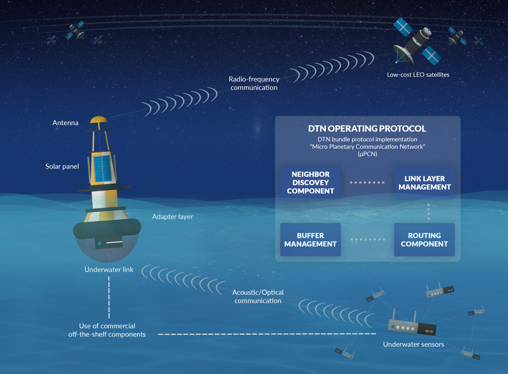
MOWGLI Feasibility Study
Status date: 09 August 2019
MOWGLI is a solution that provides a set of services for optimal microgrid planning, designing and operational and maintenance (O&M) applications in urban and rural areas of developing countries, with particular focus on India user case. The activities have been implemented in cooperation with the India Energy Storage Alliance (IESA) and funded by European Space Agency (ESA) within ARTES IAP programme.
UNDERSEE
Status date: 26 July 2019
UNDERSEE is committed to develop a scalable solution to bring knowledge about rivers, lakes and oceans to water dependent stakeholders by providing simple access to water quality data.
SFM
Status date: 04 July 2019
The objective of the SFM project is to formulate an integrated system-service aimed at monitoring and providing real-time information to first responders and decision makers, about the status of the area impacted by a release of agent chemical, bacteriological, and radiological even with explosives (CBRNe).

AgroRadar
Status date: 07 June 2019

WAMCam
Status date: 03 June 2019
Developed by Archangel Imaging, WAMCam is an innovative solution integrating satellite communication and machine learning technologies to radically improve wildlife monitoring and population studies. Researchers and conservationists working in remote regions can deploy AI-enabled cameras to remotely monitor animal traps and study areas. Receiving prompt notifications of the wildlife identified by the cameras revolutionizes the effectiveness of conservation studies.
Space Innovation System to Monitor Animals
Status date: 23 May 2019
SISMA2 provides a series of cost-effective space-based tools to facilitate the management of the pastoralism livestock industry, and cope with the future.
Invisible Worlds
Status date: 09 May 2019
Rezatec and the Eden Project will explore how geospatial data analytics could benefit individual growers or forest owners with small areas under management, by providing commercially valuable and actionable decision support tools accessed via a self-service, digital platform. In addition, these analytics could be provided as an operational service to other creative visual installations at museums and institutions around the world.
PASST
Status date: 08 May 2019
Precise Apiculture Supported by Space Technologies (acronym: PASST) is a mobile application that enables the implementation of precise apiaries management based on the latest satellite technologies and geolocation in connection with close cooperation with agricultural producers.
VtDaws
Status date: 07 May 2019
VtDaws is a service developed on a SaaS model. VtDaws includes in its features the access to EO data (especially Sentinel and Copernicus Services data), a change/anomalies detection engine based on machine learning techniques, a warning service transforming data into information to the users and community sourcing features to add in-situ data and share information on smartphones or tablets.

ARCT.esa
Status date: 12 April 2019
The ARCTTM stakeholder mapping tool offers visualization of “Project Health” in the cross-roads between society, environment, business and policy. The unique de-risking tool combines climate change risks with other factors and makes them relevant, simple and visual for owner and decision makers of any infrastructure project.
ARCT has also found a fun and engaging way to score and report on the UN Sustainability Goal Climate Action goal #13. www.arct.tools.
Tesselo
Status date: 10 April 2019
Our mission is to help organizations manage their natural resources more efficiently and sustainably. To achieve this goal, we augment satellite imagery with Artificial Intelligence and environmental expert knowledge to deliver actionable business insight to our customers.
Planet B is too far away – let’s take care of Planet A.
Greenhouse Early Warning Service
Status date: 09 April 2019
Greenhouse owners are in a very competitive market, in which unexpected costs due to damage and decay of the greenhouse assets can cause severe problems. This feasibility study aims to provide insights into how an early warning service using space data can help greenhouse owners to prevent or mitigate non-insurable risks threatening their business.
ARC-REACH
Status date: 08 April 2019
A number of countries are making preparations to turn the rapidly warming Arctic into a busy global shipping route.
The objective of the ARC-REACH project is to validate the need and feasibility to setup a cost-effective low-power long-range dynamic radio network, tailored for tracking of cargo and maritime activity, complemented with remote sensing of the environment.

CERASAT
Status date: 20 March 2019
CERASAT aims to provide reliable, real-time and global rainfall measurement services. It extracts the rainfall information from the signalling data generated in satellite communication (SatCom) networks by employing advanced machine learning and signal processing techniques. CERASAT can complement existing rainfall measurement solutions e.g. rain gauges and weather radars.

ARCtic Sea-ice and CleAN monitoring
Status date: 17 January 2019
The project brings solution for a systematic and automatic detection of sea ice (including the identification of ice and marginal ice zone) and oil slicks in the Arctic from Sentinel-1 images. Based on Machine Learning (Support Vector Machines), it permits to process automatically thousands of images with high accuracy.
Wild boar project
Status date: 14 January 2019
The key product/service is to provide a monitoring of damages to agricultural and environmental areas caused by wild boar (Sus scrofa) using remote sensing data. The technical key idea is to upscale from the investigation of local areas via high resolution aerial images to larger areas via satellite data.
WONDER
Status date: 21 December 2018
The targeted solution is an automated, cloud-based digital service for water quality monitoring which could be utilized globally. The solution builds on earth observation, global positioning, crowd sourcing, internet of things (IoT) and predictive analysis.
SPACEWHALE
Status date: 11 December 2018
SPACEWHALE is an innovative, semi-automated approach based on deep-learning techniques to detect large whales from VHR satellite images. It forms the bridge between space asset providers and stakeholders in need of population assessments of large whales to increase our ability to survey areas out of reach for traditional methods such as ship and aerial surveys.
Space Applications using Animal tracking data
Status date: 30 November 2018
The aim of the feasibility study is to evaluate a service for monitoring wildlife and farm animals. The service consists of a hardware part (collars for the animals, buy or lease) and a software to be offered as software as a service. For users these two parts are transparent, and they rent an overall service for animal tracking.

SAT-DEFO FS
Status date: 26 November 2018
SAT-DEFO project purpose is to build an app with data-proven, valid, both historical and current information about ground deformations for the inhabitants of the areas who are exposed to such changes (especially in the localizations threatened by ground subsidence caused by mining activity).
RAPSODY
Status date: 19 November 2018
RAPSODY, a project led by TEKEVER, will demonstrate the use of remotely piloted aerial systems (RPAS) in a wide area maritime context, through the execution of search & rescue and pollution monitoring missions. The missions will be executed in near-real scenarios over the Atlantic Ocean. The Satcom-enabled RPAS will be fully prepared and customized to perform these maritime missions, including the integration of specific payloads and the usage of specially tailored mission-oriented data fusion, data compression and automatic feature recognition and identification algorithms.
AquaFarm
Status date: 16 November 2018
Aquafarm brings together satellite data and Soil-Plant-Air models to provide operational services to Farmers’ service providers as well as national institutions related with crop development and forecast.
Space Applications for Wildlife
Status date: 15 November 2018
The services helps private and public organizations with assessing, monitoring, preventing, managing, and planning strategy for wildlife conservation.
SAMIPS
Status date: 15 November 2018
The main objective of the project is to investigate user needs, technological feasibility and economic sustainability of the implementation of the EO-based solution allowing for detection and monitoring of habitats affected by invasive plant species.

TSMF_10CM
Status date: 06 November 2018
The TSMF_10CM investigates the technical feasibility and commercial viability of information services regarding a) regular generation of forest stress maps and b) detection of bark beetle infestation in support of small and medium size forestry operations in Germany.
TELEKAIROS®
Status date: 29 October 2018
TELEKAIROS® Fintech is a tool for financial and (re)insurance contracts that derive value from an underlying asset such a traditional stock, a bond or stock index. TELEKAIROS is capable to manage different kinds of risks, for example by increasing the efficiency of the underlying market because they lower unforeseen costs of purchasing an asset outright.
TALED
Status date: 24 October 2018
TALED is an innovative integrated SATCOM/EO/GNSS platform to cope in RT/NRT with all kind of Fire incidents in outdoors: Forest fires, Waste fires and Hazmat Fires. The system will guarantee better technical and economical performances of the service. TALED has been integrated in the DSS of Campania Region, operated by SMA, the official service provider and TALED’s team partner.
IoTrees
Status date: 18 October 2018
Forests cover 30% of the Earths land area and provide a vital role by converting atmospheric carbon into oxygen as part of the growth process. Forests are essentially the ‘Lungs of the Earth’. Determining the rate of forest growth is an essential indicator of the health of a forest and also a key indicator to estimate future growth performance. Climate Change is a major concern to humanity and many countries around the globe have established national forest inventories to determine forest growth and health. Treemetrics through the Internet of Trees (IoTrees) project has developed a vision and plan to revolutionise the way trees and forests are measured and monitored by utilising latest Satcom and IoT technologies.
Curio Canopy
Status date: 11 October 2018
Combining analysis of satellite imagery with crowdsourced data, this urban tree montioring platform connects communities and urban forestry professionals. It provides an open data service that drives improved understanding of urban trees and access to better information in order to: i) increase tree planting and tree care; ii) improve environmental conservation management and planning; iii) support educational and communication resources for learning and knowledge-sharing.
SAMoH
Status date: 17 September 2018
Satellite Earth Observation offers a rich source of information-rich temporal data for those charged with monitoring and managing natural habitats. The SAMoH platform helps to connect these users with imagery and provides analytical and visualization tools that do not require users to be remote sensing experts. Through the use of cloud storage, cloud processing power and open data cube technology, turning imagery into insight for a range of users in the environmental sector is quick, easy and cost-effective.
COHABIT
Status date: 12 September 2018
COHABIT monitors and assesses in real-time the whereabouts of large wild animals and dynamically generates geo-fenced alerts for visitors to avoid dangerous encounters and for farmers to protects their crops and livestock. Wildlife – human cohabitation is made possible through the use of data analytics, image-recognition, animal tracking and space technology.
Blue Desert
Status date: 08 August 2018
Blue-Value (developed in the project ‘Blue Desert’) is an information and software suite to determine water related risks, support optimization of water management, and asses water footprints.
BioDiv Checker
Status date: 01 August 2018
The BioDiv Checker is a service to acquire and analyze remote sensing images for supply chain integrity within ecological farming.
RSFPS Service
Status date: 25 July 2018
The extension of the TIKKA project on the REMOTE SENSING FIRE PROTECTION SYSTEM is results of the positive evaluation of the TIKKA project by the forest users. The new Service will be based on the TIKKA project conception that has been evaluated and implemented during the demonstration phase for the Forest Users. The service will be implemented and provided to the brand-new market which are the National Parks in Poland. The beneficiary of the RSFPS during the demonstration phase of the service will be the Kampinoski National Park, which is the second biggest National Park in Poland (385 km2) and in 2000 year has been listed on UNESCO List.
WASTE IAP
Status date: 23 July 2018
The development of a service that uses Earth Observation data to detect and monitor legal waste sites, and GNSS technology to track the destination of high value waste items. The information is used to show evidence of legal operator compliance and illegal disposal or exportation of waste.
DFMS4i
Status date: 18 July 2018
The project investigated how drought and flood prediction and monitoring services derived from in-situ and space-based Earth Observation data - in from the Sentinel satellites - could support the uptake of agriculture insurance in developing countries, with an initial focus on Uganda.

Pi-Link
Status date: 13 July 2018
Collection and transmission of ocean water column data opens up new data-based revenue streams across a range of industrial sectors and stakeholders. The Pi-Link activity explores the market and technical feasibility around sustainably gathering and supplying such data using a sensor-equipped version of SNTech’s Pisces device, called Pi-Sense.
HelloBin
Status date: 11 July 2018
HelloBin services optimizes routing for waste collection for waste collectors and contributes to the ability to manage the waste stream more efficiently.
EO-li
Status date: 28 June 2018
EO-li (Earth Observation based location identifier) is an open source web-based,global platform matching demand and supply of identifying, selecting and reporting in the land restoration context. It has four components, namely the (i) identification of a location area to be restored, the (ii) selection of an area and the actors involved in the restoration activity, the (iii) monitoring and reporting on the progress of the project using earth observation and geospatial data and (iv) a learning component providing guidance and capacity strengthening.
AgeSpot Feasibility Study
Status date: 18 May 2018
AgeSpot provides THE starting point for any innovative technological solution addressing ageing populations. It enables efficient targeting of the silver economy and offers precise demographic data on WHERE and HOW MANY age specific classes currently live and will likely live in the FUTURE. With AgeSpot a new Earth Observation (EO) supported business intelligence service is offered.

SISMA
Status date: 12 March 2018
SISMA is a low-cost solution to monitor domestic and wild herds that includes regional analysis to help dependent populations and state agencies to manage animal safety and welfare and mitigate climate change. It combines IoT and satellite technologies to track the movement, activities and biometrics of the animals. It enables data sharing between herders, veterinaries, local – state authorities, scientists, consultants…
Tourism Impact Monitoring Service
Status date: 05 March 2018
Realise and monitor sustainable tourist destinations using Earth observation satellites.
WILDWEGO
Status date: 16 February 2018
WILDWEGO (in the WILDLERNESS WE GO)is an innovative Augmented Reality (AR) ecotourism game fostering biodiversity conservation in wilderness areas by tourists “on the go” in parks and by their family, friends and social networks contacts “remotely”.
International Satellite Derived Shallow Water Bathymetry Service
Status date: 15 January 2018
A web-based service to provide immediate, off-the-shelf, online access to shallow water depth data derived from very high resolution satellite imagery.

SPOTTITT
Status date: 19 December 2017
Spottitt is the new brand name for the SEWISS service delivered by the project consortium. Spottitt has been conceived to support onshore wind developers, turbine manufacturers and energy providers with the complex, expensive and time consuming process of screening and selecting the most suitable greenfield sites for development, without the need for initial travel to sites of interest.
CapeOutdoors3D
Status date: 19 December 2017
CapeOutdoors3D prototyped a web-based (and conceptualised a mobile) application for tourists planning outdoor activities in Nature Reserves and National Parks in South Africa. The project linked the space technologies Earth Observation and Satellite Navigation with the aim to provide a 3D virtual reality planning tool for tourists. In addition, Earth Observation based fuel condition maps were developed to support protected area authorities in their fire management activities.
SWAY4Edu2
Status date: 14 December 2017
Capacity Building activities for rural schools and rural radio stations in Africa based on eLearning platform accessible on-line via the Sat3Play platform.
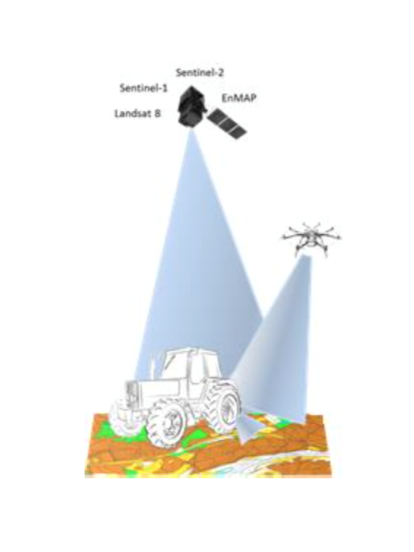
SolumScire
Status date: 14 December 2017
SolumScire makes use of latest satellite- and positioning technologies to better understand soil and soil conditions in crop production. The project collects and combines high resolution satellite and soil analysis data to provide soil spatial information and to create a service for farmers to feed spatial soil information automatically into their farm management system (FMS) to then improve field related precision farming activities.
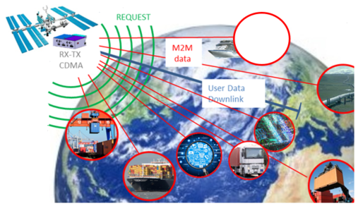
SatApps
Status date: 19 September 2017
Internet of Things/IoT – M2M – industry 4.0 – these headlines are representing large user groups which have an urgent need of a globally available, low-cost, secure data service, dedicated to very small data volumes per sensor and for use also in remote areas. The objective of the study is to perform an in depth requirements analysis on 2 focus pilot user groups: railway transportation and container/waste management.
SATLAS
Status date: 05 September 2017
SATLAS is an Idea Incubator, developed for and offered to innovators who want to “Start, Integrate and Test” their SatCom related concepts in an easy, light and quick way, taking benefit from the support, mentoring, services and tools made available from the SATLAS consortium (SES Techcom, SatADSL, Newtec).
CyMonS
Status date: 22 June 2017
CyMonS offers spatial and high-frequency water quality monitoring of inland surface waters, combined with a 1 to 5 days forecast for cyanobacteria scums. The service integrates Sentinel-2 imagery, hand held monitors (EcoSpot & WISP-3) and fixed position monitors (EcoWatch) to monitor cyanobacteria with a high spatial scale. The algae forecasting model allows water authorities to timely issue warnings and take mitigation measures.
ArTeK
Status date: 20 June 2017
ArTeK aims at developing an innovative, effective and sustainable service offered to Properties managers to have a complete and systematically updated view and enhanced awareness of the state of conservation of immovable Cultural Properties and to support their management and fruition. ArTeK integrated service builds on space assets (earth observation, navigation and satellite communication) as well as additional technologies (drones, on site equipment, etc.) in relation to specific user needs.
DAMMINGS
Status date: 24 May 2017
The project designed, developed and carried out pre-operations of a service platform providing an automated and continuous monitoring service of dam infrastructure and its surroundings by integrating GNSS and InSAR space capabilities.
ASAP DP
Status date: 24 May 2017
The proposed Agricultural Service is designed as a “One-stop-shop” for actors in the Agricultural sector, providing information on crop status and their growing conditions based on EO and ancillary data. The System flexibility and comprehensiveness ensure its applicability for a variety of problems faced by Users in different Agricultural sectors.
Urban DRR
Status date: 18 April 2017
Applying space based solutions to save lives and critical infrastructure by reducing the risk and impact of natural disasters in urban areas.
M3i
Status date: 12 April 2017
M3i is an end-to-end, one-stop service that reduces the fieldwork required to gather information on critical Landscapes of Interest. Satellite imagery, analysed in conjunction with a minimal set of ground-based data, significantly reduces the time and money required to perform surveys, and thus greatly improves the potential for all forms of land use to be incorporated into sustainable management schemes.
SMART
Status date: 22 March 2017
SMART is a system that aims to provide a decision support service targeting the “early warning" of a disaster or critical event (specifically hydro-geological events) and to improve the "first response" intervention capability. The system has the advantage of strengthening the procedures used today by the Civil Protection to collect and manage the data "monitored" without interfering with the current practice.
aircheckr
Status date: 07 December 2016
Aircheckr creates & opens up the best available air quality data in the EU. Aircheckr translates the air quality data to the specific needs of a broad range of applications like real estate, health or sports. The data is enhanced by the power of the crowd, and it is easily interpretable & include personal recommendations.
TransparentForests
Status date: 07 December 2016
TransparentForests, a web-based Geographic Information System (GIS) for mapping and data management, is designed to increase the credibility and transparency of the FSC certification process. It supports all stakeholders in engaging with, and improving the certification process. It creates opportunities for operational efficiency across the certification service delivery chain. The TransparentForests concept has applications in forest insurance, finance and biomass energy.
Intelligent sensor and satellite network (ISSN)
Status date: 02 December 2016
The project is a feasibility study in order to establish whether there are sufficient market opportunities, and the technological maturity for developing a flexible and reliable intelligent sensor network where satellites are among the nodes in the network (ISSN). ISSN has a number of potential application areas in connection with Offshore Oil & Gas exploration and production, environmental surveillance in general, safety, search and rescue, transportation etc.
PalmOilVision
Status date: 24 November 2016
PalmOilVision aims at providing the palm oil sector with innovative, reliable and cost efficient services for increasing production sustainability and efficiency, through the integration of Earth observation imagery and Remotely Piloted Aircraft Systems (RPAS).
OWASIS-NL
Status date: 17 November 2016
How can water management authorities, agro food industries and multi-national industries benefit from improved information on water availability?
The OWASIS-NL feasibility study investigated innovative services that help water managers to make more efficient use of the available water and to reduce the risk of flood and drought damage.
Saltwater
Status date: 05 October 2016
Saltwater is a service for aquaculture companies using Earth Observation and hyperspectral in situ instruments for the monitoring of harmful phytoplankton. Monitoring results are provided on a high spatial and temporal resolution. When combined with other environmental data the users can predict the movement of harmful phytoplankton, thereby reducing loss of stock and increasing feeding days.

FLARE
Status date: 10 June 2016
FLARE is an integrated software package and data service which supports the global forestry insurance industry in asset estimation, risk management and loss adjustment. This feasibility study analysed the operational, technical and economic viability of a FLARE system/ service providing Earth Observation and Global Navigation Satellite System data and mapping products, within a simple software interface.
WIMS
Status date: 02 June 2016
Using a variety of space applications to improve and streamline the maintenance and monitoring regimes of the water industry within the UK.
EO Crowd
Status date: 22 February 2016
Over 90% of our seas are unsurveyed. EO Crowd uses crowd sourcing, EO data and open data to fill this data gap.
GeoNavCon
Status date: 09 February 2016
The objective of the study is the concept preparation for the development of integrated services based on satellite navigation, satellite communication and earth observation technologies to improve availability, accuracy and integrity of position determination, data communication and geo-information for users in remote and constrained environments in the forestry domain.
SEWISS
Status date: 14 January 2016
The SEWISS service has been conceived to support onshore wind developers with the complex, expensive and time consuming process of screening and selecting the most suitable greenfield sites for development, without the need for initial travel to sites of interest. The SEWISS system is conceived to be a one-stop online portal, where developers can access recent, relevant, high resolution EO, and non EO data layers, then within the same portal use these layers of data to conduct automated land cover, rooftop recognition, green field, turbine selection and positioning analysis across their areas of interest.
Cerberus: Forest Falcon FS
Status date: 05 January 2016
If you care about the future, you also care about our planet. Greenhouse gas emissions caused by forest degradation and deforestation are one of the largest causes of global warming. Many organizations have a negative impact on the extent and quality of our forests. It is time we change that. We map what matters. Through our crowd — a big, global community of people who care about our planet just as much as we do — we build maps and information products of high quality and reliability. Our forest monitoring services can be adjusted to your specific needs, so you will get exactly the information you need.
New Commons
Status date: 18 December 2015
Combining analysis of satellite imagery with crowdsourced data, this system brings together urban forestry professionals and those living in urban environments in order to improve the levels of understanding and information available on the trees growing in these unique ecosystems.

OWASIS-UK
Status date: 02 October 2015
OWASIS – UK is a Feasibility Study aiming at developing a sustainable service line improving the monitoring of water availability, quality and distribution by integrating satellite images and innovative terrestrial sensors and information technologies.
This study focuses on the UK market and it targets all types of user groups such as industrial users, public water authorities or regulatory organisms.

WATERLENS
Status date: 04 September 2015
Feasibility study for new water infrastructure management services using space assets.

GIRP
Status date: 25 August 2015
Subsidence due to clay shrinkage is the largest ground instability issue affecting residential property in the UK (75% of all valid insurance claims) with rectification costs averaging £250m (295m Euro) p.a. Research by the insurance sector (Swiss RE and Lloyds of London) indicates that the extent of subsidence both in the UK and Europe will worsen in line with climate change forecast. The insurance sector equally recognizes the need for significantly improved profiling and predictive tools to identify and target risk mitigation management.
The Ground Instability Risk Profiler (GIRP) service is planned to enable an accurate and predictive ground stability risk profiling service to the insurance industry in a range of flexible formats through the integration of property data sources and satellite information.

EFFORS-FS
Status date: 25 August 2015
The aim of the present feasibility study is to develop an Enhanced Flood Forecasting System for Critical Infrastructures Protection in medium size Alpine catchments.The service is designed to address infrastructure located either on the river itself (e.g. bridge) or in the flood plan (e.g. a building).

PloughStars
Status date: 04 August 2015
Plough Stars is a feasibility study and part ESA’s Integrated Applications Promotion (IAP) Programme. The industrial team led by Berner & Mattner investigates new services and applications for improving winter road maintenance. Existing, mainly terrestrial, systems are enhanced with space-based technologies. Users and stakeholders involved in winter road maintenance benefit from this system through increased performance and a simplified routine.
Salt Water Surface Water Monitoring
Status date: 16 July 2015
BlueLeg Monitor (BLM) from the Netherlands investigates the use of its proprietary remote sensing technology for water quality monitoring in aquaculture. In particular Hazardous Algal Blooms create serious damage to aquaculture by incidentally suffocating fish and the release of toxins. This tendency is expected to increase as a result of global warming and nutrients run off into surface water, as well as by transport of invasive species of algae due to the release of untreated ballast water from ocean ships.
Peat Spotter
Status date: 07 July 2015
Peat Spotter was conceived by Rezatec Ltd. as a potential data service to provide cost-effective information for sustainable peatland management. Our intent is that Peat Spotter will reduce the amount of expensive field work required to gather information on peatland location, intactness and carbon content over time.

IAP-Copernicus
Status date: 08 May 2015
The IAP-Copernicus study addresses the use of space assets, combined with terrestrial « web2mobile » technologies, in the provision of reliable, ad-hoc information to all stakeholders involved in the monitoring of risks and mitigation of hazards impacting people. The study focuses on the development of an economically sustainable « Business Services Platform » for two use cases: public safety in Belgium and food security in Senegal.
SFEDONA
Status date: 25 March 2015
The SFEDONA project aims to design, develop, validate and demonstrate a complete end-to-end fire detection and alerting application which makes use of state-of-the-art fire detection technologies based on terrestrial optical cameras and sensors, data fusion, satellite and wireless communications as well as modern IT technologies.
SATMODO
Status date: 08 September 2014
The SATMODO project is aimed specifically at the round-wood timber harvesting market, by facilitating ”live” monitoring of harvest processes. To date the SATMODO project addressed current harvesting issues in remote areas by utilizing both cellular and satellite transmission technology as a means of providing data transmission pathways for the live harvest data from the Harvester Machine.
SnowSense
Status date: 08 July 2014
SnowSense aims at the qualitative, spatial and temporal improvement of available snow information (snow covered area, snow parameters). It integrates space and ground-based assets to achieve this target. The project has won the 2013 ESA IAP IntegSpace Award.

Earth Rider
Status date: 12 June 2014
The Earth Rider concept, conceived and developed by Space Synapse Systems Ltd, attempts to educate, enlighten, and engage end users with environmental and space awareness issues by:
- Sharing the personal experiences of space travel by astronauts;
- Producing high-quality planetarium shows;
- Creating an effective immersive experience that allows end users to “experience “the awe of spaceflight; and
- Disseminating downstream Earth Observation satellite applications.

BALMON
Status date: 26 March 2014
The BALMON project aims to provide an extensive, well-justified assessment of technologies, services and development needs that will support and enhance the efficiency of water quality monitoring and coastal surveillance activities in the Baltic Sea region.
FruitLook
Status date: 17 August 2012
Water is a critical resource in South Africa, which challenges the agricultural sector to reduce irrigation water consumption while keeping production sustainable. Adequate information on the crop water, growth and nutrient status is crucial to improve water management.The FruitLook pre-operational service demonstrates to Western Cape grape and deciduous fruit farmers the benefits of integrated satellite technologies in their daily water and farm management.
SAVEWATER
Status date: 07 August 2012
The Savewater Project conducts a feasibility study for integrated Satellite - AUV (autonomous underwater vehicle) applications in the field of water management. The proposed application integrates satellite services (earth observation and navigation) and mobile platform services (in situ measurements and visualization of water characteristics).
INTOGENER Feasibility Study
Status date: 08 November 2011
INTOGENER is a feasibility study for the implementation of a water flow monitoring and prediction system aimed at hydropower production and water management organizations. The study is supported by ENDESA, a Spanish utility with a leadership position in South America.
GrapeLook
Status date: 17 August 2011
This project focuses on the operational monitoring of crop water and nitrogen use of vineyards in the Western Cape province of South Africa. Based on the daily management of irrigation water resources and on-farm nitrogen by means of satellite remote sensing technologies, satellite communications and satellite positioning the project aims to assist various end-users.